United States Climate Reference Network (USCRN) Raw Data Transmitted from Satellite
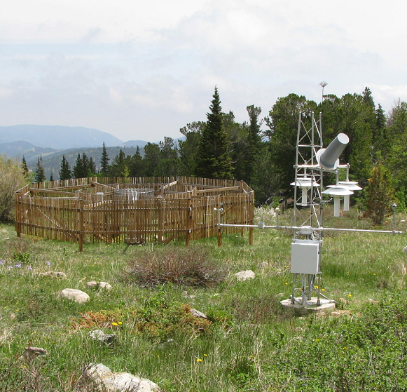 Station Picture
USCRN Raw Transmitted Data is level 0 data received from the USCRN stations that are transmitted continuously. The data values are ingested with a unique 18-bit format due to satellite transmission limitations (documentation will be archived along with data); code is also included to read the bit format and parse out values for a stream. As of 2017, there are 26 possible stream format versions over the history of the USCRN network; format versions are dependent on hardware/software upgrades to the USCRN network and may increase over time. The data stream includes observations taken by USCRN stations for temperature, precipitation, etc., but users are encouraged to use downstream, processed versions of the data, due to the complexity of reading the satellite-encoded format (see documentation for more information).
As of 2017, data are ingested via various mechanisms, including: an LRGS receiver connected to the NOAA and EDDN satellite networks, a domestic communications satellite (DOMSAT) receiver located at NCEI, and parsed data from NOAAPort. Numerous data files from different sources (usually with a distinct filenaming convention based on source) are collected throughout the month and are separated into subdirectories based on the date of ingest into the CRN database. Files from all sources and all days for the month are packaged together into a monthly archive file.
As of 2017, data are ingested via various mechanisms, including: an LRGS receiver connected to the NOAA and EDDN satellite networks, a domestic communications satellite (DOMSAT) receiver located at NCEI, and parsed data from NOAAPort. Numerous data files from different sources (usually with a distinct filenaming convention based on source) are collected throughout the month and are separated into subdirectories based on the date of ingest into the CRN database. Files from all sources and all days for the month are packaged together into a monthly archive file.
Dataset Citation
- USCRN Program requests that publications using this dataset should also cite the following article: Diamond, H.J., T.R. Karl, M.A. Palecki, C.B. Baker, J.E. Bell, R.D. Leeper, D.R. Easterling, J.H. Lawrimore, T.P. Meyers, M.R. Helfert, G. Goodge, and P.W. Thorne, 2013: U.S. Climate Reference Network after one decade of operations: status and assessment. Bull. Amer. Meteor. Soc., doi: 10.1175/BAMS-D-12-00170.
- Please refer to Credit tab for full citation information.
Dataset Identifiers
- NCEI DSI 6117_01
- NCEI DSI 6117_02
- gov.noaa.ncdc:C00309
ISO 19115-2 Metadata
gov.noaa.ncdc:C00309
| Order Data |
|
| Distribution Formats |
|
| Ordering Instructions | Contact NCEI for other distribution options and instructions. |
| Distributor |
NOAA National Centers for Environmental Information ncei.info@noaa.gov |
| Dataset Point of Contact | Customer Engagement Branch NOAA National Centers for Environmental Information 1-828-271-4800 ncei.orders@noaa.gov |
| Coverage Description | |
| Time Period | 2000-11-15 to Present |
| Spatial Reference System | urn:ogc:def:crs:EPSG::4326 |
| Spatial Bounding Box Coordinates |
West: 172.0
East: -65.0
South: 18.0
North: 72.0
|
| Spatial Coverage Map |
| General Documentation |
|
| Associated Resources |
|
| Publication Dates |
|
| Data Presentation Form | Digital table - digital representation of facts or figures systematically displayed, especially in columns |
| Dataset Progress Status | Ongoing - data is continually being updated |
| Data Update Frequency | Continual |
| Purpose | USCRN's primary goal is to provide future long-term homogeneous observations of temperature and precipitation that can be coupled to long-term historical observations for the detection and attribution of present and future climate change. Each station location is carefully selected to capture the representative climate regions of the nation. Data from the USCRN will be used in operational climate monitoring activities and for placing current climate anomalies into an historical perspective. The USCRN Raw data provides a Near-Real-Time data flow that can be used to produce high-quality datasets on a faster time scale. |
| Use Limitations |
|
| Dataset Citation |
|
| Cited Authors |
|
| Originators |
|
| Publishers |
|
| Theme keywords |
Global Change Master Directory (GCMD) Science Keywords
|
| Data Center keywords |
Global Change Master Directory (GCMD) Data Center Keywords
|
| Platform keywords |
Global Change Master Directory (GCMD) Platform Keywords
|
| Instrument keywords |
Global Change Master Directory (GCMD) Instrument Keywords
|
| Place keywords |
Global Change Master Directory (GCMD) Location Keywords
|
| Project keywords |
|
| Data Resolution keywords |
Global Change Master Directory (GCMD) Horizontal Data Resolution Keywords
|
| Stratum keywords |
Global Change Master Directory (GCMD) Location Keywords
|
| Use Constraints |
|
| Fees |
|
| Lineage information for: repository | |
|---|---|
| Processing Steps |
|
| Acquisition Information (collection) | |
|---|---|
| Instrument |
|
| Platform |
|
Last Modified: 2023-06-23
For questions about the information on this page, please email: ncei.info@noaa.gov
For questions about the information on this page, please email: ncei.info@noaa.gov