Surface Radiation Budget (SURFRAD) Network 1-Hour Observations
SURFRAD
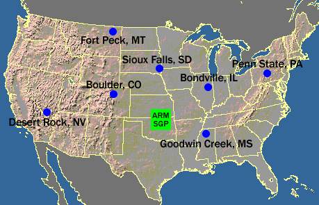 Map of SURFRAD sites.
Radiation measurements at SURFRAD stations cover the range of the electromagnetic spectrum that affects the earth/atmosphere system. Direct solar radiation is monitored with a Normal Incidence Pyrheliometer (or NIP) mounted on the solar tracker. Downwelling global solar radiation is measured by an upward-viewing broadband pyranometer. The diffuse, or sky component, of solar radiation is measured by a shaded Eppley 8-48 pyranometer mounted on a platform that is attached to the solar tracker. A ball shades the sensor of the diffuse pyranometer, thus allowing only the radiation scattered by the atmosphere to be measured. A Precision Infrared Radiometer (PIR), or pyrgeometer, is also mounted on the solar tracker shade platform to measure downwelling thermal infrared radiation. A third broadband pyranometer is mounted facing downward on a cross arm near the top of the 10-meter tower to monitor solar radiation reflected from the surface. Another pyrgeometer, also mounted facing downward on the cross arm of the tower, senses thermal radiation upwelling from the surface. Two instruments on the main platform monitor wavebands of special interest. A UVB radiometer measures the degree of harmful ultraviolet radiation (280-320 nm) that evades the ozone layer and reaches the surface. The other monitors the intensity of the waveband active in photosynthesis (400 to 700 nm). The last radiometer in the SURFRAD suite is the Multi-Filter Rotating Shadowband Radiometer (MFRSR) which measures both global and diffuse solar radiation in one broadband channel and six narrow bands of the solar spectrum. Instruments for measuring wind direction and speed, air temperature, and relative humidity are mounted at the top of the tower. Station pressure is measured at the main platform. Campbell Scientific Inc. data logging equipment samples and records signals from all instruments except the MFRSR. The sampling rate for the radiometers and the meteorological instruments is one second, and the logger has been programmed to record one-minute averages of the one-second samples beginning in 2009-01-01. Before 2009-01-01 three-minute averages were recorded. Conversion to physical units through calibration factors is done in post processing. The MFRSR has its own logger that spot samples at 15-second intervals and records one-minute averages of the output voltages. Only one-hour data are archived at NCEI. In 1999 and 2000, total sky imagers (TSI) were installed at all SURFRAD stations. This device documents sky conditions and cloud fraction every minute. These measurements aid in the interpretation of the radiation measurements during the daytime, and also offer ground truth for satellite estimates of cloud fraction. Three stations now have surface latent, sensible, and soil heat flux systems, promoting them to surface energy budget stations. These surface energy budget measurements are welcomed by those who develop new atmospheric and hydrologic models that employ explicit surface physics
Dataset Citation
- Cite as: NOAA Earth System Research Laboratory, 1995: Surface Radiation Budget (SURFRAD) Network Observations. [indicate subset used]. NOAA National Centers for Environmental Information. [access date].
Dataset Identifiers
- NCEI DSI 9872_01
- NCEI DSI 9872_02
- gov.noaa.ncdc:C00540
ISO 19115-2 Metadata
gov.noaa.ncdc:C00540
| Download Data |
|
| Order Data |
|
| Distribution Formats |
|
| Ordering Instructions | Contact NCEI for other distribution options and instructions. |
| Distributor |
NOAA National Centers for Environmental Information ncei.info@noaa.gov |
| Dataset Point of Contact | John Augustine Meteorologist DOC/NOAA/ESRL/GMD > Global Monitoring Division, Earth System Research Laboratory, NOAA, U.S. Department of Commerce 303-497-6415 john.a.augustine@noaa.gov |
| Dataset Point of Contact | Customer Engagement Branch NOAA National Centers for Environmental Information 1-828-271-4800 ncei.orders@noaa.gov |
| Time Period | 1995-01-01 to Present (time interval: 1-hour) |
| Spatial Bounding Box Coordinates |
West: -125.0
East: -66.0
South: 24.0
North: 50.0
|
| Spatial Coverage Map |
| Dataset Information |
|
| General Documentation |
|
| Processing Documents |
|
| Associated Resources |
|
| Publication Dates |
|
| Data Presentation Form | Digital table - digital representation of facts or figures systematically displayed, especially in columns |
| Dataset Progress Status | Ongoing - data is continually being updated |
| Data Update Frequency | Daily |
| Supplemental Information | Station WBAN IDs and abbreviations: 03160 Desert Rock, Nevada (DRA); 04835 Bondville, Illinois (BON); 53830 Goodwin Creek, Mississippi (GWN); 54783 Penn State, Pennsylvania (PSU); 54918 Sioux Falls, South Dakota (SXF); 94044 Table Mountain, Colorado (TBL); 94045 Fort Peck, Montana (FPK); |
| Purpose | The Surface Radiation Budget Network (SURFRAD) was established in 1993 by NOAA's Air Resources Laboratory through the support of NOAA's Office of Global Programs. It is the first and only national network of its kind. Its primary objective is to support global change research, satellite programs, renewable energy research, and modeling with continuous measurements of the surface radiation budget, which includes upward- and downward-directed shortwave and longwave radiation. |
| Dataset Citation |
|
| Cited Authors |
|
| Originators |
|
| Principal Investigators |
|
| Publishers |
|
| Theme keywords |
Global Change Master Directory (GCMD) Science Keywords
|
| Data Center keywords |
Global Change Master Directory (GCMD) Data Center Keywords
|
| Platform keywords |
Global Change Master Directory (GCMD) Platform Keywords
|
| Instrument keywords |
Global Change Master Directory (GCMD) Instrument Keywords
|
| Place keywords |
Global Change Master Directory (GCMD) Location Keywords
|
| Project keywords |
Global Change Master Directory (GCMD) Project Keywords
|
| Data Resolution keywords |
Global Change Master Directory (GCMD) Horizontal Data Resolution Keywords
|
| Stratum keywords |
Global Change Master Directory (GCMD) Location Keywords
|
| Use Constraints |
|
| Access Constraints |
|
| Fees |
|
| Lineage information for: dataset | |
|---|---|
| Lineage Statement | The original source of the SURFRAD dataset in 1995 was the NOAA Air Resources Laboratory. It was transferred to the NOAA OAR ESRL Global Monitoring Division in 2005. The 1-hour data are archived at NOAA NCEI. |
| Processor |
|
| Processing Steps |
|
| Processing Environment | UNIX |
| Processing Documents |
|
| Lineage information for: repository | |
|---|---|
| Processing Steps |
|
Last Modified: 2023-06-23
For questions about the information on this page, please email: ncei.info@noaa.gov
For questions about the information on this page, please email: ncei.info@noaa.gov