State of the Climate Monthly Overview - Drought
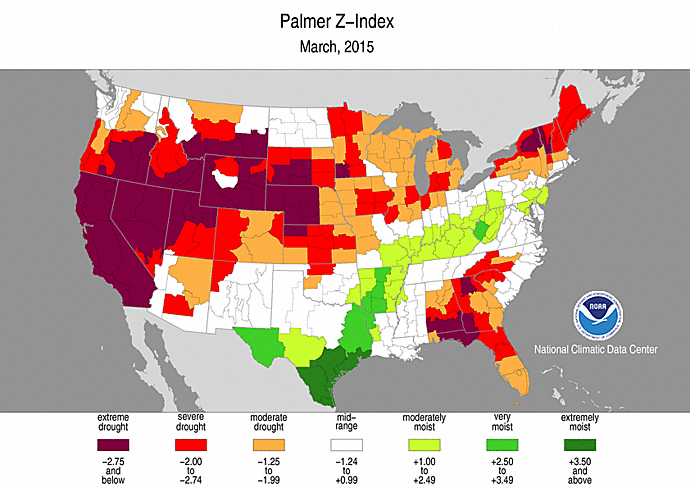 Drought Map Sample (Palmer Z-Index)
The State of the Climate is a collection of periodic summaries recapping climate-related occurrences on both a global and national scale. The State of the Climate Monthly Overview - Drought report describes conditions in the United States, including Puerto Rico and the U.S. Affiliated Pacific Islands as warranted. A national drought overview is provided with detailed discussion on various regions. Several indices are presented: Palmer drought indices, Standard Precipitation Index, and other agricultural and hydrological indices. State, regional, and national moisture and precipitation status with historical rankings are available. Content of individual reports varies somewhat according to conditions and data availability. Reports were issued sporadically in 1999 and early 2000, with regular monthly reports beginning in September 2000. Annual reports are available from 2002.
- How to cite: A suggested citation is provided at the bottom of each online report. Users should modify according to their writing style.
| Search Data |
|
| Distribution Formats |
|
| Ordering Instructions |
Contact NCEI for other distribution options and instructions. |
| Distributor |
NOAA National Centers for Environmental Information
ncei.info@noaa.gov
|
| Dataset Point of Contact |
Customer Engagement Branch
NOAA National Centers for Environmental Information
1-828-271-4800
ncei.orders@noaa.gov
|
| Time Period |
1999-07 to Present |
| Spatial Bounding Box Coordinates |
West: 172.0
East: -65.0
South: 18.0
North: 72.0
|
| Spatial Coverage Map |
|
| Dataset Information |
-
NCEI/NCEI Climate Monitoring
The Climate Monitoring mission is to monitor and assess the state of the Earth's climate in near real-time, providing decision-makers at all levels of the public and private sectors with data and information on climate trends and variability including perspectives on how the climate of today compares to the past. The web page provides access to available reports and products.
|
| General Documentation |
|
| Publication Dates |
|
| Dataset Progress Status |
Ongoing - data is continually being updated |
| Data Update Frequency |
Monthly |
| Purpose |
This State of the Climate report provides decision-makers at all levels of the public and private sectors with data and information on climate trends and variability each month, season, and year for the United States, including perspectives on how the climate of today compares to the past. |
| Dataset Citation |
- How to cite: A suggested citation is provided at the bottom of each online report. Users should modify according to their writing style.
|
| Cited Authors |
- Climate Monitoring Branch
DOC/NOAA/NESDIS/NCDC > National Climatic Data Center, NESDIS, NOAA, U.S. Department of Commerce
|
| Originators |
- Climate Monitoring Branch
DOC/NOAA/NESDIS/NCDC > National Climatic Data Center, NESDIS, NOAA, U.S. Department of Commerce
|
| Publishers |
- DOC/NOAA/NESDIS/NCEI > National Centers for Environmental Information, NESDIS, NOAA, U.S. Department of Commerce
- DOC/NOAA/NESDIS/NCDC > National Climatic Data Center, NESDIS, NOAA, U.S. Department of Commerce
|
| Theme keywords |
Global Change Master Directory (GCMD) Science Keywords
- Earth Science Services > Environmental Advisories > Agricultural Advisories > Drought Forecast
- Earth Science Services > Environmental Advisories > Hydrological Advisories > Drought
- Earth Science > Agriculture > Soils > Soil Moisture/Water Content
- Earth Science > Atmosphere > Weather Events > Drought
- Earth Science > Atmosphere > Precipitation > Precipitation Amount
- Earth Science > Atmosphere > Precipitation > Precipitation Anomalies
- Earth Science > Atmosphere > Precipitation > Precipitation Rate
- Earth Science > Atmosphere > Precipitation > Liquid Precipitation > Rain
- Earth Science > Climate Indicators > Atmospheric/Ocean Indicators > Extreme Weather > Extreme Drought
- Earth Science > Climate Indicators > Atmospheric/Ocean Indicators > Extreme Weather > Extreme Precipitation
- Earth Science > Climate Indicators > Atmospheric/Ocean Indicators > Precipitation Indicators
- Earth Science > Climate Indicators > Atmospheric/Ocean Indicators > Precipitation Indicators > Precipitation Trends
- Earth Science > Climate Indicators > Atmospheric/Ocean Indicators > Precipitation Indicators > Precipitation Variability
- Earth Science > Climate Indicators > Atmospheric/Ocean Indicators > Precipitation Indices > Standardized Precipitation index
- Earth Science > Climate Indicators > Land Surface/Agriculture Indicators > Drought Indices
- Earth Science > Climate Indicators > Land Surface/Agriculture Indicators > Drought Indices > Palmer Drought Crop Moisture index
- Earth Science > Climate Indicators > Land Surface/Agriculture Indicators > Drought Indices > Palmer Drought Severity index
- Earth Science > Climate Indicators > Land Surface/Agriculture Indicators > Drought Indices > Palmer Hydrological Drought index
- Earth Science > Climate Indicators > Land Surface/Agriculture Indicators > Drought Indices > Palmer Z Index
- Earth Science > Human Dimensions > Natural Hazards > Droughts
|
| Data Center keywords |
Global Change Master Directory (GCMD) Data Center Keywords
- DOC/NOAA/NESDIS/NCDC > National Climatic Data Center, NESDIS, NOAA, U.S. Department of Commerce
- DOC/NOAA/NESDIS/NCEI > National Centers for Environmental Information, NESDIS, NOAA, U.S. Department of Commerce
|
| Place keywords |
Global Change Master Directory (GCMD) Location Keywords- Continent > North America > United States Of America
|
| Stratum keywords |
Global Change Master Directory (GCMD) Location Keywords- Vertical Location > Land Surface
|
| Use Constraints |
- How to cite: A suggested citation is provided at the bottom of each online report. Users should modify according to their writing style.
- Please note that State of the Climate reports are based upon operational datasets. The official operational datasets chosen for the report can and do change over time. The nature of these changes can be evolutionary, such as addition of previously-missing data or changes due to quality-assurance algorithms. Changes may also be revolutionary, in that a new version of an operational dataset, or a different dataset altogether, are adopted for official use. In any of these cases, the values presented in the State of the Climate reports reflect those known at the time, using the official dataset at the time. Values are not updated or edited within past reports, unless otherwise noted, even if the underlying official dataset has since changed.
|
| Fees |
- In most cases, electronic downloads of the data are free. However, fees may apply for custom orders, data certifications, copies of analog materials, and data distribution on physical media.
|
| Lineage information for: dataset |
|---|
| Lineage Statement |
NCEI datasets are generally used as primary source data for the monthly narrative. However, for some phenomena not entirely captured by these datasets, trusted external data and analyses are used to supplement primary data sources. |
| Lineage information for: repository |
|---|
| Processing Steps |
- 2015-04-22T00:00:00 - NOAA created the National Centers for Environmental Information (NCEI) by merging NOAA's National Climatic Data Center (NCDC), National Geophysical Data Center (NGDC), and National Oceanographic Data Center (NODC), including the National Coastal Data Development Center (NCDDC), per the Consolidated and Further Continuing Appropriations Act, 2015, Public Law 113-235. NCEI launched publicly on April 22, 2015.
|
Last Modified: 2023-06-23
For questions about the information on this page, please email:
ncei.info@noaa.gov