U.S. Climate Divisional Dataset (Version Superseded)
TCDD
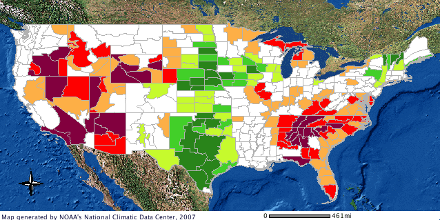 Divisional Data GIS image
This data has been superseded by a newer version of the dataset. Please refer to NOAA's Climate Divisional Database for more information. The U.S. Climate Divisional Dataset provides data access to current U.S. temperature, precipitation and drought indeces. Divisional indices included are: Precipitation Index, Palmer Drought Severity Index, Palmer Hydrological Drought Index, Modified Palmer Drought Severity Index, Temperature, Palmer Z Index, Cooling Degree Days, Heating Degree Days, 1-Month Standardized Precipitation Index (SPI), 2-Month (SPI), 3-Month (SPI), 6-Month (SPI),12-Month (SPI) and the 24-Month (SPI). All of these Indices, except for the SPI, are available for Regional, State and National views as well. There are 344 climate divisions in the CONUS. For each climate division, monthly station temperature and precipitation values are computed from the daily observations. The divisional values are weighted by area to compute statewide values and the statewide values are weighted by area to compute regional values. The indices were computed using daily station data from 1895 to present.
Dataset Citation
Cite this dataset when used as a source.
Dataset Identifiers
- NCEI DSI 9640_01
- gov.noaa.ncdc:C00702
ISO 19115-2 Metadata
gov.noaa.ncdc:C00702
| Download Data |
|
| Distribution Formats |
|
| Ordering Instructions | Contact NCEI for other distribution options and instructions. |
| Distributor |
NOAA National Centers for Environmental Information ncei.info@noaa.gov |
| Dataset Point of Contact | Customer Engagement Branch NOAA National Centers for Environmental Information 1-828-271-4800 ncei.orders@noaa.gov |
| Dataset Point of Contact | Chris Fenimore or Karin Gleason Climate Monitoring Branch Representative DOC/NOAA/NESDIS/NCEI > National Centers for Environmental Information, NESDIS, NOAA, U.S. Department of Commerce +1 828-271-4800 cmb.contact@noaa.gov |
| Time Period | 1895-01-01 to Present |
| Spatial Bounding Box Coordinates |
West: -125.0
East: -66.0
South: 24.0
North: 50.0
|
| Spatial Coverage Map |
| General Documentation |
|
| Associated Resources |
|
| Publication Dates |
|
| Data Presentation Form | Digital table - digital representation of facts or figures systematically displayed, especially in columns |
| Dataset Progress Status | Complete - production of the data has been completed |
| Data Update Frequency | Monthly |
| Purpose | The U.S. Climate Divisional Dataset is the only long-term temporally and spatially complete dataset from 1895 to the present for the contiguous United States (CONUS) from NCDC. USCDD has been used for many decades to compute long term temperature, precipitation, and drought indices. The spatial coverage was from the divisional level up to the national level. The indices were computed using daily station data from 1895 to present. |
| Use Limitations |
|
| Cited Authors |
|
| Originators |
|
| Publishers |
|
| Theme keywords |
Global Change Master Directory (GCMD) Science Keywords
|
| Data Center keywords |
Global Change Master Directory (GCMD) Data Center Keywords
|
| Platform keywords |
Global Change Master Directory (GCMD) Platform Keywords
|
| Instrument keywords |
Global Change Master Directory (GCMD) Instrument Keywords
|
| Place keywords |
Global Change Master Directory (GCMD) Location Keywords
|
| Data Resolution keywords |
Global Change Master Directory (GCMD) Temporal Data Resolution Keywords
|
| Use Constraints |
|
| Access Constraints |
|
| Fees |
|
| Lineage information for: dataset | |
|---|---|
| Lineage Statement | Data is derived from insitu observations archived at NCDC |
| Processing Steps |
|
| Source Datasets |
|
| Lineage information for: repository | |
|---|---|
| Processing Steps |
|
| Acquisition Information (collection) | |
|---|---|
| Instrument |
|
| Platform |
|
Last Modified: 2023-06-23
For questions about the information on this page, please email: ncei.info@noaa.gov
For questions about the information on this page, please email: ncei.info@noaa.gov