NOAA Next Generation Radar (NEXRAD) Level 3 Products
- identificationInfo
- contentInfo
- contentInfo
- contentInfo
- contentInfo
- contentInfo
- contentInfo
- distributionInfo
- dataQualityInfo
- dataQualityInfo
- dataQualityInfo
- metadataMaintenance
- acquisitionInformation
(MI_Metadata)
fileIdentifier: gov.noaa.ncdc:C00708
language: eng; USA
characterSet: (MD_CharacterSetCode) utf8
hierarchyLevel: (MD_ScopeCode) dataset
contact: (CI_ResponsibleParty)
organisationName: NOAA National Centers for Environmental Information
contactInfo: (CI_Contact)
address: (CI_Address)
electronicMailAddress: ncei.info@noaa.gov
onlineResource: (CI_OnlineResource)
linkage: https://www.ncei.noaa.gov/contact
name: NCEI Contact Information
description: Information for contacts at NCEI.
function: (CI_OnLineFunctionCode) information
role: (CI_RoleCode) pointOfContact
dateStamp: 2023-08-22
metadataStandardName: ISO 19115-2 Geographic Information - Metadata - Part 2: Extensions for Imagery and Gridded Data
metadataStandardVersion: ISO 19115-2:2009(E)
return to top
identificationInfo: (MD_DataIdentification)
citation: (CI_Citation)
title: NOAA Next Generation Radar (NEXRAD) Level 3 Products
alternateTitle: Weather Radar (Level III)
date: (CI_Date)
date: 1992
dateType: (CI_DateTypeCode) publication
identifier: (MD_Identifier)
code: gov.noaa.class:wxradar
identifier: (MD_Identifier)
code: NCEI DSI 7000
identifier: (MD_Identifier)
code: gov.noaa.ncdc:C00708
citedResponsibleParty: (CI_ResponsibleParty)
organisationName: NOAA National Centers for Environmental Information
role: (CI_RoleCode) publisher
citedResponsibleParty: (CI_ResponsibleParty)
organisationName: NOAA National Weather Service (NWS) Radar Operations Center
contactInfo: (CI_Contact)
address: (CI_Address)
deliveryPoint: 1200 Westheimer Drive
deliveryPoint: Radar Operations Center, NOAA/NWS
city: Norman
administrativeArea: OK
postalCode: 73069
country: USA
role: (CI_RoleCode) originator
citedResponsibleParty: (CI_ResponsibleParty)
organisationName: NOAA National Weather Service (NWS) Radar Operations Center
contactInfo: (CI_Contact)
address: (CI_Address)
deliveryPoint: 1200 Westheimer Drive
deliveryPoint: Radar Operations Center, NOAA/NWS
city: Norman
administrativeArea: OK
postalCode: 73069
country: USA
role: (CI_RoleCode) author
presentationForm: (CI_PresentationFormCode) imageDigital
abstract: This dataset consists of Level 3 weather radar products collected from Next-Generation Radar (NEXRAD) stations located in the contiguous United States, Alaska, Hawaii, U.S. territories and at military base sites. NEXRAD is a network of 160 high-resolution Doppler weather radars operated by the NOAA National Weather Service (NWS), the Federal Aviation Administration (FAA), and the U.S. Air Force (USAF). Doppler radars detect atmospheric precipitation and winds, which allow scientists to track and anticipate weather events, such as rain, ice pellets, snow, hail, and tornadoes, as well as some non-weather objects like birds and insects. NEXRAD stations use the Weather Surveillance Radar - 1988, Doppler (WSR-88D) system. This is a 10 cm wavelength (S-Band) radar that operates at a frequency between 2,700 and 3,000 MHz. The radar system operates in two basic modes: a slow-scanning Clear Air Mode (Mode B) for analyzing air movements when there is little or no precipitation activity in the area, and a Precipitation Mode (Mode A) with a faster scan for tracking active weather. The two modes employ nine Volume Coverage Patterns (VCPs) to adequately sample the atmosphere based on weather conditions. A VCP is a series of 360 degree sweeps of the antenna at pre-determined elevation angles and pulse repetition frequencies completed in a specified period of time. The radar scan times 4.5, 5, 6 or 10 minutes depending on the selected VCP. During 2008, the WSR-88D radars were upgraded to produce increased spatial resolution data, called Super Resolution. The earlier Legacy Resolution data provides radar reflectivity at 1.0 degree azimuthal by 1 km range gate resolution to a range of 460 km, and Doppler velocity and spectrum width at 1.0 degree azimuthal by 250 m range gate resolution to a range of 230 km. The upgraded Super Resolution data provides radar reflectivity at 0.5 degree azimuthal by 250 m range gate resolution to a range of 460 km, and Doppler velocity and spectrum width at 0.5 degree azimuthal by 250 m range gate resolution to a range of 300 km. Super resolution makes a compromise of slightly decreased noise reduction for a large gain in resolution. In 2010, the deployment of the Dual Polarization (Dual Pol) capability to NEXRAD sites began with the first operational Dual Pol radar in May 2011. Dual Pol radar capability adds vertical polarization to the previous horizontal radar waves, in order to more accurately discern the return signal. This allows the radar to better distinguish between types of precipitation (e.g., rain, hail and snow), improves rainfall estimates, improves data retrieval in mountainous terrain, and aids in removal of non-weather artifacts. The NEXRAD products are divided in two data processing levels. The lower Level 2 data are base products at original resolution. Level 2 data are recorded at all NWS and most USAF and FAA WSR-88D sites. From the Level 2 quantities, computer processing generates numerous meteorological analysis Level 3 products. The Level 3 data consists of reduced resolution, low-bandwidth, base products as well as many derived, post-processed products. Level 3 products are recorded at most U.S. sites, though non-US sites do not have Level 3 products. There are over 40 Level 3 products available from the NCDC. General products for Level 3 include the base and composite reflectivity, storm relative velocity, vertical integrated liquid, echo tops and VAD wind profile. Precipitation products for Level 3 include estimated ground accumulated rainfall amounts for one and three hour periods, storm totals, and digital arrays. Estimates are based on reflectivity to rainfall rate (Z-R) relationships. Overlay products for Level 3 are alphanumeric data that give detailed information on certain parameters for an identified storm cell. These include storm structure, hail index, mesocyclone identification, tornadic vortex signature, and storm tracking information. Radar messages for Level 3 are sent by the radar site to users in order to know more about the radar status and special product data. NEXRAD data are provided to the NOAA National Centers for Environmental Information (NCEI) for archiving and dissemination to users. Data coverage varies by station and ranges from May 1992 to 1 day from present. Most stations began observing in the mid-1990s, and most period of records are continuous.
purpose: Level-2 NEXRAD data include three meteorological base data quantities: reflectivity, mean radial velocity, and spectrum width. With the advent of dual polarization beginning in 2011, additional base products of differential reflectivity, correlation coefficient and differential phase are available. NEXRAD Level 3 products are used to remotely detect atmospheric features, such as precipitation, precipitation-type, storms, turbulence and wind, for operational forecasting and data research analysis.
status: (MD_ProgressCode) onGoing
pointOfContact: (CI_ResponsibleParty)
organisationName: NOAA National Centers for Environmental Information
positionName: Customer Engagement Branch
contactInfo: (CI_Contact)
phone: (CI_Telephone)
voice: 1-828-271-4800
facsimile: 1-828-271-4876
address: (CI_Address)
deliveryPoint: 151 Patton Avenue
deliveryPoint: Veach-Baley Federal Building, Room 468
city: Asheville
administrativeArea: NC
postalCode: 28801-5001
country: USA
electronicMailAddress: ncei.orders@noaa.gov
onlineResource: (CI_OnlineResource)
linkage: https://www.ncei.noaa.gov
protocol: HTTPS
applicationProfile: Web Browser
name: NOAA National Centers for Environmental Information (NCEI)
description: NCEI home page with information, data access and contact information.
function: (CI_OnLineFunctionCode) information
hoursOfService: 8:00 - 6:00 Eastern
role: (CI_RoleCode) pointOfContact
resourceMaintenance: (MD_MaintenanceInformation)
maintenanceAndUpdateFrequency: (MD_MaintenanceFrequencyCode) continual
graphicOverview: (MD_BrowseGraphic)
fileName: https://www.ncei.noaa.gov/pub/data/metadata/images/C00708_fdr_baserefl.jpg
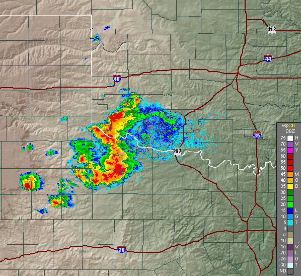
fileDescription: NEXRAD reflectivity image
fileType: JPEG
descriptiveKeywords: (MD_Keywords)
keyword: Earth Science > Spectral/Engineering > Radar > Doppler Velocity
keyword: Earth Science > Spectral/Engineering > Radar > Radar Cross-Section
keyword: Earth Science > Spectral/Engineering > Radar > Radar Reflectivity
keyword: Earth Science > Spectral/Engineering > Radar > Spectrum Width
keyword: Earth Science > Spectral/Engineering > Sensor Characteristics > Viewing Geometry
keyword: Earth Science > Human Dimensions > Natural Hazards > Tropical Cyclones > Typhoons
keyword: Earth Science > Atmosphere > Weather Events > Tropical Cyclones
keyword: Earth Science > Atmosphere > Weather Events > Hurricanes
keyword: Earth Science > Atmosphere > Weather Events > Rain Storms
keyword: Earth Science > Atmosphere > Weather Events > Tornados
keyword: Earth Science > Atmosphere > Atmospheric Winds > Upper Level Winds > Boundary Layer Winds
keyword: Earth Science > Atmosphere > Atmospheric Winds > Upper Level Winds > Wind Speed
keyword: Earth Science > Atmosphere > Atmospheric Winds > Upper Level Winds > Wind Direction
keyword: Earth Science > Atmosphere > Atmospheric Winds > Wind Profiles
keyword: Earth Science > Atmosphere > Atmospheric Winds > Wind Dynamics > Vertical Wind Velocity/Speed
keyword: Earth Science > Atmosphere > Atmospheric Winds > Wind Dynamics > Wind Shear
keyword: Earth Science > Atmosphere > Atmospheric Winds > Wind Dynamics > Convection
keyword: Earth Science > Atmosphere > Clouds > Cloud Microphysics > Cloud Liquid Water/Ice
keyword: Earth Science > Atmosphere > Clouds > Convective Clouds/Systems (observed/Analyzed) > Mesoscale Convective Complex
keyword: Earth Science > Atmosphere > Precipitation > Precipitation Amount
keyword: Earth Science > Atmosphere > Precipitation > Precipitation Rate
keyword: Earth Science > Atmosphere > Precipitation > Liquid Precipitation > Rain
keyword: Earth Science > Atmosphere > Precipitation > Solid Precipitation > Snow
keyword: Earth Science > Atmosphere > Precipitation > Solid Precipitation > Hail
keyword: Earth Science Services > Environmental Advisories > Hydrological Advisories > Floods
keyword: Earth Science Services > Environmental Advisories > Weather/Climate Advisories > Severe Weather
type: (MD_KeywordTypeCode) theme
thesaurusName: (CI_Citation)
title: Global Change Master Directory (GCMD) Science Keywords
date: (CI_Date)
date: 2018
dateType: (CI_DateTypeCode) revision
edition: Version 8.6
citedResponsibleParty: (CI_ResponsibleParty)
organisationName: Global Change Data Center, Science and Exploration Directorate, Goddard Space Flight Center (GSFC) National Aeronautics and Space Administration (NASA)
contactInfo: (CI_Contact)
onlineResource: (CI_OnlineResource)
linkage: https://earthdata.nasa.gov/about/gcmd/global-change-master-directory-gcmd-keywords
protocol: HTTPS
applicationProfile: Web Browser
name: Global Change Master Directory (GCMD) Keywords
description: The information provided on this page seeks to define how the GCMD Keywords are structured, used and accessed. It also provides information on how users can participate in the further development of the keywords.
function: (CI_OnLineFunctionCode) information
role: (CI_RoleCode) publisher
descriptiveKeywords: (MD_Keywords)
keyword: Radar
type: (MD_KeywordTypeCode) product
thesaurusName: (CI_Citation)
title: Keyword Thesaurus Title
date: (missing)
descriptiveKeywords: (MD_Keywords)
keyword: Continent > North America > United States Of America
keyword: Continent > Asia > Eastern Asia > South Korea
keyword: Geographic Region > Mid-Latitude
keyword: Geographic Region > Northern Hemisphere
keyword: Ocean > Atlantic Ocean > North Atlantic Ocean > Azores
keyword: Ocean > Atlantic Ocean > North Atlantic Ocean > Caribbean Sea > Puerto Rico
keyword: Ocean > Atlantic Ocean > North Atlantic Ocean > Gulf Of Mexico
keyword: Ocean > Pacific Ocean > Central Pacific Ocean > Guam
keyword: Ocean > Pacific Ocean > Central Pacific Ocean > Hawaiian Islands
keyword: Ocean > Pacific Ocean > Central Pacific Ocean > Kiribati
keyword: Ocean > Pacific Ocean > North Pacific Ocean > Bering Sea
keyword: Ocean > Pacific Ocean > North Pacific Ocean > Gulf Of Alaska
keyword: Ocean > Pacific Ocean > North Pacific Ocean > Okinawa
keyword: Ocean > Pacific Ocean > Western Pacific Ocean > East China Sea
keyword: Ocean > Pacific Ocean > Western Pacific Ocean > Yellow Sea
type: (MD_KeywordTypeCode) place
thesaurusName: (CI_Citation)
title: Global Change Master Directory (GCMD) Location Keywords
date: (CI_Date)
date: 2018
dateType: (CI_DateTypeCode) revision
edition: Version 8.6
citedResponsibleParty: (CI_ResponsibleParty)
organisationName: Global Change Data Center, Science and Exploration Directorate, Goddard Space Flight Center (GSFC) National Aeronautics and Space Administration (NASA)
contactInfo: (CI_Contact)
onlineResource: (CI_OnlineResource)
linkage: https://earthdata.nasa.gov/about/gcmd/global-change-master-directory-gcmd-keywords
protocol: HTTPS
applicationProfile: Web Browser
name: Global Change Master Directory (GCMD) Keywords
description: The information provided on this page seeks to define how the GCMD Keywords are structured, used and accessed. It also provides information on how users can participate in the further development of the keywords.
function: (CI_OnLineFunctionCode) information
role: (CI_RoleCode) publisher
descriptiveKeywords: (MD_Keywords)
keyword: Vertical Location > Boundary Layer
keyword: Vertical Location > Land Surface
keyword: Vertical Location > Troposphere
type: (MD_KeywordTypeCode) stratum
thesaurusName: (CI_Citation)
title: Global Change Master Directory (GCMD) Location Keywords
date: (CI_Date)
date: 2018
dateType: (CI_DateTypeCode) revision
edition: Version 8.6
citedResponsibleParty: (CI_ResponsibleParty)
organisationName: Global Change Data Center, Science and Exploration Directorate, Goddard Space Flight Center (GSFC) National Aeronautics and Space Administration (NASA)
contactInfo: (CI_Contact)
onlineResource: (CI_OnlineResource)
linkage: https://earthdata.nasa.gov/about/gcmd/global-change-master-directory-gcmd-keywords
protocol: HTTPS
applicationProfile: Web Browser
name: Global Change Master Directory (GCMD) Keywords
description: The information provided on this page seeks to define how the GCMD Keywords are structured, used and accessed. It also provides information on how users can participate in the further development of the keywords.
function: (CI_OnLineFunctionCode) information
role: (CI_RoleCode) publisher
descriptiveKeywords: (MD_Keywords)
keyword: In Situ Land-based Platforms > Weather Stations/Networks > Weather Stations
type: (MD_KeywordTypeCode) platform
thesaurusName: (CI_Citation)
title: Global Change Master Directory (GCMD) Platform Keywords
date: (CI_Date)
date: 2018
dateType: (CI_DateTypeCode) revision
edition: Version 8.6
citedResponsibleParty: (CI_ResponsibleParty)
organisationName: Global Change Data Center, Science and Exploration Directorate, Goddard Space Flight Center (GSFC) National Aeronautics and Space Administration (NASA)
contactInfo: (CI_Contact)
onlineResource: (CI_OnlineResource)
linkage: https://earthdata.nasa.gov/about/gcmd/global-change-master-directory-gcmd-keywords
protocol: HTTPS
applicationProfile: Web Browser
name: Global Change Master Directory (GCMD) Keywords
description: The information provided on this page seeks to define how the GCMD Keywords are structured, used and accessed. It also provides information on how users can participate in the further development of the keywords.
function: (CI_OnLineFunctionCode) information
role: (CI_RoleCode) publisher
descriptiveKeywords: (MD_Keywords)
keyword: NOAA OneStop Project
type: (MD_KeywordTypeCode) project
thesaurusName: (CI_Citation)
title: Global Change Master Directory (GCMD) Project Keywords
date: (CI_Date)
date: 2018
dateType: (CI_DateTypeCode) revision
edition: Version 8.6
citedResponsibleParty: (CI_ResponsibleParty)
organisationName: Global Change Data Center, Science and Exploration Directorate, Goddard Space Flight Center (GSFC) National Aeronautics and Space Administration (NASA)
contactInfo: (CI_Contact)
onlineResource: (CI_OnlineResource)
linkage: https://earthdata.nasa.gov/about/gcmd/global-change-master-directory-gcmd-keywords
protocol: HTTPS
applicationProfile: Web Browser
name: Global Change Master Directory (GCMD) Keywords
description: The information provided on this page seeks to define how the GCMD Keywords are structured, used and accessed. It also provides information on how users can participate in the further development of the keywords.
function: (CI_OnLineFunctionCode) information
role: (CI_RoleCode) publisher
descriptiveKeywords: (MD_Keywords)
keyword: Earth Remote Sensing Instruments > Active Remote Sensing > Profilers/Sounders > Radar Sounders > NEXRAD > NEXt Generation RADar
keyword: Earth Remote Sensing Instruments > Active Remote Sensing > Profilers/Sounders > Radar Sounders > Doppler Radar
type: (MD_KeywordTypeCode) instrument
thesaurusName: (CI_Citation)
title: Global Change Master Directory (GCMD) Instrument Keywords
date: (CI_Date)
date: 2018
dateType: (CI_DateTypeCode) revision
edition: Version 8.6
citedResponsibleParty: (CI_ResponsibleParty)
organisationName: Global Change Data Center, Science and Exploration Directorate, Goddard Space Flight Center (GSFC) National Aeronautics and Space Administration (NASA)
contactInfo: (CI_Contact)
onlineResource: (CI_OnlineResource)
linkage: https://earthdata.nasa.gov/about/gcmd/global-change-master-directory-gcmd-keywords
protocol: HTTPS
applicationProfile: Web Browser
name: Global Change Master Directory (GCMD) Keywords
description: The information provided on this page seeks to define how the GCMD Keywords are structured, used and accessed. It also provides information on how users can participate in the further development of the keywords.
function: (CI_OnLineFunctionCode) information
role: (CI_RoleCode) publisher
descriptiveKeywords: (MD_Keywords)
keyword: DOC/NOAA/NESDIS/NCEI > National Centers for Environmental Information, NESDIS, NOAA, U.S. Department of Commerce
keyword: DOC/NOAA/NESDIS/NCDC > National Climatic Data Center, NESDIS, NOAA, U.S. Department of Commerce
type: (MD_KeywordTypeCode) dataCentre
thesaurusName: (CI_Citation)
title: Global Change Master Directory (GCMD) Data Center Keywords
date: (CI_Date)
date: 2018
dateType: (CI_DateTypeCode) revision
edition: Version 8.6
citedResponsibleParty: (CI_ResponsibleParty)
organisationName: Global Change Data Center, Science and Exploration Directorate, Goddard Space Flight Center (GSFC) National Aeronautics and Space Administration (NASA)
contactInfo: (CI_Contact)
onlineResource: (CI_OnlineResource)
linkage: https://earthdata.nasa.gov/about/gcmd/global-change-master-directory-gcmd-keywords
protocol: HTTPS
applicationProfile: Web Browser
name: Global Change Master Directory (GCMD) Keywords
description: The information provided on this page seeks to define how the GCMD Keywords are structured, used and accessed. It also provides information on how users can participate in the further development of the keywords.
function: (CI_OnLineFunctionCode) information
role: (CI_RoleCode) publisher
descriptiveKeywords: (MD_Keywords)
keyword: SAR
type: (MD_KeywordTypeCode) other
resourceConstraints: (MD_LegalConstraints)
useConstraints: (MD_RestrictionCode) otherRestrictions
otherConstraints: Cite as: NOAA National Weather Service (NWS) Radar Operations Center (1992): NOAA Next Generation Radar (NEXRAD) Level 3 Products. [indicate subset used]. NOAA National Centers for Environmental Information. NCEI DSI 7000. [access date].
resourceConstraints: (MD_LegalConstraints)
accessConstraints: (MD_RestrictionCode) otherRestrictions
otherConstraints: Distribution liability: NOAA and NCEI make no warranty, expressed or implied, regarding these data, nor does the fact of distribution constitute such a warranty. NOAA and NCEI cannot assume liability for any damages caused by any errors or omissions in these data. If appropriate, NCEI can only certify that the data it distributes are an authentic copy of the records that were accepted for inclusion in the NCEI archives.
resourceConstraints: (MD_LegalConstraints)
useConstraints: (MD_RestrictionCode) otherRestrictions
otherConstraints: Use liability: NOAA and NCEI cannot provide any warranty as to the accuracy, reliability, or completeness of furnished data. Users assume responsibility to determine the usability of these data. The user is responsible for the results of any application of this data for other than its intended purpose.
aggregationInfo: (MD_AggregateInformation)
aggregateDataSetName: (CI_Citation)
title: Data Stewardship Maturity Report for NOAA Next Generation Radar (NEXRAD) Level III Products
date: (CI_Date)
date: 2021
dateType: (CI_DateTypeCode) publication
citedResponsibleParty: (CI_ResponsibleParty)
individualName: NOAA Institutional Repository
role: (CI_RoleCode) publisher
citedResponsibleParty: (CI_ResponsibleParty)
organisationName: (missing)
contactInfo: (CI_Contact)
onlineResource: (CI_OnlineResource)
linkage: https://doi.org/10.25923/cqck-0915
protocol: HTTPS
applicationProfile: Web Browser
name: DSMR Publication at the NOAA Institutional Repository
description: Report documenting the Scientific Data Stewardship Maturity for this dataset.
function: (CI_OnLineFunctionCode) information
role: (inapplicable)
associationType: (DS_AssociationTypeCode) crossReference
initiativeType: (DS_InitiativeTypeCode) sciencePaper
aggregationInfo: (MD_AggregateInformation)
aggregateDataSetName: (CI_Citation)
title: NEXRAD WSR-88D Interface Control Documents
date: (missing)
citedResponsibleParty: (CI_ResponsibleParty)
organisationName: Radar Operations Center, National Weather Service, NOAA, U.S. Department of Commerce
contactInfo: (CI_Contact)
address: (CI_Address)
city: Norman
administrativeArea: OK
role: (CI_RoleCode) publisher
citedResponsibleParty: (CI_ResponsibleParty)
organisationName: (missing)
contactInfo: (CI_Contact)
onlineResource: (CI_OnlineResource)
linkage: https://www.roc.noaa.gov/WSR88D/BuildInfo/Files.aspx
protocol: HTTPS
applicationProfile: Web Browser
name: NEXRAD WSR-88D Interface Control Documents
description: The Interface Control Documents (ICDs) describe the data format specification for multiple WSR-88D Build Versions.
function: (CI_OnLineFunctionCode) information
role: (missing)
associationType: (DS_AssociationTypeCode) crossReference
initiativeType: (DS_InitiativeTypeCode) dataDictionary
aggregationInfo: (MD_AggregateInformation)
aggregateDataSetName: (CI_Citation)
title: Federal Meteorological Handbook No. 11 - Doppler Radar Meteorological Observations (WSR-88D)
date: (missing)
citedResponsibleParty: (CI_ResponsibleParty)
organisationName: (missing)
contactInfo: (CI_Contact)
onlineResource: (CI_OnlineResource)
linkage: https://www.icams-portal.gov/resources/ofcm/fmh/allfmh2.htm
applicationProfile: Web Browser
name: Federal Meteorological Handbook No. 11 - Doppler Radar Meteorological Observations (WSR-88D)
description: The Handbook defines standardized data management practices.
function: (CI_OnLineFunctionCode) information
role: (missing)
associationType: (DS_AssociationTypeCode) crossReference
initiativeType: (DS_InitiativeTypeCode) userGuide
aggregationInfo: (MD_AggregateInformation)
aggregateDataSetName: (CI_Citation)
title: The WSR-88D and the WSR-88D Operational Support Facility
date: (CI_Date)
date: 1993-09
dateType: (CI_DateTypeCode) publication
identifier: (MD_Identifier)
code: doi:10.1175/1520-0477%281993%29074%3C1669%3ATWATWO%3E2.0.CO%3B2
citedResponsibleParty: (CI_ResponsibleParty)
organisationName: American Meteorological Society
contactInfo: (CI_Contact)
address: (CI_Address)
city: Boston
administrativeArea: MA
role: (CI_RoleCode) publisher
citedResponsibleParty: (CI_ResponsibleParty)
organisationName: Crum, T.D.
role: (CI_RoleCode) author
citedResponsibleParty: (CI_ResponsibleParty)
organisationName: Alberty, R.L.
role: (CI_RoleCode) author
citedResponsibleParty: (CI_ResponsibleParty)
organisationName: (missing)
contactInfo: (CI_Contact)
onlineResource: (CI_OnlineResource)
linkage: https://doi.org/10.1175/1520-0477%281993%29074%3C1669%3ATWATWO%3E2.0.CO%3B2
protocol: HTTPS
applicationProfile: Web Browser
name: The WSR-88D and the WSR-88D Operational Support Facility
description: AMS Journal Publication.
function: (CI_OnLineFunctionCode) information
role: (missing)
series: (CI_Series)
name: Bulletin of the American Meteorological Society, Volume 74
issueIdentification: Issue 9, pp. 1669-1687
otherCitationDetails: pp. 1669-1687
associationType: (DS_AssociationTypeCode) crossReference
initiativeType: (DS_InitiativeTypeCode) sciencePaper
aggregationInfo: (MD_AggregateInformation)
aggregateDataSetName: (CI_Citation)
title: History of Operational Use of Weather Radar by U.S. Weather Services. Part I: The Pre-NEXRAD Era
date: (CI_Date)
date: 1998-06
dateType: (CI_DateTypeCode) publication
identifier: (MD_Identifier)
code: doi:10.1175/1520-0434%281998%29013%3C0219%3AHOOUOW%3E2.0.CO%3B2
citedResponsibleParty: (CI_ResponsibleParty)
organisationName: American Meteorological Society
contactInfo: (CI_Contact)
address: (CI_Address)
city: Boston
administrativeArea: MA
role: (CI_RoleCode) publisher
citedResponsibleParty: (CI_ResponsibleParty)
organisationName: Whiton, R.C.
role: (CI_RoleCode) author
citedResponsibleParty: (CI_ResponsibleParty)
organisationName: Smith, P.L.
role: (CI_RoleCode) author
citedResponsibleParty: (CI_ResponsibleParty)
organisationName: Bigler, S.G.
role: (CI_RoleCode) author
citedResponsibleParty: (CI_ResponsibleParty)
organisationName: Wilk, K.E.
role: (CI_RoleCode) author
citedResponsibleParty: (CI_ResponsibleParty)
organisationName: Harbuck, A.C.
role: (CI_RoleCode) author
citedResponsibleParty: (CI_ResponsibleParty)
organisationName: (missing)
contactInfo: (CI_Contact)
onlineResource: (CI_OnlineResource)
linkage: https://doi.org/10.1175/1520-0434%281998%29013%3C0219%3AHOOUOW%3E2.0.CO%3B2
protocol: HTTPS
applicationProfile: Web Browser
name: History of Operational Use of Weather Radar by U.S. Weather Services. Part I: The Pre-NEXRAD Era
description: AMS Journal Publication.
function: (CI_OnLineFunctionCode) information
role: (missing)
series: (CI_Series)
name: Weather and Forecasting, Volume 13
issueIdentification: Issue 2, pp. 219-243
otherCitationDetails: pp. 219-243
associationType: (DS_AssociationTypeCode) crossReference
initiativeType: (DS_InitiativeTypeCode) sciencePaper
aggregationInfo: (MD_AggregateInformation)
aggregateDataSetName: (CI_Citation)
title: History of Operational Use of Weather Radar by U.S. Weather Services. Part II: Development of Operational Doppler Weather Radars
date: (CI_Date)
date: 1998-06
dateType: (CI_DateTypeCode) publication
identifier: (MD_Identifier)
code: doi:10.1175/1520-0434%281998%29013%3C0244%3AHOOUOW%3E2.0.CO%3B2
citedResponsibleParty: (CI_ResponsibleParty)
organisationName: American Meteorological Society (AMS)
contactInfo: (CI_Contact)
phone: (CI_Telephone)
voice: (617) 227-2425
facsimile: (617) 742-8718
address: (CI_Address)
deliveryPoint: 45 Beacon Street
city: Boston
administrativeArea: MA
postalCode: 02108-3693
country: USA
electronicMailAddress: amsinfo@ametsoc.org
role: (CI_RoleCode) publisher
citedResponsibleParty: (CI_ResponsibleParty)
organisationName: Whiton, R.C.
role: (CI_RoleCode) author
citedResponsibleParty: (CI_ResponsibleParty)
organisationName: Smith, P.L.
role: (CI_RoleCode) author
citedResponsibleParty: (CI_ResponsibleParty)
organisationName: Bigler, S.G.
role: (CI_RoleCode) author
citedResponsibleParty: (CI_ResponsibleParty)
organisationName: Wilk, K.E.
role: (CI_RoleCode) author
citedResponsibleParty: (CI_ResponsibleParty)
organisationName: Harbuck, A.C.
role: (CI_RoleCode) author
citedResponsibleParty: (CI_ResponsibleParty)
organisationName: (missing)
contactInfo: (CI_Contact)
onlineResource: (CI_OnlineResource)
linkage: https://doi.org/10.1175/1520-0434%281998%29013%3C0244%3AHOOUOW%3E2.0.CO%3B2
protocol: HTTPS
applicationProfile: Web Browser
name: History of Operational Use of Weather Radar by U.S. Weather Services. Part II: Development of Operational Doppler Weather Radars
description: AMS Journal Publication.
function: (CI_OnLineFunctionCode) information
role: (missing)
series: (CI_Series)
name: Weather and Forecasting, Volume 13
issueIdentification: Issue 2, pp. 244-252
otherCitationDetails: pp. 244-252
associationType: (DS_AssociationTypeCode) crossReference
initiativeType: (DS_InitiativeTypeCode) sciencePaper
language: eng; USA
topicCategory: (MD_TopicCategoryCode) climatologyMeteorologyAtmosphere
extent: (EX_Extent)
geographicElement: (EX_GeographicBoundingBox)
westBoundLongitude: 124.0
eastBoundLongitude: -64.0
southBoundLatitude: 11.0
northBoundLatitude: 68.0
temporalElement: (EX_TemporalExtent)
extent:
TimePeriod:
beginPosition: 1992-05-07
endPosition:
return to top
contentInfo: (MI_CoverageDescription)
attributeDescription:
RecordType: General Meteorological Products: General products include the baseline reflectivity and velocity, and also algorithmic graphic products spectrum width, vertical integrated liquid, and VAD wind profile.
contentType: (unknown)
dimension: (MD_Band)
sequenceIdentifier:
MemberName:
aName: Base Reflectivity
attributeType: (unknown)
descriptor: A display of echo intensity measured in dBZ. This product is used to detect precipitation, evaluate storm structure, locate boundaries and determine hail potential. The 4 lowest elevations angles are available.
maxValue:
Real: 95
minValue:
Real: -30
units:
UnitDefinition:
identifier: dBZ
name: dBZ
dimension: (MD_Band)
sequenceIdentifier:
MemberName:
aName: Base Velocity
attributeType: (unknown)
descriptor: A measure of the radial component of the wind either toward the radar (negative values) or away from the radar (positive values). Negative values are represented by cool colors (green) while positive values are represented by warm colors (red). This product is used to estimate wind speed and direction, locate boundaries, locate severe weather signatures and identify suspected areas of turbulence.
maxValue:
Real: 100
minValue:
Real: -100
units:
UnitDefinition:
identifier: knots
name: knots
dimension: (MD_Band)
sequenceIdentifier:
MemberName:
aName: Composite Reflectivity
attributeType: (unknown)
descriptor: A display of maximum reflectivity for the total volume within the range of the radar. This product is used to reveal the highest reflectivities in all echoes, examine storm structure features and determine intensity of storms.
maxValue:
Real: 75
minValue:
Real: -32
units:
UnitDefinition:
identifier: dbz
name: dbz
dimension: (MD_Band)
sequenceIdentifier:
MemberName:
aName: Layer Composite Reflectivity
attributeType: (unknown)
descriptor: A display of maximum reflectivity for three different height ranges within the volume scan. This product is used to reveal the highest reflectivities in all echoes, examine storm structure features and determine intensity of storms.
maxValue:
Real: 75
minValue:
Real: -32
units:
UnitDefinition:
identifier: dbz
name: dbz
dimension: (MD_Band)
sequenceIdentifier:
MemberName:
aName: Storm Relative Veolicty
attributeType: (unknown)
descriptor: When the motion of storms are subtracted from the wind field, the result is a picture of the wind as if the storms were stationary. Color induces are the same as base velocity. Comparing the storm relative motion image with base velocity image helps identify the rotating storm.
maxValue:
Real: 100
minValue:
Real: -100
units:
UnitDefinition:
identifier: knots
name: knots
dimension: (MD_Band)
sequenceIdentifier:
MemberName:
aName: Echo Tops
attributeType: (unknown)
descriptor: An image of the echo top heights color coded in user-defined increments. This product is used for a quick estimation of the most intense convection and higher echo tops, as an aid in identification of storm structure features and for pilot briefing purposes.
maxValue:
Real: 70000
minValue:
Real: 5000
units:
UnitDefinition:
identifier: feet
name: feet
dimension: (MD_Band)
sequenceIdentifier:
MemberName:
aName: Vertical Integrated Liquid
attributeType: (unknown)
descriptor: The water content of a 2.2 X 2.2 nmi column of air which is color coded and plotted on a 124 nmi map. This product is used as an effective hail indicator, to locate most significant storms and to identify areas of heavy rainfall.
maxValue:
Real: 200
minValue:
Real: 0
units:
UnitDefinition:
identifier: kg/m**2
name: kg/m**2
dimension: (MD_Band)
sequenceIdentifier:
MemberName:
aName: VAD Wind Profile
attributeType: (unknown)
descriptor: A graphic display of wind barbs plotted on a height staff in 500 ft or 1000 ft increments. The current (far right) and up to 10 previous plots may be displayed simultaneously. This product is an excellent tool for meteorologists in weather forecasting, severe weather and aviation.
units: (missing)
return to top
contentInfo: (MI_CoverageDescription)
attributeDescription:
RecordType: Hydrometeorological Products: Precipitation products are estimated ground accumulated rainfall. Estimates are based off a reflectivity and rainfall rate relationship called Z-R.
contentType: (unknown)
dimension: (MD_Band)
sequenceIdentifier:
MemberName:
aName: One Hour Precipitation
attributeType: (unknown)
descriptor: A display of estimated one hour precipitation accumulation on a 1.1 X 1.1 nmi grid. This product is used to assess rainfall intensities for flash flood warnings, urban flood statements and special weather statements.
maxValue:
Real: 50
minValue:
Real: 0
units:
UnitDefinition:
identifier: inches
name: inches
dimension: (MD_Band)
sequenceIdentifier:
MemberName:
aName: Three Hour Precipitation
attributeType: (unknown)
descriptor: A display of estimated three hour precipitation accumulation on a 1.1 X 1.1 nmi grid. This product is used to assess rainfall intensities for flash flood warnings, urban flood statements and special weather statements.
maxValue:
Real: 50
minValue:
Real: 0
units:
UnitDefinition:
identifier: inches
name: inches
dimension: (MD_Band)
sequenceIdentifier:
MemberName:
aName: Storm Total Precipitation
attributeType: (unknown)
descriptor: A map of estimated storm total precipitation accumulation continuously updated since the last one-hour break. This product is used to locate flood potential over urban or rural areas, estimate total basin runoff and provide rainfall data 24 hours a day.
maxValue:
Real: 50
minValue:
Real: 0
units:
UnitDefinition:
identifier: inches
name: inches
dimension: (MD_Band)
sequenceIdentifier:
MemberName:
aName: Digital Precipitation Array
attributeType: (unknown)
descriptor: An array format of estimated one hour precipitation accumulations on the 1/4 LFM (4.7625 km HRAP) grid. This is a 8 bit product with 255 possible precip values. This product is used to assess rainfall intensities for flash flood warnings, urban flood statements and special weather statements.
maxValue:
Real: 50
minValue:
Real: 0
units:
UnitDefinition:
identifier: inches
name: inches
return to top
contentInfo: (MI_CoverageDescription)
attributeDescription:
RecordType: Storm Overlay Products: Overlay products are alphanumeric data that gives detailed information on certain parameters for an identified storm cell.
contentType: (unknown)
rangeElementDescription: (MI_RangeElementDescription)
name: Storm Structure
definition: A table displaying information on storm attributes which include maximum reflectivity, maximum velocity at lowest elevation angle, storm overhang, mass weighted storm volume, storm area base and top, storm position and storm tilt.
rangeElement:
Record: Alphanumeric values: Product is alphanumeric.
rangeElementDescription: (MI_RangeElementDescription)
name: Hail Index
definition: A product designed to locate storms which have the potential to produce hail. Hail potential is labeled as either probable (hollow green triangle) or positive (filled green triangle). Probable means the storm is probably producing hail and positive means the storm is producing hail.
rangeElement:
Record: Alphanumeric values: Product is alphanumeric.
rangeElementDescription: (MI_RangeElementDescription)
name: Mesocyclone
definition: This product is designed to display information regarding the existence and nature of rotations associated with thunderstorms. Numerical output includes azimuth, range, and height of the mesocyclone.
rangeElement:
Record: Alphanumeric values: Product is alphanumeric.
rangeElementDescription: (MI_RangeElementDescription)
name: Tornadic Vortex Signature
definition: A product which shows an intense gate to gate azimuthal shear associated with tornadic- scale rotation. It is depicted by a red triangle with numerical output of location and height.
rangeElement:
Record: Alphanumeric values: Product is alphanumeric.
rangeElementDescription: (MI_RangeElementDescription)
name: Storm Tracking Information
definition: A product which shows a plot of the past hours movement, current location, and forecast movement for the next hour or less for each identified thunderstorm cell. This product is used to determine reliable storm movement.
rangeElement:
Record: Alphanumeric values: Product is alphanumeric.
return to top
contentInfo: (MI_CoverageDescription)
attributeDescription:
RecordType: Radar Messages: Radar messages are sent by the radar site to users in order to know more about the radar status and special product data.
contentType: (unknown)
rangeElementDescription: (MI_RangeElementDescription)
name: General Status Message
definition: A text message describing the status of the Radar site. A reason may be provided if the Radar is not transmitting.
rangeElement:
Record: Alphanumeric Text: Message contains alphanumeric text.
rangeElementDescription: (MI_RangeElementDescription)
name: Radar Coded Message
definition: A three part message containing a tabular listing of composite reflectivity data, a vertical wind profile derived from the VAD algorithm and the locations of algorithm produced severe weather features such as the Hail Index (HI) and the Tornado Vortex Signature (TVS).
rangeElement:
Record: Alphanumeric Text: Message contains alphanumeric text.
rangeElementDescription: (MI_RangeElementDescription)
name: Radar Outage Notification
definition: Notification message of radar outage.
rangeElement:
Record: Alphanumeric Text: Message contains alphanumeric text.
rangeElementDescription: (MI_RangeElementDescription)
name: Interim Radar Message
definition: Notification message of radar outage.
rangeElement:
Record: Alphanumeric Text: Message contains alphanumeric text.
rangeElementDescription: (MI_RangeElementDescription)
name: Radar Coded Message
definition: The Radar Coded Message product (RCM) is based on grid squares approximately 10 km on a side. It is composed of three parts preceded by a communications header.
rangeElement:
Record: Part A: Reflectivity is produced automatically and is presented to the user as a tabular listing of alphanumerics.
rangeElement:
Record: Part B: Velocity Azimuth Display is also produced automatically and is presented to the user as an alphanumeric message.
rangeElement:
Record: Part C: Remarks, consists of automatically provided information that can be augmented at the option of the user. The automatically produced portion of Part C is presented to the user as an alphanumeric message.
return to top
contentInfo: (MD_FeatureCatalogueDescription)
includedWithDataset: (missing)
featureCatalogueCitation: (CI_Citation)
title: Entity and Attribute Overview: http://www1.ncdc.noaa.gov/pub/data/documentlibrary/tddoc/td7000.pdf
date: (inapplicable)
otherCitationDetails: Entity and Attribute Detail Citation: none
return to top
contentInfo: (MD_ImageDescription)
attributeDescription: (inapplicable)
contentType: (inapplicable)
processingLevelCode: (MD_Identifier)
authority: (CI_Citation)
title: Content Standard for Digital Geospatial Metadata: Extensions for Remote Sensing Metadata - Appendix B, NOAA Data Product Levels
date: (CI_Date)
date: 2002-10-09
dateType: (CI_DateTypeCode) publication
edition: FGDC-STD-012-2002
citedResponsibleParty: (CI_ResponsibleParty)
organisationName: Federal Geographic Data Committee Secretariat c/o U.S. Geological Survey
contactInfo: (CI_Contact)
address: (CI_Address)
deliveryPoint: 590 National Center
city: Reston
administrativeArea: VA
postalCode: 20192
role: (CI_RoleCode) publisher
citedResponsibleParty: (CI_ResponsibleParty)
organisationName: Standards Working Group, Federal Geographic Data Committee
role: (CI_RoleCode) originator
citedResponsibleParty: (CI_ResponsibleParty)
organisationName: (missing)
contactInfo: (CI_Contact)
onlineResource: (CI_OnlineResource)
linkage: https://www.fgdc.gov/standards/projects/FGDC-standards-projects/csdgm_rs_ex/MetadataRemoteSensingExtens.pdf
protocol: HTTPS
applicationProfile: Information
name: Content Standard for Digital Geospatial Metadata: Extensions for Remote Sensing Metadata, FGDC-STD-012-2002
description: The purpose of this standard is to provide extensions to the Federal Geographic Data Committee (FGDC) Content Standard for Digital Geospatial Metadata for describing geospatial data obtained from remote sensing.
function: (CI_OnLineFunctionCode) information
role: (inapplicable)
code: Level 3
return to top
distributionInfo: (MD_Distribution)
distributor: (MD_Distributor)
distributorContact: (CI_ResponsibleParty)
organisationName: NOAA National Centers for Environmental Information
contactInfo: (CI_Contact)
address: (CI_Address)
electronicMailAddress: ncei.info@noaa.gov
onlineResource: (CI_OnlineResource)
linkage: https://www.ncei.noaa.gov/contact
name: NCEI Contact Information
description: Information for contacts at NCEI.
function: (CI_OnLineFunctionCode) information
role: (CI_RoleCode) distributor
distributionOrderProcess: (MD_StandardOrderProcess)
fees: In most cases, electronic downloads of the data are free. However, fees may apply for custom orders, data certifications, copies of analog materials, and data distribution on physical media.
orderingInstructions: Contact NCEI for other distribution options and instructions.
distributorFormat: (MD_Format)
name: Native Binary
version: (missing)
fileDecompressionTechnique: Unix Zip (.Z) or gzip (.gz) compression and tape archive (.tar) may be applied to data files retreived from the NCDC archive.
distributorTransferOptions: (MD_DigitalTransferOptions)
onLine: (CI_OnlineResource)
linkage: https://www.ncei.noaa.gov/metadata/geoportal/rest/metadata/item/gov.noaa.ncdc:C00708/html
protocol: HTTPS
applicationProfile: Landing Page
name: NCEI Dataset Landing Page
description: Landing page for the dataset.
function: (CI_OnLineFunctionCode) information
distributorTransferOptions: (MD_DigitalTransferOptions)
onLine: (CI_OnlineResource)
linkage: https://www.ncei.noaa.gov/products/radar/next-generation-weather-radar
protocol: HTTPS
applicationProfile: Information
name: NCEI NEXRAD page
description: Informational resources for NEXRAD Radar Data.
function: (CI_OnLineFunctionCode) information
distributorTransferOptions: (MD_DigitalTransferOptions)
onLine: (CI_OnlineResource)
linkage: https://www.ncei.noaa.gov/access/search/data-search/weather-radar-level-iii
protocol: HTTPS
applicationProfile: Data Search Application
name: NCEI Data Search
description: Search the data archive to submit an order via the interface or download files if available.
function: (CI_OnLineFunctionCode) search
distributorTransferOptions: (MD_DigitalTransferOptions)
onLine: (CI_OnlineResource)
linkage: https://www.ncei.noaa.gov/maps/radar/
protocol: HTTPS
applicationProfile: Map Search Application
name: NCEI GIS Map Viewer
description: Dynamic GIS mapping application to locate stations and data for selected layers.
function: (CI_OnLineFunctionCode) search
distributorTransferOptions: (MD_DigitalTransferOptions)
onLine: (CI_OnlineResource)
linkage: https://www.ncdc.noaa.gov/nexradinv/
protocol: HTTPS
applicationProfile: Web Browser
name: NCEI NEXRAD Data Inventory Search
description: Search for radar data and estimated VCP mode by station ID, location, and date via a text-based interface.
function: (CI_OnLineFunctionCode) search
distributorTransferOptions: (MD_DigitalTransferOptions)
onLine: (CI_OnlineResource)
linkage: https://gis.ncdc.noaa.gov/arcgis/rest/services/cdo/nexrad/MapServer
protocol: HTTPS
applicationProfile: REST
name: NCEI ArcGIS REST Services Directory
description: ArcGIS Server REST API for the dataset.
function: (CI_OnLineFunctionCode) download
distributorTransferOptions: (MD_DigitalTransferOptions)
onLine: (CI_OnlineResource)
linkage: https://gis.ncdc.noaa.gov/arcgis/services/cdo/nexrad/MapServer/WMSServer?request=GetCapabilities&service=WMS
protocol: HTTPS
applicationProfile: WMS
name: NCEI NEXRAD WMS
description: Web Map Service for the dataset.
function: (CI_OnLineFunctionCode) download
distributorTransferOptions: (MD_DigitalTransferOptions)
onLine: (CI_OnlineResource)
linkage: https://gis.ncdc.noaa.gov/arcgis/services/cdo/nexrad/MapServer/WFSServer?request=GetCapabilities&service=WFS
protocol: HTTPS
applicationProfile: WFS
name: NCEI NEXRAD WFS
description: Web Feature Service for the dataset.
function: (CI_OnLineFunctionCode) download
distributorTransferOptions: (MD_DigitalTransferOptions)
onLine: (CI_OnlineResource)
linkage: https://gis.ncdc.noaa.gov/kml/nexrad.kmz
protocol: HTTPS
applicationProfile: KML
name: KMZ file for dataset
description: Direct download link for KMZ file.
function: (CI_OnLineFunctionCode) download
distributorTransferOptions: (MD_DigitalTransferOptions)
onLine: (CI_OnlineResource)
linkage: https://www.ncei.noaa.gov/products/radar/radar-display-conversion-tools
protocol: HTTPS
applicationProfile: Web Browser
name: NEXRAD Display and Conversion Tools
description: Information on free visualization, analysis, and decoding tools for the radar data format.
function: (CI_OnLineFunctionCode) information
return to top
dataQualityInfo: (DQ_DataQuality)
scope: (DQ_Scope)
level: (MD_ScopeCode) dataset
lineage: (LI_Lineage)
statement: NEXRAD Level 3 products were created by the NOAA National Weather Service (NWS) and are archived by the NOAA National Centers for Environmental Information (NCEI).
processStep: (LE_ProcessStep)
description: Level 2 data are the three meteorological base data quantities: reflectivity, mean radial velocity, and spectrum width. From these Level 2 data, computer processors generate numerous meteorological analysis Level 3 products based on the Level 3 product algorithms. Level 2 data are recorded at all NWS and several select CONUS DOD WSR-88D sites. Level 3 products are recorded at all U.S. sites. The data are sent to the NOAA National Centers for Environmental Information for archiving and dissemination.
dateTime: (unknown)
processor: (CI_ResponsibleParty)
organisationName: DOC/NOAA/NWS/ROC
positionName: Primary Algorithm Product Lead
contactInfo: (CI_Contact)
address: (CI_Address)
deliveryPoint: Radar Operations Center
city: Norman
administrativeArea: Oklahoma
country: USA
role: (CI_RoleCode) processor
source: #Level_2
source: (LI_Source)
description: Source Contribution: The Level 2 data are used in processing Level 3 data. Source Type: digital
sourceCitation: (CI_Citation)
title: NWS WSR-88D Next Generation Radar (NEXRAD) Level 2
date: (CI_Date)
date: 1988
dateType: (CI_DateTypeCode) publication
identifier: (MD_Identifier)
code: gov.noaa.ncdc:C00345
citedResponsibleParty: (CI_ResponsibleParty)
organisationName: DOC/NOAA/NWS > National Weather Service, NOAA, U.S. Department of Commerce
contactInfo: (CI_Contact)
address: (CI_Address)
deliveryPoint: National Oceanic and Atmospheric Administration National Weather Service 1325 East West Highway
city: Silver Spring
administrativeArea: MD
postalCode: 20910
country: USA
role: (CI_RoleCode) originator
citedResponsibleParty: (CI_ResponsibleParty)
organisationName: (missing)
contactInfo: (CI_Contact)
onlineResource: (CI_OnlineResource)
linkage: https://doi.org/10.7289/V5W9574V
protocol: HTTPS
applicationProfile: Web Browser
name: NWS Next Generation RADar (NEXRAD) Level 2 Data
description: NEXRAD Level 2 data information page.
function: (CI_OnLineFunctionCode) information
role: (missing)
sourceExtent: (EX_Extent)
temporalElement: (EX_TemporalExtent)
extent:
TimePeriod:
beginPosition: 1992-05-07
endPosition:
return to top
dataQualityInfo: (DQ_DataQuality)
scope: (DQ_Scope)
level: (MD_ScopeCode) repository
levelDescription: (MD_ScopeDescription)
other: NOAA National Centers for Environmental Information
lineage: (LI_Lineage)
processStep: (LE_ProcessStep)
description: NOAA created the National Centers for Environmental Information (NCEI) by merging NOAA's National Climatic Data Center (NCDC), National Geophysical Data Center (NGDC), and National Oceanographic Data Center (NODC), including the National Coastal Data Development Center (NCDDC), per the Consolidated and Further Continuing Appropriations Act, 2015, Public Law 113-235. NCEI launched publicly on April 22, 2015.
dateTime:
DateTime: 2015-04-22T00:00:00
return to top
dataQualityInfo: (DQ_DataQuality)
scope: (DQ_Scope)
level: (MD_ScopeCode) dataset
levelDescription: (MD_ScopeDescription)
other: Data Stewardship
report: (DQ_ConceptualConsistency)
nameOfMeasure: Data Stewardship Maturity Assessment
measureIdentification: (MD_Identifier)
code: MM-Stew
measureDescription: The Data Stewardship Maturity Matrix (DSMM) is a unified framework that defines criteria for each of nine components based on measurable practices, which can be used to apply a progressive, 6-level rating to an individual dataset, representing stewardship maturity stages rated as Not Assessed or Not Available (Level 0), adHoc (Level 1), minimum (Level 2), intermediate (Level 3), advanced (Level 4), and optimal (Level 5).
evaluationMethodDescription: Data Stewardship Maturity Assessment was evaluated by the metadata content editor for the NOAA OneStop project using the Scientific Data Stewardship Maturity Assessment Model Template v4.0.
evaluationProcedure: (CI_Citation)
title: The Scientific Data Stewardship Maturity Assessment Model Template
date: (CI_Date)
date: 2016-11-28
dateType: (CI_DateTypeCode) publication
edition: NCDC-CICS-SMM_0001_Rev.1 v4.0 11/28/2016
identifier: (MD_Identifier)
code:
Anchor: DOI link doi:10.10.6084/m9.figshare.1211954
citedResponsibleParty: (CI_ResponsibleParty)
individualName: Peng, Ge
organisationName: CICS-NC/NCEI
role: (CI_RoleCode) author
citedResponsibleParty: (CI_ResponsibleParty)
organisationName: (inapplicable)
contactInfo: (CI_Contact)
onlineResource: (CI_OnlineResource)
linkage: https://doi.org/10.6084/m9.figshare.1211954
protocol: HTTPS
applicationProfile: Web Browser
name: The Scientific Data Stewardship Maturity Assessment Model Template
description: Landing page for quality evaluation procedure.
function: (CI_OnLineFunctionCode) information
role: (inapplicable)
dateTime:
DateTime: 2016-11-28T00:00:00
result: (DQ_QuantitativeResult)
valueUnit: (inapplicable)
value:
Record:
CodeListValue: intermediate
value:
Record:
CodeListValue: optimal
value:
Record:
CodeListValue: intermediate
value:
Record:
CodeListValue: optimal
value:
Record:
CodeListValue: optimal
value:
Record:
CodeListValue: advanced
value:
Record:
CodeListValue: advanced
value:
Record:
CodeListValue: advanced
value:
Record:
CodeListValue: advanced
return to top
metadataMaintenance: (MD_MaintenanceInformation)
maintenanceAndUpdateFrequency: (MD_MaintenanceFrequencyCode) asNeeded
maintenanceNote: Bulk metadata change applied on 2023-06-23. See version control repository history for metadata change details.
return to top
acquisitionInformation: (MI_AcquisitionInformation)
instrument: (MI_Instrument)
identifier: (MD_Identifier)
code: NEXRAD > NEXt Generation RADar
type: (missing)
operation: (MI_Operation)
identifier: (MD_Identifier)
code: NEXRAD > NEXt Generation Weather RADar
status: (missing)
parentOperation: (inapplicable)
platform: (MI_Platform)
identifier: (MD_Identifier)
code: National Weather Service
description: (missing)
instrument: (missing)