NOAA Climate Data Record (CDR) of SSM/I and SSMIS Microwave Brightness Temperatures, RSS Version 6 (Version Superseded)
SSMI(S) Brightness Temperatures - RSS
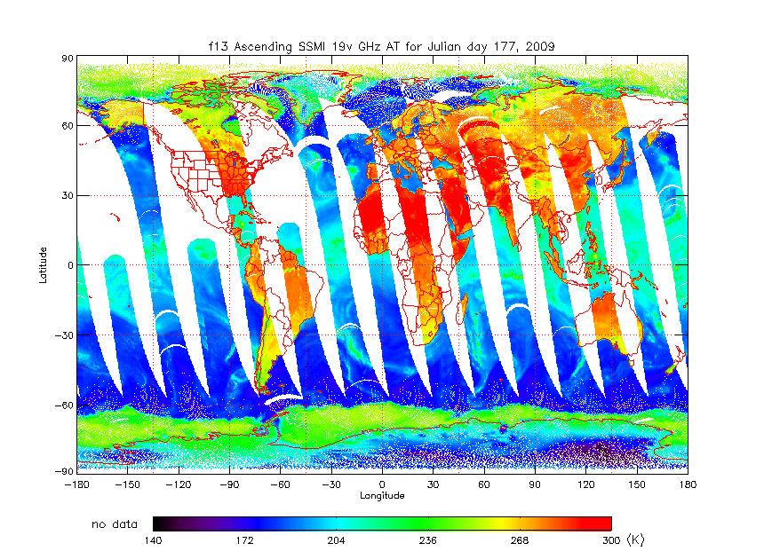 SSM/I Ascending 19 Vertical GHz Antenna Temperature
*Note: This dataset version has been superseded by a newer version. It is highly recommended that users access the current version. Users should only use this version for special cases, such as reproducing studies that used this version.* The Special Sensor Microwave Imagers (SSM/I) are a series of six satellite radiometers that have been in operation since 1987 under the Defense Meteorological Satellite Program (DMSP). The six SSM/Is (aboard F08, F10, F11, F13, F14, and F15) have a seven channel linearly polarized passive microwave radiometer that operate at frequencies of 19.36 (vertical and horizontal polarized), 22.235 (vertical polarized), 37.0 (vertical and horizontal polarized), and 85.5 GHz (vertical and horizontal polarized). The Remote Sensing Systems (RSS) Version-6 SSM/I Fundamental Climate Data Record (FCDR) dataset has incorporated all past geolocation corrections, sensor calibration (including cross-scan biases), and quality control procedures in a consistent way for the entire 24-year SSM/I brightness temperature period of record. Version-5 was relatively short lived due to subtle calibration problems that caused small spurious trends in the climate retrievals (the SSM/I record had become long enough at this point to detect such errors). The problem was due to subtle correlations in the derivation of the target factors for the F10 and F14 SSM/I. Like the Microwave Sounding Unit (MSU), some of the SSM/I exhibit errors that are correlated with the hot-load target temperatures, and we removed these errors using the target multiplier approach. Application of the solutions described herein provided the current V6 SSM/I TA and TB dataset. RSS Version-6 SSM/I FCDR data are stored as netCDF-4 files that have been internally compressed at the maximum GZIP utility level. A typical file will have a size of 6.4 megabytes.
Dataset Citation
- Users must cite this dataset when used as a source.
Dataset Identifiers
- NCEI DSI 3623_02
- gov.noaa.ncdc:C00801
ISO 19115-2 Metadata
gov.noaa.ncdc:C00801
| Distribution Formats |
|
| Ordering Instructions | Contact NCEI for other distribution options and instructions. |
| Distributor |
NOAA National Centers for Environmental Information ncei.info@noaa.gov |
| Dataset Point of Contact | NOAA Climate Data Record Program Office DOC/NOAA/NESDIS/NCEI > National Centers for Environmental Information, NESDIS, NOAA, U.S. Department of Commerce +1 (828) 271-4800 rss_ssmi_contacts@noaa.gov |
| Time Period | 1987-07-09 to 2010-08-31 |
| Spatial Bounding Box Coordinates |
West: -180.0
East: 180.0
South: -90.0
North: 90.0
|
| Spatial Coverage Map |
| Dataset Information |
|
| General Documentation |
|
| Associated Resources |
|
| Publication Dates |
|
| Edition | Version 6 |
| Data Presentation Form | Digital image |
| Dataset Progress Status | Complete - production of the data has been completed Historical archive - data has been stored in an offline storage facility Superseded - replaced by new |
| Data Update Frequency | Not planned |
| Purpose | For the Remote Sensing Systems (RSS) Version-6 Special Sensor Microwave Imagers (SSM/I) FCDR, the six SSM/Is (aboard F08, F10, F11, F13, F14, and F15) have been carefully inter-calibrated which allow investigators to confidently use these SSM/I products for detailed inter-annual and decadal trend studies. This FCDR is used widely by the satellite precipitation and cryosphere scientific communities to create climate-quality products for highly visible programs or institutions such as the Global Precipitation Climatology Project (GPCP), Goddard Profiling Algorithm (GPROF) and the National Snow and Ice Data Center (NSIDC) Sea-ice extent monitoring web page. |
| Dataset Citation |
|
| Cited Authors |
|
| Originators |
|
| Publishers |
|
| Theme keywords |
Global Change Master Directory (GCMD) Science Keywords
|
| Data Center keywords |
Global Change Master Directory (GCMD) Data Center Keywords
|
| Platform keywords |
Global Change Master Directory (GCMD) Platform Keywords
|
| Instrument keywords |
Global Change Master Directory (GCMD) Instrument Keywords
|
| Place keywords |
Global Change Master Directory (GCMD) Location Keywords
|
| Project keywords |
|
| Use Constraints |
|
| Access Constraints |
|
| Fees |
|
| Lineage information for: repository | |
|---|---|
| Processing Steps |
|
Last Modified: 2023-09-18
For questions about the information on this page, please email: ncei.info@noaa.gov
For questions about the information on this page, please email: ncei.info@noaa.gov