NOAA Climate Data Record (CDR) of AVHRR Daily and Monthly Aerosol Optical Thickness over Global Oceans, Version 2.0 (Version Superseded)
AVHRR Aerosol Optical Thickness; AVHRR AOT
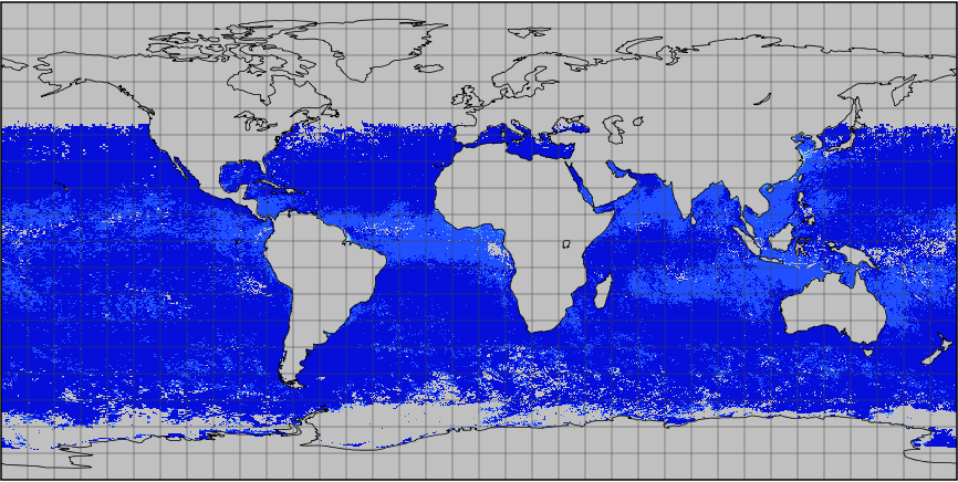 AVHRR AOT monthly file example
*Note: This dataset version has been superseded by a newer version. It is highly recommended that users access the current version. Users should only use this version for special cases, such as reproducing studies that used this version.* This NOAA Climate Data Record (CDR) of Aerosol Optical Thickness (AOT) is derived from data taken over global oceans from the PATMOS-x AVHRR level-2b channel 1 (0.63 micron) orbital clear-sky radiance. The retrieval is performed for selected spatial (8-km) and temporal (1 time per day) resolution in cloud free condition during daytime over global oceans. The AVHRR AOT CDR version 2 extends from 1981 to 2009 and includes both daily and monthly data in an equal angle grid (0.1x0.1 degree). Version 2 has improved cloud screening and data processing from version 1. Due to the relatively large uncertainties associated with surface reflectance over water glint area and land surface as well as limited AVHRR retrieval channels, the current algorithm only performs retrieval over non-glint water surface (specifically at the anti-solar side of the orbit and viewing angle is larger than 40 degree away from the specular ray).
- Cite as: Xuepeng Zhao, Pui Chan, and NOAA CDR Program (2014): NOAA Climate Data Record (CDR) of AVHRR Daily and Monthly Aerosol Optical Thickness over Global Oceans, Version 2.0. [indicate subset used]. NOAA National Centers for Environmental Information. doi:10.7289/V5SB43PD [access date].
| Distribution Formats |
|
| Ordering Instructions |
Contact NCEI for other distribution options and instructions. |
| Distributor |
NOAA National Centers for Environmental Information
ncei.info@noaa.gov
|
| Dataset Point of Contact |
NOAA Climate Data Record Program Office
DOC/NOAA/NESDIS/NCEI > National Centers for Environmental Information, NESDIS, NOAA, U.S. Department of Commerce
+1 (828) 271-4800
avhrr_aot_contacts@noaa.gov
|
| Time Period |
1981-01-01 to 2009-12-31 |
| Spatial Bounding Box Coordinates |
West: -180.0
East: 180.0
South: -90.0
North: 90.0
|
| Spatial Coverage Map |
|
| Dataset Information |
|
| General Documentation |
|
| Processing Documents |
- Aerosol Optical Thickness (AOT) Data Flow Diagram
- Aerosol Optical Thickness (AOT) Climate Algorithm Theoretical Basis Document (C-ATBD)
|
| Associated Resources |
- NCEI Dataset Landing Page for the Current Version
- A global survey of the effect of cloud contamination on the aerosol optical thickness and its long-term trend derived from operational AVHRR satellite observations
- Long-Term Aerosol Climate Data Record Derived from Operational AVHRR Satellite Observations
- Aerosol Optical Thickness CDR Overview
|
| Publication Dates |
|
| Edition |
Version 2.0 |
| Data Presentation Form |
Digital image
|
| Dataset Progress Status |
Complete - production of the data has been completed
Superseded - replaced by new
Historical archive - data has been stored in an offline storage facility |
| Data Update Frequency |
Not planned |
| Purpose |
This dataset provides a high quality Climate Data Record (CDR) of aerosol optical thickness (AOT). As a high quality climate data record, this dataset can be used for climate model evaluation as well as air pollution and climate assessment. |
| Use Limitations |
- *Note: This dataset version has been superseded by a newer version. It is highly recommended that users access the current version. Users should only use this version for special cases, such as reproducing studies that used this version.*
- For a complete description of use limitations see the Algorithm Theoretical Basis Document.
|
| Dataset Citation |
- Cite as: Xuepeng Zhao, Pui Chan, and NOAA CDR Program (2014): NOAA Climate Data Record (CDR) of AVHRR Daily and Monthly Aerosol Optical Thickness over Global Oceans, Version 2.0. [indicate subset used]. NOAA National Centers for Environmental Information. doi:10.7289/V5SB43PD [access date].
|
| Cited Authors |
- Xuepeng Zhao
DOC/NOAA/NESDIS/NCDC > National Climatic Data Center, NESDIS, NOAA, U.S. Department of Commerce
- Pui Chan
DOC/NOAA/NESDIS/NCDC > National Climatic Data Center, NESDIS, NOAA, U.S. Department of Commerce
- NOAA CDR Program
DOC/NOAA/NESDIS/NCDC > National Climatic Data Center, NESDIS, NOAA, U.S. Department of Commerce
|
| Originators |
- Xuepeng Zhao
DOC/NOAA/NESDIS/NCDC > National Climatic Data Center, NESDIS, NOAA, U.S. Department of Commerce
- Pui Chan
DOC/NOAA/NESDIS/NCDC > National Climatic Data Center, NESDIS, NOAA, U.S. Department of Commerce
- NOAA CDR Program
DOC/NOAA/NESDIS/NCDC > National Climatic Data Center, NESDIS, NOAA, U.S. Department of Commerce
|
| Publishers |
- DOC/NOAA/NESDIS/NCEI > National Centers for Environmental Information, NESDIS, NOAA, U.S. Department of Commerce
- DOC/NOAA/NESDIS/NCDC > National Climatic Data Center, NESDIS, NOAA, U.S. Department of Commerce
|
| Theme keywords |
Global Change Master Directory (GCMD) Science Keywords- Earth Science > Atmosphere > Aerosols > Aerosol Optical Depth/Thickness
Global Climate Observing System (GCOS) Essential Climate Variables (ECVs)- Atmospheric - Composition - Aerosol Properties
|
| Data Center keywords |
Global Change Master Directory (GCMD) Data Center Keywords
- DOC/NOAA/NESDIS/NCDC > National Climatic Data Center, NESDIS, NOAA, U.S. Department of Commerce
- DOC/NOAA/NESDIS/NCEI > National Centers for Environmental Information, NESDIS, NOAA, U.S. Department of Commerce
|
| Platform keywords |
Global Change Master Directory (GCMD) Platform Keywords
- NOAA-7 > National Oceanic & Atmospheric Administration-7
- NOAA-9 > National Oceanic & Atmospheric Administration-9
- NOAA-11 > National Oceanic & Atmospheric Administration-11
- NOAA-12 > National Oceanic & Atmospheric Administration-12
- NOAA-14 > National Oceanic & Atmospheric Administration-14
- NOAA-15 > National Oceanic & Atmospheric Administration-15
- NOAA-16 > National Oceanic & Atmospheric Administration-16
- NOAA-17 > National Oceanic & Atmospheric Administration-17
- NOAA-18 > National Oceanic & Atmospheric Administration-18
- NOAA-19 > National Oceanic & Atmospheric Administration-19
- NOAA POES > NOAA Polar Orbiting Environmental Satellites
|
| Instrument keywords |
Global Change Master Directory (GCMD) Instrument Keywords
- AVHRR > Advanced Very High Resolution Radiometer
- AVHRR-3 > Advanced Very High Resolution Radiometer-3
- AVHRR-2 > Advanced Very High Resolution Radiometer-2
|
| Place keywords |
Global Change Master Directory (GCMD) Location Keywords- Geographic Region > Global Ocean
|
| Project keywords |
Keyword Thesaurus Title- NOAA Climate Data Record (CDR) Program
Global Change Master Directory (GCMD) Project Keywords
|
| Data Resolution keywords |
Global Change Master Directory (GCMD) Horizontal Data Resolution Keywords- 50 km - < 100 km or approximately .5 degree - < 1 degree
|
| Use Constraints |
- Cite as: Xuepeng Zhao, Pui Chan, and NOAA CDR Program (2014): NOAA Climate Data Record (CDR) of AVHRR Daily and Monthly Aerosol Optical Thickness over Global Oceans, Version 2.0. [indicate subset used]. NOAA National Centers for Environmental Information. doi:10.7289/V5SB43PD [access date].
- Use liability: NOAA and NCEI cannot provide any warranty as to the accuracy, reliability, or completeness of furnished data. Users assume responsibility to determine the usability of these data. The user is responsible for the results of any application of this data for other than its intended purpose.
|
| Access Constraints |
- Distribution liability: NOAA and NCEI make no warranty, expressed or implied, regarding these data, nor does the fact of distribution constitute such a warranty. NOAA and NCEI cannot assume liability for any damages caused by any errors or omissions in these data. If appropriate, NCEI can only certify that the data it distributes are an authentic copy of the records that were accepted for inclusion in the NCEI archives.
|
| Fees |
- In most cases, electronic downloads of the data are free. However, fees may apply for custom orders, data certifications, copies of analog materials, and data distribution on physical media.
|
| Lineage information for: dataset |
|---|
| Lineage Statement |
For more information, see associated processing documentation. |
| Processing Documents |
- Aerosol Optical Thickness (AOT) Data Flow Diagram
- Aerosol Optical Thickness (AOT) Climate Algorithm Theoretical Basis Document (C-ATBD)
|
| Source Datasets |
- Fundamental Climate Data Record (CDR) of Reflectance from AVHRR Bands 1, 2 and 3a
-
AVHRR Reflectance - PATMOS-x
Landing Page for the NOAA Climate Data Record (CDR) of Reflectance from AVHRR Pathfinder Atmospheres - Extended (PATMOS-x), Version 5.2
- Description of Source: Data were derived using PATMOS-X v5.2 data
- Temporal extent used: 1981-01-01 to 2009-12-31
- Spatial extent used: N:90.0 S:-90.0 E:180.0 W:-180.0
|
| Lineage information for: repository |
|---|
| Processing Steps |
- 2015-04-22T00:00:00 - NOAA created the National Centers for Environmental Information (NCEI) by merging NOAA's National Climatic Data Center (NCDC), National Geophysical Data Center (NGDC), and National Oceanographic Data Center (NODC), including the National Coastal Data Development Center (NCDDC), per the Consolidated and Further Continuing Appropriations Act, 2015, Public Law 113-235. NCEI launched publicly on April 22, 2015.
|
Last Modified: 2023-09-13
For questions about the information on this page, please email:
ncei.info@noaa.gov