NOAA Climate Data Record (CDR) of Visible and Near Infrared Reflectance from AVHRR, Version 1.0
(MI_Metadata)
fileIdentifier: gov.noaa.ncdc:C00860
language: eng; USA
characterSet: (MD_CharacterSetCode) utf8
hierarchyLevel: (MD_ScopeCode) dataset
contact: (CI_ResponsibleParty)
organisationName: NOAA National Centers for Environmental Information
contactInfo: (CI_Contact)
address: (CI_Address)
electronicMailAddress: ncei.info@noaa.gov
onlineResource: (CI_OnlineResource)
linkage: https://www.ncei.noaa.gov/contact
name: NCEI Contact Information
description: Information for contacts at NCEI.
function: (CI_OnLineFunctionCode) information
role: (CI_RoleCode) pointOfContact
dateStamp: 2023-06-23
metadataStandardName: ISO 19115-2 Geographic Information - Metadata - Part 2: Extensions for Imagery and Gridded Data
metadataStandardVersion: ISO 19115-2:2009(E)
return to top
identificationInfo: (MD_DataIdentification)
citation: (CI_Citation)
title: NOAA Climate Data Record (CDR) of Visible and Near Infrared Reflectance from AVHRR, Version 1.0
alternateTitle: AVHRR Radiances - NASA
date: (CI_Date)
date: 2015-08-01
dateType: (CI_DateTypeCode) publication
edition: Version 1.0
identifier: (MD_Identifier)
code:
Anchor: DOI doi:10.7289/V5NK3C0J
identifier: (MD_Identifier)
code: NCEI DSI 2005_01
identifier: (MD_Identifier)
code: gov.noaa.ncdc:C00860
citedResponsibleParty: (CI_ResponsibleParty)
organisationName: NOAA National Centers for Environmental Information
role: (CI_RoleCode) publisher
citedResponsibleParty: (CI_ResponsibleParty)
organisationName: DOC/NOAA/NESDIS/NCDC > National Climatic Data Center, NESDIS, NOAA, U.S. Department of Commerce
positionName: User Engagement and Services Branch
contactInfo: (CI_Contact)
phone: (CI_Telephone)
voice: 1-828-271-4800
facsimile: 1-828-271-4876
address: (CI_Address)
deliveryPoint: 151 Patton Avenue
deliveryPoint: Veach-Baley Federal Building, Room 468
city: Asheville
administrativeArea: NC
postalCode: 28801-5001
country: USA
electronicMailAddress: ncei.orders@noaa.gov
onlineResource: (CI_OnlineResource)
linkage: https://www.ncdc.noaa.gov
protocol: HTTPS
applicationProfile: Web Browser
name: NOAA National Centers for Environmental Information (NCEI)
description: NCEI home page with information, data access, and customer support contacts.
function: (CI_OnLineFunctionCode) information
hoursOfService: 8:00 - 6:00 Eastern
role: (CI_RoleCode) publisher
citedResponsibleParty: (CI_ResponsibleParty)
individualName: Doelling, David
organisationName: Science Directorate, NASA Langley Research Center
positionName: Research Scientist
contactInfo: (CI_Contact)
phone: (CI_Telephone)
voice: 757-864-2155
address: (CI_Address)
electronicMailAddress: david.r.doelling@nasa.gov
role: (CI_RoleCode) principalInvestigator
citedResponsibleParty: (CI_ResponsibleParty)
individualName: Doelling, David
organisationName: Science Directorate, NASA Langley Research Center
positionName: Research Scientist
contactInfo: (CI_Contact)
phone: (CI_Telephone)
voice: 757-864-2155
address: (CI_Address)
electronicMailAddress: david.r.doelling@nasa.gov
role: (CI_RoleCode) author
citedResponsibleParty: (CI_ResponsibleParty)
individualName: Minnis, Patrick
organisationName: Science Directorate, NASA Langley Research Center
positionName: Senior Scientist
contactInfo: (CI_Contact)
address: (CI_Address)
electronicMailAddress: p.minnis@nasa.gov
role: (CI_RoleCode) principalInvestigator
citedResponsibleParty: (CI_ResponsibleParty)
individualName: Minnis, Patrick
organisationName: Science Directorate, NASA Langley Research Center
positionName: Senior Scientist
contactInfo: (CI_Contact)
address: (CI_Address)
electronicMailAddress: p.minnis@nasa.gov
role: (CI_RoleCode) author
citedResponsibleParty: (CI_ResponsibleParty)
organisationName: NOAA CDR Program
contactInfo: (CI_Contact)
phone: (CI_Telephone)
voice: +1 828-271-4800
address: (CI_Address)
electronicMailAddress: cdr-ipt-cloud_bundle@noaa.gov
role: (CI_RoleCode) collaborator
citedResponsibleParty: (CI_ResponsibleParty)
organisationName: NOAA CDR Program
contactInfo: (CI_Contact)
phone: (CI_Telephone)
voice: +1 828-271-4800
address: (CI_Address)
electronicMailAddress: cdr-ipt-cloud_bundle@noaa.gov
role: (CI_RoleCode) author
presentationForm: (CI_PresentationFormCode) imageDigital
abstract: The AVHRR visible gains and offsets convert GAC pixel level counts to radiances and are provided for each visible band encompassing TIROS-N, NOAA-6 through NOAA-19 and Metop-A and B satellites. The resulting radiances are referenced to the Aqua-MODIS band 1 and 2 absolute calibration. Instructions are also given to convert AVHRR-3 (NOAA-15 to Metop-B) GAC high and low gain counts to the proper radiance. The gains vary temporally and are given as a function of day since launch, where the launch date is provided. The satellite and band specific solar constants are also provided to convert radiances into reflectances based on the solar incoming irradiance used by the MODIS Science Team. The resulting radiance uncertainty is given in %. The calibration coefficients are only valid for the start and end dates listed for each satellite. Three data variables are derived from 4 km AVHRR Global Area Coverage data: Calibrated 0.63 micron channel reflectance (unitless), Calibrated 0.86 micron reflectance (unitless), Calibrated 1.61 micron reflectance (unitless)
purpose: The visible calibration coefficients are designed for cloud, land use, and radiation imager retrieval algorithms to provide consistent 35+year climate quality retrievals over time and across satellite platforms. The satellite-based visible calibration uncertainties are provided as a quality indicator of the calibration coefficients. The calibration coefficients are referenced to the Aqua-MODIS band 1 and 2 absolute calibration. The visible calibration coefficients were derived over deep convective clouds, Sahara and Arabian Desert sites, as well as the Dome-C and Greenland pseudo invariant targets to compensate for individual site stability fluctuations over satellite lifetimes.
status: (MD_ProgressCode) onGoing
pointOfContact: (CI_ResponsibleParty)
organisationName: NOAA National Centers for Environmental Information
positionName: Customer Engagement Branch
contactInfo: (CI_Contact)
phone: (CI_Telephone)
voice: 1-828-271-4800
facsimile: 1-828-271-4876
address: (CI_Address)
deliveryPoint: 151 Patton Avenue
deliveryPoint: Veach-Baley Federal Building, Room 468
city: Asheville
administrativeArea: NC
postalCode: 28801-5001
country: USA
electronicMailAddress: ncei.orders@noaa.gov
onlineResource: (CI_OnlineResource)
linkage: https://www.ncei.noaa.gov
protocol: HTTPS
applicationProfile: Web Browser
name: NOAA National Centers for Environmental Information (NCEI)
description: NCEI home page with information, data access and contact information.
function: (CI_OnLineFunctionCode) information
hoursOfService: 8:00 - 6:00 Eastern
role: (CI_RoleCode) pointOfContact
pointOfContact: (CI_ResponsibleParty)
organisationName: DOC/NOAA/NESDIS/NCEI > National Centers for Environmental Information, NESDIS, NOAA, U.S. Department of Commerce
positionName: NOAA Climate Data Record Program Office
contactInfo: (CI_Contact)
phone: (CI_Telephone)
voice: +1 828-271-4800
address: (CI_Address)
electronicMailAddress: cdr-ipt-cloud_bundle@noaa.gov
role: (CI_RoleCode) pointOfContact
resourceMaintenance: (MD_MaintenanceInformation)
maintenanceAndUpdateFrequency: (MD_MaintenanceFrequencyCode) monthly
graphicOverview: (MD_BrowseGraphic)
fileName: https://www.ncei.noaa.gov/pub/data/metadata/images/C00860.PNG
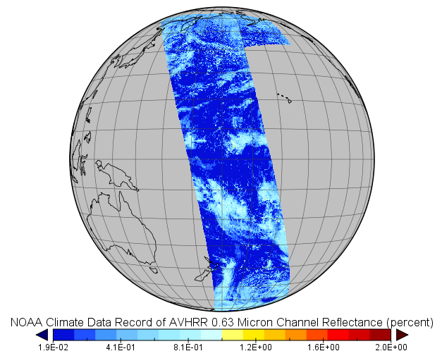
fileDescription: Sample image from dataset
fileType: PNG
descriptiveKeywords: (MD_Keywords)
keyword: Earth Science > Atmosphere > Atmospheric Radiation > Reflectance
keyword: Earth Science > Atmosphere > Atmospheric Radiation > Shortwave Radiation
keyword: Earth Science > Atmosphere > Atmospheric Radiation > Solar Radiation
keyword: Earth Science > Atmosphere > Clouds > Cloud Radiative Transfer
keyword: Earth Science > Atmosphere > Clouds > Cloud Properties
keyword: Earth Science > Land Surface > Surface Radiative Properties > Albedo
keyword: Earth Science > Land Surface > Surface Radiative Properties > Reflectance
type: (MD_KeywordTypeCode) theme
thesaurusName: (CI_Citation)
title: Global Change Master Directory (GCMD) Science Keywords
date: (CI_Date)
date: 2018
dateType: (CI_DateTypeCode) revision
edition: Version 8.6
citedResponsibleParty: (CI_ResponsibleParty)
organisationName: Global Change Data Center, Science and Exploration Directorate, Goddard Space Flight Center (GSFC) National Aeronautics and Space Administration (NASA)
contactInfo: (CI_Contact)
onlineResource: (CI_OnlineResource)
linkage: https://earthdata.nasa.gov/about/gcmd/global-change-master-directory-gcmd-keywords
protocol: HTTPS
applicationProfile: Web Browser
name: Global Change Master Directory (GCMD) Keywords
description: The information provided on this page seeks to define how the GCMD Keywords are structured, used and accessed. It also provides information on how users can participate in the further development of the keywords.
function: (CI_OnLineFunctionCode) information
role: (CI_RoleCode) publisher
descriptiveKeywords: (MD_Keywords)
keyword: Atmospheric - Composition - Earth Radiation Budget
keyword: Atmospheric - Composition - Surface Radiation Budget
type: (MD_KeywordTypeCode) theme
thesaurusName: (CI_Citation)
title: Global Climate Observing System (GCOS) Essential Climate Variables (ECVs)
date: (CI_Date)
date: 2017
dateType: (CI_DateTypeCode) publication
edition: Release 2017
citedResponsibleParty: (CI_ResponsibleParty)
organisationName: World Meteorological Organization, United Nations
contactInfo: (CI_Contact)
onlineResource: (CI_OnlineResource)
linkage: https://public.wmo.int/en/programmes/global-climate-observing-system/essential-climate-variables
protocol: HTTP
applicationProfile: Information
name: GCOS Essential Climate Variables
description: Overview of the GCOS Essential Climate Variables.
function: (CI_OnLineFunctionCode) information
role: (CI_RoleCode) custodian
descriptiveKeywords: (MD_Keywords)
keyword: NOAA Climate Data Record (CDR) Program
keyword: NOAA OneStop Project
type: (MD_KeywordTypeCode) project
thesaurusName: (CI_Citation)
title: Global Change Master Directory (GCMD) Project Keywords
date: (CI_Date)
date: 2018
dateType: (CI_DateTypeCode) revision
edition: Version 8.6
citedResponsibleParty: (CI_ResponsibleParty)
organisationName: Global Change Data Center, Science and Exploration Directorate, Goddard Space Flight Center (GSFC) National Aeronautics and Space Administration (NASA)
contactInfo: (CI_Contact)
onlineResource: (CI_OnlineResource)
linkage: https://earthdata.nasa.gov/about/gcmd/global-change-master-directory-gcmd-keywords
protocol: HTTPS
applicationProfile: Web Browser
name: Global Change Master Directory (GCMD) Keywords
description: The information provided on this page seeks to define how the GCMD Keywords are structured, used and accessed. It also provides information on how users can participate in the further development of the keywords.
function: (CI_OnLineFunctionCode) information
role: (CI_RoleCode) publisher
descriptiveKeywords: (MD_Keywords)
keyword: Satellite
type: (MD_KeywordTypeCode) product
thesaurusName: (missing)
descriptiveKeywords: (MD_Keywords)
keyword: Geographic Region > Global
type: (MD_KeywordTypeCode) place
thesaurusName: (CI_Citation)
title: Global Change Master Directory (GCMD) Location Keywords
date: (CI_Date)
date: 2018
dateType: (CI_DateTypeCode) revision
edition: Version 8.6
citedResponsibleParty: (CI_ResponsibleParty)
organisationName: Global Change Data Center, Science and Exploration Directorate, Goddard Space Flight Center (GSFC) National Aeronautics and Space Administration (NASA)
contactInfo: (CI_Contact)
onlineResource: (CI_OnlineResource)
linkage: https://earthdata.nasa.gov/about/gcmd/global-change-master-directory-gcmd-keywords
protocol: HTTPS
applicationProfile: Web Browser
name: Global Change Master Directory (GCMD) Keywords
description: The information provided on this page seeks to define how the GCMD Keywords are structured, used and accessed. It also provides information on how users can participate in the further development of the keywords.
function: (CI_OnLineFunctionCode) information
role: (CI_RoleCode) publisher
descriptiveKeywords: (MD_Keywords)
keyword: Vertical Location > Boundary Layer
keyword: Vertical Location > Stratosphere
type: (MD_KeywordTypeCode) stratum
thesaurusName: (CI_Citation)
title: Global Change Master Directory (GCMD) Location Keywords
date: (CI_Date)
date: 2018
dateType: (CI_DateTypeCode) revision
edition: Version 8.6
citedResponsibleParty: (CI_ResponsibleParty)
organisationName: Global Change Data Center, Science and Exploration Directorate, Goddard Space Flight Center (GSFC) National Aeronautics and Space Administration (NASA)
contactInfo: (CI_Contact)
onlineResource: (CI_OnlineResource)
linkage: https://earthdata.nasa.gov/about/gcmd/global-change-master-directory-gcmd-keywords
protocol: HTTPS
applicationProfile: Web Browser
name: Global Change Master Directory (GCMD) Keywords
description: The information provided on this page seeks to define how the GCMD Keywords are structured, used and accessed. It also provides information on how users can participate in the further development of the keywords.
function: (CI_OnLineFunctionCode) information
role: (CI_RoleCode) publisher
descriptiveKeywords: (MD_Keywords)
keyword: AVHRR > Advanced Very High Resolution Radiometer
keyword: AVHRR-2 > Advanced Very High Resolution Radiometer-2
keyword: AVHRR-3 > Advanced Very High Resolution Radiometer-3
keyword: GOES I-M IMAGER
type: (MD_KeywordTypeCode) instrument
thesaurusName: (CI_Citation)
title: Global Change Master Directory (GCMD) Instrument Keywords
date: (CI_Date)
date: 2018
dateType: (CI_DateTypeCode) revision
edition: Version 8.6
citedResponsibleParty: (CI_ResponsibleParty)
organisationName: Global Change Data Center, Science and Exploration Directorate, Goddard Space Flight Center (GSFC) National Aeronautics and Space Administration (NASA)
contactInfo: (CI_Contact)
onlineResource: (CI_OnlineResource)
linkage: https://earthdata.nasa.gov/about/gcmd/global-change-master-directory-gcmd-keywords
protocol: HTTPS
applicationProfile: Web Browser
name: Global Change Master Directory (GCMD) Keywords
description: The information provided on this page seeks to define how the GCMD Keywords are structured, used and accessed. It also provides information on how users can participate in the further development of the keywords.
function: (CI_OnLineFunctionCode) information
role: (CI_RoleCode) publisher
descriptiveKeywords: (MD_Keywords)
keyword: TIROS-N > Television Infrared Observation Satellite-N
keyword: NOAA-6 > National Oceanic & Atmospheric Administration-6
keyword: NOAA-7 > National Oceanic & Atmospheric Administration-7
keyword: NOAA-8 > National Oceanic & Atmospheric Administration-8
keyword: NOAA-9 > National Oceanic & Atmospheric Administration-9
keyword: NOAA-10 > National Oceanic & Atmospheric Administration-10
keyword: NOAA-11 > National Oceanic & Atmospheric Administration-11
keyword: NOAA-12 > National Oceanic & Atmospheric Administration-12
keyword: NOAA-14 > National Oceanic & Atmospheric Administration-14
keyword: NOAA-15 > National Oceanic & Atmospheric Administration-15
keyword: NOAA-16 > National Oceanic & Atmospheric Administration-16
keyword: NOAA-17 > National Oceanic & Atmospheric Administration-17
keyword: NOAA-18 > National Oceanic & Atmospheric Administration-18
keyword: NOAA-19 > National Oceanic & Atmospheric Administration-19
keyword: METOP-A > Meteorological Operational Satellite - A
keyword: METOP-B > Meteorological Operational Satellite - B
keyword: GOES-1 > Geostationary Operational Environmental Satellite 1
keyword: GOES-2 > Geostationary Operational Environmental Satellite 2
keyword: GOES-3 > Geostationary Operational Environmental Satellite 3
keyword: GOES-4 > Geostationary Operational Environmental Satellite 4
keyword: GOES-5 > Geostationary Operational Environmental Satellite 5
keyword: GOES-6 > Geostationary Operational Environmental Satellite 6
keyword: GOES-7 > Geostationary Operational Environmental Satellite 7
keyword: GOES-8 > Geostationary Operational Environmental Satellite 8
keyword: GOES-9 > Geostationary Operational Environmental Satellite 9
keyword: GOES-10 > Geostationary Operational Environmental Satellite 10
keyword: GOES-11 > Geostationary Operational Environmental Satellite 11
keyword: GOES-12 > Geostationary Operational Environmental Satellite 12
keyword: GOES-13 > Geostationary Operational Environmental Satellite 13
type: (MD_KeywordTypeCode) platform
thesaurusName: (CI_Citation)
title: Global Change Master Directory (GCMD) Platform Keywords
date: (CI_Date)
date: 2018
dateType: (CI_DateTypeCode) revision
edition: Version 8.6
citedResponsibleParty: (CI_ResponsibleParty)
organisationName: Global Change Data Center, Science and Exploration Directorate, Goddard Space Flight Center (GSFC) National Aeronautics and Space Administration (NASA)
contactInfo: (CI_Contact)
onlineResource: (CI_OnlineResource)
linkage: https://earthdata.nasa.gov/about/gcmd/global-change-master-directory-gcmd-keywords
protocol: HTTPS
applicationProfile: Web Browser
name: Global Change Master Directory (GCMD) Keywords
description: The information provided on this page seeks to define how the GCMD Keywords are structured, used and accessed. It also provides information on how users can participate in the further development of the keywords.
function: (CI_OnLineFunctionCode) information
role: (CI_RoleCode) publisher
descriptiveKeywords: (MD_Keywords)
keyword: 1 km - < 10 km or approximately .01 degree - < .09 degree
type: (MD_KeywordTypeCode) dataResolution
thesaurusName: (CI_Citation)
title: Global Change Master Directory (GCMD) Horizontal Data Resolution Keywords
date: (CI_Date)
date: 2018
dateType: (CI_DateTypeCode) revision
edition: Version 8.6
citedResponsibleParty: (CI_ResponsibleParty)
organisationName: Global Change Data Center, Science and Exploration Directorate, Goddard Space Flight Center (GSFC) National Aeronautics and Space Administration (NASA)
contactInfo: (CI_Contact)
onlineResource: (CI_OnlineResource)
linkage: https://earthdata.nasa.gov/about/gcmd/global-change-master-directory-gcmd-keywords
protocol: HTTPS
applicationProfile: Web Browser
name: Global Change Master Directory (GCMD) Keywords
description: The information provided on this page seeks to define how the GCMD Keywords are structured, used and accessed. It also provides information on how users can participate in the further development of the keywords.
function: (CI_OnLineFunctionCode) information
role: (CI_RoleCode) publisher
descriptiveKeywords: (MD_Keywords)
keyword: Hourly - < Daily
type: (MD_KeywordTypeCode) dataResolution
thesaurusName: (CI_Citation)
title: Global Change Master Directory (GCMD) Temporal Data Resolution Keywords
date: (CI_Date)
date: 2018
dateType: (CI_DateTypeCode) revision
edition: Version 8.6
citedResponsibleParty: (CI_ResponsibleParty)
organisationName: Global Change Data Center, Science and Exploration Directorate, Goddard Space Flight Center (GSFC) National Aeronautics and Space Administration (NASA)
contactInfo: (CI_Contact)
onlineResource: (CI_OnlineResource)
linkage: https://earthdata.nasa.gov/about/gcmd/global-change-master-directory-gcmd-keywords
protocol: HTTPS
applicationProfile: Web Browser
name: Global Change Master Directory (GCMD) Keywords
description: The information provided on this page seeks to define how the GCMD Keywords are structured, used and accessed. It also provides information on how users can participate in the further development of the keywords.
function: (CI_OnLineFunctionCode) information
role: (CI_RoleCode) publisher
descriptiveKeywords: (MD_Keywords)
keyword: > 1 km
type: (MD_KeywordTypeCode) dataResolution
thesaurusName: (CI_Citation)
title: Global Change Master Directory (GCMD) Vertical Data Resolution Keywords
date: (CI_Date)
date: 2018
dateType: (CI_DateTypeCode) revision
edition: Version 8.6
citedResponsibleParty: (CI_ResponsibleParty)
organisationName: Global Change Data Center, Science and Exploration Directorate, Goddard Space Flight Center (GSFC) National Aeronautics and Space Administration (NASA)
contactInfo: (CI_Contact)
onlineResource: (CI_OnlineResource)
linkage: https://earthdata.nasa.gov/about/gcmd/global-change-master-directory-gcmd-keywords
protocol: HTTPS
applicationProfile: Web Browser
name: Global Change Master Directory (GCMD) Keywords
description: The information provided on this page seeks to define how the GCMD Keywords are structured, used and accessed. It also provides information on how users can participate in the further development of the keywords.
function: (CI_OnLineFunctionCode) information
role: (CI_RoleCode) publisher
descriptiveKeywords: (MD_Keywords)
keyword: DOC/NOAA/NESDIS/NCDC > National Climatic Data Center, NESDIS, NOAA, U.S. Department of Commerce
keyword: DOC/NOAA/NESDIS/NCEI > National Centers for Environmental Information, NESDIS, NOAA, U.S. Department of Commerce
keyword: Science Directorate, Langley Research Center, NASA
type: (MD_KeywordTypeCode) dataCentre
thesaurusName: (CI_Citation)
title: Global Change Master Directory (GCMD) Data Center Keywords
date: (CI_Date)
date: 2018
dateType: (CI_DateTypeCode) revision
edition: Version 8.6
citedResponsibleParty: (CI_ResponsibleParty)
organisationName: Global Change Data Center, Science and Exploration Directorate, Goddard Space Flight Center (GSFC) National Aeronautics and Space Administration (NASA)
contactInfo: (CI_Contact)
onlineResource: (CI_OnlineResource)
linkage: https://earthdata.nasa.gov/about/gcmd/global-change-master-directory-gcmd-keywords
protocol: HTTPS
applicationProfile: Web Browser
name: Global Change Master Directory (GCMD) Keywords
description: The information provided on this page seeks to define how the GCMD Keywords are structured, used and accessed. It also provides information on how users can participate in the further development of the keywords.
function: (CI_OnLineFunctionCode) information
role: (CI_RoleCode) publisher
resourceConstraints: (MD_Constraints)
useLimitation: See the Algorithm Theoretical Basis Document for a description of the use limitations for this dataset. Individual satellite AVHRR visible calibration uncertainty will increase over time as the NOAA satellite orbit degrades to either sunset or sunrise. The shorter the spacecraft temporal record the more uncertain the calibration. The space count was not explicitly derived for each satellite and dark calibrated radiances may not be accurate for certain applications, for example over clear-sky ocean and near terminator conditions. Older AVHRR satellite spectral response functions are not as well known and may introduce uncertainties, which cannot be estimated. The calibration coefficients address only the long term optical degradation and does not address detector to detector striping, orbital dependent variation, scan angle dependencies, or instrument noise.
resourceConstraints: (MD_LegalConstraints)
useConstraints: (MD_RestrictionCode) otherRestrictions
otherConstraints: Cite as: Doelling, David; Minnis, Patrick; and the NOAA CDR Program (2015): NOAA Climate Data Record (CDR) of Visible and Near Infrared Reflectance from GOES and AVHRR, Version 1.0. [indicate subset used]. NOAA National Centers for Environmental Information. doi:10.789/V5NK3C0J [access date].
resourceConstraints: (MD_LegalConstraints)
useConstraints: (MD_RestrictionCode) otherRestrictions
otherConstraints: See the Use Agreement for this CDR available on the CDR page.
resourceConstraints: (MD_LegalConstraints)
accessConstraints: (MD_RestrictionCode) otherRestrictions
otherConstraints: Distribution liability: NOAA and NCEI make no warranty, expressed or implied, regarding these data, nor does the fact of distribution constitute such a warranty. NOAA and NCEI cannot assume liability for any damages caused by any errors or omissions in these data. If appropriate, NCEI can only certify that the data it distributes are an authentic copy of the records that were accepted for inclusion in the NCEI archives.
resourceConstraints: (MD_LegalConstraints)
useConstraints: (MD_RestrictionCode) otherRestrictions
otherConstraints: Use liability: NOAA and NCEI cannot provide any warranty as to the accuracy, reliability, or completeness of furnished data. Users assume responsibility to determine the usability of these data. The user is responsible for the results of any application of this data for other than its intended purpose.
aggregationInfo: (MD_AggregateInformation)
aggregateDataSetName: (CI_Citation)
title: NOAA Climate Data Record (CDR) of Clear-Sky Radiation Properties, Version 1.0
date: (CI_Date)
date: 2015-03-01
dateType: (CI_DateTypeCode) publication
edition: 1.0
citedResponsibleParty: (CI_ResponsibleParty)
organisationName: DOC/NOAA/NESDIS/NCDC > National Climatic Data Center, NESDIS, NOAA, U.S. Department of Commerce
role: (CI_RoleCode) publisher
citedResponsibleParty: (CI_ResponsibleParty)
organisationName: (missing)
contactInfo: (CI_Contact)
onlineResource: (CI_OnlineResource)
linkage: https://doi.org/10.7289/V5HT2M8T
protocol: HTTPS
applicationProfile: Landing Page
name: NCEI Landing Page for AVHRR Cloud Properties - NASA
description: Related dataset landing page with general information and access links for that dataset.
function: (CI_OnLineFunctionCode) information
role: (missing)
associationType: (DS_AssociationTypeCode) largerWorkCitation
initiativeType: (DS_InitiativeTypeCode) collection
spatialResolution: (MD_Resolution)
distance:
Distance: 4000
language: eng; USA
topicCategory: (MD_TopicCategoryCode) climatologyMeteorologyAtmosphere
extent: (EX_Extent)
geographicElement: (EX_GeographicBoundingBox)
extentTypeCode: 1
westBoundLongitude: -180.0
eastBoundLongitude: 180.0
southBoundLatitude: -90.0
northBoundLatitude: 90.0
temporalElement: (EX_TemporalExtent)
extent:
TimePeriod:
description: ground condition
beginPosition: 1978-11-05
endPosition:
timeInterval: 2
return to top
contentInfo: (MI_CoverageDescription)
attributeDescription:
RecordType: NSS.GHRR.[SatID].D[Date].S[StartTime].E[EndTime]_NASA_LaRC_cloud_properties.nc
contentType: (MD_CoverageContentTypeCode) physicalMeasurement
dimension: (MD_Band)
sequenceIdentifier:
MemberName:
aName: latitude
attributeType:
TypeName:
aName: float
descriptor: latitude (latitude)
units: http://example.org/someUnitsDictionary.xml#degrees_north
dimension: (MD_Band)
sequenceIdentifier:
MemberName:
aName: longitude
attributeType:
TypeName:
aName: float
descriptor: longitude (longitude)
units: http://example.org/someUnitsDictionary.xml#degrees_east
dimension: (MD_Band)
sequenceIdentifier:
MemberName:
aName: year_and_dayofyear
attributeType:
TypeName:
aName: int
descriptor: Scan Line Year and Day of Year in YYYYDDD Format
dimension: (MD_Band)
sequenceIdentifier:
MemberName:
aName: time
attributeType:
TypeName:
aName: int
descriptor: Scan Line Time (time)
units: http://example.org/someUnitsDictionary.xml#seconds%20since%202015-12-31%2000%3A00%3A00
dimension: (MD_Band)
sequenceIdentifier:
MemberName:
aName: reflectance_063micron
attributeType:
TypeName:
aName: int
descriptor: NOAA Climate Data Record of AVHRR 0.63 Micron Channel Reflectance (toa_bidirectional_reflectance)
units: http://example.org/someUnitsDictionary.xml#percent
dimension: (MD_Band)
sequenceIdentifier:
MemberName:
aName: reflectance_086micron
attributeType:
TypeName:
aName: int
descriptor: NOAA Climate Data Record of AVHRR 0.86 Micron Channel Reflectance (toa_bidirectional_reflectance)
units: http://example.org/someUnitsDictionary.xml#percent
dimension: (MD_Band)
sequenceIdentifier:
MemberName:
aName: reflectance_161micron
attributeType:
TypeName:
aName: int
descriptor: NOAA Climate Data Record of AVHRR 1.61 Micron Channel Reflectance (toa_bidirectional_reflectance)
units: http://example.org/someUnitsDictionary.xml#percent
dimension: (MD_Band)
sequenceIdentifier:
MemberName:
aName: brightness_temperature_375micron
attributeType:
TypeName:
aName: short
descriptor: AVHRR 3.75 Micron Channel Brightness Temperature (brightness_temperature)
units: http://example.org/someUnitsDictionary.xml#degrees_Kelvin
dimension: (MD_Band)
sequenceIdentifier:
MemberName:
aName: brightness_temperature_108micron
attributeType:
TypeName:
aName: short
descriptor: AVHRR 10.8 Micron Channel Brightness Temperature (brightness_temperature)
units: http://example.org/someUnitsDictionary.xml#degrees_Kelvin
dimension: (MD_Band)
sequenceIdentifier:
MemberName:
aName: brightness_temperature_120micron
attributeType:
TypeName:
aName: short
descriptor: AVHRR 12.0 Micron Channel Brightness Temperature (brightness_temperature)
units: http://example.org/someUnitsDictionary.xml#degrees_Kelvin
dimension: (MD_Band)
sequenceIdentifier:
MemberName:
aName: cloud_mask
attributeType:
TypeName:
aName: byte
descriptor: NOAA Climate Data Record of Cloudy and Clear Sky Pixel Detection (cloud_binary_mask)
dimension: (MD_Band)
sequenceIdentifier:
MemberName:
aName: cloud_phase
attributeType:
TypeName:
aName: byte
descriptor: NOAA Climate Data Record of Cloud Top Thermodynamic Phase (thermodynamic_phase_of_cloud_water_particles_at_cloud_top)
dimension: (MD_Band)
sequenceIdentifier:
MemberName:
aName: optical_depth
attributeType:
TypeName:
aName: short
descriptor: NOAA Climate Data Record of Cloud Optical Depth (atmosphere_optical_thickness_due_to_cloud)
dimension: (MD_Band)
sequenceIdentifier:
MemberName:
aName: effective_radius
attributeType:
TypeName:
aName: short
descriptor: NOAA Climate Data Record of Particle Effective Radius (effective_radius_of_cloud_liquid_water_particle_at_liquid_water_cloud_top)
units: http://example.org/someUnitsDictionary.xml#microns
dimension: (MD_Band)
sequenceIdentifier:
MemberName:
aName: cloud_top_pressure
attributeType:
TypeName:
aName: short
descriptor: Cloud Top Pressure (air_pressure_at_cloud_top)
units: http://example.org/someUnitsDictionary.xml#hPa
dimension: (MD_Band)
sequenceIdentifier:
MemberName:
aName: cloud_effective_pressure
attributeType:
TypeName:
aName: short
descriptor: NOAA Climate Data Record of Air Pressure At Effective Cloud Top (air_pressure_at_effective_cloud_top_defined_by_infrared_radiation)
units: http://example.org/someUnitsDictionary.xml#hPa
dimension: (MD_Band)
sequenceIdentifier:
MemberName:
aName: cloud_base_pressure
attributeType:
TypeName:
aName: short
descriptor: Cloud Base Pressure (air_pressure_at_cloud_base)
units: http://example.org/someUnitsDictionary.xml#hPa
dimension: (MD_Band)
sequenceIdentifier:
MemberName:
aName: cloud_top_height
attributeType:
TypeName:
aName: short
descriptor: Cloud Top Height (cloud_top_altitude)
units: http://example.org/someUnitsDictionary.xml#kilometers
dimension: (MD_Band)
sequenceIdentifier:
MemberName:
aName: cloud_effective_height
attributeType:
TypeName:
aName: short
descriptor: NOAA Climate Data Record of Height At Effective Cloud Top (height_at_effective_cloud_top_defined_by_infrared_radiation)
units: http://example.org/someUnitsDictionary.xml#kilometers
dimension: (MD_Band)
sequenceIdentifier:
MemberName:
aName: cloud_base_height
attributeType:
TypeName:
aName: short
descriptor: Cloud Base Height (cloud_base_altitude)
units: http://example.org/someUnitsDictionary.xml#kilometers
dimension: (MD_Band)
sequenceIdentifier:
MemberName:
aName: cloud_top_temperature
attributeType:
TypeName:
aName: short
descriptor: Cloud Top Temperature (air_temperature_at_cloud_top)
units: http://example.org/someUnitsDictionary.xml#degrees_Kelvin
dimension: (MD_Band)
sequenceIdentifier:
MemberName:
aName: cloud_effective_temperature
attributeType:
TypeName:
aName: short
descriptor: NOAA Climate Data Record of Air Temperature At Effective Cloud Top (air_temperature_at_effective_cloud_top_defined_by_infrared_radiation)
units: http://example.org/someUnitsDictionary.xml#degrees_Kelvin
dimension: (MD_Band)
sequenceIdentifier:
MemberName:
aName: overshooting_mask
attributeType:
TypeName:
aName: byte
descriptor: Overshooting Convective Cloud Top Detection Mask
dimension: (MD_Band)
sequenceIdentifier:
MemberName:
aName: pixel_skin_temperature
attributeType:
TypeName:
aName: short
descriptor: Clear Sky Surface Skin Temperature (surface_temperature)
units: http://example.org/someUnitsDictionary.xml#degrees_Kelvin
dimension: (MD_Band)
sequenceIdentifier:
MemberName:
aName: shortwave_broadband_albedo
attributeType:
TypeName:
aName: short
descriptor: Top of Atmosphere Shortwave Broadband Albedo (toa_outgoing_shortwave_flux)
dimension: (MD_Band)
sequenceIdentifier:
MemberName:
aName: longwave_broadband_flux
attributeType:
TypeName:
aName: short
descriptor: Top of Atmosphere Longwave Broadband Flux (toa_outgoing_longwave_flux)
units: http://example.org/someUnitsDictionary.xml#W%20m-2
dimension: (MD_Band)
sequenceIdentifier:
MemberName:
aName: relative_azimuth
attributeType:
TypeName:
aName: short
descriptor: Relative Azimuth Angle (relative_sensor_azimuth_angle)
units: http://example.org/someUnitsDictionary.xml#degrees
dimension: (MD_Band)
sequenceIdentifier:
MemberName:
aName: viewing_zenith
attributeType:
TypeName:
aName: short
descriptor: Viewing Zenith Angle (zenith_angle)
units: http://example.org/someUnitsDictionary.xml#degrees
dimension: (MD_Band)
sequenceIdentifier:
MemberName:
aName: solar_zenith
attributeType:
TypeName:
aName: short
descriptor: Solar Zenith Angle (solar_zenith_angle)
units: http://example.org/someUnitsDictionary.xml#degrees
dimension: (MD_Band)
sequenceIdentifier:
MemberName:
aName: snowice_flag
attributeType:
TypeName:
aName: byte
descriptor: Snow and Ice Cover Analysis or Detection from MERRA and AVHRR
dimension: (MD_Band)
sequenceIdentifier:
MemberName:
aName: pixel_skin_temperature_quality_flag
attributeType:
TypeName:
aName: byte
descriptor: Quality Flag for Pixel Level Skin Temperature Retrieval
dimension: (MD_Band)
sequenceIdentifier:
MemberName:
aName: clear_sky_category
attributeType:
TypeName:
aName: byte
descriptor: Clear Sky Pixel Classification
dimension: (MD_Band)
sequenceIdentifier:
MemberName:
aName: cloud_category
attributeType:
TypeName:
aName: byte
descriptor: Cloudy Pixel Classification
return to top
distributionInfo: (MD_Distribution)
distributor: (MD_Distributor)
distributorContact: (CI_ResponsibleParty)
organisationName: NOAA National Centers for Environmental Information
contactInfo: (CI_Contact)
address: (CI_Address)
electronicMailAddress: ncei.info@noaa.gov
onlineResource: (CI_OnlineResource)
linkage: https://www.ncei.noaa.gov/contact
name: NCEI Contact Information
description: Information for contacts at NCEI.
function: (CI_OnLineFunctionCode) information
role: (CI_RoleCode) distributor
distributionOrderProcess: (MD_StandardOrderProcess)
fees: In most cases, electronic downloads of the data are free. However, fees may apply for custom orders, data certifications, copies of analog materials, and data distribution on physical media.
orderingInstructions: Contact NCEI for other distribution options and instructions.
distributorFormat: (MD_Format)
name: netCDF
version: 4
specification: The NetCDF data files comply with the Climate and Forecast (CF) Metadata Conventions and the NetCDF Attribute Convention for Dataset Discovery (ACDD).
distributorFormat: (MD_Format)
name: netCDF
version: 4
specification: The NetCDF data files comply with the Climate and Forecast (CF) Metadata Conventions and the NetCDF Attribute Convention for Dataset Discovery (ACDD).
distributorTransferOptions: (MD_DigitalTransferOptions)
onLine: (CI_OnlineResource)
linkage: https://doi.org/10.7289/V5NK3C0J
protocol: HTTPS
applicationProfile: Landing Page
name: NCEI Dataset Landing Page
description: Landing page for the dataset.
function: (CI_OnLineFunctionCode) information
distributorTransferOptions: (MD_DigitalTransferOptions)
transferSize: (missing)
onLine: (CI_OnlineResource)
linkage: https://www.ncdc.noaa.gov/has/HAS.FileAppRouter?datasetname=200501&subqueryby=STATION&applname=&outdest=FILE
protocol: HTTPS
applicationProfile: Data Search Application
name: NCEI Archive Information Request System (AIRS)
description: Search the data archive and submit an order for the dataset via the interface.
function: (CI_OnLineFunctionCode) download
distributorTransferOptions: (MD_DigitalTransferOptions)
transferSize: (missing)
onLine: (CI_OnlineResource)
linkage: https://www.ncdc.noaa.gov/cdr/fundamental/avhrr-radiances-nasa
protocol: HTTPS
applicationProfile: Information
name: AVHRR Radiances - NASA
description: Access to the published CDR, source code, and documentation.
function: (CI_OnLineFunctionCode) download
return to top
dataQualityInfo: (DQ_DataQuality)
scope: (DQ_Scope)
level: (MD_ScopeCode) dataset
extent: #boundingExtent
lineage: (LI_Lineage)
statement: The data were produced by the NASA Langley Research Center, and are archived at the NOAA National Centers for Environmental Information (NCEI). Data are converted from GAC pixel counts to radiances; for calibration, these radiances are referenced to the Aqua-MODIS band 1 and 2 absolute calibration before being converted to reflectances based on the solar incoming irradiance used by the MODIS Science Team. For more information, please review the documentation. In 2017, the dataset title was changed to remove reference to GOES. This was done to prevent confusion as GOES data is not used in the dataset--the actual TCDR files where the calibration coefficients were applied only contain the AVHRR data. The publically available calibration coefficient files for the dataset do include the GOES solar calibration coefficients.
processStep: (LE_ProcessStep)
description: For a description of the processing steps, see the Algorithm Theoretical Basis Document and Data Flow Diagram for this dataset.
dateTime: (missing)
processor: (CI_ResponsibleParty)
organisationName: NASA Langley Research Center
role: (CI_RoleCode) processor
source: sd001
processingInformation: (LE_Processing)
identifier: (missing)
softwareReference: (CI_Citation)
title: Source Code Package for AVHRR Radiances - NASA
date: (CI_Date)
date: 2015-08-01
dateType: (CI_DateTypeCode) publication
citedResponsibleParty: (CI_ResponsibleParty)
organisationName: DOC/NOAA/NESDIS/NCEI > National Centers for Environmental Information, NESDIS, NOAA, U.S. Department of Commerce
role: (CI_RoleCode) publisher
citedResponsibleParty: (CI_ResponsibleParty)
organisationName: (missing)
contactInfo: (CI_Contact)
onlineResource: (CI_OnlineResource)
linkage: https://www.ncei.noaa.gov/pub/data/sds/cdr/CDRs/AVHRR_Radiances_NASA/SourceCode_01B-30a.tar.gz
protocol: HTTPS
applicationProfile: Web Browser
name: CDR Source Code
description: This source code is for reference only. The source code is provided to maintain transparency of the algorithm and processes used in creating the Climate Data Record (CDR). The source code is not intended to be portable to any computer system(s) beyond that of the original CDR producer's environment.
function: (CI_OnLineFunctionCode) download
role: (missing)
documentation: (CI_Citation)
title: Calibration Coefficients for AVHRR Radiances - NASA
date: (CI_Date)
date: 2015-08-01
dateType: (CI_DateTypeCode) publication
citedResponsibleParty: (CI_ResponsibleParty)
organisationName: DOC/NOAA/NESDIS/NCEI > National Centers for Environmental Information, NESDIS, NOAA, U.S. Department of Commerce
role: (CI_RoleCode) publisher
citedResponsibleParty: (CI_ResponsibleParty)
organisationName: (missing)
contactInfo: (CI_Contact)
onlineResource: (CI_OnlineResource)
linkage: https://www.ncei.noaa.gov/pub/data/sds/cdr/CDRs/AVHRR_Radiances_NASA/Calibration_coefficients.tar.gz
protocol: HTTPS
applicationProfile: Web Browser
name: Calibrartion Coefficients
description: This code is for reference only. The code is provided to maintain transparency of the algorithm and processes used in creating the Climate Data Record (CDR). The code is not intended to be portable to any computer system(s) beyond that of the original CDR producer's environment.
function: (CI_OnLineFunctionCode) download
role: (missing)
documentation: (CI_Citation)
title: NASA LaRC AVHRR & GOES Shortwave Channel Calibration FCDR Top Level Flowchart
date: (CI_Date)
date: 2016-09-09
dateType: (CI_DateTypeCode) publication
edition: Rev 1
identifier: (MD_Identifier)
code: CDRP-DIA-0825
citedResponsibleParty: (CI_ResponsibleParty)
organisationName: DOC/NOAA/NESDIS/NCEI > National Centers for Environmental Information, NESDIS, NOAA, U.S. Department of Commerce
role: (CI_RoleCode) publisher
citedResponsibleParty: (CI_ResponsibleParty)
organisationName: (missing)
contactInfo: (CI_Contact)
onlineResource: (CI_OnlineResource)
linkage: https://www.ncei.noaa.gov/pub/data/sds/cdr/CDRs/AVHRR_Radiances_NASA/DataFlowDiagram_01B-30a.pdf
protocol: HTTPS
applicationProfile: Web Browser
name: CDR Data Flow Diagram
description: Flowcharts for the CDR product.
function: (CI_OnLineFunctionCode) information
role: (missing)
algorithm: (LE_Algorithm)
citation: (CI_Citation)
title: Climate Algorithm Theoretical Basis Document for AVHRR Radiances - NASA -- Calibration of Historical and Future AVHRR and GOES Visible and Near-Infrared Sensors
date: (CI_Date)
date: 2016-07-10
dateType: (CI_DateTypeCode) publication
edition: Revision 1
identifier: (MD_Identifier)
code: CDRP-ATBD-0823
citedResponsibleParty: (CI_ResponsibleParty)
organisationName: DOC/NOAA/NESDIS/NCDC > National Climatic Data Center, NESDIS, NOAA, U.S. Department of Commerce
positionName: NOAA Climate Data Record Program Office
contactInfo: (CI_Contact)
phone: (CI_Telephone)
voice: +1 (828) 271-4800
facsimile: +1 (828) 271-4328
address: (CI_Address)
deliveryPoint: 151 Patton Avenue
deliveryPoint: Veach-Baley Federal Building, Room 447
city: Asheville
administrativeArea: NC
postalCode: 28801-5001
country: USA
electronicMailAddress: cdr_program.ncdc@noaa.gov
hoursOfService: 8:00 - 6:00 Eastern
role: (CI_RoleCode) publisher
citedResponsibleParty: (CI_ResponsibleParty)
organisationName: (missing)
contactInfo: (CI_Contact)
onlineResource: (CI_OnlineResource)
linkage: https://www.ncei.noaa.gov/pub/data/sds/cdr/CDRs/AVHRR_Radiances_NASA/AlgorithmDescription_01B-30a.pdf
protocol: HTTPS
applicationProfile: Web Browser
name: Climate Algorithm Theoretical Basis Document
description: ATBD for the CDR product.
function: (CI_OnLineFunctionCode) download
role: (missing)
description: See Algorithm Citation
source: (LE_Source)
description: AVHRR GAC Data are the primary input into this dataset
sourceCitation: (CI_Citation)
title: Advanced Very High Resolution Radiometer (AVHRR) Global Access Coverage (GAC) data
date: (missing)
citedResponsibleParty: (CI_ResponsibleParty)
organisationName: DOC/NOAA/CLASS > Comprehensive Large Array-data Stewardship System, NOAA, U.S. Department of Commerce
role: (CI_RoleCode) distributor
citedResponsibleParty: (CI_ResponsibleParty)
organisationName: (missing)
contactInfo: (CI_Contact)
onlineResource: (CI_OnlineResource)
linkage: https://www.class.noaa.gov/saa/products/search?datatype_family=AVHRR
applicationProfile: Web Browser
name: AVHRR GAC data access point
description: For more information about the NOAA AVHRR GAC dataset, please refer to the link.
function: (CI_OnLineFunctionCode) information
role: (missing)
sourceExtent: (EX_Extent)
geographicElement: (EX_GeographicBoundingBox)
extentTypeCode: 1
westBoundLongitude: -180
eastBoundLongitude: 180
southBoundLatitude: -90
northBoundLatitude: 90
temporalElement: (EX_TemporalExtent)
extent:
TimePeriod:
beginPosition: 1978-01-01
endPosition:
sourceStep: ps001
return to top
dataQualityInfo: (DQ_DataQuality)
scope: (DQ_Scope)
level: (MD_ScopeCode) repository
levelDescription: (MD_ScopeDescription)
other: NOAA National Centers for Environmental Information
lineage: (LI_Lineage)
processStep: (LE_ProcessStep)
description: NOAA created the National Centers for Environmental Information (NCEI) by merging NOAA's National Climatic Data Center (NCDC), National Geophysical Data Center (NGDC), and National Oceanographic Data Center (NODC), including the National Coastal Data Development Center (NCDDC), per the Consolidated and Further Continuing Appropriations Act, 2015, Public Law 113-235. NCEI launched publicly on April 22, 2015.
dateTime:
DateTime: 2015-04-22T00:00:00
return to top
metadataMaintenance: (MD_MaintenanceInformation)
maintenanceAndUpdateFrequency: (MD_MaintenanceFrequencyCode) asNeeded
maintenanceNote: Bulk metadata change applied on 2023-06-23. See version control repository history for metadata change details.