NOAA Climate Data Record of Microwave Sounding Unit (MSU) and Advanced Microwave Sounding Unit (AMSU-A) Mean Layer Temperature, Version 3.0
- identificationInfo
- contentInfo
- contentInfo
- contentInfo
- distributionInfo
- dataQualityInfo
- dataQualityInfo
- dataQualityInfo
- metadataMaintenance
(MI_Metadata)
fileIdentifier: gov.noaa.ncdc:C00935
language: eng; USA
characterSet: (MD_CharacterSetCode) utf8
hierarchyLevel: (MD_ScopeCode) dataset
contact: (CI_ResponsibleParty)
organisationName: NOAA National Centers for Environmental Information
contactInfo: (CI_Contact)
address: (CI_Address)
electronicMailAddress: ncei.info@noaa.gov
onlineResource: (CI_OnlineResource)
linkage: https://www.ncei.noaa.gov/contact
name: NCEI Contact Information
description: Information for contacts at NCEI.
function: (CI_OnLineFunctionCode) information
role: (CI_RoleCode) pointOfContact
dateStamp: 2023-08-10
metadataStandardName: ISO 19115-2 Geographic Information - Metadata - Part 2: Extensions for Imagery and Gridded Data
metadataStandardVersion: ISO 19115-2:2009(E)
return to top
identificationInfo: (MD_DataIdentification)
citation: (CI_Citation)
title: NOAA Climate Data Record of Microwave Sounding Unit (MSU) and Advanced Microwave Sounding Unit (AMSU-A) Mean Layer Temperature, Version 3.0
alternateTitle: Mean Layer Temperature - NOAA
date: (CI_Date)
date: 2015-04-15
dateType: (CI_DateTypeCode) publication
edition: Version 3.0
identifier: (MD_Identifier)
code:
Anchor: DOI doi:10.7289/V5QF8QTK
identifier: (MD_Identifier)
code: NCEI DSI 3709_02
identifier: (MD_Identifier)
code: gov.noaa.ncdc:C00935
citedResponsibleParty: (CI_ResponsibleParty)
organisationName: NOAA National Centers for Environmental Information
role: (CI_RoleCode) publisher
citedResponsibleParty: (CI_ResponsibleParty)
organisationName: DOC/NOAA/NESDIS/NCDC > National Climatic Data Center, NESDIS, NOAA, U.S. Department of Commerce
positionName: NOAA Climate Data Record Program Office
contactInfo: (CI_Contact)
phone: (CI_Telephone)
voice: +1 (828) 271-4800
facsimile: +1 (828) 271-4328
address: (CI_Address)
deliveryPoint: 151 Patton Avenue
deliveryPoint: Veach-Baley Federal Building, Room 447
city: Asheville
administrativeArea: NC
postalCode: 28801-5001
country: USA
electronicMailAddress: cdr_program.ncdc@noaa.gov
onlineResource: (CI_OnlineResource)
linkage: https://www.ncdc.noaa.gov/
protocol: HTTPS
applicationProfile: Information
name: NOAA Climate Data Record Program
description: Information on the NOAA CDR Program and data.
function: (CI_OnLineFunctionCode) information
hoursOfService: 8:00 - 6:00 Eastern
role: (CI_RoleCode) publisher
citedResponsibleParty: (CI_ResponsibleParty)
individualName: Zou, Cheng-Zhi
organisationName: DOC/NOAA/NESDIS/STAR > Center for Satellite Applications and Research, NESDIS, NOAA, U.S. Department of Commerce
positionName: Physical Scientist
contactInfo: (CI_Contact)
phone: (CI_Telephone)
voice: 301-683-3592
address: (CI_Address)
electronicMailAddress: Cheng-Zhi.Zou@noaa.gov
contactInstructions: by email
role: (CI_RoleCode) principalInvestigator
citedResponsibleParty: (CI_ResponsibleParty)
individualName: Zou, Cheng-Zhi
organisationName: DOC/NOAA/NESDIS/STAR > Center for Satellite Applications and Research, NESDIS, NOAA, U.S. Department of Commerce
positionName: Physical Scientist
contactInfo: (CI_Contact)
phone: (CI_Telephone)
voice: 301-683-3592
address: (CI_Address)
electronicMailAddress: Cheng-Zhi.Zou@noaa.gov
contactInstructions: by email
role: (CI_RoleCode) author
citedResponsibleParty: (CI_ResponsibleParty)
individualName: Wang, Wenhui
organisationName: DOC/NOAA/NESDIS/STAR > Center for Satellite Applications and Research, NESDIS, NOAA, U.S. Department of Commerce
positionName: Physical Scientist
role: (CI_RoleCode) collaborator
citedResponsibleParty: (CI_ResponsibleParty)
individualName: Wang, Wenhui
organisationName: DOC/NOAA/NESDIS/STAR > Center for Satellite Applications and Research, NESDIS, NOAA, U.S. Department of Commerce
positionName: Physical Scientist
role: (CI_RoleCode) author
citedResponsibleParty: (CI_ResponsibleParty)
individualName: Li, Jian
organisationName: DOC/NOAA/NESDIS/STAR > Center for Satellite Applications and Research, NESDIS, NOAA, U.S. Department of Commerce
positionName: Physical Scientist
role: (CI_RoleCode) collaborator
citedResponsibleParty: (CI_ResponsibleParty)
individualName: Li, Jian
organisationName: DOC/NOAA/NESDIS/STAR > Center for Satellite Applications and Research, NESDIS, NOAA, U.S. Department of Commerce
positionName: Physical Scientist
role: (CI_RoleCode) author
citedResponsibleParty: (CI_ResponsibleParty)
individualName: NOAA CDR Program
organisationName: DOC/NOAA/NESDIS/NCDC > National Climatic Data Center, NESDIS, NOAA, U.S. Department of Commerce
role: (CI_RoleCode) collaborator
citedResponsibleParty: (CI_ResponsibleParty)
individualName: NOAA CDR Program
organisationName: DOC/NOAA/NESDIS/NCDC > National Climatic Data Center, NESDIS, NOAA, U.S. Department of Commerce
role: (CI_RoleCode) author
presentationForm: (CI_PresentationFormCode) tableDigital
abstract: The dataset contains three channel-based, monthly gridded atmospheric layer temperature Climate Data Records generated by merging nine MSU NOAA polar orbiting satellites, TIROS-N and NOAA-6 through NOAA-14, and six AMSU-A polar orbiting satellites, NOAA-15 through NOAA-18, MetOp-A, and NASA AQUA. These are temperatures of middle-troposphere (TMT), upper-troposphere (TUT, also known as temperature troposphere stratosphere), and lower-stratosphere (TLS), corresponding to measurements from MSU/AMSU-A channels 2/5, 3/7, and 4/9, respectively. Adjustments of observations included limb-adjustment, diurnal drift corrections, warm target temperature effect, and residual inter-satellite bias removal. Data coverage is from November 1978 to present; It is monthly global gridded dataset with 2.5 latitude by 2.5 longitude resolution. The dataset is updated each month with full Period of Record (POR) files in order to monitor operationally the change of upper air temperature.
purpose: This dataset provides advanced scientific researchers a high quality Climate Data Record (CDR) of Upper Atmospheric Layer Temperatures. It is used for monitoring and investigation of long-term temperature trend and variability for the atmospheric layers as defined by TMT, TUT, and TLS.
status: (MD_ProgressCode) completed
pointOfContact: (CI_ResponsibleParty)
organisationName: NOAA National Centers for Environmental Information
positionName: Customer Engagement Branch
contactInfo: (CI_Contact)
phone: (CI_Telephone)
voice: 1-828-271-4800
facsimile: 1-828-271-4876
address: (CI_Address)
deliveryPoint: 151 Patton Avenue
deliveryPoint: Veach-Baley Federal Building, Room 468
city: Asheville
administrativeArea: NC
postalCode: 28801-5001
country: USA
electronicMailAddress: ncei.orders@noaa.gov
onlineResource: (CI_OnlineResource)
linkage: https://www.ncei.noaa.gov
protocol: HTTPS
applicationProfile: Web Browser
name: NOAA National Centers for Environmental Information (NCEI)
description: NCEI home page with information, data access and contact information.
function: (CI_OnLineFunctionCode) information
hoursOfService: 8:00 - 6:00 Eastern
role: (CI_RoleCode) pointOfContact
pointOfContact: (CI_ResponsibleParty)
organisationName: DOC/NOAA/NESDIS/NCDC > National Climatic Data Center, NESDIS, NOAA, U.S. Department of Commerce
positionName: Climate Data Record Program Office
contactInfo: (CI_Contact)
phone: (CI_Telephone)
voice: +1 828-271-4328
address: (CI_Address)
electronicMailAddress: zou_msu_contacts@noaa.gov
role: (CI_RoleCode) resourceProvider
resourceMaintenance: (MD_MaintenanceInformation)
maintenanceAndUpdateFrequency: (MD_MaintenanceFrequencyCode) monthly
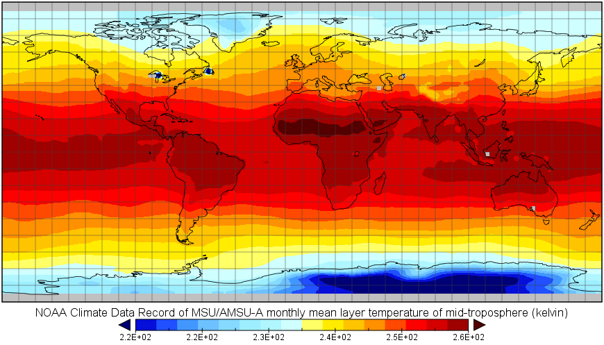
graphicOverview: (MD_BrowseGraphic)
fileName: https://www.ncei.noaa.gov/pub/data/metadata/images/C00935_MLT.PNG
fileDescription: MLT Sample Image
fileType: PNG
descriptiveKeywords: (MD_Keywords)
keyword: Earth Science > Climate Indicators > Atmospheric/Ocean Indicators > Temperature Indicators
keyword: Earth Science > Spectral/Engineering > Microwave > Brightness Temperature
type: (MD_KeywordTypeCode) theme
thesaurusName: (CI_Citation)
title: Global Change Master Directory (GCMD) Science Keywords
date: (CI_Date)
date: 2018
dateType: (CI_DateTypeCode) revision
edition: Version 8.6
citedResponsibleParty: (CI_ResponsibleParty)
organisationName: Global Change Data Center, Science and Exploration Directorate, Goddard Space Flight Center (GSFC) National Aeronautics and Space Administration (NASA)
contactInfo: (CI_Contact)
onlineResource: (CI_OnlineResource)
linkage: https://earthdata.nasa.gov/about/gcmd/global-change-master-directory-gcmd-keywords
protocol: HTTPS
applicationProfile: Web Browser
name: Global Change Master Directory (GCMD) Keywords
description: The information provided on this page seeks to define how the GCMD Keywords are structured, used and accessed. It also provides information on how users can participate in the further development of the keywords.
function: (CI_OnLineFunctionCode) information
role: (CI_RoleCode) publisher
descriptiveKeywords: (MD_Keywords)
keyword: NOAA Climate Data Record (CDR) Program
keyword: NOAA OneStop Project
type: (MD_KeywordTypeCode) project
thesaurusName: (CI_Citation)
title: Global Change Master Directory (GCMD) Project Keywords
date: (CI_Date)
date: 2018
dateType: (CI_DateTypeCode) revision
edition: Version 8.6
citedResponsibleParty: (CI_ResponsibleParty)
organisationName: Global Change Data Center, Science and Exploration Directorate, Goddard Space Flight Center (GSFC) National Aeronautics and Space Administration (NASA)
contactInfo: (CI_Contact)
onlineResource: (CI_OnlineResource)
linkage: https://earthdata.nasa.gov/about/gcmd/global-change-master-directory-gcmd-keywords
protocol: HTTPS
applicationProfile: Web Browser
name: Global Change Master Directory (GCMD) Keywords
description: The information provided on this page seeks to define how the GCMD Keywords are structured, used and accessed. It also provides information on how users can participate in the further development of the keywords.
function: (CI_OnLineFunctionCode) information
role: (CI_RoleCode) publisher
descriptiveKeywords: (MD_Keywords)
keyword: Satellite
type: (MD_KeywordTypeCode) product
thesaurusName: (missing)
descriptiveKeywords: (MD_Keywords)
keyword: Geographic Region > Global
type: (MD_KeywordTypeCode) place
thesaurusName: (CI_Citation)
title: Global Change Master Directory (GCMD) Location Keywords
date: (CI_Date)
date: 2018
dateType: (CI_DateTypeCode) revision
edition: Version 8.6
citedResponsibleParty: (CI_ResponsibleParty)
organisationName: Global Change Data Center, Science and Exploration Directorate, Goddard Space Flight Center (GSFC) National Aeronautics and Space Administration (NASA)
contactInfo: (CI_Contact)
onlineResource: (CI_OnlineResource)
linkage: https://earthdata.nasa.gov/about/gcmd/global-change-master-directory-gcmd-keywords
protocol: HTTPS
applicationProfile: Web Browser
name: Global Change Master Directory (GCMD) Keywords
description: The information provided on this page seeks to define how the GCMD Keywords are structured, used and accessed. It also provides information on how users can participate in the further development of the keywords.
function: (CI_OnLineFunctionCode) information
role: (CI_RoleCode) publisher
descriptiveKeywords: (MD_Keywords)
keyword: MSU > Microwave Sounding Unit
keyword: AMSU-A > Advanced Microwave Sounding Unit-A
type: (MD_KeywordTypeCode) instrument
thesaurusName: (CI_Citation)
title: Global Change Master Directory (GCMD) Instrument Keywords
date: (CI_Date)
date: 2018
dateType: (CI_DateTypeCode) revision
edition: Version 8.6
citedResponsibleParty: (CI_ResponsibleParty)
organisationName: Global Change Data Center, Science and Exploration Directorate, Goddard Space Flight Center (GSFC) National Aeronautics and Space Administration (NASA)
contactInfo: (CI_Contact)
onlineResource: (CI_OnlineResource)
linkage: https://earthdata.nasa.gov/about/gcmd/global-change-master-directory-gcmd-keywords
protocol: HTTPS
applicationProfile: Web Browser
name: Global Change Master Directory (GCMD) Keywords
description: The information provided on this page seeks to define how the GCMD Keywords are structured, used and accessed. It also provides information on how users can participate in the further development of the keywords.
function: (CI_OnLineFunctionCode) information
role: (CI_RoleCode) publisher
descriptiveKeywords: (MD_Keywords)
keyword: NOAA POES > NOAA Polar Orbiting Environmental Satellites
type: (MD_KeywordTypeCode) platform
thesaurusName: (CI_Citation)
title: Global Change Master Directory (GCMD) Platform Keywords
date: (CI_Date)
date: 2018
dateType: (CI_DateTypeCode) revision
edition: Version 8.6
citedResponsibleParty: (CI_ResponsibleParty)
organisationName: Global Change Data Center, Science and Exploration Directorate, Goddard Space Flight Center (GSFC) National Aeronautics and Space Administration (NASA)
contactInfo: (CI_Contact)
onlineResource: (CI_OnlineResource)
linkage: https://earthdata.nasa.gov/about/gcmd/global-change-master-directory-gcmd-keywords
protocol: HTTPS
applicationProfile: Web Browser
name: Global Change Master Directory (GCMD) Keywords
description: The information provided on this page seeks to define how the GCMD Keywords are structured, used and accessed. It also provides information on how users can participate in the further development of the keywords.
function: (CI_OnLineFunctionCode) information
role: (CI_RoleCode) publisher
descriptiveKeywords: (MD_Keywords)
keyword: 100 km - < 250 km or approximately 1 degree - < 2.5 degrees
type: (MD_KeywordTypeCode) dataResolution
thesaurusName: (CI_Citation)
title: Global Change Master Directory (GCMD) Horizontal Data Resolution Keywords
date: (CI_Date)
date: 2018
dateType: (CI_DateTypeCode) revision
edition: Version 8.6
citedResponsibleParty: (CI_ResponsibleParty)
organisationName: Global Change Data Center, Science and Exploration Directorate, Goddard Space Flight Center (GSFC) National Aeronautics and Space Administration (NASA)
contactInfo: (CI_Contact)
onlineResource: (CI_OnlineResource)
linkage: https://earthdata.nasa.gov/about/gcmd/global-change-master-directory-gcmd-keywords
protocol: HTTPS
applicationProfile: Web Browser
name: Global Change Master Directory (GCMD) Keywords
description: The information provided on this page seeks to define how the GCMD Keywords are structured, used and accessed. It also provides information on how users can participate in the further development of the keywords.
function: (CI_OnLineFunctionCode) information
role: (CI_RoleCode) publisher
descriptiveKeywords: (MD_Keywords)
keyword: > 1 km
type: (MD_KeywordTypeCode) dataResolution
thesaurusName: (CI_Citation)
title: Global Change Master Directory (GCMD) Vertical Data Resolution Keywords
date: (CI_Date)
date: 2018
dateType: (CI_DateTypeCode) revision
edition: Version 8.6
citedResponsibleParty: (CI_ResponsibleParty)
organisationName: Global Change Data Center, Science and Exploration Directorate, Goddard Space Flight Center (GSFC) National Aeronautics and Space Administration (NASA)
contactInfo: (CI_Contact)
onlineResource: (CI_OnlineResource)
linkage: https://earthdata.nasa.gov/about/gcmd/global-change-master-directory-gcmd-keywords
protocol: HTTPS
applicationProfile: Web Browser
name: Global Change Master Directory (GCMD) Keywords
description: The information provided on this page seeks to define how the GCMD Keywords are structured, used and accessed. It also provides information on how users can participate in the further development of the keywords.
function: (CI_OnLineFunctionCode) information
role: (CI_RoleCode) publisher
descriptiveKeywords: (MD_Keywords)
keyword: Monthly - < Annual
type: (MD_KeywordTypeCode) dataResolution
thesaurusName: (CI_Citation)
title: Global Change Master Directory (GCMD) Temporal Data Resolution Keywords
date: (CI_Date)
date: 2018
dateType: (CI_DateTypeCode) revision
edition: Version 8.6
citedResponsibleParty: (CI_ResponsibleParty)
organisationName: Global Change Data Center, Science and Exploration Directorate, Goddard Space Flight Center (GSFC) National Aeronautics and Space Administration (NASA)
contactInfo: (CI_Contact)
onlineResource: (CI_OnlineResource)
linkage: https://earthdata.nasa.gov/about/gcmd/global-change-master-directory-gcmd-keywords
protocol: HTTPS
applicationProfile: Web Browser
name: Global Change Master Directory (GCMD) Keywords
description: The information provided on this page seeks to define how the GCMD Keywords are structured, used and accessed. It also provides information on how users can participate in the further development of the keywords.
function: (CI_OnLineFunctionCode) information
role: (CI_RoleCode) publisher
descriptiveKeywords: (MD_Keywords)
keyword: DOC/NOAA/NESDIS/NCDC > National Climatic Data Center, NESDIS, NOAA, U.S. Department of Commerce
keyword: DOC/NOAA/NESDIS/NCEI > National Centers for Environmental Information, NESDIS, NOAA, U.S. Department of Commerce
keyword: DOC/NOAA/NESDIS/STAR > Center for Satellite Applications and Research, NESDIS, NOAA, U.S. Department of Commerce
type: (MD_KeywordTypeCode) dataCentre
thesaurusName: (CI_Citation)
title: Global Change Master Directory (GCMD) Data Center Keywords
date: (CI_Date)
date: 2018
dateType: (CI_DateTypeCode) revision
edition: Version 8.6
citedResponsibleParty: (CI_ResponsibleParty)
organisationName: Global Change Data Center, Science and Exploration Directorate, Goddard Space Flight Center (GSFC) National Aeronautics and Space Administration (NASA)
contactInfo: (CI_Contact)
onlineResource: (CI_OnlineResource)
linkage: https://earthdata.nasa.gov/about/gcmd/global-change-master-directory-gcmd-keywords
protocol: HTTPS
applicationProfile: Web Browser
name: Global Change Master Directory (GCMD) Keywords
description: The information provided on this page seeks to define how the GCMD Keywords are structured, used and accessed. It also provides information on how users can participate in the further development of the keywords.
function: (CI_OnLineFunctionCode) information
role: (CI_RoleCode) publisher
resourceConstraints: (MD_Constraints)
useLimitation: See the Algorithm Theoretical Basis Document for a description of the use limitations for this dataset. The temperatures as defined by the datasets are mean layer temperatures which are not suitable for temperature trend determination at specific atmospheric levels. Satellite retrievals must be conducted to obtain level temperatures.
resourceConstraints: (MD_LegalConstraints)
useConstraints: (MD_RestrictionCode) otherRestrictions
otherConstraints: Cite as: Zou, Cheng-Zhi; Wang, Wenhui; Li, Jian; and NOAA CDR Program (2015). NOAA Climate Data Record of Microwave Sounding Unit (MSU) and Advanced Microwave Sounding Unit (AMSU-A) Mean Layer Temperature, Version 3.0. [indicate subset used]. NOAA National Centers for Environmental Information. doi:10.7289/V5QF8QTK [access date].
resourceConstraints: (MD_LegalConstraints)
useConstraints: (MD_RestrictionCode) otherRestrictions
otherConstraints: See the Use Agreement for this CDR available on the CDR page.
resourceConstraints: (MD_LegalConstraints)
accessConstraints: (MD_RestrictionCode) otherRestrictions
otherConstraints: Distribution liability: NOAA and NCEI make no warranty, expressed or implied, regarding these data, nor does the fact of distribution constitute such a warranty. NOAA and NCEI cannot assume liability for any damages caused by any errors or omissions in these data. If appropriate, NCEI can only certify that the data it distributes are an authentic copy of the records that were accepted for inclusion in the NCEI archives.
resourceConstraints: (MD_LegalConstraints)
useConstraints: (MD_RestrictionCode) otherRestrictions
otherConstraints: Use liability: NOAA and NCEI cannot provide any warranty as to the accuracy, reliability, or completeness of furnished data. Users assume responsibility to determine the usability of these data. The user is responsible for the results of any application of this data for other than its intended purpose.
aggregationInfo: (MD_AggregateInformation)
aggregateDataSetName: (CI_Citation)
title: Data Stewardship Maturity Report for NOAA Climate Data Record of Microwave Sounding Unit (MSU) and Advanced Microwave Sounding Unit (AMSU-A) Mean Layer Temperature, Version 3.0
date: (CI_Date)
date: 2022
dateType: (CI_DateTypeCode) publication
citedResponsibleParty: (CI_ResponsibleParty)
individualName: NOAA Institutional Repository
role: (CI_RoleCode) publisher
citedResponsibleParty: (CI_ResponsibleParty)
organisationName: (missing)
contactInfo: (CI_Contact)
onlineResource: (CI_OnlineResource)
linkage: https://doi.org/10.25923/gxm8-eg04
protocol: HTTPS
applicationProfile: Web Browser
name: DSMR Publication at the NOAA Institutional Repository
description: Report documenting the Scientific Data Stewardship Maturity for this dataset.
function: (CI_OnLineFunctionCode) information
role: (inapplicable)
associationType: (DS_AssociationTypeCode) crossReference
initiativeType: (DS_InitiativeTypeCode) sciencePaper
aggregationInfo: (MD_AggregateInformation)
aggregateDataSetName: (CI_Citation)
title: Data Stewardship Maturity Report for NOAA Climate Data Record of Microwave Sounding Unit (MSU) and Advanced Microwave Sounding Unit (AMSU-A) Mean Layer Temperature, Version 3.0
date: (CI_Date)
date: 2021
dateType: (CI_DateTypeCode) publication
citedResponsibleParty: (CI_ResponsibleParty)
individualName: NOAA Institutional Repository
role: (CI_RoleCode) publisher
citedResponsibleParty: (CI_ResponsibleParty)
organisationName: (missing)
contactInfo: (CI_Contact)
onlineResource: (CI_OnlineResource)
linkage: https://doi.org/10.25923/gxm8-eg04
protocol: HTTPS
applicationProfile: Web Browser
name: DSMR Publication at the NOAA Institutional Repository
description: Report documenting the Scientific Data Stewardship Maturity for this dataset.
function: (CI_OnLineFunctionCode) information
role: (inapplicable)
associationType: (DS_AssociationTypeCode) crossReference
initiativeType: (DS_InitiativeTypeCode) sciencePaper
aggregationInfo: (MD_AggregateInformation)
aggregateDataSetName: (CI_Citation)
title: NOAA Climate Data Record of Microwave Sounding Unit (MSU) Mean Atmospheric Layer Temperature
date: (CI_Date)
date: 2014-06-11
dateType: (CI_DateTypeCode) publication
edition: V1.2
citedResponsibleParty: (CI_ResponsibleParty)
organisationName: DOC/NOAA/NESDIS/NCDC > National Climatic Data Center, NESDIS, NOAA, U.S. Department of Commerce
role: (CI_RoleCode) publisher
citedResponsibleParty: (CI_ResponsibleParty)
organisationName: (missing)
contactInfo: (CI_Contact)
onlineResource: (CI_OnlineResource)
linkage: https://doi.org/10.7289/V5RB72J1
protocol: HTTPS
applicationProfile: Landing Page
name: NCEI Landing Page for Version 1.2 dataset
description: Superseded dataset landing page. This version of the data should not be used except in rare cases (e.g., when reproducing studies that used this earlier version).
function: (CI_OnLineFunctionCode) information
role: (missing)
associationType: (DS_AssociationTypeCode) crossReference
initiativeType: (DS_InitiativeTypeCode) collection
aggregationInfo: (MD_AggregateInformation)
aggregateDataSetName: (CI_Citation)
title: Stability of the MSU-derived atmospheric temperature trend
date: (CI_Date)
date: 2010-11-01
dateType: (CI_DateTypeCode) publication
edition: Journal of Atmospheric and Oceanic Technology, Vol. 27
identifier: (MD_Identifier)
code: DOI: 10.1175/2009JTECHA1333.1
citedResponsibleParty: (CI_ResponsibleParty)
organisationName: American Meteorological Society
role: (CI_RoleCode) publisher
citedResponsibleParty: (CI_ResponsibleParty)
organisationName: (missing)
contactInfo: (CI_Contact)
onlineResource: (CI_OnlineResource)
linkage: https://doi.org/10.1175/2009JTECHA1333.1
protocol: HTTPS
applicationProfile: Web Browser
name: Stability of the MSU-derived atmospheric temperature trend
description: Paper describing some of the methods used to create the dataset.
function: (CI_OnLineFunctionCode) information
role: (missing)
associationType: (DS_AssociationTypeCode) crossReference
initiativeType: (DS_InitiativeTypeCode) sciencePaper
aggregationInfo: (MD_AggregateInformation)
aggregateDataSetName: (CI_Citation)
title: Inter-satellite calibration of AMSU-A observations for weather and climate applications
date: (CI_Date)
date: 2011-12-13
dateType: (CI_DateTypeCode) publication
edition: Journal of Geophysical Research-Atmosphere, Vol. 116
identifier: (MD_Identifier)
code: DOI: 10.1029/2011JD016205
citedResponsibleParty: (CI_ResponsibleParty)
organisationName: American Geophysical Union
role: (CI_RoleCode) publisher
citedResponsibleParty: (CI_ResponsibleParty)
organisationName: (missing)
contactInfo: (CI_Contact)
onlineResource: (CI_OnlineResource)
linkage: https://doi.org/10.1029/2011JD016205
protocol: HTTPS
applicationProfile: Web Browser
name: Inter-satellite calibration of AMSU-A observations for weather and climate applications
description: Paper describing inter-satellite calibration methods for AMSU-A level-1c data and approach for merging MSU and AMSU-A observations for CDR generation
function: (CI_OnLineFunctionCode) information
role: (missing)
associationType: (DS_AssociationTypeCode) crossReference
initiativeType: (DS_InitiativeTypeCode) sciencePaper
aggregationInfo: (MD_AggregateInformation)
aggregateDataSetName: (CI_Citation)
title: Recalibration of microwave sounding unit for climate studies using simultaneous nadir overpasses
date: (CI_Date)
date: 2006-10-14
dateType: (CI_DateTypeCode) publication
edition: Journal of Geophysical Research-Atmosphere, Vol. 111
identifier: (MD_Identifier)
code: DOI: 10.1029/2005JD006798
citedResponsibleParty: (CI_ResponsibleParty)
organisationName: American Geophysical Union
role: (CI_RoleCode) publisher
citedResponsibleParty: (CI_ResponsibleParty)
organisationName: (missing)
contactInfo: (CI_Contact)
onlineResource: (CI_OnlineResource)
linkage: https://doi.org/10.1029/2005JD006798
protocol: HTTPS
applicationProfile: Web Browser
name: Recalibration of microwave sounding unit for climate studies using simultaneous nadir overpasses
description: Earliest paper describing inter-satellite calibration methods using simultaneous nadir overpasses for MSU data
function: (CI_OnLineFunctionCode) information
role: (missing)
associationType: (DS_AssociationTypeCode) crossReference
initiativeType: (DS_InitiativeTypeCode) sciencePaper
aggregationInfo: (MD_AggregateInformation)
aggregateDataSetName: (CI_Citation)
title: Error structure and atmospheric temperature trends in observations from the Microwave Sounding Unit
date: (CI_Date)
date: 2009-04-01
dateType: (CI_DateTypeCode) publication
edition: 22
identifier: (MD_Identifier)
code: doi: https://doi.org/10.1175/2008JCLI2233.1
citedResponsibleParty: (CI_ResponsibleParty)
organisationName: American Meteorological Society
role: (CI_RoleCode) publisher
citedResponsibleParty: (CI_ResponsibleParty)
organisationName: (missing)
contactInfo: (CI_Contact)
onlineResource: (CI_OnlineResource)
linkage: https://doi.org/10.1175/2008JCLI2233.1
protocol: HTTPS
applicationProfile: Web Browser
name: Error structure and atmospheric temperature trends in observations from the Microwave Sounding Unit
description: Paper describing intercalibration research for the MSU sensors.
function: (CI_OnLineFunctionCode) information
role: (missing)
associationType: (DS_AssociationTypeCode) crossReference
initiativeType: (DS_InitiativeTypeCode) sciencePaper
aggregationInfo: (MD_AggregateInformation)
aggregateDataSetName: (CI_Citation)
title: STAR Microwave Sounding Calibration and Trends
date: (CI_Date)
date: 2017-03-13
dateType: (CI_DateTypeCode) publication
citedResponsibleParty: (CI_ResponsibleParty)
organisationName: DOC/NOAA/NESDIS/STAR > Center for Satellite Applications and Research, NESDIS, NOAA, U.S. Department of Commerce
role: (CI_RoleCode) publisher
citedResponsibleParty: (CI_ResponsibleParty)
organisationName: (missing)
contactInfo: (CI_Contact)
onlineResource: (CI_OnlineResource)
linkage: https://www.star.nesdis.noaa.gov/smcd/emb/mscat/index.php
protocol: HTTPS
applicationProfile: Web Browser
name: STAR Microwave Sounding Calibration and Trends Web Page
description: More information about the dataset, hosted by NOAA STAR.
function: (CI_OnLineFunctionCode) information
role: (missing)
associationType: (DS_AssociationTypeCode) crossReference
initiativeType: (DS_InitiativeTypeCode) collection
spatialRepresentationType: (MD_SpatialRepresentationTypeCode) grid
spatialResolution: (MD_Resolution)
distance:
Distance: 110000
language: eng; USA
topicCategory: (MD_TopicCategoryCode) climatologyMeteorologyAtmosphere
environmentDescription: Computer hardware minimum configuration for data processing is as follows: Processor: 2.0GHz; Memory: 200 MB; Disk Space 200 GB; A system with multiple CPUs is preferred. Operating System can be Linux or Windows. Programming Languages: JAVA and Bash script; Compilers: Sun JAVA Compiler; External Library: NetCDF-JAVA 4.1, Jscience4.3; Storage Requirement : 200GB; Execution Time Requirement: Single CPU ~30 hours for 15 satellites - varies when using parallel computing
extent: (EX_Extent)
geographicElement: (EX_GeographicBoundingBox)
extentTypeCode: 1
westBoundLongitude: -180.0
eastBoundLongitude: 180.0
southBoundLatitude: -90.0
northBoundLatitude: 90.0
temporalElement: (EX_TemporalExtent)
extent:
TimePeriod:
description: ground condition
beginPosition: 1978-11
endPosition:
timeInterval: 1
return to top
contentInfo: (MI_CoverageDescription)
attributeDescription:
RecordType: NESDIS-STAR_TCDR_MSU-AMSUA_V03R00_TLS_S[YYYYMM]_E[YYYYMM]_C[YYYYMMDD].nc
contentType: (MD_CoverageContentTypeCode) physicalMeasurement
dimension: (MD_Band)
sequenceIdentifier:
MemberName:
aName: latitude
attributeType:
TypeName:
aName: float
descriptor: (latitude)
units: http://example.org/someUnitsDictionary.xml#degrees_north
dimension: (MD_Band)
sequenceIdentifier:
MemberName:
aName: longitude
attributeType:
TypeName:
aName: float
descriptor: (longitude)
units: http://example.org/someUnitsDictionary.xml#degrees_east
dimension: (MD_Band)
sequenceIdentifier:
MemberName:
aName: latitude_bounds
attributeType:
TypeName:
aName: float
descriptor: latitude bounds (latitude)
units: http://example.org/someUnitsDictionary.xml#degrees_north
dimension: (MD_Band)
sequenceIdentifier:
MemberName:
aName: longitude_bounds
attributeType:
TypeName:
aName: float
descriptor: longitude bounds (longitude)
units: http://example.org/someUnitsDictionary.xml#degrees_east
dimension: (MD_Band)
sequenceIdentifier:
MemberName:
aName: time
attributeType:
TypeName:
aName: double
descriptor: (time)
units: http://example.org/someUnitsDictionary.xml#days%20since%201978-01-01%2000%3A00%3A00
dimension: (MD_Band)
sequenceIdentifier:
MemberName:
aName: time_bounds
attributeType:
TypeName:
aName: double
descriptor: time bounds (time)
units: http://example.org/someUnitsDictionary.xml#days%20since%201978-01-01%2000%3A00%3A00
dimension: (MD_Band)
sequenceIdentifier:
MemberName:
aName: tcdr_MSU_AMSUA_channel_TLS
attributeType:
TypeName:
aName: float
descriptor: NOAA Climate Data Record of MSU/AMSU-A monthly mean layer temperature of lower-stratosphere (brightness_temperature)
units: http://example.org/someUnitsDictionary.xml#kelvin
return to top
contentInfo: (MI_CoverageDescription)
attributeDescription:
RecordType: NESDIS-STAR_TCDR_MSU-AMSUA_V03R00_TMT_S[YYYYMM]_E[YYYYMM]_C[YYYYMMDD].nc
contentType: (MD_CoverageContentTypeCode) physicalMeasurement
dimension: (MD_Band)
sequenceIdentifier:
MemberName:
aName: latitude
attributeType:
TypeName:
aName: float
descriptor: (latitude)
units: http://example.org/someUnitsDictionary.xml#degrees_north
dimension: (MD_Band)
sequenceIdentifier:
MemberName:
aName: longitude
attributeType:
TypeName:
aName: float
descriptor: (longitude)
units: http://example.org/someUnitsDictionary.xml#degrees_east
dimension: (MD_Band)
sequenceIdentifier:
MemberName:
aName: latitude_bounds
attributeType:
TypeName:
aName: float
descriptor: latitude bounds (latitude)
units: http://example.org/someUnitsDictionary.xml#degrees_north
dimension: (MD_Band)
sequenceIdentifier:
MemberName:
aName: longitude_bounds
attributeType:
TypeName:
aName: float
descriptor: longitude bounds (longitude)
units: http://example.org/someUnitsDictionary.xml#degrees_east
dimension: (MD_Band)
sequenceIdentifier:
MemberName:
aName: time
attributeType:
TypeName:
aName: double
descriptor: (time)
units: http://example.org/someUnitsDictionary.xml#days%20since%201978-01-01%2000%3A00%3A00
dimension: (MD_Band)
sequenceIdentifier:
MemberName:
aName: time_bounds
attributeType:
TypeName:
aName: double
descriptor: time bounds (time)
units: http://example.org/someUnitsDictionary.xml#days%20since%201978-01-01%2000%3A00%3A00
dimension: (MD_Band)
sequenceIdentifier:
MemberName:
aName: tcdr_MSU_AMSUA_channel_TMT
attributeType:
TypeName:
aName: float
descriptor: NOAA Climate Data Record of MSU/AMSU-A monthly mean layer temperature of mid-troposphere (brightness_temperature)
units: http://example.org/someUnitsDictionary.xml#kelvin
return to top
contentInfo: (MI_CoverageDescription)
attributeDescription:
RecordType: NESDIS-STAR_TCDR_MSU-AMSUA_V03R00_TUT_S[YYYYMM]_E[YYYYMM]_C[YYYYMMDD].nc
contentType: (MD_CoverageContentTypeCode) physicalMeasurement
dimension: (MD_Band)
sequenceIdentifier:
MemberName:
aName: latitude
attributeType:
TypeName:
aName: float
descriptor: (latitude)
units: http://example.org/someUnitsDictionary.xml#degrees_north
dimension: (MD_Band)
sequenceIdentifier:
MemberName:
aName: longitude
attributeType:
TypeName:
aName: float
descriptor: (longitude)
units: http://example.org/someUnitsDictionary.xml#degrees_east
dimension: (MD_Band)
sequenceIdentifier:
MemberName:
aName: latitude_bounds
attributeType:
TypeName:
aName: float
descriptor: latitude bounds (latitude)
units: http://example.org/someUnitsDictionary.xml#degrees_north
dimension: (MD_Band)
sequenceIdentifier:
MemberName:
aName: longitude_bounds
attributeType:
TypeName:
aName: float
descriptor: longitude bounds (longitude)
units: http://example.org/someUnitsDictionary.xml#degrees_east
dimension: (MD_Band)
sequenceIdentifier:
MemberName:
aName: time
attributeType:
TypeName:
aName: double
descriptor: (time)
units: http://example.org/someUnitsDictionary.xml#days%20since%201978-01-01%2000%3A00%3A00
dimension: (MD_Band)
sequenceIdentifier:
MemberName:
aName: time_bounds
attributeType:
TypeName:
aName: double
descriptor: time bounds (time)
units: http://example.org/someUnitsDictionary.xml#days%20since%201978-01-01%2000%3A00%3A00
dimension: (MD_Band)
sequenceIdentifier:
MemberName:
aName: tcdr_MSU_AMSUA_channel_TUT
attributeType:
TypeName:
aName: float
descriptor: NOAA Climate Data Record of MSU/AMSU-A monthly mean layer temperature of upper-troposphere (brightness_temperature)
units: http://example.org/someUnitsDictionary.xml#kelvin
return to top
distributionInfo: (MD_Distribution)
distributor: (MD_Distributor)
distributorContact: (CI_ResponsibleParty)
organisationName: NOAA National Centers for Environmental Information
contactInfo: (CI_Contact)
address: (CI_Address)
electronicMailAddress: ncei.info@noaa.gov
onlineResource: (CI_OnlineResource)
linkage: https://www.ncei.noaa.gov/contact
name: NCEI Contact Information
description: Information for contacts at NCEI.
function: (CI_OnLineFunctionCode) information
role: (CI_RoleCode) distributor
distributionOrderProcess: (MD_StandardOrderProcess)
fees: In most cases, electronic downloads of the data are free. However, fees may apply for custom orders, data certifications, copies of analog materials, and data distribution on physical media.
orderingInstructions: Contact NCEI for other distribution options and instructions.
distributorFormat: (MD_Format)
name: netCDF
version: 4
specification: The NetCDF data files comply with the Climate and Forecast (CF) Metadata Conventions and the NetCDF Attribute Convention for Dataset Discovery (ACDD).
distributorFormat: (MD_Format)
name: netCDF
version: 4
specification: The NetCDF data files comply with the Climate and Forecast (CF) Metadata Conventions and the NetCDF Attribute Convention for Dataset Discovery (ACDD).
distributorTransferOptions: (MD_DigitalTransferOptions)
onLine: (CI_OnlineResource)
linkage: https://doi.org/10.7289/V5QF8QTK
protocol: HTTPS
applicationProfile: Landing Page
name: NCEI Dataset Landing Page
description: Landing page for the dataset.
function: (CI_OnLineFunctionCode) information
distributorTransferOptions: (MD_DigitalTransferOptions)
transferSize:
Real: 100
onLine: (CI_OnlineResource)
linkage: https://www.ncei.noaa.gov/data/mean-layer-temperature-noaa/access/
protocol: HTTPS
applicationProfile: Download
name: NCEI Direct Download
description: Direct download for dataset files.
function: (CI_OnLineFunctionCode) download
distributorTransferOptions: (MD_DigitalTransferOptions)
transferSize:
Real: 100
onLine: (CI_OnlineResource)
linkage: https://www.ncei.noaa.gov/thredds/catalog/cdr/nesdis-msu-amsu/catalog.html
protocol: HTTPS
applicationProfile: THREDDS
name: NOAA MSU/AMSU Mean Layer Temperature THREDDS Service
description: Use THREDDS to subset and download the files
function: (CI_OnLineFunctionCode) download
distributorTransferOptions: (MD_DigitalTransferOptions)
transferSize: (missing)
onLine: (CI_OnlineResource)
linkage: https://www.ncdc.noaa.gov/cdr/fundamental/mean-layer-temperature-noaa
protocol: HTTPS
applicationProfile: Information
name: Mean Layer Temperature - NOAA
description: Data access for the CDR product
function: (CI_OnLineFunctionCode) information
distributorTransferOptions: (MD_DigitalTransferOptions)
onLine: (CI_OnlineResource)
linkage: https://registry.opendata.aws/noaa-cdr-fundamental/
protocol: HTTPS
applicationProfile: Information
name: Registry of Open Data on AWS
description: Information on AWS data access.
function: (CI_OnLineFunctionCode) information
distributorTransferOptions: (MD_DigitalTransferOptions)
unitsOfDistribution: Region: us-east-1
onLine: (CI_OnlineResource)
linkage: https://noaa-cdr-mean-layer-temp-pds.s3.amazonaws.com/index.html
protocol: HTTPS
applicationProfile: Download
name: AWS S3 Explorer (Region: us-east-1)
description: Browse view to explore the S3 bucket.
function: (CI_OnLineFunctionCode) download
distributorTransferOptions: (MD_DigitalTransferOptions)
unitsOfDistribution: Region: us-east
onLine: (CI_OnlineResource)
linkage: https://microsoft.github.io/AIforEarthDataSets/data/noaa-cdr.html
protocol: HTTPS
applicationProfile: Information
name: Azure Landing Page (Region: us-east)
description: Information on Microsoft Azure data access.
function: (CI_OnLineFunctionCode) information
return to top
dataQualityInfo: (DQ_DataQuality)
scope: (DQ_Scope)
level: (MD_ScopeCode) dataset
extent: #boundingExtent
lineage: (LI_Lineage)
statement: The data were produced by the NOAA Center for Satellite Applications and Research (STAR), and are archived at the NOAA National Centers for Environmental Information (NCEI). The MSU on board NOAA polar orbiting satellite series had been the primary instruments for measuring upper-air temperature profiles under all weather conditions, excluding precipitation, during 1978-2007. MSU was a microwave Dicke radiometer with four-channels to make passive measurements in the 5.5 millimeter oxygen region. The radiance measured by each frequency channel comes from a different layer of the atmosphere, depending on the strength of the absorption at that frequency. The percentage contribution of individual levels within the layer to the measured layer temperature is represented by a vertical weighting function, which is typically bell-shaped, peaking at a certain level in the height coordinate. Among these, MSU channel 1 (50.3 GHz) measured surface temperature, and channels 2, 3 and 4 measured temperatures of the middle-troposphere (TMT), upper-troposphere (TUT), and lower-stratosphere (TLS) with their weighting functions peaking respectively near 550, 250, and 100 hPa. Since 1998, AMSU-A onboard NOAA-15 and its follow-on satellites has replaced MSU. As a successor to the MSU instrument, AMSU-A has improved instrument accuracy, and with its 15 channels provides finer vertical resolution and measurements well into the upper stratosphere. Among all discrete frequency channels, channels 5, 7, and 9 share a similar spectrum frequency with MSU channel 2, 3, and 4, respectively. By merging MSU and AMSU-A observations from different satellites, long-term temperature time series are obtained for these layers for climate trend monitoring and investigation. Due to stability, continuity, global coverage, and insensitive to clouds, these time series are broadly used as an indicator of global warming.
processStep: (LE_ProcessStep)
description: The following steps and algorithms are needed to derive the atmospheric layer temperature TCDR: 1....Extracting IMICA-calibrated, limb-adjusted MSU swath brightness temperatures on scan positions for channels 2, 3 and 4 from the IMICA calibrated MSU orbital Level-1c datasets. 2....Extracting IMICA-calibrated (without limb adjustment) AMSU-A swath brightness temperatures on scan positions for channels 5, 7 and 9 from the IMICA calibrated AMSU-A orbital Level-1c datasets. 3....Adjusting AMSU-A radiances of off-nadir incident angles to be close to those of the nadir directions. 4....Adjusting AMSU-A brightness temperatures due to frequency differences at each scan positions to match MSU observations for their equivalent channels. 5....Adjusting the MSU channel 2 and AMSU-A channel 5 brightness temperatures for diurnal drift effect at each scan position. 6....Binning limb-, frequency-, and diurnal-adjusted brightness temperatures at scan positions into grid cells of 2.5ox2.5o spatial resolution in monthly interval for each satellite and then averaging the binned data at each grid cell to produce Level-3 layer temperature data for each satellite. 7....Removing residual inter-satellite biases including instrument temperature effect using satellite overlap observations of the Level-3 data. 8....Bias-removed, multiple satellite Level-3 temperature data are then averaged to generate a 36-year long, merged and homogeneous layer temperature TCDR from 1978 to present. The final product is saved as NetCDF format.
rationale: The main purpose of the merging algorithm or processing steps is to derive homogeneous temperature CDR from the sequential overlapping MSU and AMSU-A observations onboard NOAA, NASA, and MetOp polar orbiting satellites channel by channel. Deriving such time series requires a number of steps: Inter-calibrating the satellite sensors; Removing instrument temperature effects on observations; ;Adjusting the observations to a common reference time (usually chosen as local noon time) to minimize diurnal effect related to satellite orbital drifts; Adjusting observations made at different viewing angles to nadir views (limb effect); Adjusting channel frequency differences between MSU and AMSU-A equivalent channels; Removing residual inter-satellite biases and their drifts. ...The Level-1c radiances data used for deriving the layer temperature TCDR were already inter-calibrated by the Integrated Microwave Inter-Calibration Approach (IMICA, formerly known as simultaneous nadir overpass approach; Zou and Wang 2013). In addition, limb-adjusted brightness temperatures are also provided in the IMICA calibrated Level-1c files. As such, only adjustments other than sensor inter-calibrations and limb-adjustments were needed for satellite merging. The IMICA calibrated MSU/AMSU-A radiances and limb adjustments were described in details in the C-ATBD associated with the MSU/AMSU-A Level-1c radiance dataset (Zou and Wang 2013). This has substantially simplified the processing procedure for developing MSU/AMSU-A layer temperature TCDR. In the MSU/AMSU-A Version 3.0 mean layer temperature TCDR, updated limb-adjustment for AMSU-A observations were developed and used, which was described in the C-ATBD associated with the Version 3.0 dataset.
dateTime: (missing)
processor: (CI_ResponsibleParty)
organisationName: NOAA/NESDIS/Center for Satellite Applications and Research
role: (CI_RoleCode) processor
source: sd001
source: sd002
processingInformation: (LE_Processing)
identifier: (MD_Identifier)
code: Version 3.0
softwareReference: (CI_Citation)
title: Mean Layer Temperature - NOAA Source Code Package
date: (missing)
citedResponsibleParty: (CI_ResponsibleParty)
organisationName: DOC/NOAA/NESDIS/NCEI > National Centers for Environmental Information, NESDIS, NOAA, U.S. Department of Commerce
role: (CI_RoleCode) distributor
citedResponsibleParty: (CI_ResponsibleParty)
organisationName: (missing)
contactInfo: (CI_Contact)
onlineResource: (CI_OnlineResource)
linkage: https://www.ncei.noaa.gov/pub/data/sds/cdr/CDRs/Mean%20Layer%20Temperatures%20-%20NOAA/SourceCode_01B-25.tar.gz
protocol: HTTPS
applicationProfile: Web Browser
name: CDR Source Code
description: This source code is for reference only. The source code is provided to maintain transparency of the algorithm and processes used in creating the Climate Data Record (CDR). The source code is not intended to be portable to any computer system(s) beyond that of the original CDR producer's environment.
function: (CI_OnLineFunctionCode) information
role: (missing)
documentation: (CI_Citation)
title: High Level Flowchart for MSU/AMSU TCDR Algorithm
date: (CI_Date)
date: 2015-04-06
dateType: (CI_DateTypeCode) publication
edition: Rev 1
identifier: (MD_Identifier)
code: CDRP-DIA-0683
citedResponsibleParty: (CI_ResponsibleParty)
organisationName: DOC/NOAA/NESDIS/NCEI > National Centers for Environmental Information, NESDIS, NOAA, U.S. Department of Commerce
role: (CI_RoleCode) publisher
citedResponsibleParty: (CI_ResponsibleParty)
organisationName: (missing)
contactInfo: (CI_Contact)
onlineResource: (CI_OnlineResource)
linkage: https://www.ncei.noaa.gov/pub/data/sds/cdr/CDRs/Mean%20Layer%20Temperatures%20-%20NOAA/DataFlowDiagram_01B-25.pdf
protocol: HTTPS
applicationProfile: Web Browser
name: CDR Data Flow Diagram
description: Flowcharts for the CDR product.
function: (CI_OnLineFunctionCode) information
role: (missing)
algorithm: (LE_Algorithm)
citation: (CI_Citation)
title: Climate Algorithm Theoretical Basis Document for NOAA MSU/AMSU-A Mean Layer Temperature
date: (CI_Date)
date: 2015-04-06
dateType: (CI_DateTypeCode) publication
edition: Revision 1
identifier: (MD_Identifier)
code: CDRP-ATBD-0682
citedResponsibleParty: (CI_ResponsibleParty)
organisationName: DOC/NOAA/NESDIS/NCDC > National Climatic Data Center, NESDIS, NOAA, U.S. Department of Commerce
positionName: NOAA Climate Data Record Program Office
contactInfo: (CI_Contact)
phone: (CI_Telephone)
voice: +1 (828) 271-4800
facsimile: +1 (828) 271-4328
address: (CI_Address)
deliveryPoint: 151 Patton Avenue
deliveryPoint: Veach-Baley Federal Building, Room 447
city: Asheville
administrativeArea: NC
postalCode: 28801-5001
country: USA
electronicMailAddress: cdr_program.ncdc@noaa.gov
hoursOfService: 8:00 - 6:00 Eastern
role: (CI_RoleCode) publisher
citedResponsibleParty: (CI_ResponsibleParty)
organisationName: (missing)
contactInfo: (CI_Contact)
onlineResource: (CI_OnlineResource)
linkage: https://www.ncei.noaa.gov/pub/data/sds/cdr/CDRs/Mean%20Layer%20Temperatures%20-%20NOAA/AlgorithmDescription_01B-25.pdf
protocol: HTTPS
applicationProfile: Web Browser
name: Climate Algorithm Theoretical Basis Document
description: ATBD for the CDR product.
function: (CI_OnLineFunctionCode) download
role: (missing)
description: See Algorithm Citation
source: (LE_Source)
description: This dataset contains Level 1c inter-calibrated brightness temperatures from the Microwave Sounding Unit (MSU) sensors onboard nine polar orbiting satellites.
sourceCitation: (CI_Citation)
title: NOAA Fundamental Climate Data Record (FCDR) of MSU Level 1c Brightness Temperature
date: (CI_Date)
date: 2013-08-01
dateType: (CI_DateTypeCode) publication
edition: Version 1.0
citedResponsibleParty: (CI_ResponsibleParty)
organisationName: DOC/NOAA/NESDIS/NCEI > National Centers for Environmental Information, NESDIS, NOAA, U.S. Department of Commerce
role: (CI_RoleCode) distributor
citedResponsibleParty: (CI_ResponsibleParty)
organisationName: (missing)
contactInfo: (CI_Contact)
onlineResource: (CI_OnlineResource)
linkage: https://doi.org/10.7289/V51Z429F
protocol: HTTPS
applicationProfile: Landing Page
name: NCEI Landing Page for MSU Brightness Temperature - NOAA
description: Source dataset landing page with general information and access links for that dataset.
function: (CI_OnLineFunctionCode) information
role: (missing)
sourceExtent: (EX_Extent)
geographicElement: (EX_GeographicBoundingBox)
extentTypeCode: 1
westBoundLongitude: -180
eastBoundLongitude: 180
southBoundLatitude: -90
northBoundLatitude: 90
temporalElement: (EX_TemporalExtent)
extent:
TimePeriod:
beginPosition: 1978-11
endPosition: 2006-09
sourceStep: ps001
source: (LE_Source)
description: This dataset contains Level 1c inter-calibrated brightness temperatures from the Advanced Microwave Sounding Unit-A (AMSU-A) sensors onboard six NOAA, NASA, and MetOp polar orbiting satellites.
sourceCitation: (CI_Citation)
title: NOAA Fundamental Climate Data Record (FCDR) of AMSU-A Level 1c Brightness Temperature
date: (CI_Date)
date: 2013-08-01
dateType: (CI_DateTypeCode) publication
edition: Version 1.0
citedResponsibleParty: (CI_ResponsibleParty)
organisationName: DOC/NOAA/NESDIS/NCEI > National Centers for Environmental Information, NESDIS, NOAA, U.S. Department of Commerce
role: (CI_RoleCode) distributor
citedResponsibleParty: (CI_ResponsibleParty)
organisationName: (missing)
contactInfo: (CI_Contact)
onlineResource: (CI_OnlineResource)
linkage: https://doi.org/10.7289/V5X63JT2
protocol: HTTPS
applicationProfile: Landing Page
name: NCEI Landing Page for AMSU Brightness Temperature - NOAA
description: Source dataset landing page with general information and access links for that dataset.
function: (CI_OnLineFunctionCode) information
role: (missing)
sourceExtent: (EX_Extent)
geographicElement: (EX_GeographicBoundingBox)
extentTypeCode: 1
westBoundLongitude: -180
eastBoundLongitude: 180
southBoundLatitude: -90
northBoundLatitude: 90
temporalElement: (EX_TemporalExtent)
extent:
TimePeriod:
beginPosition: 1998-10-26
endPosition:
sourceStep: ps001
return to top
dataQualityInfo: (DQ_DataQuality)
scope: (DQ_Scope)
level: (MD_ScopeCode) repository
levelDescription: (MD_ScopeDescription)
other: NOAA National Centers for Environmental Information
lineage: (LI_Lineage)
processStep: (LE_ProcessStep)
description: NOAA created the National Centers for Environmental Information (NCEI) by merging NOAA's National Climatic Data Center (NCDC), National Geophysical Data Center (NGDC), and National Oceanographic Data Center (NODC), including the National Coastal Data Development Center (NCDDC), per the Consolidated and Further Continuing Appropriations Act, 2015, Public Law 113-235. NCEI launched publicly on April 22, 2015.
dateTime:
DateTime: 2015-04-22T00:00:00
return to top
dataQualityInfo: (DQ_DataQuality)
scope: (DQ_Scope)
level: (MD_ScopeCode) dataset
levelDescription: (MD_ScopeDescription)
other: Data Stewardship
report: (DQ_ConceptualConsistency)
nameOfMeasure: Data Stewardship Maturity Assessment
measureIdentification: (MD_Identifier)
code: MM-Stew
measureDescription: The Data Stewardship Maturity Matrix (DSMM) is a unified framework that defines criteria for each of nine components based on measurable practices, which can be used to apply a progressive, 6-level rating to an individual dataset, representing stewardship maturity stages rated as Not Assessed or Not Available (Level 0), adHoc (Level 1), minimum (Level 2), intermediate (Level 3), advanced (Level 4), and optimal (Level 5).
evaluationMethodDescription: Data Stewardship Maturity Assessment was evaluated by the metadata content editor for the NOAA OneStop project using the Scientific Data Stewardship Maturity Assessment Model Template v4.0.
evaluationProcedure: (CI_Citation)
title: The Scientific Data Stewardship Maturity Assessment Model Template
date: (CI_Date)
date: 2016-09-27
dateType: (CI_DateTypeCode) publication
edition: NCDC-CICS-SMM_0001_Rev.1 v4.0 09/27/2016
identifier: (MD_Identifier)
code:
Anchor: DOI link doi:10.10.6084/m9.figshare.1211954
citedResponsibleParty: (CI_ResponsibleParty)
individualName: Peng, Ge
organisationName: CICS-NC/NCEI
role: (CI_RoleCode) author
citedResponsibleParty: (CI_ResponsibleParty)
organisationName: (inapplicable)
contactInfo: (CI_Contact)
onlineResource: (CI_OnlineResource)
linkage: https://doi.org/10.6084/m9.figshare.1211954
protocol: HTTPS
applicationProfile: Web Browser
name: The Scientific Data Stewardship Maturity Assessment Model Template
description: Landing page for quality evaluation procedure.
function: (CI_OnLineFunctionCode) information
role: (inapplicable)
dateTime:
DateTime: 2016-09-27T00:00:00
result: (DQ_QuantitativeResult)
valueUnit: (inapplicable)
value:
Record:
CodeListValue: intermediate
value:
Record:
CodeListValue: minimal
value:
Record:
CodeListValue: minimal
value:
Record:
CodeListValue: advanced
value:
Record:
CodeListValue: intermediate
value:
Record:
CodeListValue: advanced
value:
Record:
CodeListValue: intermediate
value:
Record:
CodeListValue: advanced
value:
Record:
CodeListValue: advanced
return to top
metadataMaintenance: (MD_MaintenanceInformation)
maintenanceAndUpdateFrequency: (MD_MaintenanceFrequencyCode) asNeeded
maintenanceNote: Bulk metadata change applied on 2023-07-06. See version control repository history for metadata change details.