United States Climate Reference Network (USCRN) Raw Experimental Datasets
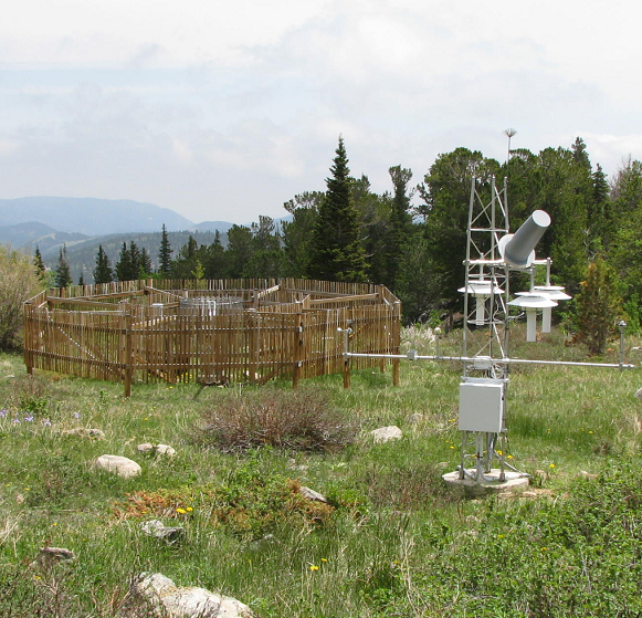 Station Picture
The Experimental USCRN data consists of data from four separate locations. Two of these stations--Johnstown, PA and Sterling, VA--were used to establish USCRN data collection and processing for precipitation. These "testbed" stations were important to evaluate the best instrumentation for the USCRN sites and their relation to other standard precipitation gauges available between 2003 and 2008. Also included is data from Marshall Field, Boulder, CO which continues to be used to calibrate different instruments used at the USCRN sites. Finally, Tiksi, Russia (Sakha Republic) was an experimental subset of USCRN standard equipment being tested in a severely cold environment. The two "testbed" stations (Johnstown and Sterling) and Tiksi are now inactive, but the expectation is that Marshall will continue to operate and send data to archive on a monthly basis. Documentation accompanies the experimental data based on location.
- Cite this dataset when used as a source.
- NCEI DSI 6132_xx
- gov.noaa.ncdc:C00957
| Order Data |
|
| Distribution Formats |
|
| Ordering Instructions |
Contact NCEI for other distribution options and instructions. |
| Distributor |
NOAA National Centers for Environmental Information
ncei.info@noaa.gov
|
| Dataset Point of Contact |
Customer Engagement Branch
NOAA National Centers for Environmental Information
1-828-271-4800
ncei.orders@noaa.gov
|
| Time Period |
2000-11-15 to Present |
| Spatial Bounding Box Coordinates |
West: -180.0
East: 128.0
South: -15.0
North: 72.0
|
| Spatial Coverage Map |
|
| Publication Dates |
|
| Data Presentation Form |
Digital table - digital representation of facts or figures systematically displayed, especially in columns
|
| Dataset Progress Status |
Ongoing - data is continually being updated |
| Data Update Frequency |
Irregular |
| Purpose |
These experimental stations are used to calibrate and understand how the various USCRN instruments perform in different areas and climates. |
| Use Limitations |
- Data are not intended to be used as climate reference stations. Station data is used to check instrument and data calibration measurements. Johnstown and Sterling data are integrated into one archive package; due to a lack of resources and documentation, Johnstown-Sterling data has limited usability.
|
| Dataset Citation |
- Cite this dataset when used as a source.
|
| Cited Authors |
- DOC/NOAA > National Oceanic & Atmospheric Administration
|
| Originators |
- DOC/NOAA > National Oceanic & Atmospheric Administration
|
| Publishers |
- DOC/NOAA/NESDIS/NCEI > National Centers for Environmental Information, NESDIS, NOAA, U.S. Department of Commerce
|
| Theme keywords |
Global Change Master Directory (GCMD) Science Keywords
- Earth Science > Atmosphere > Atmospheric Temperature > Surface Temperature > Air Temperature
- Earth Science > Atmosphere > Atmospheric Temperature > Surface Temperature > Maximum/Minimum Temperature
- Earth Science > Atmosphere > Atmospheric Temperature > Surface Temperature
- Earth Science > Atmosphere > Precipitation > Precipitation Amount
- Earth Science > Atmosphere > Atmospheric Water Vapor > Water Vapor Indicators > Humidity
- Earth Science > Atmosphere > Atmospheric Winds > Surface Winds
- Earth Science > Atmosphere > Atmospheric Radiation > Incoming Solar Radiation
- Earth Science > Atmosphere > Atmospheric Radiation > Solar Radiation
- Earth Science > Atmosphere > Atmospheric Temperature > Surface Temperature > Skin Temperature
- Earth Science > Land Surface > Soils > Soil Moisture/Water Content
- Earth Science > Land Surface > Soils > Soil Texture
- Earth Science > Land Surface > Surface Thermal Properties > Land Surface Temperature
Global Climate Observing System (GCOS) Essential Climate Variables (ECVs)
- Atmospheric - Surface - Air Temperature
- Atmospheric - Surface - Wind Speed And Direction
- Atmospheric - Surface - Precipitation
- Atmospheric - Surface - Surface Radiation Budget (including Solar Irradiance)
- Atmospheric - Surface - Water Vapour
- Terrestrial - Soil Moisture
- Terrestrial - Land Surface Temperature
|
| Data Center keywords |
Global Change Master Directory (GCMD) Data Center Keywords
- DOC/NOAA/NESDIS/NCDC > National Climatic Data Center, NESDIS, NOAA, U.S. Department of Commerce
- DOC/NOAA/NESDIS/NCEI > National Centers for Environmental Information, NESDIS, NOAA, U.S. Department of Commerce
|
| Platform keywords |
Global Change Master Directory (GCMD) Platform Keywords
|
| Instrument keywords |
Global Change Master Directory (GCMD) Instrument Keywords
- Anemometers
- PYRANOMETERS
- FAN-ASPIRATED RADIATION SHIELD
- Rain Gauges
- SOIL TEMPERATURE PROBE
- SOIL MOISTURE PROBE
- TEMPERATURE SENSORS
- HUMIDITY SENSORS
- Thermometers
- DISDROMETERS
|
| Place keywords |
Global Change Master Directory (GCMD) Location Keywords
- Geographic Region > Polar
- Geographic Region > Mid-Latitude
- Continent > North America > United States Of America
- Continent > Europe > Eastern Europe > Russian Federation
- Continent > North America > United States Of America > Colorado
- Continent > North America > United States Of America > Pennsylvania
- Continent > North America > United States Of America > Virginia
|
| Project keywords |
Global Change Master Directory (GCMD) Project Keywords- U.S. Climate Reference Network - USCRN
|
| Data Resolution keywords |
Global Change Master Directory (GCMD) Horizontal Data Resolution Keywords- 250 km - < 500 km or approximately 2.5 degrees - < 5.0 degrees
Global Change Master Directory (GCMD) Vertical Data Resolution Keywords
- < 1 meter
- 1 meter - < 10 meters
Global Change Master Directory (GCMD) Temporal Data Resolution Keywords
- Hourly - < Daily
- 1 minute - < 1 hour
|
| Stratum keywords |
Global Change Master Directory (GCMD) Location Keywords- Vertical Location > Land Surface
|
| Use Constraints |
- Cite this dataset when used as a source.
- Use liability: NOAA and NCEI cannot provide any warranty as to the accuracy, reliability, or completeness of furnished data. Users assume responsibility to determine the usability of these data. The user is responsible for the results of any application of this data for other than its intended purpose.
|
| Access Constraints |
- Distribution liability: NOAA and NCEI make no warranty, expressed or implied, regarding these data, nor does the fact of distribution constitute such a warranty. NOAA and NCEI cannot assume liability for any damages caused by any errors or omissions in these data. If appropriate, NCEI can only certify that the data it distributes are an authentic copy of the records that were accepted for inclusion in the NCEI archives.
|
| Fees |
- In most cases, electronic downloads of the data are free. However, fees may apply for custom orders, data certifications, copies of analog materials, and data distribution on physical media.
|
| Lineage information for: dataset |
|---|
| Lineage Statement |
Experimental stations were established to check the quality and consistency of USCRN Program data and instruments. More information can be found at the USCRN website or papers describing the creation of the USCRN Program. |
| Processing Steps |
- 2018-11-06T00:00:00 - Tiksi data were operational until 2018-11-06 2300 UTC
|
| Processing Environment |
Marshall data are collected from NOAA/ATDD via FTP. Tiksi data are collected via FTP from NOAA’s Environmental Technology Laboratory. Johnstown-Sterling data are no longer collected. CRNingest then reads the raw data, applies QC flags, determines priority, calculates elements, writes data to the database. |
| Lineage information for: repository |
|---|
| Processing Steps |
- 2015-04-22T00:00:00 - NOAA created the National Centers for Environmental Information (NCEI) by merging NOAA's National Climatic Data Center (NCDC), National Geophysical Data Center (NGDC), and National Oceanographic Data Center (NODC), including the National Coastal Data Development Center (NCDDC), per the Consolidated and Further Continuing Appropriations Act, 2015, Public Law 113-235. NCEI launched publicly on April 22, 2015.
|
Last Modified: 2023-06-23
For questions about the information on this page, please email:
ncei.info@noaa.gov