Hurricane Satellite (HURSAT) from International Satellite Cloud Climatology Project (ISCCP) B1, Version 6
- referenceSystemInfo
- identificationInfo
- distributionInfo
- dataQualityInfo
- dataQualityInfo
- metadataMaintenance
(MI_Metadata)
fileIdentifier: gov.noaa.ncdc:C00997
language: eng; USA
characterSet: (MD_CharacterSetCode) utf8
hierarchyLevel: (MD_ScopeCode) dataset
contact: (CI_ResponsibleParty)
organisationName: NOAA National Centers for Environmental Information
contactInfo: (CI_Contact)
address: (CI_Address)
electronicMailAddress: ncei.info@noaa.gov
onlineResource: (CI_OnlineResource)
linkage: https://www.ncei.noaa.gov/contact
name: NCEI Contact Information
description: Information for contacts at NCEI.
function: (CI_OnLineFunctionCode) information
role: (CI_RoleCode) pointOfContact
dateStamp: 2023-06-23
metadataStandardName: ISO 19115-2 Geographic Information - Metadata - Part 2: Extensions for Imagery and Gridded Data
metadataStandardVersion: ISO 19115-2:2009(E)
return to top
referenceSystemInfo: (MD_ReferenceSystem)
referenceSystemIdentifier: (RS_Identifier)
authority: (CI_Citation)
title: EPSG Geodetic Parameter Dataset Registry
date: (CI_Date)
date: 2008-11-12
dateType: (CI_DateTypeCode) publication
citedResponsibleParty: (CI_ResponsibleParty)
organisationName: International Association of Oil and Gas Producers (OGP) Geomatics Committee
contactInfo: (CI_Contact)
onlineResource: (CI_OnlineResource)
linkage: http://www.epsg-registry.org/
applicationProfile: Data Search Application
name: EPSG Geodetic Parameter Dataset Registry Application
description: Interface to the EPSG Geodetic Parameter Dataset Registry
function: (CI_OnLineFunctionCode) search
role: (CI_RoleCode) custodian
citedResponsibleParty: (CI_ResponsibleParty)
organisationName: International Association of Oil and Gas Producers (OGP) Geomatics Committee
contactInfo: (CI_Contact)
onlineResource: (CI_OnlineResource)
linkage: http://www.epsg-registry.org/export.htm?gml=urn:ogc:def:crs:EPSG::4326
applicationProfile: Download
name: Coordinate Reference System data in GML
description: Coordinate Reference System data in GML
function: (CI_OnLineFunctionCode) download
role: (CI_RoleCode) custodian
code: urn:ogc:def:crs:EPSG::4326
version: (unknown)
return to top
identificationInfo: (MD_DataIdentification)
citation: (CI_Citation)
title: Hurricane Satellite (HURSAT) from International Satellite Cloud Climatology Project (ISCCP) B1, Version 6
alternateTitle: HURSAT B1
date: (CI_Date)
date: 2017-05-01
dateType: (CI_DateTypeCode) publication
date: (CI_Date)
date: 2017-01-02
dateType: (CI_DateTypeCode) creation
edition: Version 6
identifier: (MD_Identifier)
code:
Anchor: DOI doi:10.7289/V55X274D
identifier: (MD_Identifier)
code: NCEI DSI 3641_04
identifier: (MD_Identifier)
code: gov.noaa.ncdc:C00997
citedResponsibleParty: (CI_ResponsibleParty)
individualName: Knapp, Ken
organisationName: DOC/NOAA/NESDIS/NCEI > National Centers for Environmental Information, NESDIS, NOAA, U.S. Department of Commerce
role: (CI_RoleCode) originator
citedResponsibleParty: (CI_ResponsibleParty)
individualName: Knapp, Ken
organisationName: DOC/NOAA/NESDIS/NCEI > National Centers for Environmental Information, NESDIS, NOAA, U.S. Department of Commerce
role: (CI_RoleCode) author
citedResponsibleParty: (CI_ResponsibleParty)
individualName: Kossin, James
organisationName: DOC/NOAA/NESDIS/NCEI > National Centers for Environmental Information, NESDIS, NOAA, U.S. Department of Commerce
role: (CI_RoleCode) collaborator
citedResponsibleParty: (CI_ResponsibleParty)
individualName: Kossin, James
organisationName: DOC/NOAA/NESDIS/NCEI > National Centers for Environmental Information, NESDIS, NOAA, U.S. Department of Commerce
role: (CI_RoleCode) author
citedResponsibleParty: (CI_ResponsibleParty)
organisationName: DOC/NOAA/NESDIS/NCEI > National Centers for Environmental Information, NESDIS, NOAA, U.S. Department of Commerce
role: (CI_RoleCode) publisher
presentationForm: (CI_PresentationFormCode) imageDigital
abstract: The Hurricane Satellite (HURSAT) from derived International Satellite Cloud Climatology Project (ISCCP) B1 observations of tropical cyclones worldwide. The B1 data are subsampled observations from the global constellation of geostationary satellites (GOES, Meteosat, GMS, and FY2 series) spanning 1978 through to present year. The data include infrared window, visible and other channels available from the satellite instruments. IBTrACS (International Best Track Archive for Climate Stewardship) best track locations of all global tropical cyclones were temporally interpolated to match the satellite data resolution. The satellite data were then gridded to 8km, with grid centers fixed on the tropical cyclone center of circulation at 3-hour intervals. Data are provided in a convenient NetCDF format which is self-documenting and follows standard storage and metadata conventions. HURSAT version 6 also contains information about the image derived from storm centering algorithms including ARCHER [Wimmer's SSEC algorithm] and the axisymmetric technique. Azimuthal statistics derived from these positions are also provided. Version 6 supersedes all other HURSAT B1 versions.
purpose: To provide a cohesive data set of historical tropical cyclone centered imagery for future analysis (e.g., forecast development, climate analysis, etc.).
status: (MD_ProgressCode) onGoing
pointOfContact: (CI_ResponsibleParty)
organisationName: DOC/NOAA/NESDIS/NCEI > National Centers for Environmental Information, NESDIS, NOAA, U.S. Department of Commerce
positionName: Customer Engagement Branch
contactInfo: (CI_Contact)
phone: (CI_Telephone)
voice: 1-828-271-4800
facsimile: 1-828-271-4876
address: (CI_Address)
deliveryPoint: 151 Patton Avenue
deliveryPoint: Veach-Baley Federal Building, Room 468
city: Asheville
administrativeArea: NC
postalCode: 28801-5001
country: USA
electronicMailAddress: ncei.sat.info@noaa.gov
onlineResource: (CI_OnlineResource)
linkage: https://www.ncei.noaa.gov
applicationProfile: Web Browser
name: NOAA National Centers for Environmental Information (NCEI)
description: NCEI home page with information, data access and contact information.
function: (CI_OnLineFunctionCode) information
hoursOfService: 8:00 - 6:00 Eastern
role: (CI_RoleCode) pointOfContact
resourceMaintenance: (MD_MaintenanceInformation)
maintenanceAndUpdateFrequency: (MD_MaintenanceFrequencyCode) annually
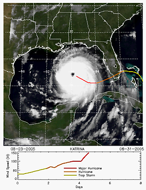
graphicOverview: (MD_BrowseGraphic)
fileName: https://www.ncei.noaa.gov/pub/data/metadata/images/C00855_HURSAT-B1-browse.png
fileDescription: HURSAT-B1
fileType: PNG
descriptiveKeywords: (MD_Keywords)
keyword: Earth Science > Atmosphere > Weather Events > Tropical Cyclones
keyword: Earth Science > Human Dimensions > Natural Hazards > Tropical Cyclones > Hurricanes
keyword: Earth Science > Human Dimensions > Natural Hazards > Tropical Cyclones > Hurricanes
keyword: Earth Science > Human Dimensions > Natural Hazards > Tropical Cyclones > Typhoons
keyword: Earth Science > Atmosphere > Atmospheric Pressure > Anticyclones/Cyclones
keyword: Earth Science > Atmosphere > Atmospheric Pressure > Sea Level Pressure
keyword: Earth Science > Oceans > Ocean Pressure > Sea Level Pressure
keyword: Earth Science > Oceans > Ocean Optics > Radiance
keyword: Earth Science > Atmosphere > Atmospheric Radiation > Albedo
keyword: Earth Science > Atmosphere > Atmospheric Radiation > Net Radiation
keyword: Earth Science > Atmosphere > Aerosols > Aerosol Optical Depth/Thickness
keyword: Earth Science > Atmosphere > Atmospheric Radiation > Solar Irradiance
keyword: Earth Science > Spectral/Engineering > Infrared Wavelengths
keyword: Earth Science > Spectral/Engineering > Visible Wavelengths
keyword: Earth Science > Atmosphere > Clouds
keyword: Earth Science > Atmosphere > Atmospheric Water Vapor
type: (MD_KeywordTypeCode) theme
thesaurusName: (CI_Citation)
title: Global Change Master Directory (GCMD) Science Keywords
date: (CI_Date)
date: 2018
dateType: (CI_DateTypeCode) revision
edition: Version 8.6
citedResponsibleParty: (CI_ResponsibleParty)
organisationName: Global Change Data Center, Science and Exploration Directorate, Goddard Space Flight Center (GSFC) National Aeronautics and Space Administration (NASA)
contactInfo: (CI_Contact)
onlineResource: (CI_OnlineResource)
linkage: https://earthdata.nasa.gov/about/gcmd/global-change-master-directory-gcmd-keywords
protocol: HTTPS
applicationProfile: Web Browser
name: Global Change Master Directory (GCMD) Keywords
description: The information provided on this page seeks to define how the GCMD Keywords are structured, used and accessed. It also provides information on how users can participate in the further development of the keywords.
function: (CI_OnLineFunctionCode) information
role: (CI_RoleCode) publisher
descriptiveKeywords: (MD_Keywords)
keyword: Oceanic - Surface - Sea Level
type: (MD_KeywordTypeCode) theme
thesaurusName: (CI_Citation)
title: Global Climate Observing System (GCOS) Essential Climate Variables (ECVs)
date: (CI_Date)
date: 2017
dateType: (CI_DateTypeCode) publication
edition: Release 2017
citedResponsibleParty: (CI_ResponsibleParty)
organisationName: World Meteorological Organization, United Nations
contactInfo: (CI_Contact)
onlineResource: (CI_OnlineResource)
linkage: https://public.wmo.int/en/programmes/global-climate-observing-system/essential-climate-variables
protocol: HTTP
applicationProfile: Information
name: GCOS Essential Climate Variables
description: Overview of the GCOS Essential Climate Variables.
function: (CI_OnLineFunctionCode) information
role: (CI_RoleCode) custodian
descriptiveKeywords: (MD_Keywords)
keyword: Geographic Region > Global
keyword: Geographic Region > Equatorial
keyword: Geographic Region > Global Ocean
type: (MD_KeywordTypeCode) place
thesaurusName: (CI_Citation)
title: Global Change Master Directory (GCMD) Location Keywords
date: (CI_Date)
date: 2018
dateType: (CI_DateTypeCode) revision
edition: Version 8.6
citedResponsibleParty: (CI_ResponsibleParty)
organisationName: Global Change Data Center, Science and Exploration Directorate, Goddard Space Flight Center (GSFC) National Aeronautics and Space Administration (NASA)
contactInfo: (CI_Contact)
onlineResource: (CI_OnlineResource)
linkage: https://earthdata.nasa.gov/about/gcmd/global-change-master-directory-gcmd-keywords
protocol: HTTPS
applicationProfile: Web Browser
name: Global Change Master Directory (GCMD) Keywords
description: The information provided on this page seeks to define how the GCMD Keywords are structured, used and accessed. It also provides information on how users can participate in the further development of the keywords.
function: (CI_OnLineFunctionCode) information
role: (CI_RoleCode) publisher
descriptiveKeywords: (MD_Keywords)
keyword: Vertical Location > Sea Surface
keyword: Vertical Location > Mesosphere
type: (MD_KeywordTypeCode) stratum
thesaurusName: (CI_Citation)
title: Global Change Master Directory (GCMD) Location Keywords
date: (CI_Date)
date: 2018
dateType: (CI_DateTypeCode) revision
edition: Version 8.6
citedResponsibleParty: (CI_ResponsibleParty)
organisationName: Global Change Data Center, Science and Exploration Directorate, Goddard Space Flight Center (GSFC) National Aeronautics and Space Administration (NASA)
contactInfo: (CI_Contact)
onlineResource: (CI_OnlineResource)
linkage: https://earthdata.nasa.gov/about/gcmd/global-change-master-directory-gcmd-keywords
protocol: HTTPS
applicationProfile: Web Browser
name: Global Change Master Directory (GCMD) Keywords
description: The information provided on this page seeks to define how the GCMD Keywords are structured, used and accessed. It also provides information on how users can participate in the further development of the keywords.
function: (CI_OnLineFunctionCode) information
role: (CI_RoleCode) publisher
descriptiveKeywords: (MD_Keywords)
keyword: VAS > VISSR Atmospheric Sounder
keyword: JAMI > Japanese Advanced Meteorological Imager
keyword: SEVIRI > Spinning Enhanced Visible and Infrared Imager
keyword: GOES I-M IMAGER
keyword: VISSR-METEOSAT > Visible and Infrared Spin Scan Radiometer (METEOSAT Series)
type: (MD_KeywordTypeCode) instrument
thesaurusName: (CI_Citation)
title: Global Change Master Directory (GCMD) Instrument Keywords
date: (CI_Date)
date: 2018
dateType: (CI_DateTypeCode) revision
edition: Version 8.6
citedResponsibleParty: (CI_ResponsibleParty)
organisationName: Global Change Data Center, Science and Exploration Directorate, Goddard Space Flight Center (GSFC) National Aeronautics and Space Administration (NASA)
contactInfo: (CI_Contact)
onlineResource: (CI_OnlineResource)
linkage: https://earthdata.nasa.gov/about/gcmd/global-change-master-directory-gcmd-keywords
protocol: HTTPS
applicationProfile: Web Browser
name: Global Change Master Directory (GCMD) Keywords
description: The information provided on this page seeks to define how the GCMD Keywords are structured, used and accessed. It also provides information on how users can participate in the further development of the keywords.
function: (CI_OnLineFunctionCode) information
role: (CI_RoleCode) publisher
descriptiveKeywords: (MD_Keywords)
keyword: GOES-1 > Geostationary Operational Environmental Satellite 1
keyword: GOES-2 > Geostationary Operational Environmental Satellite 2
keyword: GOES-3 > Geostationary Operational Environmental Satellite 3
keyword: GOES-4 > Geostationary Operational Environmental Satellite 4
keyword: GOES-5 > Geostationary Operational Environmental Satellite 5
keyword: GOES-6 > Geostationary Operational Environmental Satellite 6
keyword: GOES-7 > Geostationary Operational Environmental Satellite 7
keyword: GOES-8 > Geostationary Operational Environmental Satellite 8
keyword: GOES-9 > Geostationary Operational Environmental Satellite 9
keyword: GOES-10 > Geostationary Operational Environmental Satellite 10
keyword: GOES-11 > Geostationary Operational Environmental Satellite 11
keyword: GOES-12 > Geostationary Operational Environmental Satellite 12
keyword: SMS-2 > Synchronous Meteorological Satellite 2
keyword: METEOSAT-4 > Meteosat Operational Programme 1 (MOP-1)
keyword: METEOSAT-5 > Meteosat Operational Programme 2 (MOP-2)
keyword: METEOSAT-6 > Meteosat Operational Programme 3 (MOP-3)
keyword: METEOSAT-7
keyword: GMS-1 > Geostationary Meteorological Satellite-1
keyword: GMS-2 > Geostationary Meteorological Satellite-2
keyword: GMS-3 > Geostationary Meteorological Satellite-3
keyword: GMS-4 > Geostationary Meteorological Satellite-4
keyword: GMS-5 > Geostationary Meteorological Satellite-5
keyword: MTSAT-1R > Multi-functional Transport Satellite 1 Replacement
keyword: METEOSAT-8
type: (MD_KeywordTypeCode) platform
thesaurusName: (CI_Citation)
title: Global Change Master Directory (GCMD) Platform Keywords
date: (CI_Date)
date: 2018
dateType: (CI_DateTypeCode) revision
edition: Version 8.6
citedResponsibleParty: (CI_ResponsibleParty)
organisationName: Global Change Data Center, Science and Exploration Directorate, Goddard Space Flight Center (GSFC) National Aeronautics and Space Administration (NASA)
contactInfo: (CI_Contact)
onlineResource: (CI_OnlineResource)
linkage: https://earthdata.nasa.gov/about/gcmd/global-change-master-directory-gcmd-keywords
protocol: HTTPS
applicationProfile: Web Browser
name: Global Change Master Directory (GCMD) Keywords
description: The information provided on this page seeks to define how the GCMD Keywords are structured, used and accessed. It also provides information on how users can participate in the further development of the keywords.
function: (CI_OnLineFunctionCode) information
role: (CI_RoleCode) publisher
descriptiveKeywords: (MD_Keywords)
keyword: 1 km - < 10 km or approximately .01 degree - < .09 degree
type: (MD_KeywordTypeCode) dataResolution
thesaurusName: (CI_Citation)
title: Global Change Master Directory (GCMD) Horizontal Data Resolution Keywords
date: (CI_Date)
date: 2018
dateType: (CI_DateTypeCode) revision
edition: Version 8.6
citedResponsibleParty: (CI_ResponsibleParty)
organisationName: Global Change Data Center, Science and Exploration Directorate, Goddard Space Flight Center (GSFC) National Aeronautics and Space Administration (NASA)
contactInfo: (CI_Contact)
onlineResource: (CI_OnlineResource)
linkage: https://earthdata.nasa.gov/about/gcmd/global-change-master-directory-gcmd-keywords
protocol: HTTPS
applicationProfile: Web Browser
name: Global Change Master Directory (GCMD) Keywords
description: The information provided on this page seeks to define how the GCMD Keywords are structured, used and accessed. It also provides information on how users can participate in the further development of the keywords.
function: (CI_OnLineFunctionCode) information
role: (CI_RoleCode) publisher
descriptiveKeywords: (MD_Keywords)
keyword: Hourly - < Daily
type: (MD_KeywordTypeCode) dataResolution
thesaurusName: (CI_Citation)
title: Global Change Master Directory (GCMD) Temporal Data Resolution Keywords
date: (CI_Date)
date: 2018
dateType: (CI_DateTypeCode) revision
edition: Version 8.6
citedResponsibleParty: (CI_ResponsibleParty)
organisationName: Global Change Data Center, Science and Exploration Directorate, Goddard Space Flight Center (GSFC) National Aeronautics and Space Administration (NASA)
contactInfo: (CI_Contact)
onlineResource: (CI_OnlineResource)
linkage: https://earthdata.nasa.gov/about/gcmd/global-change-master-directory-gcmd-keywords
protocol: HTTPS
applicationProfile: Web Browser
name: Global Change Master Directory (GCMD) Keywords
description: The information provided on this page seeks to define how the GCMD Keywords are structured, used and accessed. It also provides information on how users can participate in the further development of the keywords.
function: (CI_OnLineFunctionCode) information
role: (CI_RoleCode) publisher
descriptiveKeywords: (MD_Keywords)
keyword: DOC/NOAA/NESDIS/NCEI > National Centers for Environmental Information, NESDIS, NOAA, U.S. Department of Commerce
type: (MD_KeywordTypeCode) dataCentre
thesaurusName: (CI_Citation)
title: Global Change Master Directory (GCMD) Data Center Keywords
date: (CI_Date)
date: 2018
dateType: (CI_DateTypeCode) revision
edition: Version 8.6
citedResponsibleParty: (CI_ResponsibleParty)
organisationName: Global Change Data Center, Science and Exploration Directorate, Goddard Space Flight Center (GSFC) National Aeronautics and Space Administration (NASA)
contactInfo: (CI_Contact)
onlineResource: (CI_OnlineResource)
linkage: https://earthdata.nasa.gov/about/gcmd/global-change-master-directory-gcmd-keywords
protocol: HTTPS
applicationProfile: Web Browser
name: Global Change Master Directory (GCMD) Keywords
description: The information provided on this page seeks to define how the GCMD Keywords are structured, used and accessed. It also provides information on how users can participate in the further development of the keywords.
function: (CI_OnLineFunctionCode) information
role: (CI_RoleCode) publisher
resourceConstraints: (MD_Constraints)
useLimitation: The data are not original resolution satellite data. Instead, all images are approximately 8km resolution.
resourceConstraints: (MD_LegalConstraints)
useConstraints: (MD_RestrictionCode) otherRestrictions
otherConstraints: Cite as: Knapp, K. R.; Kossin, J. P. (2017): Hurricane Satellite (HURSAT) from International Satellite Cloud Climatology Project (ISCCP) B1, Version 6. [indicate subset used]. NOAA National Center for Environmental Information. doi:10.7289/V55X274D [access date]. Also cite this paper when data is used as a source: Knapp, K. R. and J. P. Kossin, 2007: New global tropical cyclone data from ISCCP B1 geostationary satellite observations.Journal of Applied Remote Sensing, 1, 013505. doi:10.1117/1.2712816
resourceConstraints: (MD_LegalConstraints)
accessConstraints: (MD_RestrictionCode) otherRestrictions
otherConstraints: Distribution liability: NOAA and NCEI make no warranty, expressed or implied, regarding these data, nor does the fact of distribution constitute such a warranty. NOAA and NCEI cannot assume liability for any damages caused by any errors or omissions in these data. If appropriate, NCEI can only certify that the data it distributes are an authentic copy of the records that were accepted for inclusion in the NCEI archives.
resourceConstraints: (MD_LegalConstraints)
useConstraints: (MD_RestrictionCode) otherRestrictions
otherConstraints: Use liability: NOAA and NCEI cannot provide any warranty as to the accuracy, reliability, or completeness of furnished data. Users assume responsibility to determine the usability of these data. The user is responsible for the results of any application of this data for other than its intended purpose.
aggregationInfo: (MD_AggregateInformation)
aggregateDataSetName: (CI_Citation)
title: New global tropical cyclone data from ISCCP B1 geostationary satellite observations
date: (CI_Date)
date: 2007-02-08
dateType: (CI_DateTypeCode) publication
edition: Volume 1, issue 1, 013505
identifier: (MD_Identifier)
code: http://dx.doi.org/10.1117/1.2712816
citedResponsibleParty: (CI_ResponsibleParty)
organisationName: Journal of Applied Remote Sensing
role: (CI_RoleCode) publisher
citedResponsibleParty: (CI_ResponsibleParty)
organisationName: (missing)
contactInfo: (CI_Contact)
onlineResource: (CI_OnlineResource)
linkage: http://remotesensing.spiedigitallibrary.org/article.aspx?articleid=707767
applicationProfile: Web Browser
name: New global tropical cyclone data from ISCCP B1 geostationary satellite observations
description: Journal of Applied Remote Sensing landing page for science paper
function: (CI_OnLineFunctionCode) information
role: (missing)
associationType: (DS_AssociationTypeCode) crossReference
initiativeType: (DS_InitiativeTypeCode) sciencePaper
spatialRepresentationType: (MD_SpatialRepresentationTypeCode) grid
spatialResolution: (MD_Resolution)
distance:
Distance: 8000
language: eng; USA
topicCategory: (MD_TopicCategoryCode) climatologyMeteorologyAtmosphere
environmentDescription: The data are produced on Linux systems using IDL scripts. The ARCHER module was provided as a Matlab program, so is processed in Matlab. ARCHER data is passed back to IDL to be included in final HURSAT netCDF files.
extent: (EX_Extent)
geographicElement: (EX_GeographicBoundingBox)
extentTypeCode: 1
westBoundLongitude: -180.0
eastBoundLongitude: 180.0
southBoundLatitude: -90.0
northBoundLatitude: 90.0
temporalElement: (EX_TemporalExtent)
extent:
TimePeriod:
description: ground condition
beginPosition: 1978-05-30
endPosition:
timeInterval: 3
return to top
distributionInfo: (MD_Distribution)
distributor: (MD_Distributor)
distributorContact: (CI_ResponsibleParty)
organisationName: NOAA National Centers for Environmental Information
contactInfo: (CI_Contact)
address: (CI_Address)
electronicMailAddress: ncei.info@noaa.gov
onlineResource: (CI_OnlineResource)
linkage: https://www.ncei.noaa.gov/contact
name: NCEI Contact Information
description: Information for contacts at NCEI.
function: (CI_OnLineFunctionCode) information
role: (CI_RoleCode) distributor
distributionOrderProcess: (MD_StandardOrderProcess)
fees: In most cases, electronic downloads of the data are free. However, fees may apply for custom orders, data certifications, copies of analog materials, and data distribution on physical media.
orderingInstructions: Contact NCEI for other distribution options and instructions.
distributorFormat: (MD_Format)
name: XML
version: (missing)
distributorFormat: (MD_Format)
name: netCDF
version: version 4
specification: CF convention
fileDecompressionTechnique: netCDF internal compression is applied
distributorTransferOptions: (MD_DigitalTransferOptions)
onLine: (CI_OnlineResource)
linkage: https://doi.org/10.7289/V55X274D
protocol: HTTPS
applicationProfile: Landing Page
name: NCEI Dataset Landing Page
description: Landing page for the dataset.
function: (CI_OnLineFunctionCode) information
distributorTransferOptions: (MD_DigitalTransferOptions)
transferSize: (missing)
onLine: (CI_OnlineResource)
linkage: https://www.ncdc.noaa.gov/hursat/index.php
protocol: HTTPS
applicationProfile: Information
name: HURSAT Home Page
description: Project page with dataset information.
function: (CI_OnLineFunctionCode) information
distributorTransferOptions: (MD_DigitalTransferOptions)
transferSize: (missing)
onLine: (CI_OnlineResource)
linkage: https://www.ncei.noaa.gov/data/hurricane-satellite-hursat-b1/doc/v06/
protocol: HTTPS
applicationProfile: Documentation
name: Dataset Documentation
description: Please refer to the documentation file for more information about the dataset.
function: (CI_OnLineFunctionCode) information
distributorTransferOptions: (MD_DigitalTransferOptions)
transferSize:
Real: 40
onLine: (CI_OnlineResource)
linkage: https://www.ncei.noaa.gov/data/hurricane-satellite-hursat-b1/archive/v06/
protocol: HTTPS
applicationProfile: Download
name: NCEI data download
description: Direct download links for dataset files.
function: (CI_OnLineFunctionCode) download
return to top
dataQualityInfo: (DQ_DataQuality)
scope: (DQ_Scope)
level: (MD_ScopeCode) dataset
extent: #boundingExtent
lineage: (LI_Lineage)
statement: The HURSAT data are created by merging the IBTrACS data (which provides positions of tropical cyclones) with the ISCCP B1 data (which are subsampled geostationary data). The IBTrACS positions of tropical cyclones are interpolated in time to match the geostationary image time. The geostationary data are then interpolated to a latitude/longitude grid centered on the cyclone center, using nearest neighbor. The resulting data are stored in netCDF files. Some cyclone centering techniques are applied to the data and their results are stored in the netCDF files as well.
processStep: (LE_ProcessStep)
description: Identify tropical cyclone(s) in satellite data.
rationale: Need to know where the tropical cyclones are.
dateTime: (missing)
processor: (CI_ResponsibleParty)
organisationName: DOC/NOAA/NESDIS/NCEI > National Centers for Environmental Information, NESDIS, NOAA, U.S. Department of Commerce
role: (CI_RoleCode) processor
source: sd001
source: sd002
processingInformation: (LE_Processing)
identifier: (MD_Identifier)
code: IDL routines for the entire HURSAT routine are in the NCEI SVN repository: https://conman.ncdc.noaa.gov/svn-repos/hursat/b1/tags/v06/
algorithm: (LE_Algorithm)
citation: (CI_Citation)
title: New global tropical cyclone data set from ISCCP B1 geostationary satellite observations
date: (CI_Date)
date: 2007-02-01
dateType: (CI_DateTypeCode) publication
edition: Journal of Applied Remote Sensing, Volume 1 Issue 1
citedResponsibleParty: (CI_ResponsibleParty)
organisationName: SPIE
role: (CI_RoleCode) publisher
citedResponsibleParty: (CI_ResponsibleParty)
organisationName: (missing)
contactInfo: (CI_Contact)
onlineResource: (CI_OnlineResource)
linkage: https://spie.org/Publications/Journal/10.1117/1.2712816
protocol: HTTPS
applicationProfile: Web Browser
name: New global tropical cyclone data set from ISCCP B1 geostationary satellite observations
description: Website for the journal
function: (CI_OnLineFunctionCode) information
role: (missing)
description: See Algorithm Citation
algorithm: (LE_Algorithm)
citation: (CI_Citation)
title: Scientific data stewardship of international satellite cloud climatology project B1 global geostationary observations
date: (CI_Date)
date: 2008-11-19
dateType: (CI_DateTypeCode) publication
edition: Journal of Applied Remote Sensing, Volume 2 Issue 1
identifier: (MD_Identifier)
code: doi:10.1117/1.3043461
citedResponsibleParty: (CI_ResponsibleParty)
organisationName: DOC/NOAA/NESDIS/NCEI > National Centers for Environmental Information, NESDIS, NOAA, U.S. Department of Commerce
role: (CI_RoleCode) principalInvestigator
citedResponsibleParty: (CI_ResponsibleParty)
organisationName: (missing)
contactInfo: (CI_Contact)
onlineResource: (CI_OnlineResource)
linkage: http://remotesensing.spiedigitallibrary.org/article.aspx?articleid=708154
applicationProfile: Web Browser
name: Scientific data stewardship of international satellite cloud climatology project B1 global geostationary observations
description: SPIE/JARS manuscript describing the B1 data used in the HURSAT production
function: (CI_OnLineFunctionCode) information
role: (missing)
description: See Algorithm Citation
processStep: (LE_ProcessStep)
description: Calculate spatial grid from satellite data
rationale: Produce satellite imagery centered on active tropical cyclones
dateTime: (missing)
processor: (CI_ResponsibleParty)
organisationName: DOC/NOAA/NESDIS/NCEI > National Centers for Environmental Information, NESDIS, NOAA, U.S. Department of Commerce
role: (CI_RoleCode) processor
processStep: (LE_ProcessStep)
description: Calculate objective storm center using the ARCHER algorithm
rationale: The ARCHER routine objectively identifies the storm center using IR scene data. This reduces the impact of navigation errors in the source ISCCP B1 data.
dateTime: (missing)
processor: (CI_ResponsibleParty)
organisationName: DOC/NOAA/NESDIS/NCEI > National Centers for Environmental Information, NESDIS, NOAA, U.S. Department of Commerce
role: (CI_RoleCode) processor
processingInformation: (LE_Processing)
identifier: (MD_Identifier)
code: ARCHER algorithm which is available from the scientist Tony Wimmers
algorithm: (LE_Algorithm)
citation: (CI_Citation)
title: Advancements in Objective Multisatellite Tropical Cyclone Center Fixing
date: (CI_Date)
date: 2016-01-01
dateType: (CI_DateTypeCode) publication
edition: Journal of Applied Meteorology and Climatology, Volume 55
identifier: (MD_Identifier)
code: doi: 10.1175/JAMC-D-15-0098.1
citedResponsibleParty: (CI_ResponsibleParty)
organisationName: AMS
role: (CI_RoleCode) publisher
citedResponsibleParty: (CI_ResponsibleParty)
organisationName: (missing)
contactInfo: (CI_Contact)
onlineResource: (CI_OnlineResource)
linkage: https://doi.org/10.1175/JAMC-D-15-0098.1
applicationProfile: Web Browser
name: Advancements in Objective Multisatellite Tropical Cyclone Center Fixing
description: URL for algorithm description in AMS journal
function: (CI_OnLineFunctionCode) information
role: (missing)
description: See Algorithm Citation
processStep: (LE_ProcessStep)
description: Write ARCHER parameters and other statistics of the gridded data to final netCDF file
rationale: Need to get the ARCHER information (produced with Matlab and output stored in ASCII) back to the HURSAT netCDF file. Azimuthal averages are produced based on various estimates of the storm center, including the ARCHER algorithm.
dateTime: (missing)
processor: (CI_ResponsibleParty)
organisationName: DOC/NOAA/NESDIS/NCEI > National Centers for Environmental Information, NESDIS, NOAA, U.S. Department of Commerce
role: (CI_RoleCode) processor
source: (LE_Source)
description: IBTrACS
sourceCitation: (CI_Citation)
title: International Best Track Archive for Climate Stewardship
date: (CI_Date)
date: 2010-09-01
dateType: (CI_DateTypeCode) publication
edition: v03r08 (newer versions are used for annual updates)
identifier: (MD_Identifier)
code: C00834
citedResponsibleParty: (CI_ResponsibleParty)
organisationName: DOC/NOAA/NESDIS/NCEI > National Centers for Environmental Information, NESDIS, NOAA, U.S. Department of Commerce
role: (CI_RoleCode) originator
citedResponsibleParty: (CI_ResponsibleParty)
organisationName: (missing)
contactInfo: (CI_Contact)
onlineResource: (CI_OnlineResource)
linkage: https://doi.org/10.7289/V5NK3BZP
applicationProfile: Web Browser
name: International Best Track Archive for Climate Stewardship
description: AMS/BAMS manuscript describing IBTrACS data.
function: (CI_OnLineFunctionCode) information
role: (missing)
sourceExtent: (EX_Extent)
temporalElement: (EX_TemporalExtent)
extent:
TimePeriod:
beginPosition: 1978-01-01
endPosition:
sourceStep: ps001
source: (LE_Source)
description: ISCCP B1 data
sourceCitation: (CI_Citation)
title: ISCCP B1 [Subsampled Geostationary meteorological satellite data]
date: (missing)
citedResponsibleParty: (CI_ResponsibleParty)
organisationName: DOC/NOAA/NESDIS/NCEI > National Centers for Environmental Information, NESDIS, NOAA, U.S. Department of Commerce
role: (CI_RoleCode) originator
citedResponsibleParty: (CI_ResponsibleParty)
organisationName: (missing)
contactInfo: (CI_Contact)
onlineResource: (CI_OnlineResource)
linkage: https://www.ncdc.noaa.gov/gridsat/isccp-b1-info.php
protocol: HTTPS
applicationProfile: Web Browser
name: ISCCP B1 [Subsampled Geostationary meteorological satellite data]
description: Description of B1U dataset
function: (CI_OnLineFunctionCode) information
role: (missing)
sourceExtent: (EX_Extent)
temporalElement: (EX_TemporalExtent)
extent:
TimePeriod:
beginPosition: 1978-01-01
endPosition:
sourceStep: ps001
return to top
dataQualityInfo: (DQ_DataQuality)
scope: (DQ_Scope)
level: (MD_ScopeCode) repository
levelDescription: (MD_ScopeDescription)
other: NOAA National Centers for Environmental Information
lineage: (LI_Lineage)
processStep: (LE_ProcessStep)
description: NOAA created the National Centers for Environmental Information (NCEI) by merging NOAA's National Climatic Data Center (NCDC), National Geophysical Data Center (NGDC), and National Oceanographic Data Center (NODC), including the National Coastal Data Development Center (NCDDC), per the Consolidated and Further Continuing Appropriations Act, 2015, Public Law 113-235. NCEI launched publicly on April 22, 2015.
dateTime:
DateTime: 2015-04-22T00:00:00
return to top
metadataMaintenance: (MD_MaintenanceInformation)
maintenanceAndUpdateFrequency: (MD_MaintenanceFrequencyCode) annually
maintenanceNote: Bulk metadata change applied on 2023-06-23. See version control repository history for metadata change details.