Surface Weather Observations Monthly
EV2 - Surface Weather Observation Forms (1001); Monthly Surface Weather Observation Forms (Images)
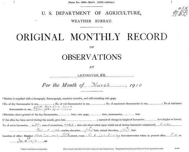 Image example
Surface Weather Observation 1001 Forms is a set of historical manuscript records for the period 1893-1948. The collection includes two very similar form types: Form 1001, in use by the US Weather Bureau, and Form 1, in use by the US Army and Navy. NCDC Climate Data Modernization Program (CDMP) scanned the vast majority of these forms in order to fill in the observation gap prior to the time when commercial aviation began in the U.S. Many forms contiaining observations taken on foreign soil have not yet been scanned. Observations were recorded two to four times daily beginning as early as 1893 at city Weather Bureau Offices. During the 1930s many of these city stations gradually moved to airport locations.
Through 1936 observations were taken twice daily; then in 1937 the general practice was to record four observations per day. The data elements are as follows: station pressure, sea level pressure, dry and wet bulb temperature, dew point, maximum and minimum temperature, wind direction and speed, precipitation, cloud amount and type, ceiling, state of weather and visibility. It should be noted that not all elements are present for all stations in this dataset, and that ceiling and visibility observations did not begin at the city offices until the 1930's. Official surface weather observation standards can be found in the Circular N manuals. The vast majority of records are available online, but some records are still only available in the physical format only.
Through 1936 observations were taken twice daily; then in 1937 the general practice was to record four observations per day. The data elements are as follows: station pressure, sea level pressure, dry and wet bulb temperature, dew point, maximum and minimum temperature, wind direction and speed, precipitation, cloud amount and type, ceiling, state of weather and visibility. It should be noted that not all elements are present for all stations in this dataset, and that ceiling and visibility observations did not begin at the city offices until the 1930's. Official surface weather observation standards can be found in the Circular N manuals. The vast majority of records are available online, but some records are still only available in the physical format only.
Dataset Citation
Cite this dataset when used as a source.
Dataset Identifiers
- NCEI DSI 3900_01
- NCEI WebARTIS: SWO (subset)
- gov.noaa.ncdc:C01105
ISO 19115-2 Metadata
gov.noaa.ncdc:C01105
| Download Data |
|
| Distribution Formats |
|
| Ordering Instructions | Contact NCEI for other distribution options and instructions. |
| Distributor |
NOAA National Centers for Environmental Information ncei.info@noaa.gov |
| Dataset Point of Contact | Customer Engagement Branch NOAA National Centers for Environmental Information 1-828-271-4800 ncei.orders@noaa.gov |
| Coverage Description | |
| Time Period | 1893 to 1948 |
| Spatial Bounding Box Coordinates |
West: -180
East: 180
South: -90
North: 90
|
| Spatial Coverage Map |
| General Documentation |
|
| Associated Resources |
|
| Publication Dates |
|
| Data Presentation Form | Digital image Hardcopy image - image archived in analog format |
| Dataset Progress Status | Complete - production of the data has been completed |
| Data Update Frequency | Irregular |
| Purpose | In the late 1990s NCDC realized the need to host digital images of weather and climate records on the internet. As a result, EV2 was developed as a key system for providing access to the millions of original source data images in the NCDC archives. With its upload and index capability, EV2 also enables the continuation of NCDC's commitment to make more of its weather and climate data available online so that users across the world can view climate and weather records held in the NCDC archives. |
| Use Limitations |
|
| Cited Authors |
|
| Originators |
|
| Publishers |
|
| Theme keywords |
Global Change Master Directory (GCMD) Science Keywords
|
| Data Center keywords |
Global Change Master Directory (GCMD) Data Center Keywords
|
| Platform keywords |
Global Change Master Directory (GCMD) Platform Keywords
|
| Instrument keywords |
Global Change Master Directory (GCMD) Instrument Keywords
|
| Place keywords |
Global Change Master Directory (GCMD) Location Keywords
|
| Stratum keywords |
Global Change Master Directory (GCMD) Location Keywords
|
| Use Constraints |
|
| Access Constraints |
|
| Fees |
|
| Lineage information for: repository | |
|---|---|
| Processing Steps |
|
| Acquisition Information (collection) | |
|---|---|
| Instrument |
|
| Platform |
|
Last Modified: 2023-06-23
For questions about the information on this page, please email: ncei.info@noaa.gov
For questions about the information on this page, please email: ncei.info@noaa.gov