NOAA GOES-R Series Advanced Baseline Imager (ABI) Level 2 Cloud Optical Depth (COD)
- referenceSystemInfo
- identificationInfo
- contentInfo
- distributionInfo
- dataQualityInfo
- dataQualityInfo
- metadataMaintenance
(MI_Metadata)
fileIdentifier: gov.noaa.ncdc:C01508
language: eng; USA
characterSet: (MD_CharacterSetCode) utf8
hierarchyLevel: (MD_ScopeCode) dataset
contact: (CI_ResponsibleParty)
organisationName: NOAA National Centers for Environmental Information
contactInfo: (CI_Contact)
address: (CI_Address)
electronicMailAddress: ncei.info@noaa.gov
onlineResource: (CI_OnlineResource)
linkage: https://www.ncei.noaa.gov/contact
name: NCEI Contact Information
description: Information for contacts at NCEI.
function: (CI_OnLineFunctionCode) information
role: (CI_RoleCode) pointOfContact
dateStamp: 2023-09-18
metadataStandardName: ISO 19115-2 Geographic Information - Metadata - Part 2: Extensions for Imagery and Gridded Data
metadataStandardVersion: ISO 19115-2:2009(E)
return to top
referenceSystemInfo: (MD_ReferenceSystem)
referenceSystemIdentifier: (RS_Identifier)
authority: (CI_Citation)
title: EPSG Geodetic Parameter Dataset Registry
date: (CI_Date)
date: 2008-11-12
dateType: (CI_DateTypeCode) publication
citedResponsibleParty: (CI_ResponsibleParty)
organisationName: International Association of Oil and Gas Producers (OGP) Geomatics Committee
contactInfo: (CI_Contact)
onlineResource: (CI_OnlineResource)
linkage: http://www.epsg-registry.org/
applicationProfile: Data Search Application
name: EPSG Geodetic Parameter Dataset Registry Application
description: Interface to the EPSG Geodetic Parameter Dataset Registry
function: (CI_OnLineFunctionCode) search
role: (CI_RoleCode) custodian
citedResponsibleParty: (CI_ResponsibleParty)
organisationName: International Association of Oil and Gas Producers (OGP) Geomatics Committee
contactInfo: (CI_Contact)
onlineResource: (CI_OnlineResource)
linkage: http://www.epsg-registry.org/export.htm?gml=urn:ogc:def:crs:EPSG::4326
applicationProfile: Download
name: Coordinate Reference System data in GML
description: Coordinate Reference System data in GML
function: (CI_OnLineFunctionCode) download
role: (CI_RoleCode) custodian
code: urn:ogc:def:crs:EPSG::4326
version: (unknown)
return to top
identificationInfo: (MD_DataIdentification)
citation: (CI_Citation)
title: NOAA GOES-R Series Advanced Baseline Imager (ABI) Level 2 Cloud Optical Depth (COD)
alternateTitle: ABI-L2-COD
alternateTitle: ABI-L2-COD2KM
date: (CI_Date)
date: 2018-02-22
dateType: (CI_DateTypeCode) publication
edition: Provisional
identifier: (MD_Identifier)
code:
Anchor: DOI doi:10.7289/V58G8J02
identifier: (MD_Identifier)
code: ABI-L2-COD
identifier: (MD_Identifier)
code: ABI-L2-COD2KM
identifier: (MD_Identifier)
code: gov.noaa.ncdc:C01508
identifier: (MD_Identifier)
code: gov.noaa.class:GRABIPRD
citedResponsibleParty: (CI_ResponsibleParty)
organisationName: NOAA National Centers for Environmental Information
role: (CI_RoleCode) publisher
citedResponsibleParty: (CI_ResponsibleParty)
organisationName: GOES-R Algorithm Working Group
role: (CI_RoleCode) principalInvestigator
citedResponsibleParty: (CI_ResponsibleParty)
organisationName: GOES-R Algorithm Working Group
role: (CI_RoleCode) author
citedResponsibleParty: (CI_ResponsibleParty)
organisationName: GOES-R Series Program
role: (CI_RoleCode) resourceProvider
citedResponsibleParty: (CI_ResponsibleParty)
organisationName: GOES-R Series Program
role: (CI_RoleCode) author
presentationForm: (CI_PresentationFormCode) imageDigital
abstract: The GOES-R Advanced Baseline Imager (ABI) Cloud Optical Depth product contains an image with pixel values identifying the measure of the extinction due to condensed water or ice clouds at a wavelength of 0.64 um. Separate algorithms are used for daytime, solar zenith angle to 82 degrees, and nighttime, solar zenith angle greater than 82 degrees, conditions. The product is generated in combination with the Cloud Particle Size product by the same algorithms. The product includes data quality information that identifies whether the daytime or nighttime algorithm generated the pixel, and provides an assessment of the cloud optical depth data values for on-earth pixels. The cloud optical depth value is a dimensionless quantity. The Cloud Optical Depth product image is produced on the ABI fixed grid at 4 km resolution for Full Disk and 2 km resolution for CONUS coverage regions. The product's spatial resolution increased from 4 km to 2 km on 22 March 2023. Product data is produced under the following conditions for the daytime algorithm: Cloudy; Geolocated source data to local zenith angles of 65 degrees and to solar zenith angles of 82 degrees. Product data generated by the nighttime algorithm is produced under the following conditions: Cloudy; Geolocated source data to local zenith angles of 70 degrees and solar zenith angles between 82 and 180 degrees. The cloud optical depth values reported range from 0 to 160. The sensitivity of the product to high optical depths is limited for nighttime conditions to the nighttime maximum threshold, which is an optical depth value of 16. Cloud Optical Depth product data is identified as degraded in the terminator region, which is a solar zenith angle between 65 and 82 degrees for the daytime algorithm, and 82 and 90 degrees for the nighttime algorithm.
purpose: Cloud Optical Depth will use both the visible and the near-infrared bands during the daytime and a combination of infrared bands for night-time detection. This product, together with the Cloud Particle Size Distribution product, will provide valuable information about the radiative properties of clouds. These two properties will enhance climate prediction, as they will provide global climate models with higher quality data regarding the Earth's energy and radiation budget.
status: (MD_ProgressCode) onGoing
pointOfContact: (CI_ResponsibleParty)
individualName: Customer Engagement Branch
organisationName: DOC/NOAA/NESDIS/NCEI > National Centers for Environmental Information, NESDIS, NOAA, U.S. Department of Commerce
contactInfo: (CI_Contact)
address: (CI_Address)
electronicMailAddress: ncei.sat.info@noaa.gov
role: (CI_RoleCode) pointOfContact
resourceMaintenance: (MD_MaintenanceInformation)
maintenanceAndUpdateFrequency: (MD_MaintenanceFrequencyCode) continual
graphicOverview: (MD_BrowseGraphic)
fileName: https://www.ncei.noaa.gov/pub/data/metadata/images/C01508.jpg
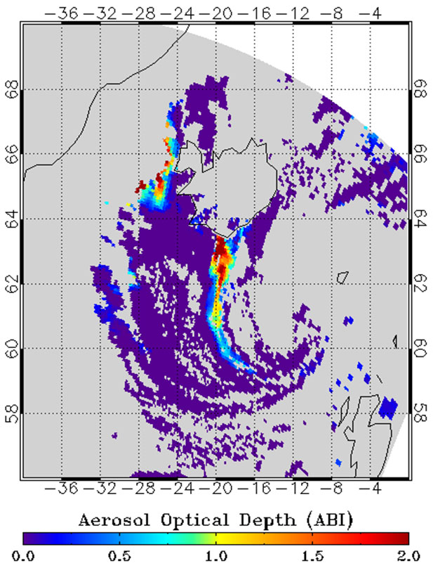
fileDescription: Example of the Cloud Optical Depth product as generated by the GOES-R Cloud Optical and Microphysical Properties algorithm.
fileType: JPEG
descriptiveKeywords: (MD_Keywords)
keyword: Earth Science > Atmosphere > Clouds > Cloud Microphysics > Cloud Optical Depth/Thickness
type: (MD_KeywordTypeCode) theme
thesaurusName: (CI_Citation)
title: Global Change Master Directory (GCMD) Science Keywords
date: (CI_Date)
date: 2018
dateType: (CI_DateTypeCode) revision
edition: Version 8.6
citedResponsibleParty: (CI_ResponsibleParty)
organisationName: Global Change Data Center, Science and Exploration Directorate, Goddard Space Flight Center (GSFC) National Aeronautics and Space Administration (NASA)
contactInfo: (CI_Contact)
onlineResource: (CI_OnlineResource)
linkage: https://earthdata.nasa.gov/about/gcmd/global-change-master-directory-gcmd-keywords
protocol: HTTPS
applicationProfile: Web Browser
name: Global Change Master Directory (GCMD) Keywords
description: The information provided on this page seeks to define how the GCMD Keywords are structured, used and accessed. It also provides information on how users can participate in the further development of the keywords.
function: (CI_OnLineFunctionCode) information
role: (CI_RoleCode) publisher
descriptiveKeywords: (MD_Keywords)
keyword: Atmospheric - Upper-air - Cloud Properties
type: (MD_KeywordTypeCode) theme
thesaurusName: (CI_Citation)
title: Global Climate Observing System (GCOS) Essential Climate Variables (ECVs)
date: (CI_Date)
date: 2017
dateType: (CI_DateTypeCode) publication
edition: Release 2017
citedResponsibleParty: (CI_ResponsibleParty)
organisationName: World Meteorological Organization, United Nations
contactInfo: (CI_Contact)
onlineResource: (CI_OnlineResource)
linkage: https://public.wmo.int/en/programmes/global-climate-observing-system/essential-climate-variables
protocol: HTTP
applicationProfile: Information
name: GCOS Essential Climate Variables
description: Overview of the GCOS Essential Climate Variables.
function: (CI_OnLineFunctionCode) information
role: (CI_RoleCode) custodian
descriptiveKeywords: (MD_Keywords)
keyword: Geographic Region > Equatorial
keyword: Geographic Region > Mid-Latitude
keyword: Geographic Region > Northern Hemisphere
keyword: Geographic Region > Southern Hemisphere
keyword: Geographic Region > Western Hemisphere
keyword: Geographic Region > Tropics
keyword: Continent > North America > United States Of America
keyword: Continent > North America > Central America
keyword: Continent > South America
keyword: Ocean > Atlantic Ocean
keyword: Ocean > Pacific Ocean
type: (MD_KeywordTypeCode) place
thesaurusName: (CI_Citation)
title: Global Change Master Directory (GCMD) Location Keywords
date: (CI_Date)
date: 2018
dateType: (CI_DateTypeCode) revision
edition: Version 8.6
citedResponsibleParty: (CI_ResponsibleParty)
organisationName: Global Change Data Center, Science and Exploration Directorate, Goddard Space Flight Center (GSFC) National Aeronautics and Space Administration (NASA)
contactInfo: (CI_Contact)
onlineResource: (CI_OnlineResource)
linkage: https://earthdata.nasa.gov/about/gcmd/global-change-master-directory-gcmd-keywords
protocol: HTTPS
applicationProfile: Web Browser
name: Global Change Master Directory (GCMD) Keywords
description: The information provided on this page seeks to define how the GCMD Keywords are structured, used and accessed. It also provides information on how users can participate in the further development of the keywords.
function: (CI_OnLineFunctionCode) information
role: (CI_RoleCode) publisher
descriptiveKeywords: (MD_Keywords)
keyword: Vertical Location > Troposphere
type: (MD_KeywordTypeCode) stratum
thesaurusName: (CI_Citation)
title: Global Change Master Directory (GCMD) Location Keywords
date: (CI_Date)
date: 2018
dateType: (CI_DateTypeCode) revision
edition: Version 8.6
citedResponsibleParty: (CI_ResponsibleParty)
organisationName: Global Change Data Center, Science and Exploration Directorate, Goddard Space Flight Center (GSFC) National Aeronautics and Space Administration (NASA)
contactInfo: (CI_Contact)
onlineResource: (CI_OnlineResource)
linkage: https://earthdata.nasa.gov/about/gcmd/global-change-master-directory-gcmd-keywords
protocol: HTTPS
applicationProfile: Web Browser
name: Global Change Master Directory (GCMD) Keywords
description: The information provided on this page seeks to define how the GCMD Keywords are structured, used and accessed. It also provides information on how users can participate in the further development of the keywords.
function: (CI_OnLineFunctionCode) information
role: (CI_RoleCode) publisher
descriptiveKeywords: (MD_Keywords)
keyword: GOES > Geostationary Operational Environmental Satellites
keyword: ABI-L2-COD
keyword: ABI-L2-COD2KM
keyword: gov.noaa.class:GRABIPRD
keyword: GRABIPRD
type: (MD_KeywordTypeCode) project
thesaurusName: (CI_Citation)
title: Global Change Master Directory (GCMD) Project Keywords
date: (CI_Date)
date: 2018
dateType: (CI_DateTypeCode) revision
edition: Version 8.6
citedResponsibleParty: (CI_ResponsibleParty)
organisationName: Global Change Data Center, Science and Exploration Directorate, Goddard Space Flight Center (GSFC) National Aeronautics and Space Administration (NASA)
contactInfo: (CI_Contact)
onlineResource: (CI_OnlineResource)
linkage: https://earthdata.nasa.gov/about/gcmd/global-change-master-directory-gcmd-keywords
protocol: HTTPS
applicationProfile: Web Browser
name: Global Change Master Directory (GCMD) Keywords
description: The information provided on this page seeks to define how the GCMD Keywords are structured, used and accessed. It also provides information on how users can participate in the further development of the keywords.
function: (CI_OnLineFunctionCode) information
role: (CI_RoleCode) publisher
descriptiveKeywords: (MD_Keywords)
keyword: ABI > Advanced Baseline Imager
type: (MD_KeywordTypeCode) instrument
thesaurusName: (CI_Citation)
title: Global Change Master Directory (GCMD) Instrument Keywords
date: (CI_Date)
date: 2018
dateType: (CI_DateTypeCode) revision
edition: Version 8.6
citedResponsibleParty: (CI_ResponsibleParty)
organisationName: Global Change Data Center, Science and Exploration Directorate, Goddard Space Flight Center (GSFC) National Aeronautics and Space Administration (NASA)
contactInfo: (CI_Contact)
onlineResource: (CI_OnlineResource)
linkage: https://earthdata.nasa.gov/about/gcmd/global-change-master-directory-gcmd-keywords
protocol: HTTPS
applicationProfile: Web Browser
name: Global Change Master Directory (GCMD) Keywords
description: The information provided on this page seeks to define how the GCMD Keywords are structured, used and accessed. It also provides information on how users can participate in the further development of the keywords.
function: (CI_OnLineFunctionCode) information
role: (CI_RoleCode) publisher
descriptiveKeywords: (MD_Keywords)
keyword: GOES-16 > Geostationary Operational Environmental Satellite 16
keyword: GOES-17 > Geostationary Operational Environmental Satellite 17
keyword: GOES-18 > Geostationary Operational Environmental Satellite 18
type: (MD_KeywordTypeCode) platform
thesaurusName: (CI_Citation)
title: Global Change Master Directory (GCMD) Platform Keywords
date: (CI_Date)
date: 2018
dateType: (CI_DateTypeCode) revision
edition: Version 8.6
citedResponsibleParty: (CI_ResponsibleParty)
organisationName: Global Change Data Center, Science and Exploration Directorate, Goddard Space Flight Center (GSFC) National Aeronautics and Space Administration (NASA)
contactInfo: (CI_Contact)
onlineResource: (CI_OnlineResource)
linkage: https://earthdata.nasa.gov/about/gcmd/global-change-master-directory-gcmd-keywords
protocol: HTTPS
applicationProfile: Web Browser
name: Global Change Master Directory (GCMD) Keywords
description: The information provided on this page seeks to define how the GCMD Keywords are structured, used and accessed. It also provides information on how users can participate in the further development of the keywords.
function: (CI_OnLineFunctionCode) information
role: (CI_RoleCode) publisher
descriptiveKeywords: (MD_Keywords)
keyword: 1 km - < 10 km or approximately .01 degree - < .09 degree
type: (MD_KeywordTypeCode) dataResolution
thesaurusName: (CI_Citation)
title: Global Change Master Directory (GCMD) Horizontal Data Resolution Keywords
date: (CI_Date)
date: 2018
dateType: (CI_DateTypeCode) revision
edition: Version 8.6
citedResponsibleParty: (CI_ResponsibleParty)
organisationName: Global Change Data Center, Science and Exploration Directorate, Goddard Space Flight Center (GSFC) National Aeronautics and Space Administration (NASA)
contactInfo: (CI_Contact)
onlineResource: (CI_OnlineResource)
linkage: https://earthdata.nasa.gov/about/gcmd/global-change-master-directory-gcmd-keywords
protocol: HTTPS
applicationProfile: Web Browser
name: Global Change Master Directory (GCMD) Keywords
description: The information provided on this page seeks to define how the GCMD Keywords are structured, used and accessed. It also provides information on how users can participate in the further development of the keywords.
function: (CI_OnLineFunctionCode) information
role: (CI_RoleCode) publisher
descriptiveKeywords: (MD_Keywords)
keyword: 1 minute - < 1 hour
type: (MD_KeywordTypeCode) dataResolution
thesaurusName: (CI_Citation)
title: Global Change Master Directory (GCMD) Temporal Data Resolution Keywords
date: (CI_Date)
date: 2018
dateType: (CI_DateTypeCode) revision
edition: Version 8.6
citedResponsibleParty: (CI_ResponsibleParty)
organisationName: Global Change Data Center, Science and Exploration Directorate, Goddard Space Flight Center (GSFC) National Aeronautics and Space Administration (NASA)
contactInfo: (CI_Contact)
onlineResource: (CI_OnlineResource)
linkage: https://earthdata.nasa.gov/about/gcmd/global-change-master-directory-gcmd-keywords
protocol: HTTPS
applicationProfile: Web Browser
name: Global Change Master Directory (GCMD) Keywords
description: The information provided on this page seeks to define how the GCMD Keywords are structured, used and accessed. It also provides information on how users can participate in the further development of the keywords.
function: (CI_OnLineFunctionCode) information
role: (CI_RoleCode) publisher
descriptiveKeywords: (MD_Keywords)
keyword: DOC/NOAA/NESDIS/NCDC > National Climatic Data Center, NESDIS, NOAA, U.S. Department of Commerce
keyword: DOC/NOAA/NESDIS/NCEI > National Centers for Environmental Information, NESDIS, NOAA, U.S. Department of Commerce
keyword: DOC/NOAA/NESDIS/STAR > Center for Satellite Applications and Research, NESDIS, NOAA, U.S. Department of Commerce
keyword: DOC/NOAA/NESDIS/OSPO > Office of Satellite and Product Operations, NESDIS, NOAA, U.S. Department of Commerce
type: (MD_KeywordTypeCode) dataCentre
thesaurusName: (CI_Citation)
title: Global Change Master Directory (GCMD) Data Center Keywords
date: (CI_Date)
date: 2018
dateType: (CI_DateTypeCode) revision
edition: Version 8.6
citedResponsibleParty: (CI_ResponsibleParty)
organisationName: Global Change Data Center, Science and Exploration Directorate, Goddard Space Flight Center (GSFC) National Aeronautics and Space Administration (NASA)
contactInfo: (CI_Contact)
onlineResource: (CI_OnlineResource)
linkage: https://earthdata.nasa.gov/about/gcmd/global-change-master-directory-gcmd-keywords
protocol: HTTPS
applicationProfile: Web Browser
name: Global Change Master Directory (GCMD) Keywords
description: The information provided on this page seeks to define how the GCMD Keywords are structured, used and accessed. It also provides information on how users can participate in the further development of the keywords.
function: (CI_OnLineFunctionCode) information
role: (CI_RoleCode) publisher
descriptiveKeywords: (MD_Keywords)
keyword: gov.noaa.class:GRABIPRD
type: (MD_KeywordTypeCode) project
resourceConstraints: (MD_Constraints)
useLimitation: For a complete description of use limitations for this baseline product, see the Algorithm Theoretical Basis Document (ATBD).
resourceConstraints: (MD_LegalConstraints)
useConstraints: (MD_RestrictionCode) otherRestrictions
otherConstraints: Cite as: GOES-R Algorithm Working Group and GOES-R Program Office, (2018): NOAA GOES-R Series Advanced Baseline Imager (ABI) Level 2 Cloud Optical Depth (COD). [indicate subset used]. NOAA National Centers for Environmental Information. doi:10.7289/V58G8J02. [access date].
resourceConstraints: (MD_LegalConstraints)
accessConstraints: (MD_RestrictionCode) otherRestrictions
otherConstraints: Distribution liability: NOAA and NCEI make no warranty, expressed or implied, regarding these data, nor does the fact of distribution constitute such a warranty. NOAA and NCEI cannot assume liability for any damages caused by any errors or omissions in these data. If appropriate, NCEI can only certify that the data it distributes are an authentic copy of the records that were accepted for inclusion in the NCEI archives.
resourceConstraints: (MD_LegalConstraints)
useConstraints: (MD_RestrictionCode) otherRestrictions
otherConstraints: Use liability: NOAA and NCEI cannot provide any warranty as to the accuracy, reliability, or completeness of furnished data. Users assume responsibility to determine the usability of these data. The user is responsible for the results of any application of this data for other than its intended purpose.
aggregationInfo: (MD_AggregateInformation)
aggregateDataSetName: (CI_Citation)
title: GOES-R Program Document Library
date: (missing)
citedResponsibleParty: (CI_ResponsibleParty)
organisationName: (missing)
contactInfo: (CI_Contact)
onlineResource: (CI_OnlineResource)
linkage: https://www.goes-r.gov/resources/docs.html
applicationProfile: Web Browser
name: GOES-R Program Document Library
description: Webpage with product algorithm, users guides, and education and outreach materials.
function: (CI_OnLineFunctionCode) information
role: (missing)
associationType: (DS_AssociationTypeCode) crossReference
initiativeType: (DS_InitiativeTypeCode) userGuide
aggregationInfo: (MD_AggregateInformation)
aggregateDataSetName: (CI_Citation)
title: GOES Operational Status - NOAA Office of Satellite and Product Operations
date: (missing)
citedResponsibleParty: (CI_ResponsibleParty)
organisationName: (missing)
contactInfo: (CI_Contact)
onlineResource: (CI_OnlineResource)
linkage: https://www.ospo.noaa.gov/Operations/GOES/status.html
applicationProfile: Web Browser
name: GOES Operational Status - NOAA Office of Satellite and Product Operations
description: GOES spacecraft status page.
function: (CI_OnLineFunctionCode) information
role: (missing)
associationType: (DS_AssociationTypeCode) crossReference
initiativeType: (DS_InitiativeTypeCode) userGuide
spatialRepresentationType: (MD_SpatialRepresentationTypeCode) grid
spatialResolution: (MD_Resolution)
distance:
Distance: 4000
language: eng; USA
topicCategory: (MD_TopicCategoryCode) climatologyMeteorologyAtmosphere
extent: (EX_Extent)
geographicElement: (EX_GeographicBoundingBox)
extentTypeCode: 1
westBoundLongitude: -156.2
eastBoundLongitude: 6.2995
southBoundLatitude: -81.32
northBoundLatitude: 81.328
temporalElement: (EX_TemporalExtent)
extent:
TimePeriod:
description: ground condition
beginPosition: 2017-06-08
endPosition:
timeInterval: 10
return to top
contentInfo: (MI_CoverageDescription)
attributeDescription:
RecordType: OR_ABI-L2-CODC_Mode_G16_sYYYYDDDHHMMSS_eYYYYDDDHHMMSS_cYYYYDDDHHMMSS.nc
contentType: (MD_CoverageContentTypeCode) physicalMeasurement
dimension: (MD_Band)
sequenceIdentifier:
MemberName:
aName: COD
attributeType:
TypeName:
aName: short
descriptor: ABI L2+ Cloud Optical Depth at 640 nm (atmosphere_optical_thickness_due_to_cloud)
units: http://example.org/someUnitsDictionary.xml#1
dimension: (MD_Band)
sequenceIdentifier:
MemberName:
aName: DQF
attributeType:
TypeName:
aName: byte
descriptor: ABI L2+ Cloud Optical Depth at 640 nm data quality flags (status_flag)
units: http://example.org/someUnitsDictionary.xml#1
dimension: (MD_Band)
sequenceIdentifier:
MemberName:
aName: t
attributeType:
TypeName:
aName: double
descriptor: J2000 epoch mid-point between the start and end image scan in seconds (time)
units: http://example.org/someUnitsDictionary.xml#seconds%20since%202000-01-01%2012%3A00%3A00
dimension: (MD_Band)
sequenceIdentifier:
MemberName:
aName: y
attributeType:
TypeName:
aName: short
descriptor: GOES fixed grid projection y-coordinate (projection_y_coordinate)
units: http://example.org/someUnitsDictionary.xml#rad
dimension: (MD_Band)
sequenceIdentifier:
MemberName:
aName: x
attributeType:
TypeName:
aName: short
descriptor: GOES fixed grid projection x-coordinate (projection_x_coordinate)
units: http://example.org/someUnitsDictionary.xml#rad
dimension: (MD_Band)
sequenceIdentifier:
MemberName:
aName: time_bounds
attributeType:
TypeName:
aName: double
descriptor: Scan start and end times in seconds since epoch (2000-01-01 12:00:00)
dimension: (MD_Band)
sequenceIdentifier:
MemberName:
aName: goes_imager_projection
attributeType:
TypeName:
aName: int
descriptor: GOES-R ABI fixed grid projection
dimension: (MD_Band)
sequenceIdentifier:
MemberName:
aName: y_image
attributeType:
TypeName:
aName: float
descriptor: GOES-R fixed grid projection y-coordinate center of image (projection_y_coordinate)
units: http://example.org/someUnitsDictionary.xml#rad
dimension: (MD_Band)
sequenceIdentifier:
MemberName:
aName: y_image_bounds
attributeType:
TypeName:
aName: float
descriptor: GOES-R fixed grid projection y-coordinate north/south extent of image
dimension: (MD_Band)
sequenceIdentifier:
MemberName:
aName: x_image
attributeType:
TypeName:
aName: float
descriptor: GOES-R fixed grid projection x-coordinate center of image (projection_x_coordinate)
units: http://example.org/someUnitsDictionary.xml#rad
dimension: (MD_Band)
sequenceIdentifier:
MemberName:
aName: x_image_bounds
attributeType:
TypeName:
aName: float
descriptor: GOES-R fixed grid projection x-coordinate west/east extent of image
dimension: (MD_Band)
sequenceIdentifier:
MemberName:
aName: nominal_satellite_subpoint_lat
attributeType:
TypeName:
aName: float
descriptor: nominal satellite subpoint latitude (platform latitude) (latitude)
units: http://example.org/someUnitsDictionary.xml#degrees_north
dimension: (MD_Band)
sequenceIdentifier:
MemberName:
aName: nominal_satellite_subpoint_lon
attributeType:
TypeName:
aName: float
descriptor: nominal satellite subpoint longitude (platform longitude) (longitude)
units: http://example.org/someUnitsDictionary.xml#degrees_east
dimension: (MD_Band)
sequenceIdentifier:
MemberName:
aName: nominal_satellite_height
attributeType:
TypeName:
aName: float
descriptor: nominal satellite height above GRS 80 ellipsoid (platform altitude) (height_above_reference_ellipsoid)
units: http://example.org/someUnitsDictionary.xml#km
dimension: (MD_Band)
sequenceIdentifier:
MemberName:
aName: geospatial_lat_lon_extent
attributeType:
TypeName:
aName: float
descriptor: geospatial latitude and longitude references
dimension: (MD_Band)
sequenceIdentifier:
MemberName:
aName: minimum_COD_day
attributeType:
TypeName:
aName: float
descriptor: minimum cloud optical depth at 640 nm pixels in day portion of image (atmosphere_optical_thickness_due_to_cloud)
units: http://example.org/someUnitsDictionary.xml#1
dimension: (MD_Band)
sequenceIdentifier:
MemberName:
aName: maximum_COD_day
attributeType:
TypeName:
aName: float
descriptor: maximum cloud optical depth at 640 nm pixels in day portion of image (atmosphere_optical_thickness_due_to_cloud)
units: http://example.org/someUnitsDictionary.xml#1
dimension: (MD_Band)
sequenceIdentifier:
MemberName:
aName: mean_COD_day
attributeType:
TypeName:
aName: float
descriptor: mean cloud optical depth at 640 nm pixels in day portion of image (atmosphere_optical_thickness_due_to_cloud)
units: http://example.org/someUnitsDictionary.xml#1
dimension: (MD_Band)
sequenceIdentifier:
MemberName:
aName: std_dev_COD_day
attributeType:
TypeName:
aName: float
descriptor: standard deviation of cloud optical depth at 640 nm values of pixels in day portion of image (atmosphere_optical_thickness_due_to_cloud)
units: http://example.org/someUnitsDictionary.xml#1
dimension: (MD_Band)
sequenceIdentifier:
MemberName:
aName: minimum_COD_night
attributeType:
TypeName:
aName: float
descriptor: minimum cloud optical depth at 640 nm pixels in night portion of image (atmosphere_optical_thickness_due_to_cloud)
units: http://example.org/someUnitsDictionary.xml#1
dimension: (MD_Band)
sequenceIdentifier:
MemberName:
aName: maximum_COD_night
attributeType:
TypeName:
aName: float
descriptor: maximum cloud optical depth at 640 nm pixels in night portion of image (atmosphere_optical_thickness_due_to_cloud)
units: http://example.org/someUnitsDictionary.xml#1
dimension: (MD_Band)
sequenceIdentifier:
MemberName:
aName: mean_COD_night
attributeType:
TypeName:
aName: float
descriptor: mean cloud optical depth at 640 nm pixels in night portion of image (atmosphere_optical_thickness_due_to_cloud)
units: http://example.org/someUnitsDictionary.xml#1
dimension: (MD_Band)
sequenceIdentifier:
MemberName:
aName: std_dev_COD_night
attributeType:
TypeName:
aName: float
descriptor: standard deviation of cloud optical depth at 640 nm values of pixels in night portion of image (atmosphere_optical_thickness_due_to_cloud)
units: http://example.org/someUnitsDictionary.xml#1
dimension: (MD_Band)
sequenceIdentifier:
MemberName:
aName: cod_product_wavelength
attributeType:
TypeName:
aName: float
descriptor: cloud optical depth product data wavelength (radiation_wavelength)
units: http://example.org/someUnitsDictionary.xml#um
dimension: (MD_Band)
sequenceIdentifier:
MemberName:
aName: outlier_COD_day
attributeType:
TypeName:
aName: int
descriptor: number of cloud optical depth at 640 nm pixels whose value is outside valid measurement range in day portion of image
units: http://example.org/someUnitsDictionary.xml#count
dimension: (MD_Band)
sequenceIdentifier:
MemberName:
aName: outlier_COD_night
attributeType:
TypeName:
aName: int
descriptor: number of cloud optical depth at 640 nm pixels whose value is outside valid measurement range in night portion of image
units: http://example.org/someUnitsDictionary.xml#count
dimension: (MD_Band)
sequenceIdentifier:
MemberName:
aName: algorithm_dynamic_input_data_container
attributeType:
TypeName:
aName: int
descriptor: container for filenames of dynamic algorithm input data
dimension: (MD_Band)
sequenceIdentifier:
MemberName:
aName: processing_parm_version_container
attributeType:
TypeName:
aName: int
descriptor: container for processing parameter filenames
dimension: (MD_Band)
sequenceIdentifier:
MemberName:
aName: algorithm_product_version_container
attributeType:
TypeName:
aName: int
descriptor: container for algorithm package filename and product version
dimension: (MD_Band)
sequenceIdentifier:
MemberName:
aName: day_retrieval_local_zenith_angle
attributeType:
TypeName:
aName: float
descriptor: threshold angle between the line of sight to the satellite and the local zenith at the observation target for good or degraded quality cloud optical depth and cloud particle size data production by the day algorithm (platform_zenith_angle)
units: http://example.org/someUnitsDictionary.xml#degree
dimension: (MD_Band)
sequenceIdentifier:
MemberName:
aName: night_retrieval_local_zenith_angle
attributeType:
TypeName:
aName: float
descriptor: threshold angle between the line of sight to the satellite and the local zenith at the observation target for good or degraded quality cloud optical depth and cloud particle size data production by the night algorithm (platform_zenith_angle)
units: http://example.org/someUnitsDictionary.xml#degree
dimension: (MD_Band)
sequenceIdentifier:
MemberName:
aName: quantitative_local_zenith_angle
attributeType:
TypeName:
aName: float
descriptor: threshold angle between the line of sight to the satellite and the local zenith at the observation target for good quality cloud optical depth and cloud particle size data production (platform_zenith_angle)
units: http://example.org/someUnitsDictionary.xml#degree
dimension: (MD_Band)
sequenceIdentifier:
MemberName:
aName: day_retrieval_local_zenith_angle_bounds
attributeType:
TypeName:
aName: float
descriptor: local zenith angle degree range where good or degraded quality cloud optical depth and cloud particle size data is produced by the day algorithm
dimension: (MD_Band)
sequenceIdentifier:
MemberName:
aName: night_retrieval_local_zenith_angle_bounds
attributeType:
TypeName:
aName: float
descriptor: local zenith angle degree range where good or degraded quality cloud optical depth and cloud particle size data is produced by the night algorithm
dimension: (MD_Band)
sequenceIdentifier:
MemberName:
aName: quantitative_local_zenith_angle_bounds
attributeType:
TypeName:
aName: float
descriptor: local zenith angle degree range where good quality cloud optical depth and cloud particle size data is produced
dimension: (MD_Band)
sequenceIdentifier:
MemberName:
aName: day_solar_zenith_angle
attributeType:
TypeName:
aName: float
descriptor: threshold angle of the day region for the angle between the line of sight to the sun and the local zenith at the observation target for good quality cloud optical depth and cloud particle size data production (solar_zenith_angle)
units: http://example.org/someUnitsDictionary.xml#degree
dimension: (MD_Band)
sequenceIdentifier:
MemberName:
aName: night_solar_zenith_angle
attributeType:
TypeName:
aName: float
descriptor: threshold angle of the night region for the angle between the line of sight to the sun and the local zenith at the observation target for good quality cloud optical depth and cloud particle size data production (solar_zenith_angle)
units: http://example.org/someUnitsDictionary.xml#degree
dimension: (MD_Band)
sequenceIdentifier:
MemberName:
aName: twilight_solar_zenith_angle
attributeType:
TypeName:
aName: float
descriptor: midpoint of the twilight region for the angle between the line of sight to the sun and the local zenith at the observation target for degraded quality cloud optical depth and cloud particle size data production (solar_zenith_angle)
units: http://example.org/someUnitsDictionary.xml#degree
dimension: (MD_Band)
sequenceIdentifier:
MemberName:
aName: day_algorithm_solar_zenith_angle
attributeType:
TypeName:
aName: float
descriptor: threshold angle of the day algorithm region for the angle between the line of sight to the sun and the local zenith at the observation target (solar_zenith_angle)
units: http://example.org/someUnitsDictionary.xml#degree
dimension: (MD_Band)
sequenceIdentifier:
MemberName:
aName: night_algorithm_solar_zenith_angle
attributeType:
TypeName:
aName: float
descriptor: threshold angle of the night algorithm region for the angle between the line of sight to the sun and the local zenith at the observation target (solar_zenith_angle)
units: http://example.org/someUnitsDictionary.xml#degree
dimension: (MD_Band)
sequenceIdentifier:
MemberName:
aName: day_solar_zenith_angle_bounds
attributeType:
TypeName:
aName: float
descriptor: day region solar zenith angle degree range where good quality cloud optical depth and cloud particle size data is produced
dimension: (MD_Band)
sequenceIdentifier:
MemberName:
aName: night_solar_zenith_angle_bounds
attributeType:
TypeName:
aName: float
descriptor: night region solar zenith angle degree range where good quality cloud optical depth and cloud particle size data is produced
dimension: (MD_Band)
sequenceIdentifier:
MemberName:
aName: twilight_solar_zenith_angle_bounds
attributeType:
TypeName:
aName: float
descriptor: twilight region solar zenith angle degree range where degraded quality cloud optical depth and cloud particle size data is produced
dimension: (MD_Band)
sequenceIdentifier:
MemberName:
aName: day_algorithm_solar_zenith_angle_bounds
attributeType:
TypeName:
aName: float
descriptor: solar zenith angle degree range for the day algorithm region
dimension: (MD_Band)
sequenceIdentifier:
MemberName:
aName: night_algorithm_solar_zenith_angle_bounds
attributeType:
TypeName:
aName: float
descriptor: solar zenith angle degree range for the night algorithm region
dimension: (MD_Band)
sequenceIdentifier:
MemberName:
aName: percent_uncorrectable_GRB_errors
attributeType:
TypeName:
aName: float
descriptor: percent data lost due to uncorrectable GRB errors
units: http://example.org/someUnitsDictionary.xml#percent
dimension: (MD_Band)
sequenceIdentifier:
MemberName:
aName: percent_uncorrectable_L0_errors
attributeType:
TypeName:
aName: float
descriptor: percent data lost due to uncorrectable L0 errors
units: http://example.org/someUnitsDictionary.xml#percent
dimension: (MD_Band)
sequenceIdentifier:
MemberName:
aName: daytime_cloud_pixels
attributeType:
TypeName:
aName: int
descriptor: number of pixels identified as cloudy in the day portion of the image
units: http://example.org/someUnitsDictionary.xml#count
dimension: (MD_Band)
sequenceIdentifier:
MemberName:
aName: nighttime_cloud_pixels
attributeType:
TypeName:
aName: int
descriptor: number of pixels identified as cloudy in the night portion of the image
units: http://example.org/someUnitsDictionary.xml#count
dimension: (MD_Band)
sequenceIdentifier:
MemberName:
aName: percent_daytime_pixels
attributeType:
TypeName:
aName: float
descriptor: percent of pixels that are associated with the day solar zenith angle range (area_fraction_of_day_defined_by_solar_zenith_angle)
units: http://example.org/someUnitsDictionary.xml#percent
dimension: (MD_Band)
sequenceIdentifier:
MemberName:
aName: percent_nighttime_pixels
attributeType:
TypeName:
aName: float
descriptor: percent of pixels that are associated with the night solar zenith angle range (area_fraction_of_night_defined_by_solar_zenith_angle)
units: http://example.org/someUnitsDictionary.xml#percent
dimension: (MD_Band)
sequenceIdentifier:
MemberName:
aName: percent_terminator_pixels
attributeType:
TypeName:
aName: float
descriptor: percent of pixels that are associated with the twilight solar zenith angle range (area_fraction_of_twilight_defined_by_solar_zenith_angle)
units: http://example.org/someUnitsDictionary.xml#percent
return to top
distributionInfo: (MD_Distribution)
distributor: (MD_Distributor)
distributorContact: (CI_ResponsibleParty)
organisationName: NOAA National Centers for Environmental Information
contactInfo: (CI_Contact)
address: (CI_Address)
electronicMailAddress: ncei.info@noaa.gov
onlineResource: (CI_OnlineResource)
linkage: https://www.ncei.noaa.gov/contact
name: NCEI Contact Information
description: Information for contacts at NCEI.
function: (CI_OnLineFunctionCode) information
role: (CI_RoleCode) distributor
distributionOrderProcess: (MD_StandardOrderProcess)
fees: In most cases, electronic downloads of the data are free. However, fees may apply for custom orders, data certifications, copies of analog materials, and data distribution on physical media.
orderingInstructions: Contact NCEI for other distribution options and instructions.
distributorFormat: (MD_Format)
name: NetCDF
version: 4
distributorTransferOptions: (MD_DigitalTransferOptions)
onLine: (CI_OnlineResource)
linkage: https://doi.org/10.7289/V58G8J02
protocol: HTTPS
applicationProfile: Landing Page
name: NCEI Dataset Landing Page
description: Landing page for the dataset.
function: (CI_OnLineFunctionCode) information
distributorTransferOptions: (MD_DigitalTransferOptions)
onLine: (CI_OnlineResource)
linkage: https://www.ncdc.noaa.gov/airs-web/search
protocol: HTTPS
applicationProfile: Data Search Application
name: NCEI Archive Information Request System
description: Search the data archive and submit an order for the dataset via the interface.
function: (CI_OnLineFunctionCode) order
distributorTransferOptions: (MD_DigitalTransferOptions)
onLine: (CI_OnlineResource)
linkage: http://www.class.noaa.gov/saa/products/search?datatype_family=GRABIPRD
protocol: HTTPS
applicationProfile: Data Search Application
name: NOAA CLASS Data Search and Order
description: Search the data archive and submit an order for the dataset via the interface.
function: (CI_OnLineFunctionCode) order
distributorTransferOptions: (MD_DigitalTransferOptions)
onLine: (CI_OnlineResource)
linkage: https://www.ncei.noaa.gov/products/goes-terrestrial-weather-abi-glm>
protocol: HTTPS
applicationProfile: Information
name: NCEI GOES-R Terrestrial Weather (ABI/GLM)
description: Description of the products and related resources.
function: (CI_OnLineFunctionCode) information
distributorTransferOptions: (MD_DigitalTransferOptions)
onLine: (CI_OnlineResource)
linkage: http://www.goes-r.gov/users/docs/PUG-main-vol1.pdf
applicationProfile: Documentation
name: Product Definition and Users' Guide (PUG) Vol.1 Main
description: The Product Definition and User's Guide (PUG) document provides product descriptions and formats for all data and products produced and made available to users by the Geostationary Operational Environmental Satellite R Series (GOES-R) Core Ground Segment (GS).
function: (CI_OnLineFunctionCode) information
distributorTransferOptions: (MD_DigitalTransferOptions)
onLine: (CI_OnlineResource)
linkage: http://www.goes-r.gov/products/docs/PUG-L2+-vol5.pdf
applicationProfile: Documentation
name: Product Definition and Users' Guide (PUG) Vol.5 Level 2+ Products
description: The Product Definition and User's Guide (PUG) document provides product descriptions and formats for all data and products produced and made available to users by the Geostationary Operational Environmental Satellite R Series (GOES-R) Core Ground Segment (GS).
function: (CI_OnLineFunctionCode) information
distributorTransferOptions: (MD_DigitalTransferOptions)
onLine: (CI_OnlineResource)
linkage: https://registry.opendata.aws/noaa-goes/
protocol: HTTPS
applicationProfile: Information
name: Registry of Open Data on AWS
description: Information on AWS data access.
function: (CI_OnLineFunctionCode) information
distributorTransferOptions: (MD_DigitalTransferOptions)
unitsOfDistribution: Region: us-east-1
onLine: (CI_OnlineResource)
linkage: https://noaa-goes16.s3.amazonaws.com/index.html
protocol: HTTPS
applicationProfile: Download
name: GOES-16 AWS S3 Explorer (Region: us-east-1)
description: Browse view to explore the S3 bucket for GOES-16 datasets. Data relevant to this can be found in folders with the prefix ABI-L2-COD.
function: (CI_OnLineFunctionCode) download
distributorTransferOptions: (MD_DigitalTransferOptions)
unitsOfDistribution: Region: us-east-1
onLine: (CI_OnlineResource)
linkage: https://noaa-goes17.s3.amazonaws.com/index.html
protocol: HTTPS
applicationProfile: Download
name: GOES-17 AWS S3 Explorer (Region: us-east-1)
description: Browse view to explore the S3 bucket for GOES-17 datasets. Data relevant to this can be found in folders with the prefix ABI-L2-COD.
function: (CI_OnLineFunctionCode) download
distributorTransferOptions: (MD_DigitalTransferOptions)
unitsOfDistribution: Region: us-east-1
onLine: (CI_OnlineResource)
linkage: https://noaa-goes18.s3.amazonaws.com/index.html
protocol: HTTPS
applicationProfile: Download
name: GOES-18 AWS S3 Explorer (Region: us-east-1)
description: Browse view to explore the S3 bucket for GOES-18 datasets. Data relevant to this can be found in folders with the prefix ABI-L2-COD.
function: (CI_OnLineFunctionCode) download
distributorTransferOptions: (MD_DigitalTransferOptions)
unitsOfDistribution: Region: US-multiple
onLine: (CI_OnlineResource)
linkage: https://console.cloud.google.com/storage/browser/gcp-public-data-goes-16
protocol: HTTPS
applicationProfile: Download
name: GOES-16 Google Cloud Bucket Explorer (Region: US-multiple)
description: Browse view to explore the Google Cloud bucket for GOES-16. Data relevant to this can be found in folders with the prefix ABI-L2-COD.
function: (CI_OnLineFunctionCode) download
distributorTransferOptions: (MD_DigitalTransferOptions)
unitsOfDistribution: Region: US-multiple
onLine: (CI_OnlineResource)
linkage: https://console.cloud.google.com/storage/browser/gcp-public-data-goes-17
protocol: HTTPS
applicationProfile: Download
name: GOES-17 Google Cloud Bucket Explorer (Region: US-multiple)
description: Browse view to explore the Google Cloud bucket for GOES-17. Data relevant to this can be found in folders with the prefix ABI-L2-COD.
function: (CI_OnLineFunctionCode) download
distributorTransferOptions: (MD_DigitalTransferOptions)
unitsOfDistribution: Region: US-multiple
onLine: (CI_OnlineResource)
linkage: https://console.cloud.google.com/storage/browser/gcp-public-data-goes-18
protocol: HTTPS
applicationProfile: Download
name: GOES-18 Google Cloud Bucket Explorer (Region: US-multiple)
description: Browse view to explore the Google Cloud bucket for GOES-18. Data relevant to this can be found in folders with the prefix ABI-L2-COD.
function: (CI_OnLineFunctionCode) download
distributorTransferOptions: (MD_DigitalTransferOptions)
unitsOfDistribution: Region: US-multiple
onLine: (CI_OnlineResource)
linkage: https://console.cloud.google.com/marketplace/product/noaa-public/goes
protocol: HTTPS
applicationProfile: Information
name: Google Cloud Landing Page (Region: US-multiple)
description: Information on Google Cloud data access for GOES datasets.
function: (CI_OnLineFunctionCode) information
return to top
dataQualityInfo: (DQ_DataQuality)
scope: (DQ_Scope)
level: (MD_ScopeCode) dataset
extent: #boundingExtent
lineage: (LI_Lineage)
statement: These data were produced by the NOAA Office of Satellite and Product Operations (OSPO) and are archived at the NOAA National Centers for Environmental Information (NCEI).
processStep: (LE_ProcessStep)
description: The Cloud Optical Depth and Cloud Particle Size products are generated by the GOES-R ABI Cloud Microphysical and Optical Properties (COMP) ground processing algorithms for daytime and nighttime. The daytime algorithm employs a physical retrieval based on theoretically computed lookup tables while the nighttime retrieval employs the Community Radiative Transfer Model (CRTM) calculations in an iterative physical retrieval that seeks to minimize the difference between the compute TOA brightness temperature and the observations. The algorithm processes the data pixel-by-pixel, choosing to use the daytime or nighttime approach based on the solar zenith angle
dateTime: (missing)
processor: (CI_ResponsibleParty)
organisationName: DOC/NOAA/NESDIS/OSPO > Office of Satellite and Product Operations, NESDIS, NOAA, U.S. Department of Commerce
role: (CI_RoleCode) processor
source: sd001
processingInformation: (LE_Processing)
identifier: (missing)
documentation: (CI_Citation)
title: GOES-R Algorithm Working Group
date: (missing)
citedResponsibleParty: (CI_ResponsibleParty)
organisationName: DOC/NOAA/NESDIS/STAR > Center for Satellite Applications and Research, NESDIS, NOAA, U.S. Department of Commerce
role: (CI_RoleCode) publisher
citedResponsibleParty: (CI_ResponsibleParty)
organisationName: (missing)
contactInfo: (CI_Contact)
onlineResource: (CI_OnlineResource)
linkage: https://www.star.nesdis.noaa.gov/goesr/
protocol: HTTPS
applicationProfile: Web Browser
name: GOES-R Algorithm Working Group
description: The GOES-R Algorithm Working Group creates the algorithms that process the quality controlled satellite instrument data and produces resulting data products.
function: (CI_OnLineFunctionCode) information
role: (missing)
documentation: (CI_Citation)
title: NOAA Satellite Information System Product Quality
date: (missing)
citedResponsibleParty: (CI_ResponsibleParty)
organisationName: (missing)
contactInfo: (CI_Contact)
onlineResource: (CI_OnlineResource)
linkage: https://www.noaasis.noaa.gov/GOES/PS_PVR2.html
protocol: HTTPS
applicationProfile: Web Browser
name: NOAA Satellite Information System Product Quality
description: Peer/Stakeholder Product Validation Reviews by satellite and product.
function: (CI_OnLineFunctionCode) information
role: (missing)
algorithm: (LE_Algorithm)
citation: (CI_Citation)
title: GOES-R Algorithm Theoretical Basis Documents
date: (missing)
citedResponsibleParty: (CI_ResponsibleParty)
organisationName: DOC/NOAA/NESDIS/STAR > Center for Satellite Applications and Research, NESDIS, NOAA, U.S. Department of Commerce
role: (CI_RoleCode) publisher
citedResponsibleParty: (CI_ResponsibleParty)
organisationName: (missing)
contactInfo: (CI_Contact)
onlineResource: (CI_OnlineResource)
linkage: https://www.star.nesdis.noaa.gov/goesr/documentation_ATBDs.php
applicationProfile: Web Browser
name: GOES-R Algorithm Theoretical Basis Documents
description: Descriptions of how the algorithms work, their underlying designs, and initial comparison with prior algorithms and results.
function: (CI_OnLineFunctionCode) information
role: (missing)
description: See Algorithm Citation
processStep: (LE_ProcessStep)
description: The GOES-16 ABI Cloud Optical Depth algorithm reached beta maturity.
dateTime:
DateTime: 2017-07-18T00:00:00
processor: (CI_ResponsibleParty)
organisationName: (missing)
role: (CI_RoleCode) processor
processStep: (LE_ProcessStep)
description: The GOES-16 ABI Cloud Optical Depth algorithm reached provisional maturity.
dateTime:
DateTime: 2018-02-26T00:00:00
processor: (CI_ResponsibleParty)
organisationName: (missing)
role: (CI_RoleCode) processor
processStep: (LE_ProcessStep)
description: The GOES-16 ABI Cloud Optical Depth algorithm reached full validation maturity.
dateTime: (missing)
processor: (CI_ResponsibleParty)
organisationName: (missing)
role: (CI_RoleCode) processor
processStep: (LE_ProcessStep)
description: The GOES-17 ABI Cloud Optical Depth algorithm reached beta maturity.
dateTime:
DateTime: 2018-08-27T00:00:00
processor: (CI_ResponsibleParty)
organisationName: (missing)
role: (CI_RoleCode) processor
processStep: (LE_ProcessStep)
description: The GOES-17 ABI Cloud Optical Depth algorithm reached provisional maturity.
dateTime:
DateTime: 2019-09-24T00:00:00
processor: (CI_ResponsibleParty)
organisationName: (missing)
role: (CI_RoleCode) processor
processStep: (LE_ProcessStep)
description: The GOES-17 ABI Cloud Optical Depth algorithm reached full validation maturity.
dateTime: (missing)
processor: (CI_ResponsibleParty)
organisationName: (missing)
role: (CI_RoleCode) processor
source: (LE_Source)
description: Level 1b radiances
sourceCitation: (CI_Citation)
title: NOAA GOES-R Series Advanced Baseline Imager (ABI) Level 1b Radiances
date: (CI_Date)
date: 2017-07-10
dateType: (CI_DateTypeCode) publication
edition: Provisional
identifier: (MD_Identifier)
code: doi:10.7289/V5BV7DSR
citedResponsibleParty: (CI_ResponsibleParty)
organisationName: DOC/NOAA/NESDIS/NCEI > National Centers for Environmental Information, NESDIS, NOAA, U.S. Department of Commerce
role: (CI_RoleCode) distributor
citedResponsibleParty: (CI_ResponsibleParty)
organisationName: (missing)
contactInfo: (CI_Contact)
onlineResource: (CI_OnlineResource)
linkage: https://doi.org/10.7289/V5BV7DSR
protocol: HTTPS
applicationProfile: Web Browser
name: NCEI landing page for ABI-L1B-RAD
description: Source dataset landing page with general information and access links for the dataset.
function: (CI_OnLineFunctionCode) information
role: (missing)
sourceExtent: (EX_Extent)
geographicElement: (EX_GeographicBoundingBox)
extentTypeCode: 1
westBoundLongitude: -156.2
eastBoundLongitude: 6.2995
southBoundLatitude: -81.32
northBoundLatitude: 81.328
temporalElement: (EX_TemporalExtent)
extent:
TimePeriod:
beginPosition: 2017-02-28
endPosition:
sourceStep: ps001
return to top
dataQualityInfo: (DQ_DataQuality)
scope: (DQ_Scope)
level: (MD_ScopeCode) repository
levelDescription: (MD_ScopeDescription)
other: NOAA National Centers for Environmental Information
lineage: (LI_Lineage)
processStep: (LE_ProcessStep)
description: NOAA created the National Centers for Environmental Information (NCEI) by merging NOAA's National Climatic Data Center (NCDC), National Geophysical Data Center (NGDC), and National Oceanographic Data Center (NODC), including the National Coastal Data Development Center (NCDDC), per the Consolidated and Further Continuing Appropriations Act, 2015, Public Law 113-235. NCEI launched publicly on April 22, 2015.
dateTime:
DateTime: 2015-04-22T00:00:00
return to top
metadataMaintenance: (MD_MaintenanceInformation)
maintenanceAndUpdateFrequency: (MD_MaintenanceFrequencyCode) asNeeded
maintenanceNote: Bulk metadata change applied on 2023-07-12. See version control repository history for metadata change details.