Earth System Research Laboratory Carbon Cycle and Greenhouse Gases Group Flask-Air Sample Measurements of CO2, CH4, CO, N2O, H2, and SF6 from the Aircraft Program, 1992-Present
ESRL GMD CCGG Aircraft Program
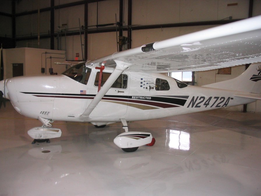 Aircraft Program Airplane
The Global Greenhouse Gas Reference Network for the Carbon Cycle and Greenhouse Gases (CCGG) Group is part of NOAA'S Earth System Research Laboratory (ESRL) in Boulder, CO. The Reference Network measures the atmospheric distribution and trends of the three main long-term drivers of climate change, carbon dioxide (CO2), methane (CH4), and nitrous oxide (N2O), as well as carbon monoxide (CO) which is an important indicator of air pollution. The Reference Network measurement program includes continuous in-situ measurements at 4 baseline observatories (global background sites) and 8 tall towers, as well as flask-air samples collected by volunteers at over 50 additional regional background sites and from small aircraft. The air samples are returned to ESRL for analysis where measurements of about 55 trace gases are done. NOAA's Global Greenhouse Gas Reference Network maintains the World Meteorological Organization international calibration scales for CO2, CH4, CO, N2O, and SF6 in air. The measurements of the Global Greenhouse Gas Reference Network serve as a comparison with measurements made by many other international laboratories, and with regional studies. They are widely used in studies inferring space-time patterns of emissions and removals of greenhouse gases that are optimally consistent with the atmospheric observations. They serve as an early warning for climate "surprises". The measurements are also helpful for the ongoing evaluation of remote sensing technologies.
Aircraft Program Measurements: Since its inception in 1992, the Global Greenhouse Gas Reference Network's aircraft program has been dedicated to collecting air samples in vertical profiles over North America. The program's mission is to capture seasonal and inter-annual changes in trace gas mixing ratios throughout the boundary layer and free troposphere. Data collected by the aircraft program provide a view of how the large-scale horizontal and vertical distribution of the measured trace gases change throughout a given year over the continent. The measured data are baseline levels, trends, and causes of variability of atmospheric gases that have the potential to affect global climate.
The historical data set contains measurements from 31 aircraft program missions. The ongoing data set is contingent upon the aircraft program missions that are still in use going forward. At present, most aircraft program flights collect 12 flask samples at different altitudes via a portable, automated sampling system. At a predetermined altitude, the sampling system is simply activated by a toggle switch that is easily accessible to the pilot. Time, location and auxiliary variables such as temperature and relative humidity are logged with each sample and downloaded into the NOAA/ESRL database when the samples are returned to the laboratory. Sampling frequency and height distribution varies at each site, but samples are collected from 500 m above ground to 8000 m above sea level at the majority of aircraft sites. While sampling flights have been conducted at some sites as often as two to three times per week, sample flights at most sites are only carried out once every two to three weeks.
Through the Big Earth Data Initiative (BEDI), ESRL/GMD has taken their data collection and converted files into NetCDF-4, a self-describing format.
Dataset Citation
- Cite as: C. Sweeney, J. Higgs, S. Wolter, A. Crotwell, D. Neff, E. Dlugokencky, P. Lang, P. Novelli, J. Mund, E. Moglia, M. Crotwell, and NOAA ESRL (2017): Earth System Research Laboratory Carbon Cycle and Greenhouse Gases Group Flask-Air Sample Measurements of CO2, CH4, CO, N2O, H2, and SF6 from the Aircraft Program, 1992-Present, Version 1. [User indicate subset used]. NOAA National Centers for Environmental Information. DOI: 10.7289/V5N58JMF [User indicate access date].
Dataset Identifiers
- doi:10.7289/V5N58JMF
- NCEI DSI 3278_01
- gov.noaa.ncdc:C01544
ISO 19115-2 Metadata
gov.noaa.ncdc:C01544
| Download Data |
|
| Distribution Formats |
|
| Ordering Instructions | Contact NCEI for other distribution options and instructions. |
| Distributor |
NOAA National Centers for Environmental Information ncei.info@noaa.gov |
| Dataset Point of Contact | Mund, John Developer DOC/NOAA/ESRL/GMD > Global Monitoring Division, Earth System Research Laboratory, NOAA, U.S. Department of Commerce (303) 497-5472 john.mund@noaa.gov |
| Dataset Point of Contact | Customer Engagement Branch NOAA National Centers for Environmental Information 1-828-271-4800 ncei.orders@noaa.gov |
| Time Period | 1992-11-09 to Present |
| Spatial Bounding Box Coordinates |
West: -180.0
East: 180.0
South: -90.0
North: 90.0
|
| Spatial Coverage Map |
| General Documentation |
|
| Associated Resources |
|
| Publication Dates |
|
| Edition | Version 1 |
| Data Presentation Form | Digital table - digital representation of facts or figures systematically displayed, especially in columns |
| Dataset Progress Status | Ongoing - data is continually being updated |
| Data Update Frequency | Annually |
| Purpose | The carefully calibrated and documented measurements of the Global Greenhouse Gas Reference Network serve as a comparison with measurements made by many other international laboratories, and with regional studies. They are widely used in studies inferring space-time patterns of emissions and removals of greenhouse gases that are optimally consistent with the atmospheric observations. The calibrated observations are also indispensable for the ongoing evaluation of remote sensing technologies. |
| Dataset Citation |
|
| Cited Authors |
|
| Originators |
|
| Principal Investigators |
|
| Collaborators |
|
| Publishers |
|
| Theme keywords |
Global Change Master Directory (GCMD) Science Keywords
|
| Data Center keywords |
Global Change Master Directory (GCMD) Data Center Keywords
|
| Platform keywords |
Global Change Master Directory (GCMD) Platform Keywords
|
| Instrument keywords |
Global Change Master Directory (GCMD) Instrument Keywords
|
| Place keywords |
Global Change Master Directory (GCMD) Location Keywords
|
| Project keywords |
Global Change Master Directory (GCMD) Project Keywords
|
| Data Resolution keywords |
Global Change Master Directory (GCMD) Vertical Data Resolution Keywords
|
| Stratum keywords |
Global Change Master Directory (GCMD) Location Keywords
|
| Use Constraints |
|
| Access Constraints |
|
| Fees |
|
| Lineage information for: dataset | |
|---|---|
| Lineage Statement | Raw data from the 12-pack flask sampling systems from the aircraft flights are sent back to NOAA/ESRL in Boulder, CO for analysis. The greenhouse gases are measured by the Measurement of Atmospheric Gases that Influence Climate Change (MAGICC) system on one of two nearly-identical automated analytical systems. Halocarbons and hydrocarbons are measured using a GC/mass spectrometric technique. A subset of 12-pack flasks is also analyzed for isotopes of CO2 at the University of Colorado INSTAAR Stable Isotope Lab. There are multiple levels of quality control for 12-pack flask samples taken at each aircraft site, but there are also multiple sources of errors that are assessed in the lab. Once data are analyzed the data are compiled into standard NetCDF files at ESRL/GMD and are archived at the NOAA National Centers for Environmental Information (NCEI). |
| Processor |
|
| Processing Steps |
|
| Processing Environment | The processing environment is a custom software suite on a Linux platform. |
| Source Datasets |
|
| Lineage information for: repository | |
|---|---|
| Processing Steps |
|
Last Modified: 2023-06-23
For questions about the information on this page, please email: ncei.info@noaa.gov
For questions about the information on this page, please email: ncei.info@noaa.gov