Earth System Research Laboratory Carbon Cycle and Greenhouse Gases Group Continuous Measurements of CO2, CO, and CH4 from Tall Towers, 1992-Present
ESRL GMD CCGG Tall Towers Measurements
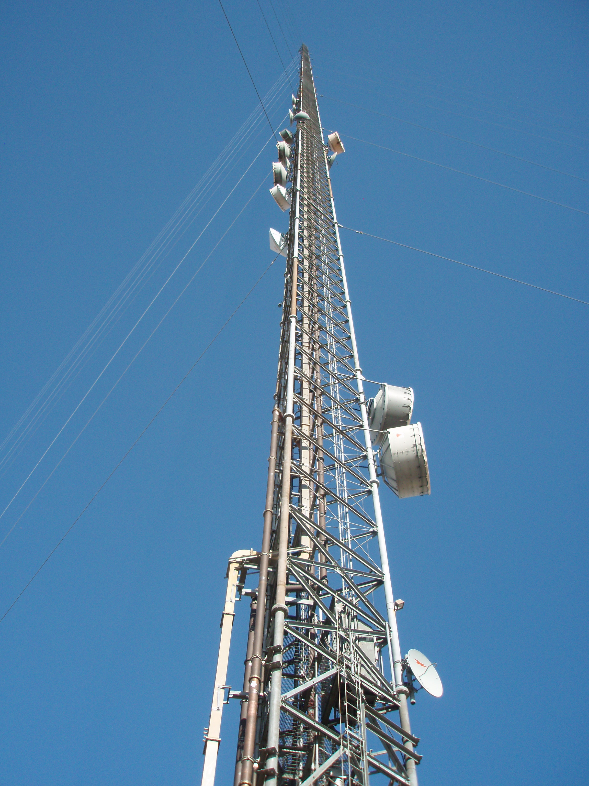 Tall Tower at Walnut Grove, CA
The Global Greenhouse Gas Reference Network for the Carbon Cycle and Greenhouse Gases (CCGG) Group is part of NOAA'S Earth System Research Laboratory (ESRL) in Boulder, CO. The Reference Network measures the atmospheric distribution and trends of the three main long-term drivers of climate change, carbon dioxide (CO2), methane (CH4), and nitrous oxide (N2O), as well as carbon monoxide (CO) which is an important indicator of air pollution. The Reference Network measurement program includes continuous in-situ measurements at 4 baseline observatories, also known as global background sites, and 8 tall towers, as well as flask-air samples collected by volunteers at over 50 additional sites, also known as regional background sites, and from small aircraft. The air samples are returned to ESRL for analysis where measurements of about 55 trace gases are done. NOAA's Global Greenhouse Gas Reference Network maintains the World Meteorological Organization international calibration scales for CO2, CH4, CO, N2O, and SF6 in air. The measurements of the Global Greenhouse Gas Reference Network serve as a comparison with measurements made by many other international laboratories, and with regional studies. They are widely used in studies inferring space-time patterns of emissions and removals of greenhouse gases that are optimally consistent with the atmospheric observations. They serve as an early warning for climate "surprises". The measurements are also helpful for the ongoing evaluation of remote sensing technologies.
Tall Tower Measurements: ESRL's Global Monitoring Division (GMD) began making measurements from tall towers in the 1990s in order to extend long-term carbon-cycle gas monitoring to continental areas. Existing television, radio and cell phone towers are utilized as sampling platforms for continuous in-situ sampling of CO2 and other atmospheric trace gases, including carbon monoxide (CO) in the continental boundary layer. The measured data are baseline levels, trends, and causes of variability of atmospheric gases that have the potential to affect global climate. The tall tower sites are part of the North American Carbon Program and are a primary data source for ESRL's Carbon Tracker CO2 data assimilation system. The historic data set is from 8 tall towers. The ongoing data set is contingent upon the observation sites that are still in use going forward.
Through the Big Earth Data Initiative (BEDI), ESRL/GMD has taken their data collection and converted files into NetCDF-4, a self-describing format.
Dataset Citation
- Cite as: Andrews, A.; Kofler,J.; Trudeau, M.E.; Bakwin, P.S.; Fisher, M.L.; Sweeney, C.; Desai, A.R.; and NOAA ESRL (2017): Earth System Research Laboratory Carbon Cycle and Greenhouse Gases Group Continuous Measurements of CO2, CO, and CH4 from Tall Towers, 1992-Present, Version 1. [indicate subset used]. NOAA National Centers for Environmental Information. doi: 10.7289/V57W69F2 [access date].
Dataset Identifiers
- doi:10.7289/V57W69F2
- NCEI DSI 3278_01
- gov.noaa.ncdc:C01547
ISO 19115-2 Metadata
gov.noaa.ncdc:C01547
| Download Data |
|
| Distribution Formats |
|
| Ordering Instructions | Contact NCEI for other distribution options and instructions. |
| Distributor |
NOAA National Centers for Environmental Information ncei.info@noaa.gov |
| Dataset Point of Contact | John Mund Developer DOC/NOAA/ESRL/GMD > Global Monitoring Division, Earth System Research Laboratory, NOAA, U.S. Department of Commerce (303) 497-5472 john.mund@noaa.gov |
| Dataset Point of Contact | Customer Engagement Branch NOAA National Centers for Environmental Information 1-828-271-4800 ncei.orders@noaa.gov |
| Time Period | 2000-01-01 to Present (time interval: 1-hour) |
| Spatial Bounding Box Coordinates |
West: -180.0
East: 180.0
South: -90.0
North: 90.0
|
| Spatial Coverage Map |
| Dataset Information |
|
| General Documentation |
|
| Associated Resources |
|
| Publication Dates |
|
| Edition | 1 |
| Data Presentation Form | Digital table - digital representation of facts or figures systematically displayed, especially in columns |
| Dataset Progress Status | Ongoing - data is continually being updated |
| Data Update Frequency | Annually |
| Purpose | The carefully calibrated and documented measurements of the Global Greenhouse Gas Reference Network serve as a comparison with measurements made by many other international laboratories, and with regional studies. They are widely used in studies inferring space-time patterns of emissions and removals of greenhouse gases that are optimally consistent with the atmospheric observations. The calibrated observations are also indispensable for the ongoing evaluation of remote sensing technologies. |
| Dataset Citation |
|
| Cited Authors |
|
| Originators |
|
| Principal Investigators |
|
| Collaborators |
|
| Publishers |
|
| Theme keywords |
Global Change Master Directory (GCMD) Science Keywords
|
| Data Center keywords |
Global Change Master Directory (GCMD) Data Center Keywords
|
| Platform keywords |
Global Change Master Directory (GCMD) Platform Keywords
|
| Instrument keywords |
Global Change Master Directory (GCMD) Instrument Keywords
|
| Place keywords |
Global Change Master Directory (GCMD) Location Keywords
|
| Project keywords |
Global Change Master Directory (GCMD) Project Keywords
|
| Data Resolution keywords |
Global Change Master Directory (GCMD) Horizontal Data Resolution Keywords
|
| Stratum keywords |
Global Change Master Directory (GCMD) Location Keywords
|
| Use Constraints |
|
| Access Constraints |
|
| Fees |
|
| Lineage information for: dataset | |
|---|---|
| Lineage Statement | Raw data are transferred from station computers back to NOAA/ESRL in Boulder, CO. Known corrections to the data are applied. Once data are analyzed the data are compiled into standard NetCDF files at ESRL/GMD and are archived at the NOAA National Centers for Environmental Information (NCEI). |
| Processor |
|
| Processing Steps |
|
| Processing Environment | The processing environment is a custom software suite on a Linux platform. |
| Source Datasets |
|
| Lineage information for: repository | |
|---|---|
| Processing Steps |
|
Last Modified: 2023-06-23
For questions about the information on this page, please email: ncei.info@noaa.gov
For questions about the information on this page, please email: ncei.info@noaa.gov