GOES-R Series Level 1b EXIS X-Ray Sensor (XRS) Product in Daily Aggregations
GOES-R EXIS XRS L1b
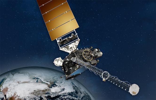 NOAA GOES Spacecraft
The EUV and X-Ray Irradiance Sensors (EXIS) measures solar irradiance at the very short wavelengths where the Sun's output varies the most. The GOES-R Extreme Ultraviolet and X-Ray Irradiance Sensors (EXIS) X-Ray Sensor (XRS) Level 1b (L1b) Science-Quality data contains 1-second cadence soft X-Ray irradiance measurements covering 0.05-0.4 nm and 0.1-0.8 nm integrated passbands. EXIS was designed and built by the Laboratory for Atmospheric and Space Physics (LASP) at the University of Colorado Boulder. This science-quality dataset is produced by NOAA’s National Centers for Environmental Information (NCEI) and utilizes code provided by LASP, and differs from the L1b operational product used at the NOAA Space Weather Prediction Center (SWPC) in that it incorporates retrospective fixes for issues in the operational product and uses the most recent calibrations.
Dataset Citation
- Cite this dataset when used as a source: GOES-R EXIS XRS L1b Data in Daily Aggregations. NOAA National Centers for Environmental Information.
Dataset Identifiers
- gov.noaa.ncei.swx:exis-l1b-sfxr-goesr
ISO 19115-2 Metadata
gov.noaa.ncei.swx:exis-l1b-sfxr-goesr
| Download Data |
|
| Distribution Formats |
|
| Distributor |
NOAA National Centers for Environmental Information goesr.spaceweatherdata@noaa.gov |
| Dataset distributor | Janet Machol Instrument Scientist NOAA National Centers for Environmental Information goesr.exis@noaa.gov |
| Coverage Description | non-geographic dataset |
| Time Period | 2017-12-08 to Present |
| Spatial Bounding Box Coordinates | Bounding coordinates not available |
| Dataset Information |
|
| Processing Documents |
|
| Associated Resources |
|
| Publication Dates |
|
| Edition | 1.0.0 |
| Data Presentation Form | Digital table - digital representation of facts or figures systematically displayed, especially in columns |
| Dataset Progress Status | Planned - fixed date has been established upon or by which the data will be created or updated |
| Data Update Frequency | Daily |
| Supplemental Information | NESDIS produces GOES-R EXIS XRS Level 1b products from GOES-R EXIS Level 0 source files. These output files span 30 seconds of one-second observations. NOAA's National Centers for Environmental Information (NCEI) then takes the 30-second files and aggregates them to produce daily EXIS XRS L1b products. These daily files are intended to be more convenient for users than the original 30-second files. |
| Purpose | The GOES-R X-Ray Sensor (XRS) monitors solar flares and helps predict solar proton events that can penetrate Earth’s magnetic field. The XRS is important in monitoring X-ray input into the Earth's upper atmosphere and alerts scientists to X-ray flares that are strong enough to cause radio blackouts and aides in space weather predictions. This is different from the SUVI instrument which takes extreme ultraviolet images of the sun to monitor features on the sun as well as flares and coronal mass ejections. EXIS provides more information on solar flares and includes a more complete and detailed report of solar variability than what is available from the previous generation of GOES. |
| Dataset Citation |
|
| Cited Authors |
|
| Publishers |
|
| Theme keywords |
NASA Global Change Master Directory (GCMD) Science and Services Keywords
|
| Platform keywords |
NASA Global Change Master Directory (GCMD) Platform Keywords
|
| Instrument keywords |
NASA Global Change Master Directory (GCMD) Instrument Keywords
|
| Place keywords |
NASA Global Change Master Directory (GCMD) Location Keywords
|
| Project keywords |
NASA Global Change Master Directory (GCMD) Project Keywords
|
| Data Resolution keywords |
NASA Global Change Master Directory (GCMD) Data Resolution Keywords
|
| Stratum keywords |
NASA Global Change Master Directory (GCMD) Location Keywords
|
| Use Constraints |
|
| Fees |
|
| Lineage information for: dataset | |
|---|---|
| Lineage Statement | This dataset was produced by NESDIS, and is archived at the NOAA National Centers for Environmental Information (NCEI). |
| Processor |
|
| Processing Steps |
|
| Processing Documents |
|
| Source Datasets |
|
Last Modified: 2022-09-27T04:02:32
For questions about the information on this page, please email: goesr.spaceweatherdata@noaa.gov
For questions about the information on this page, please email: goesr.spaceweatherdata@noaa.gov