GOES-R Series Level 1b EXIS X-Ray Sensor (XRS) Product in Daily Aggregations
(MI_Metadata)
fileIdentifier: gov.noaa.ncei.swx:exis-l1b-sfxr-goesr
language: eng; USA
characterSet: (MD_CharacterSetCode) utf8
hierarchyLevel: (MD_ScopeCode) dataset
contact: (CI_ResponsibleParty)
organisationName: NOAA National Centers for Environmental Information
contactInfo: (CI_Contact)
phone: (CI_Telephone)
voice: 303-497-6223
address: (CI_Address)
electronicMailAddress: goesr.spaceweatherdata@noaa.gov
role: (CI_RoleCode) distributor
dateStamp:
DateTime: 2022-09-27T04:02:32
metadataStandardName: ISO 19115-2 Geographic Information - Metadata - Part 2: Extensions for Imagery and Gridded Data
metadataStandardVersion: ISO 19115-2:2009(E)
return to top
identificationInfo: (MD_DataIdentification)
citation: (CI_Citation)
title: GOES-R Series Level 1b EXIS X-Ray Sensor (XRS) Product in Daily Aggregations
alternateTitle: GOES-R EXIS XRS L1b
date: (CI_Date)
date: 2018-07-18
dateType: (CI_DateTypeCode) publication
edition: 1.0.0
identifier: (MD_Identifier)
authority:
code: gov.noaa.ncei.swx:exis-l1b-sfxr-goesr
citedResponsibleParty: (CI_ResponsibleParty)
organisationName: NOAA National Centers for Environmental Information
role: (CI_RoleCode) publisher
citedResponsibleParty: (CI_ResponsibleParty)
organisationName: NOAA National Centers for Environmental Information
contactInfo: (CI_Contact)
address: (CI_Address)
electronicMailAddress: goesr.exis@noaa.gov
role: (CI_RoleCode) author
citedResponsibleParty: (CI_ResponsibleParty)
organisationName: (missing)
contactInfo: (CI_Contact)
onlineResource: (CI_OnlineResource)
linkage: https://www.ngdc.noaa.gov/stp/satellite/goes-r.html
protocol: HTTP
applicationProfile: Information
name: GOES-R Space Weather Data Access Information Page
description: Website for information on GOES-R space weather data
function: (CI_OnLineFunctionCode) information
role: (missing)
citedResponsibleParty: (CI_ResponsibleParty)
organisationName: (missing)
contactInfo: (CI_Contact)
onlineResource: (CI_OnlineResource)
linkage: https://data.ngdc.noaa.gov/platforms/solar-space-observing-satellites/goes/goes16/l1b/docs/GOES-R_EXIS_XRS_L1b_Operational_Data_ReadMe.pdf
protocol: HTTP
applicationProfile: Information
name: GOES-R EXIS XRS Level 1b Operational Data Readme
description: Readme for GOES-R EXIS XRS Level 1b Operational Data
function: (CI_OnLineFunctionCode) information
role: (missing)
presentationForm: (CI_PresentationFormCode) tableDigital
abstract: The EUV and X-Ray Irradiance Sensors (EXIS) measures solar irradiance at the very short wavelengths where the Sun's output varies the most. The GOES-R Extreme Ultraviolet and X-Ray Irradiance Sensors (EXIS) X-Ray Sensor (XRS) Level 1b (L1b) Science-Quality data contains 1-second cadence soft X-Ray irradiance measurements covering 0.05-0.4 nm and 0.1-0.8 nm integrated passbands. EXIS was designed and built by the Laboratory for Atmospheric and Space Physics (LASP) at the University of Colorado Boulder. This science-quality dataset is produced by NOAA’s National Centers for Environmental Information (NCEI) and utilizes code provided by LASP, and differs from the L1b operational product used at the NOAA Space Weather Prediction Center (SWPC) in that it incorporates retrospective fixes for issues in the operational product and uses the most recent calibrations.
purpose: The GOES-R X-Ray Sensor (XRS) monitors solar flares and helps predict solar proton events that can penetrate Earth’s magnetic field. The XRS is important in monitoring X-ray input into the Earth's upper atmosphere and alerts scientists to X-ray flares that are strong enough to cause radio blackouts and aides in space weather predictions. This is different from the SUVI instrument which takes extreme ultraviolet images of the sun to monitor features on the sun as well as flares and coronal mass ejections. EXIS provides more information on solar flares and includes a more complete and detailed report of solar variability than what is available from the previous generation of GOES.
status: (MD_ProgressCode) planned
pointOfContact: (CI_ResponsibleParty)
individualName: Janet Machol
organisationName: NOAA National Centers for Environmental Information
positionName: Instrument Scientist
contactInfo: (CI_Contact)
address: (CI_Address)
electronicMailAddress: goesr.exis@noaa.gov
role: (CI_RoleCode) distributor
resourceMaintenance: (MD_MaintenanceInformation)
maintenanceAndUpdateFrequency: (MD_MaintenanceFrequencyCode) daily
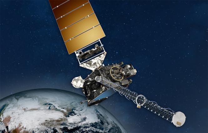
graphicOverview: (MD_BrowseGraphic)
fileName: https://www.ncei.noaa.gov/pub/data/metadata/images/noaa_goesr_series_satellite_illustration.jpg
fileDescription: NOAA GOES Spacecraft
fileType: JPEG
descriptiveKeywords: (MD_Keywords)
keyword: EARTH SCIENCE > SUN-EARTH INTERACTIONS > SOLAR ACTIVITY > SOLAR X-RAY EMISSIONS
type: (MD_KeywordTypeCode) theme
thesaurusName: (CI_Citation)
title: NASA Global Change Master Directory (GCMD) Science and Services Keywords
date: (CI_Date)
date: 2015-08-04
dateType: (CI_DateTypeCode) revision
edition: Version 8.1
citedResponsibleParty: (CI_ResponsibleParty)
organisationName: NASA/GSFC/SED/ESD/GCDC/GCMD > Global Change Master Directory, Global Change Data Center, Earth Sciences Division, Science and Exploration Directorate, Goddard Space Flight Center, NASA
contactInfo: (CI_Contact)
onlineResource: (CI_OnlineResource)
linkage: http://gcmd.gsfc.nasa.gov/learn/keywords.html
protocol: HTTP
applicationProfile: Web Browser
name: NASA GCMD Keyword Community Page
description: Overview of the NASA GCMD Keywords.
function: (CI_OnLineFunctionCode) information
role: (CI_RoleCode) publisher
descriptiveKeywords: (MD_Keywords)
keyword: SPACE > EARTH MAGNETIC FIELD > MAGNETOSPHERE (OTHER)
type: (MD_KeywordTypeCode) place
thesaurusName: (CI_Citation)
title: NASA Global Change Master Directory (GCMD) Location Keywords
date: (CI_Date)
date: 2015-04-07
dateType: (CI_DateTypeCode) revision
edition: Version 8.1
citedResponsibleParty: (CI_ResponsibleParty)
organisationName: NASA/GSFC/SED/ESD/GCDC/GCMD > Global Change Master Directory, Global Change Data Center, Earth Sciences Division, Science and Exploration Directorate, Goddard Space Flight Center, NASA
contactInfo: (CI_Contact)
onlineResource: (CI_OnlineResource)
linkage: http://gcmd.gsfc.nasa.gov/learn/keywords.html
protocol: HTTP
applicationProfile: Web Browser
name: NASA GCMD Keyword Community Page
description: Overview of the NASA GCMD Keywords.
function: (CI_OnLineFunctionCode) information
role: (CI_RoleCode) publisher
descriptiveKeywords: (MD_Keywords)
keyword: SPACE > EARTH MAGNETIC FIELD > MAGNETOSPHERE (OTHER)
type: (MD_KeywordTypeCode) stratum
thesaurusName: (CI_Citation)
title: NASA Global Change Master Directory (GCMD) Location Keywords
date: (CI_Date)
date: 2015-04-07
dateType: (CI_DateTypeCode) revision
edition: Version 8.1
citedResponsibleParty: (CI_ResponsibleParty)
organisationName: NASA/GSFC/SED/ESD/GCDC/GCMD > Global Change Master Directory, Global Change Data Center, Earth Sciences Division, Science and Exploration Directorate, Goddard Space Flight Center, NASA
contactInfo: (CI_Contact)
onlineResource: (CI_OnlineResource)
linkage: http://gcmd.gsfc.nasa.gov/learn/keywords.html
protocol: HTTP
applicationProfile: Web Browser
name: NASA GCMD Keyword Community Page
description: Overview of the NASA GCMD Keywords.
function: (CI_OnLineFunctionCode) information
role: (CI_RoleCode) publisher
descriptiveKeywords: (MD_Keywords)
keyword: GOES > Geostationary Operational Environmental Satellites
keyword: NOAA OneStop Project
type: (MD_KeywordTypeCode) project
thesaurusName: (CI_Citation)
title: NASA Global Change Master Directory (GCMD) Project Keywords
date: (CI_Date)
date: 2015-09-10
dateType: (CI_DateTypeCode) revision
edition: Version 8.1
citedResponsibleParty: (CI_ResponsibleParty)
organisationName: NASA/GSFC/SED/ESD/GCDC/GCMD > Global Change Master Directory, Global Change Data Center, Earth Sciences Division, Science and Exploration Directorate, Goddard Space Flight Center, NASA
contactInfo: (CI_Contact)
onlineResource: (CI_OnlineResource)
linkage: http://gcmd.gsfc.nasa.gov/learn/keywords.html
protocol: HTTP
applicationProfile: Web Browser
name: NASA GCMD Keyword Community Page
description: Overview of the NASA GCMD Keywords.
function: (CI_OnLineFunctionCode) information
role: (CI_RoleCode) publisher
descriptiveKeywords: (MD_Keywords)
keyword: Solar/Space Observing Instruments > X-Ray/Gamma Ray Detectors > > > EXIS-XRS-GOESR
type: (MD_KeywordTypeCode) instrument
thesaurusName: (CI_Citation)
title: NASA Global Change Master Directory (GCMD) Instrument Keywords
date: (CI_Date)
date: 2015-10-02
dateType: (CI_DateTypeCode) revision
edition: Version 8.1
citedResponsibleParty: (CI_ResponsibleParty)
organisationName: NASA/GSFC/SED/ESD/GCDC/GCMD > Global Change Master Directory, Global Change Data Center, Earth Sciences Division, Science and Exploration Directorate, Goddard Space Flight Center, NASA
contactInfo: (CI_Contact)
onlineResource: (CI_OnlineResource)
linkage: http://gcmd.gsfc.nasa.gov/learn/keywords.html
protocol: HTTP
applicationProfile: Web Browser
name: NASA GCMD Keyword Community Page
description: Overview of the NASA GCMD Keywords.
function: (CI_OnLineFunctionCode) information
role: (CI_RoleCode) publisher
descriptiveKeywords: (MD_Keywords)
keyword: Solar/Space Observation Satellites > GOES (Geostationary Operational Environmental Satellite)
type: (MD_KeywordTypeCode) platform
thesaurusName: (CI_Citation)
title: NASA Global Change Master Directory (GCMD) Platform Keywords
date: (CI_Date)
date: 2015-09-23
dateType: (CI_DateTypeCode) revision
edition: Version 8.1
citedResponsibleParty: (CI_ResponsibleParty)
organisationName: NASA/GSFC/SED/ESD/GCDC/GCMD > Global Change Master Directory, Global Change Data Center, Earth Sciences Division, Science and Exploration Directorate, Goddard Space Flight Center, NASA
contactInfo: (CI_Contact)
onlineResource: (CI_OnlineResource)
linkage: http://gcmd.gsfc.nasa.gov/learn/keywords.html
protocol: HTTP
applicationProfile: Web Browser
name: NASA GCMD Keyword Community Page
description: Overview of the NASA GCMD Keywords.
function: (CI_OnLineFunctionCode) information
role: (CI_RoleCode) publisher
descriptiveKeywords: (MD_Keywords)
keyword: Temporal Resolution Range: 1 second - < 1 minute
type: (MD_KeywordTypeCode) dataResolution
thesaurusName: (CI_Citation)
title: NASA Global Change Master Directory (GCMD) Data Resolution Keywords
date: (CI_Date)
date: 2013-03-19
dateType: (CI_DateTypeCode) revision
edition: Version 8.1
citedResponsibleParty: (CI_ResponsibleParty)
organisationName: NASA/GSFC/SED/ESD/GCDC/GCMD > Global Change Master Directory, Global Change Data Center, Earth Sciences Division, Science and Exploration Directorate, Goddard Space Flight Center, NASA
contactInfo: (CI_Contact)
onlineResource: (CI_OnlineResource)
linkage: http://gcmd.gsfc.nasa.gov/learn/keywords.html
protocol: HTTP
applicationProfile: Web Browser
name: NASA GCMD Keyword Community Page
description: Overview of the NASA GCMD Keywords.
function: (CI_OnLineFunctionCode) information
role: (CI_RoleCode) publisher
resourceConstraints: (MD_LegalConstraints)
useConstraints: (MD_RestrictionCode) otherRestrictions
otherConstraints: Cite this dataset when used as a source: GOES-R EXIS XRS L1b Data in Daily Aggregations. NOAA National Centers for Environmental Information.
resourceConstraints: (MD_LegalConstraints)
useConstraints: (MD_RestrictionCode) otherRestrictions
otherConstraints: NCEI cannot assume liability for any damages caused by any errors or omissions in the data, nor as a result of the failure of the data to function on a particular system. NCEI makes no warranty, expressed or implied, nor does the fact of distribution constitute such a warranty. NCEI can only certify that the data it distributes are an authentic copy of the records that were accepted for inclusion in the NCEI archives.
aggregationInfo: (MD_AggregateInformation)
aggregateDataSetName: (CI_Citation)
title: GOES-R Series Product Definition and User Guide (PUG)
date: (missing)
citedResponsibleParty: (CI_ResponsibleParty)
organisationName: GOES-R Program
role: (CI_RoleCode) distributor
citedResponsibleParty: (CI_ResponsibleParty)
organisationName: (missing)
contactInfo: (CI_Contact)
onlineResource: (CI_OnlineResource)
linkage: http://www.goes-r.gov/users/docs/PUG-L1b-vol3.pdf
protocol: HTTP
applicationProfile: Web Browser
name: GOES-R Series Product Definition and User Guide (PUG)
description: GOES-R Series PUG, Vol. 3 (L1b Products)
function: (CI_OnLineFunctionCode) information
role: (missing)
associationType: (DS_AssociationTypeCode) crossReference
initiativeType: (DS_InitiativeTypeCode) userGuide
language: eng; USA
topicCategory: (MD_TopicCategoryCode) environment
extent: (EX_Extent)
description: non-geographic dataset
geographicElement: (inapplicable)
temporalElement: (EX_TemporalExtent)
extent:
TimePeriod:
description: ground condition
beginPosition: 2017-12-08
endPosition:
supplementalInformation: NESDIS produces GOES-R EXIS XRS Level 1b products from GOES-R EXIS Level 0 source files. These output files span 30 seconds of one-second observations. NOAA's National Centers for Environmental Information (NCEI) then takes the 30-second files and aggregates them to produce daily EXIS XRS L1b products. These daily files are intended to be more convenient for users than the original 30-second files.
return to top
distributionInfo: (MD_Distribution)
distributor: (MD_Distributor)
distributorContact: (CI_ResponsibleParty)
organisationName: NOAA National Centers for Environmental Information
contactInfo: (CI_Contact)
address: (CI_Address)
electronicMailAddress: goesr.spaceweatherdata@noaa.gov
role: (CI_RoleCode) distributor
distributionOrderProcess: (MD_StandardOrderProcess)
fees: Electronic downloads of the data are free.
distributorFormat: (MD_Format)
name: NetCDF-4
version: (missing)
distributorTransferOptions: (MD_DigitalTransferOptions)
transferSize: (missing)
onLine: (CI_OnlineResource)
linkage: https://data.ngdc.noaa.gov/platforms/solar-space-observing-satellites/goes/
protocol: HTTP
applicationProfile: Download
name: EXIS XRS L1b daily files available for immediate download
description: Files available for download. From the above URL, choose satellite (e.g., goes16), then l1b/exis-l1b-sfxr, then the dates of interest.
function: (CI_OnLineFunctionCode) download
return to top
dataQualityInfo: (DQ_DataQuality)
scope: (DQ_Scope)
level: (MD_ScopeCode) dataset
extent: #boundingExtent (EX_Extent)
temporalElement:
lineage: (LI_Lineage)
statement: This dataset was produced by NESDIS, and is archived at the NOAA National Centers for Environmental Information (NCEI).
processStep: (LE_ProcessStep)
description: The EXIS XRS L1b Calibration Algorithm produces the X-Ray irradiance fluxes.
dateTime: (missing)
processor: (CI_ResponsibleParty)
organisationName: WCDAS (Wallops Command and Data Acquisition Station, Chincoteague, VA)
role: (CI_RoleCode) processor
source: sd001
processingInformation: (LE_Processing)
identifier: (missing)
algorithm: (LE_Algorithm)
citation: (CI_Citation)
title: OR_EXIS-L1b-ALG-SFXR_<Version>.zip (planned publication in August 2018)
date: (CI_Date)
date: 2018-08-01
dateType: (CI_DateTypeCode) publication
citedResponsibleParty: (CI_ResponsibleParty)
organisationName: DOC/NOAA/NESDIS/NCEI > National Centers for Environmental Information, NESDIS, NOAA, U.S. Department of Commerce
role: (CI_RoleCode) distributor
citedResponsibleParty: (CI_ResponsibleParty)
organisationName: (missing)
role: (missing)
description: See Algorithm Citation
processStep: (LE_ProcessStep)
description: Aggregation of EXIS XRS 30-second files into daily aggregated files.
rationale: User convenience
dateTime: (missing)
processor: (CI_ResponsibleParty)
organisationName: DOC/NOAA/NESDIS/NCEI > National Centers for Environmental Information, NESDIS, NOAA, U.S. Department of Commerce
role: (CI_RoleCode) processor
source: sd002
processingInformation: (LE_Processing)
identifier: (MD_Identifier)
code: NCEI-CO's goes-aggregation routines
source: (LE_Source)
description: GOES-R EXIS Level 0 data
sourceCitation: (CI_Citation)
title: GOES-R EXIS Level 0 data
date: (missing)
citedResponsibleParty: (CI_ResponsibleParty)
organisationName: DOC/NOAA/NESDIS/NCEI > National Centers for Environmental Information, NESDIS, NOAA, U.S. Department of Commerce
role: (CI_RoleCode) pointOfContact
citedResponsibleParty: (CI_ResponsibleParty)
organisationName: (missing)
role: (missing)
sourceExtent: (EX_Extent)
temporalElement: (EX_TemporalExtent)
extent:
TimePeriod:
beginPosition: 2018-07-18
endPosition:
sourceStep: ps001
source: (LE_Source)
description: EXIS XRS Level 1b data (30-second files)
sourceCitation: (CI_Citation)
title: EXIS XRS Level 1b data
date: (missing)
citedResponsibleParty: (CI_ResponsibleParty)
organisationName: DOC/NOAA/CLASS > Comprehensive Large Array-data Stewardship System, NOAA, U.S. Department of Commerce
role: (CI_RoleCode) distributor
citedResponsibleParty: (CI_ResponsibleParty)
organisationName: (missing)
contactInfo: (CI_Contact)
onlineResource: (CI_OnlineResource)
linkage: https://www.ncdc.noaa.gov/airs-web/search
protocol: HTTP
applicationProfile: Web Browser
name: EXIS XRS Level 1b data
description: Web site to extract 30-second EXIS XRS files from CLASS
function: (CI_OnLineFunctionCode) information
role: (missing)
sourceExtent: (EX_Extent)
temporalElement: (EX_TemporalExtent)
extent:
TimePeriod:
beginPosition: 2017-12-08
endPosition:
sourceStep: ps002
return to top
metadataMaintenance: (MD_MaintenanceInformation)
maintenanceAndUpdateFrequency: (MD_MaintenanceFrequencyCode) asNeeded