GOES-R Series Level 1b SEISS Magnetospheric Particle Sensor High Energy (MPS-HI) Product in Daily Aggregations
(MI_Metadata)
fileIdentifier: gov.noaa.ncei.swx:seis-l1b-mpsh-goesr
language: eng; USA
characterSet: (MD_CharacterSetCode) utf8
hierarchyLevel: (MD_ScopeCode) dataset
contact: (CI_ResponsibleParty)
organisationName: NOAA National Centers for Environmental Information
contactInfo: (CI_Contact)
phone: (CI_Telephone)
voice: 303-497-6223
address: (CI_Address)
electronicMailAddress: goesr.spaceweatherdata@noaa.gov
role:
dateStamp:
DateTime: 2022-09-27T03:10:19
metadataStandardName: ISO 19115-2 Geographic Information - Metadata - Part 2: Extensions for Imagery and Gridded Data
metadataStandardVersion: ISO 19115-2:2009(E)
return to top
identificationInfo: (MD_DataIdentification)
citation: (CI_Citation)
title: GOES-R Series Level 1b SEISS Magnetospheric Particle Sensor High Energy (MPS-HI) Product in Daily Aggregations
alternateTitle: GOES-R SEISS MPS-HI L1b Data in Daily Aggregations
date: (CI_Date)
date: 2017-12-19
dateType: (CI_DateTypeCode) publication
edition: 1.0.0
identifier: (MD_Identifier)
authority:
code: gov.noaa.ncei.swx:seis-l1b-mpsh-goesr
citedResponsibleParty: (CI_ResponsibleParty)
organisationName: National Centers for Environmental Information
role: (CI_RoleCode) publisher
citedResponsibleParty: (CI_ResponsibleParty)
organisationName: National Centers for Environmental Information
contactInfo: (CI_Contact)
address: (CI_Address)
electronicMailAddress: goesr.seiss@noaa.gov
role: (CI_RoleCode) author
citedResponsibleParty: (CI_ResponsibleParty)
organisationName: (missing)
contactInfo: (CI_Contact)
onlineResource: (CI_OnlineResource)
linkage: https://www.ngdc.noaa.gov/stp/satellite/goes-r.html
protocol: HTTP
applicationProfile: Information
name: GOES-R Space Weather Data Access Information Page
description: Website for information on GOES-R space weather data
function: (CI_OnLineFunctionCode) information
role: (missing)
presentationForm: (CI_PresentationFormCode) tableDigital
abstract: The GOES-R Magnetospheric Electrons and Protons: Medium and High Energy (MPSH) Product consists of fluxes of medium and high energy electrons and protons derived from in situ measurements of electron and proton count rates. The Magnetospheric Particle Sensor High (MPS-HI) makes these measurements. MPS-HI consists of ten solid state telescopes, five for electrons and five for protons, that define a 170-degree fan-like field-of-regard in the north-south plane. Differential and integral electron fluxes are reported at eleven energy bands from each electron telescope. Ten of the energy bands are evenly spaced logarithmically spanning from 50 keV to 4 MeV with differential electron flux being reported. The eleventh energy band collects electrons with energies greater than 2 MeV with electron integral flux being reported. In addition, differential proton fluxes are reported at eleven energy bands from each proton telescope. The eleven proton energy bands are evenly spaced logarithmically and range from 80 keV to 12 MeV. In addition, the product contains ionizing radiation doses in two energy deposition ranges, 50 keV to 1 MeV (low linear energy transfer, LOLET) and 1 MeV to 50 MeV (high linear energy transfer, HILET). The product also contains processing and data quality metadata, satellite state and location information, and data required for the generation of level 2 products. Measurement resolution is one second. NOAA's National Centers for Environmental Information (NCEI) has created these daily files by aggregating the official L1b files produced by the GOES-R Ground System. The granular L1b files each span 30 seconds of observations.
purpose: The GOES-R Magnetospheric Electrons and Protons: Medium and High Energy (MPSH) Product consists of fluxes of medium and high energy electrons and protons derived from in situ measurements of electron and proton count rates. Differential and integral electron fluxes are reported at eleven energy bands in five angular look directions. The data will help users who wish to monitor solar energetic particle (SEP) events and research magnetospheric conditions. NESDIS produces GOES-R SEISS MPS-HI Level 1b products from GOES-R SEISS Level 0 source files. These output files span 30 seconds of one-second observations. NOAA's National Centers for Environmental Information (NCEI) then takes the 30-second files and aggregates them to produce daily SEISS MPS-HI L1b products. These daily files are intended to be more convenient for users than the original 30-second files.
status: (MD_ProgressCode) planned
pointOfContact: (CI_ResponsibleParty)
individualName: Brian T. Kress
organisationName: NOAA National Centers for Environmental Information
positionName: Instrument Scientist
contactInfo: (CI_Contact)
address: (CI_Address)
electronicMailAddress: goesr.seiss@noaa.gov
role: (CI_RoleCode) pointOfContact
resourceMaintenance: (MD_MaintenanceInformation)
maintenanceAndUpdateFrequency: (MD_MaintenanceFrequencyCode) daily
graphicOverview: (MD_BrowseGraphic)
fileName: https://www.ncei.noaa.gov/pub/data/metadata/images/noaa_goesr_series_satellite_illustration.jpg
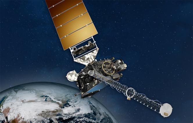
fileDescription: NOAA GOES Spacecraft
fileType: JPEG
descriptiveKeywords: (MD_Keywords)
keyword: EARTH SCIENCE > SUN-EARTH INTERACTIONS > SOLAR ENERGETIC PARTICLE FLUX > PROTON FLUX
keyword: EARTH SCIENCE > SUN-EARTH INTERACTIONS > IONOSPHERE/MAGNETOSPHERE DYNAMICS
type: (MD_KeywordTypeCode) theme
thesaurusName: (CI_Citation)
title: NASA Global Change Master Directory (GCMD) Science and Services Keywords
date: (CI_Date)
date: 2015-08-04
dateType: (CI_DateTypeCode) revision
edition: Version 8.1
citedResponsibleParty: (CI_ResponsibleParty)
organisationName: NASA/GSFC/SED/ESD/GCDC/GCMD > Global Change Master Directory, Global Change Data Center, Earth Sciences Division, Science and Exploration Directorate, Goddard Space Flight Center, NASA
contactInfo: (CI_Contact)
onlineResource: (CI_OnlineResource)
linkage: http://gcmd.gsfc.nasa.gov/learn/keywords.html
protocol: HTTP
applicationProfile: Web Browser
name: NASA GCMD Keyword Community Page
description: Overview of the NASA GCMD Keywords.
function: (CI_OnLineFunctionCode) information
role: (CI_RoleCode) publisher
descriptiveKeywords: (MD_Keywords)
keyword: SPACE > EARTH MAGNETIC FIELD > MAGNETOSPHERE (OTHER)
type: (MD_KeywordTypeCode) place
thesaurusName: (CI_Citation)
title: NASA Global Change Master Directory (GCMD) Location Keywords
date: (CI_Date)
date: 2015-04-07
dateType: (CI_DateTypeCode) revision
edition: Version 8.1
citedResponsibleParty: (CI_ResponsibleParty)
organisationName: NASA/GSFC/SED/ESD/GCDC/GCMD > Global Change Master Directory, Global Change Data Center, Earth Sciences Division, Science and Exploration Directorate, Goddard Space Flight Center, NASA
contactInfo: (CI_Contact)
onlineResource: (CI_OnlineResource)
linkage: http://gcmd.gsfc.nasa.gov/learn/keywords.html
protocol: HTTP
applicationProfile: Web Browser
name: NASA GCMD Keyword Community Page
description: Overview of the NASA GCMD Keywords.
function: (CI_OnLineFunctionCode) information
role: (CI_RoleCode) publisher
descriptiveKeywords: (MD_Keywords)
keyword: SPACE > EARTH MAGNETIC FIELD > MAGNETOSPHERE (OTHER)
type: (MD_KeywordTypeCode) stratum
thesaurusName: (CI_Citation)
title: NASA Global Change Master Directory (GCMD) Location Keywords
date: (CI_Date)
date: 2015-04-07
dateType: (CI_DateTypeCode) revision
edition: Version 8.1
citedResponsibleParty: (CI_ResponsibleParty)
organisationName: NASA/GSFC/SED/ESD/GCDC/GCMD > Global Change Master Directory, Global Change Data Center, Earth Sciences Division, Science and Exploration Directorate, Goddard Space Flight Center, NASA
contactInfo: (CI_Contact)
onlineResource: (CI_OnlineResource)
linkage: http://gcmd.gsfc.nasa.gov/learn/keywords.html
protocol: HTTP
applicationProfile: Web Browser
name: NASA GCMD Keyword Community Page
description: Overview of the NASA GCMD Keywords.
function: (CI_OnLineFunctionCode) information
role: (CI_RoleCode) publisher
descriptiveKeywords: (MD_Keywords)
keyword: GOES > Geostationary Operational Environmental Satellites
keyword: NOAA OneStop Project
type: (MD_KeywordTypeCode) project
thesaurusName: (CI_Citation)
title: NASA Global Change Master Directory (GCMD) Project Keywords
date: (CI_Date)
date: 2015-09-10
dateType: (CI_DateTypeCode) revision
edition: Version 8.1
citedResponsibleParty: (CI_ResponsibleParty)
organisationName: NASA/GSFC/SED/ESD/GCDC/GCMD > Global Change Master Directory, Global Change Data Center, Earth Sciences Division, Science and Exploration Directorate, Goddard Space Flight Center, NASA
contactInfo: (CI_Contact)
onlineResource: (CI_OnlineResource)
linkage: http://gcmd.gsfc.nasa.gov/learn/keywords.html
protocol: HTTP
applicationProfile: Web Browser
name: NASA GCMD Keyword Community Page
description: Overview of the NASA GCMD Keywords.
function: (CI_OnLineFunctionCode) information
role: (CI_RoleCode) publisher
descriptiveKeywords: (MD_Keywords)
keyword: Solar/Space Observing Instruments > Particle Detectors > > > SEISS-GOESR
type: (MD_KeywordTypeCode) instrument
thesaurusName: (CI_Citation)
title: NASA Global Change Master Directory (GCMD) Instrument Keywords
date: (CI_Date)
date: 2015-10-02
dateType: (CI_DateTypeCode) revision
edition: Version 8.1
citedResponsibleParty: (CI_ResponsibleParty)
organisationName: NASA/GSFC/SED/ESD/GCDC/GCMD > Global Change Master Directory, Global Change Data Center, Earth Sciences Division, Science and Exploration Directorate, Goddard Space Flight Center, NASA
contactInfo: (CI_Contact)
onlineResource: (CI_OnlineResource)
linkage: http://gcmd.gsfc.nasa.gov/learn/keywords.html
protocol: HTTP
applicationProfile: Web Browser
name: NASA GCMD Keyword Community Page
description: Overview of the NASA GCMD Keywords.
function: (CI_OnLineFunctionCode) information
role: (CI_RoleCode) publisher
descriptiveKeywords: (MD_Keywords)
keyword: Solar/Space Observation Satellites > GOES (Geostationary Operational Environmental Satellite)
keyword: GOES-16 > Geostationary Operational Environmental Satellite 16
keyword: GOES-17 > Geostationary Operational Environmental Satellite 17
type: (MD_KeywordTypeCode) platform
thesaurusName: (CI_Citation)
title: NASA Global Change Master Directory (GCMD) Platform Keywords
date: (CI_Date)
date: 2015-09-23
dateType: (CI_DateTypeCode) revision
edition: Version 8.1
citedResponsibleParty: (CI_ResponsibleParty)
organisationName: NASA/GSFC/SED/ESD/GCDC/GCMD > Global Change Master Directory, Global Change Data Center, Earth Sciences Division, Science and Exploration Directorate, Goddard Space Flight Center, NASA
contactInfo: (CI_Contact)
onlineResource: (CI_OnlineResource)
linkage: http://gcmd.gsfc.nasa.gov/learn/keywords.html
protocol: HTTP
applicationProfile: Web Browser
name: NASA GCMD Keyword Community Page
description: Overview of the NASA GCMD Keywords.
function: (CI_OnLineFunctionCode) information
role: (CI_RoleCode) publisher
descriptiveKeywords: (MD_Keywords)
keyword: Temporal Resolution Range: 1 second - < 1 minute
type: (MD_KeywordTypeCode) dataResolution
thesaurusName: (CI_Citation)
title: NASA Global Change Master Directory (GCMD) Data Resolution Keywords
date: (CI_Date)
date: 2013-03-19
dateType: (CI_DateTypeCode) revision
edition: Version 8.1
citedResponsibleParty: (CI_ResponsibleParty)
organisationName: NASA/GSFC/SED/ESD/GCDC/GCMD > Global Change Master Directory, Global Change Data Center, Earth Sciences Division, Science and Exploration Directorate, Goddard Space Flight Center, NASA
contactInfo: (CI_Contact)
onlineResource: (CI_OnlineResource)
linkage: http://gcmd.gsfc.nasa.gov/learn/keywords.html
protocol: HTTP
applicationProfile: Web Browser
name: NASA GCMD Keyword Community Page
description: Overview of the NASA GCMD Keywords.
function: (CI_OnLineFunctionCode) information
role: (CI_RoleCode) publisher
resourceConstraints: (MD_LegalConstraints)
useConstraints: (MD_RestrictionCode) otherRestrictions
otherConstraints: Cite this dataset when used as a source: GOES-R SEISS MPS-HI L1b Data in Daily Aggregations. NOAA National Centers for Environmental Information.
resourceConstraints: (MD_LegalConstraints)
useConstraints: (MD_RestrictionCode) otherRestrictions
otherConstraints: NCEI cannot assume liability for any damages caused by any errors or omissions in the data, nor as a result of the failure of the data to function on a particular system. NCEI makes no warranty, expressed or implied, nor does the fact of distribution constitute such a warranty. NCEI can only certify that the data it distributes are an authentic copy of the records that were accepted for inclusion in the NCEI archives.
resourceConstraints: (MD_Constraints)
useLimitation: These GOES-16 data have reached provisional maturity and are still undergoing testing. Users receiving these data through any dissemination means assume all risk related to their use and NOAA disclaims any and all warranties, whether express or implied, including (without limitation) any implied warranties of merchantability or fitness for a particular purpose.
aggregationInfo: (MD_AggregateInformation)
aggregateDataSetName: (CI_Citation)
title: GOES-R Series Product Definition and User Guide (PUG)
date: (missing)
citedResponsibleParty: (CI_ResponsibleParty)
organisationName: GOES-R Program
role: (CI_RoleCode) distributor
citedResponsibleParty: (CI_ResponsibleParty)
organisationName: (missing)
contactInfo: (CI_Contact)
onlineResource: (CI_OnlineResource)
linkage: http://www.goes-r.gov/users/docs/PUG-L1b-vol3.pdf
protocol: HTTP
applicationProfile: Web Browser
name: GOES-R Series Product Definition and User Guide (PUG)
description: GOES-R Series PUG, Vol. 3 (L1b Products)
function: (CI_OnLineFunctionCode) information
role: (missing)
associationType: (DS_AssociationTypeCode) crossReference
initiativeType: (DS_InitiativeTypeCode) userGuide
language: eng; USA
topicCategory: (MD_TopicCategoryCode) environment
extent: (EX_Extent)
description: non-geographic dataset
geographicElement: (inapplicable)
temporalElement: (EX_TemporalExtent)
extent:
TimePeriod:
description: ground condition
beginPosition: 2017-12-08
endPosition:
supplementalInformation: MPS-HI consists of ten solid state telescopes, five for electrons and five for protons. Collectively, the five telescopes per species, each with a 30 degree conical field-of- view, span a total angular range of 170 degrees in the Y-Z plane, arranged north-to-south in a fan. The central telescope has an anti-earthward look-angle parallel to the minus Z-axis (in spacecraft body-reference- frame coordinates). Neighboring telescope centers are separated by 35 degrees. The north-to- south order of telescope numbers is (3, 1, 4, 2, 5) for electrons and (1, 4, 2, 5, 3) for protons when the spacecraft is upright. The MPSH product's low linear energy transfer (LOLET) and high linear energy transfer (HILET) radiation dose measurements are obtained from a pair of dosimeters with 250 mil (0.635 cm, Dosimeter 1) and 100 mil (0.254 cm, Dosimeter 2) aluminum shielding, for a total of four dose products.
return to top
distributionInfo: (MD_Distribution)
distributor: (MD_Distributor)
distributorContact: (CI_ResponsibleParty)
organisationName: NOAA National Centers for Environmental Information
contactInfo: (CI_Contact)
address: (CI_Address)
electronicMailAddress: goesr.spaceweatherdata@noaa.gov
role: (CI_RoleCode) distributor
distributionOrderProcess: (MD_StandardOrderProcess)
fees: Electronic downloads of the data are free.
distributorFormat: (MD_Format)
name: NetCDF-4
version: (missing)
distributorTransferOptions: (MD_DigitalTransferOptions)
transferSize: (missing)
onLine: (CI_OnlineResource)
linkage: https://data.ngdc.noaa.gov/platforms/solar-space-observing-satellites/goes/
protocol: HTTP
applicationProfile: Download
name: SEISS MPS-HI L1b daily files available for immediate download
description: Files available for download. From the above URL, choose satellite (e.g., goes16), then l1b/seis-l1b-mpsh, then the dates of interest.
function: (CI_OnLineFunctionCode) download
return to top
dataQualityInfo: (DQ_DataQuality)
scope: (DQ_Scope)
level: (MD_ScopeCode) dataset
extent: #boundingExtent (EX_Extent)
temporalElement:
lineage: (LI_Lineage)
statement: This dataset was produced by NESDIS, and is archived at the NOAA National Centers for Environmental Information (NCEI).
processStep: (LE_ProcessStep)
description: The SEISS MPS-HI L1b Calibration Algorithm (SMHCA) produces the MPS-HI electron and proton fluxes. The MPS-HI raw count rates are first corrected for the dead-time effect. The proton count rates are assumed to be free from out-of-band contamination, based on pre-flight ground calibration activities. For the electron out-of-band contamination correction, the SMHCA uses proton fluxes from the SEISS SGPS-X sensor unit (in particular, from Telescope 3) to correct the highest energy electron channels. Finally, the dead-time corrected and contamination-corrected count rates for both protons and electrons are divided by geometrical factors to obtain differential fluxes for the differential channels, and integral fluxes for the integral channels.
dateTime: (missing)
processor: (CI_ResponsibleParty)
organisationName: WCDAS (Wallops Command and Data Acquisition Station, Chincoteague, VA)
role: (CI_RoleCode) processor
source: sd001
processingInformation: (LE_Processing)
identifier: (missing)
algorithm: (LE_Algorithm)
citation: (CI_Citation)
title: OR_SEIS-L1b-ALG-MPSH_<Version>.zip (planned publication in August 2018)
date: (CI_Date)
date: 2018-08-01
dateType: (CI_DateTypeCode) publication
citedResponsibleParty: (CI_ResponsibleParty)
organisationName: DOC/NOAA/NESDIS/NCEI > National Centers for Environmental Information, NESDIS, NOAA, U.S. Department of Commerce
role: (CI_RoleCode) distributor
citedResponsibleParty: (CI_ResponsibleParty)
organisationName: (missing)
role: (missing)
description: See Algorithm Citation
processStep: (LE_ProcessStep)
description: Aggregation of SEISS MPS-HI 30-second files into daily aggregated files.
rationale: User convenience
dateTime: (missing)
processor: (CI_ResponsibleParty)
organisationName: DOC/NOAA/NESDIS/NCEI > National Centers for Environmental Information, NESDIS, NOAA, U.S. Department of Commerce
role: (CI_RoleCode) processor
source: sd002
processingInformation: (LE_Processing)
identifier: (MD_Identifier)
code: NCEI-CO's goes-aggregation routines
source: (LE_Source)
description: GOES-R SEISS Level 0 data
sourceCitation: (CI_Citation)
title: GOES-R SEISS Level 0 data
date: (missing)
citedResponsibleParty: (CI_ResponsibleParty)
organisationName: DOC/NOAA/NESDIS/NCEI > National Centers for Environmental Information, NESDIS, NOAA, U.S. Department of Commerce
role: (CI_RoleCode) pointOfContact
citedResponsibleParty: (CI_ResponsibleParty)
organisationName: (missing)
role: (missing)
sourceExtent: (EX_Extent)
temporalElement: (EX_TemporalExtent)
extent:
TimePeriod:
beginPosition: 2017-12-16
endPosition:
sourceStep: ps001
source: (LE_Source)
description: SEISS MPS-HI Level 1b data (30-second files)
sourceCitation: (CI_Citation)
title: SEISS MPS-HI Level 1b data
date: (missing)
citedResponsibleParty: (CI_ResponsibleParty)
organisationName: DOC/NOAA/CLASS > Comprehensive Large Array-data Stewardship System, NOAA, U.S. Department of Commerce
role: (CI_RoleCode) distributor
citedResponsibleParty: (CI_ResponsibleParty)
organisationName: (missing)
contactInfo: (CI_Contact)
onlineResource: (CI_OnlineResource)
linkage: https://www.ncdc.noaa.gov/airs-web/search
protocol: HTTP
applicationProfile: Web Browser
name: SEISS MPS-HI Level 1b data
description: Web site to extract 30-second SEIS-L1b-MPSH files from CLASS
function: (CI_OnLineFunctionCode) information
role: (missing)
sourceExtent: (EX_Extent)
temporalElement: (EX_TemporalExtent)
extent:
TimePeriod:
beginPosition: 2017-12-08
endPosition:
sourceStep: ps002
return to top
metadataMaintenance: (MD_MaintenanceInformation)
maintenanceAndUpdateFrequency: (MD_MaintenanceFrequencyCode) asNeeded