The NGDC Seafloor Sediment Grain Size Database
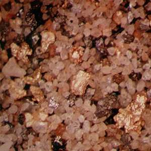 image of a placer deposit
The NGDC (now NCEI) Seafloor Sediment Grain Size Database contains particle size data for over 17,000 seafloor samples worldwide. The file was begun by NGDC in 1976 in response to a need by the Outer Continental Shelf Environmental Assessment Program (OCSEAP) for a detailed, digital file of textural analyses. Data are from OCSEAP studies, academic institutions, environmental baseline studies conducted under contract to the Bureau of Land Management under the Outer Continental Shelf (OCS) Program, and from laboratory reports generated by the U.S. Naval Oceanographic Office. Data include collecting institution, ship, cruise, sample id, latitude/longitude, date of collection, water depth, sampling device, method of analysis, sample weight, sampled interval, raw weight percentages of sediment, within a given phi range. Some samples also have percentages of total gravel, sand, silt, clay, and statistical measurements such as mean, median, skewness, kurtosis, and standard deviation of grain size.
Dataset Citation
- Cite as: National Geophysical Data Center. 1976: The NGDC Seafloor Sediment Grain Size Database. First Version. NOAA National Centers for Environmental Information. https://doi.org/10.7289/V5G44N6W. Accessed [date].
Dataset Identifiers
- doi:10.7289/V5G44N6W
- NCEI Metadata ID: gov.noaa.ngdc.mgg.geology:G00127
ISO 19115-2 Metadata
gov.noaa.ngdc.mgg.geology:G00127
| Search Data |
|
| Download Data |
|
| Distribution Formats |
|
| Ordering Instructions | Contact NCEI for other distribution options and instructions. |
| Distributor |
NOAA National Centers for Environmental Information ncei.info@noaa.gov |
| Dataset Point of Contact |
NOAA National Centers for Environmental Information ncei.info@noaa.gov |
| Dataset Point of Contact | Marine Geology Data Manager NOAA National Centers for Environmental Information geology.info@noaa.gov |
| Coverage Description | Global Ocean |
| Time Period | 1956-01-01 to 2000-12-31 |
| Spatial Reference System | urn:ogc:def:crs:EPSG:4326 |
| Spatial Bounding Box Coordinates |
West: -180
East: 180
South: -78.3667
North: 81.0705
|
| Spatial Coverage Map |
| General Documentation |
|
| Associated Resources |
|
| Publication Dates |
|
| Edition | First Version |
| Data Presentation Form | Digital table - digital representation of facts or figures systematically displayed, especially in columns |
| Dataset Progress Status | Complete - production of the data has been completed Historical archive - data has been stored in an offline storage facility |
| Data Update Frequency | Not planned - Although no updates are planned, project-specific updates are possible if resources become available. |
| Supplemental Information | Quality control: Missing data or gross percentage errors are noted. Processing: Data sources include contractors for the Outer Continental Shelf Environmental Assessment Program; contractors for the Outer Continental Shelf Office, Bureau of Land Management; and project managers from academic institutions. |
| Purpose | environmental research |
| Use Limitations |
|
| Dataset Citation |
|
| Cited Authors |
|
| Publishers |
|
| Acknowledgments |
|
| Theme keywords |
Library of Congress Subject Headings
|
| Data Center keywords |
Global Change Master Directory (GCMD) Data Center Keywords
|
| Platform keywords |
Global Change Master Directory (GCMD) Platform Keywords
|
| Instrument keywords |
Global Change Master Directory (GCMD) Instrument Keywords
|
| Place keywords |
Global Change Master Directory (GCMD) Location Keywords
|
| Project keywords |
Global Change Master Directory (GCMD) Project Keywords
|
| Use Constraints |
|
| Access Constraints |
|
| Other Constraints | Cite as: National Geophysical Data Center. 1976: The NGDC Seafloor Sediment Grain Size Database. First Version. NOAA National Centers for Environmental Information. https://doi.org/10.7289/V5G44N6W. Accessed [date]. |
| Fees |
|
| Lineage information for: dataset | |
|---|---|
| Lineage Statement | Lineage varies by data source. Most data were contributed originally to NOAA's former National Oceanographic Data Center (NODC) as part of larger environmental studies. NODC forwarded the grain size portion of these studies to NGDC for distribution and archive, and in many cases maintained a copy for the NODC archive. Relatively few data sets were contributed directly to the former National Geophysical Data Center (NGDC). Some data were coded by NGDC from paper reports, especially unpublished laboratory item reports from the U.S. Naval Oceanographic Office (NAVOCEANO). Some data were translated from other formats, including the historic 003 Intergovernmental Oceanographic Commission (IOC) format, and the University of Washington format. |
| Processing Environment | Native Dataset Environment: ASCII text |
| Source Datasets | |
| Lineage information for: repository | |
|---|---|
| Processing Steps |
|
| Acquisition Information (collection) | |
|---|---|
| Instrument |
|
| Platform |
|
Last Modified: 2020-04-21
For questions about the information on this page, please email: ncei.info@noaa.gov
For questions about the information on this page, please email: ncei.info@noaa.gov