BLM/OCS Southern California Outer Continental Shelf Environmental Baseline Studies
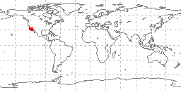 sample locations in study area
Data in this file were produced by Science Applications, Inc., prime contractor on the Bureau of Land Management/Outer Continental Shelf - Southern California Studies (BLM/OCS). Data consist of six data files (benthic sediment characteristics, benthic sediment hydrocarbons, intertidal sediment hydrocarbons, intertidal sediment trace metals, benthic sediment trace metals, and intertidal sediment characteristics). Data are derived from 801 grab and box core samples from the sea floor offshore Southern California. Original documentation have been scanned as images to a .PDF document. The data were received on August 19, 1977. Some documentation has been transcribed to an ASCII readme file. Additional data codes and documentation are in poor, extremely hard to read condition. There are known problems in these data files, including truncation of records past the 80th column in the first file (Benthic Sediment Characteristics). Other problems exist in device codes and analyses that were unable to be resolved by multiple exchanges with the contributors. Additional problems may exist, including deviations from the specified formats.
Dataset Citation
- Cite as: John Wilson. 1977: BLM/OCS Southern California Outer Continental Shelf Environmental Baseline Studies. NOAA National Centers for Environmental Information. Accessed [date].
Dataset Identifiers
- ID not available.
ISO 19115-2 Metadata
gov.noaa.ngdc.mgg.geology:G02881
| Download Data |
|
| Distribution Formats |
|
| Ordering Instructions | Contact NCEI for other distribution options and instructions. |
| Distributor |
NOAA National Centers for Environmental Information ncei.info@noaa.gov |
| Dataset Point of Contact |
NOAA National Centers for Environmental Information ncei.info@noaa.gov |
| Dataset Point of Contact | Marine Geology Data Manager NOAA National Centers for Environmental Information geology.info@noaa.gov |
| Coverage Description | Offshore Southern California |
| Time Period | 1975-9-8 to 1976-5-7 |
| Spatial Reference System | urn:ogc:def:crs:EPSG:4326 |
| Spatial Bounding Box Coordinates |
West: -120.533
East: -117.251
South: 30.666
North: 34.411
|
| Spatial Coverage Map |
| General Documentation |
|
| Associated Resources |
|
| Publication Dates |
|
| Edition | First |
| Data Presentation Form | Digital table - digital representation of facts or figures systematically displayed, especially in columns |
| Dataset Progress Status | Complete - production of the data has been completed Historical archive - data has been stored in an offline storage facility |
| Data Update Frequency | Not planned - Completed data set, no additions planned. |
| Supplemental Information | Due to quality concerns, these data were not added to the historic NGDC Seafloor Sediment Grain Size Database, and are only available in their original form. Vertical extent is not known, continental shelf |
| Purpose | environmental studies |
| Use Limitations |
|
| Dataset Citation |
|
| Cited Authors |
|
| Publishers |
|
| Acknowledgments |
|
| Theme keywords |
Library of Congress Subject Headings
|
| Data Center keywords |
Global Change Master Directory (GCMD) Data Center Keywords
|
| Platform keywords |
Global Change Master Directory (GCMD) Platform Keywords
|
| Instrument keywords |
Global Change Master Directory (GCMD) Instrument Keywords
|
| Place keywords |
Global Change Master Directory (GCMD) Location Keywords
|
| Project keywords |
Global Change Master Directory (GCMD) Project Keywords
|
| Use Constraints |
|
| Access Constraints |
|
| Other Constraints | Cite as: John Wilson. 1977: BLM/OCS Southern California Outer Continental Shelf Environmental Baseline Studies. NOAA National Centers for Environmental Information. Accessed [date]. |
| Fees |
|
| Lineage information for: dataset | |
|---|---|
| Lineage Statement | Grain size analyses from this data set were not reformatted to the 073 format for addition to the NGDC Seafloor Sediment Grain Size Database due to quality concerns. Data were contributed by the originator to NOAA's former National Oceanographic Data Center (NODC) and may be part of a larger compilation archived as oceanographic data by NCEI. Data were received in September of 1977 on nine track magnetic tape in EBCDIC form as five files of 130 character records blocked to 2600 characters per block. The tape contained 2, 580 records, there were 1,066 sample header records, but all but 801 were duplicated. Francis Mitchel of NODC noted on transmission that the data were probably not usable. |
| Processing Environment | Native Dataset Environment: ASCII text |
| Source Datasets | |
| Lineage information for: repository | |
|---|---|
| Processing Steps |
|
| Acquisition Information (collection) | |
|---|---|
| Instrument |
|
| Platform |
|
Last Modified: 2020-04-21
For questions about the information on this page, please email: ncei.info@noaa.gov
For questions about the information on this page, please email: ncei.info@noaa.gov