Heat Flow Data Cruise MD72 RV Marion Dufresne over the Mascarene Ridge
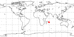 sample locations in study area
Data were gathered by the R/V Marion Dufresne in May and June of 1992 over the Mascarene Ridge in the Indian Ocean on cruise MD72/MASCAFLUX. Heat flow measurements for 96 in-situ readings including both thermal conductivity and thermal gradient were recorded along two profiles perpendicular to the mascarene ridge. NCEI also archives bathymetric and magnetic data from the cruise. Data correspond to: Bonneville, et al., EOS, 73, 43, p. 542, 1992. and Bonneville, A., R.P. Von Herzen and F. Lucazeau, Heat flow over Reunion hot spot track: additional evidence for thermal rejuvenation of oceanic lithosphere, Journal of Geophysical Research, 1995. The data were sent to NCEI by Dr. Alain Bonneville for distribution.
Dataset Citation
- Cite as: Bonneville, Alain; Herzen, Richard P. Von and F. Lucazeau. 1997: Heat Flow Data Cruise MD72 RV Marion Dufresne over the Mascarene Ridge. NOAA National Centers for Environmental Information. Accessed [date].
Dataset Identifiers
- ID not available.
ISO 19115-2 Metadata
gov.noaa.ngdc.mgg.geology:G02886
| Download Data |
|
| Distribution Formats |
|
| Ordering Instructions | Contact NCEI for other distribution options and instructions. |
| Distributor |
NOAA National Centers for Environmental Information ncei.info@noaa.gov |
| Dataset Point of Contact |
NOAA National Centers for Environmental Information ncei.info@noaa.gov |
| Dataset Point of Contact | Marine Geology Data Manager NOAA National Centers for Environmental Information geology.info@noaa.gov |
| Coverage Description | Mascarene Ridge, Indian Ocean |
| Time Period | 1992-05-10 to 1992-06-08 |
| Spatial Reference System | urn:ogc:def:crs:EPSG:4326 |
| Spatial Bounding Box Coordinates |
West: 55.8183
East: 59.3337
South: -18.4342
North: -16.167
|
| Spatial Coverage Map |
| General Documentation |
|
| Associated Resources |
|
| Publication Dates |
|
| Edition | First |
| Data Presentation Form | Digital table - digital representation of facts or figures systematically displayed, especially in columns |
| Dataset Progress Status | Complete - production of the data has been completed Historical archive - data has been stored in an offline storage facility |
| Data Update Frequency | Not planned - Completed data set, no additions planned. |
| Purpose | environmental research |
| Use Limitations |
|
| Dataset Citation |
|
| Cited Authors |
|
| Publishers |
|
| Acknowledgments |
|
| Theme keywords |
Library of Congress Subject Headings
|
| Data Center keywords |
Global Change Master Directory (GCMD) Data Center Keywords
|
| Platform keywords |
Global Change Master Directory (GCMD) Platform Keywords
|
| Instrument keywords |
Global Change Master Directory (GCMD) Instrument Keywords
|
| Place keywords |
Global Change Master Directory (GCMD) Location Keywords
|
| Project keywords |
Global Change Master Directory (GCMD) Project Keywords
|
| Use Constraints |
|
| Access Constraints |
|
| Other Constraints | Cite as: Bonneville, Alain; Herzen, Richard P. Von and F. Lucazeau. 1997: Heat Flow Data Cruise MD72 RV Marion Dufresne over the Mascarene Ridge. NOAA National Centers for Environmental Information. Accessed [date]. |
| Fees |
|
| Lineage information for: dataset | |
|---|---|
| Lineage Statement | lineage prior to transfer to NCEI is unknown |
| Processing Environment | Native Dataset Environment: ASCII text |
| Source Datasets | |
| Lineage information for: repository | |
|---|---|
| Processing Steps |
|
| Acquisition Information (collection) | |
|---|---|
| Instrument |
|
| Platform | |
Last Modified: 2020-04-21
For questions about the information on this page, please email: ncei.info@noaa.gov
For questions about the information on this page, please email: ncei.info@noaa.gov