Dataset Overview | National Centers for Environmental Information (NCEI)

Grain Size Data from the NOAA Outer Continental Shelf Environmental Assessment Program (OCSEAP)

browse graphic
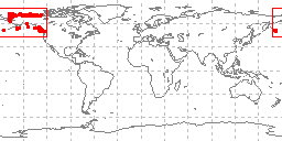
sample locations in study area
This data set contains grain size data from samples acquired under the NOAA Outer Continental Shelf Environmental Assessment Program (OCSEAP) from the Outer Continental Shelf around Alaska. Data were contributed by the University of Alaska, the University of South Carolina, the Scripps Institution of Oceanography, and the US Geological Survey with funding from NOAA. Data fields include collecting institution, ship, cruise, sample id, latitude/longitude, date of collection, water depth, sampling device, method of analysis, sample weight, sampled interval, raw weight percentages of sediment, within a given phi range. Some samples also have percentages of total gravel, sand, silt, clay, and statistical measurements such as mean, median, skewness, kurtosis, and standard deviation of grain size. These data are part of the larger NGDC Seafloor Sediment Grain Size Database (doi:10.7289/V5G44N6W).
  • Cite as: NOAA Outer Continental Shelf Environmental Assessment Program (OCSEAP); University of Alaska; University of South Carolina and US Geological Survey. 1980: Grain Size Data from the NOAA Outer Continental Shelf Environmental Assessment Program (OCSEAP). NOAA National Centers for Environmental Information. Accessed [date].
  • ID not available.
gov.noaa.ngdc.mgg.geology:G02891
Download Data
  • Original data and documentation (download)
    Data in the original fixed-field 073 format and accompanying documentation.
  • MGG41005002 delimited data (download)
    Extract data for Univ of Alaska, 64 grabs, Alaska OCS, cruise 780414 1977 (MGG41005002) in delimited form from the NGDC Seafloor Sediment Grain Size Database.
  • MGG41015001 delimited data (download)
    Extract data for Univ of Alaska, 36 grabs, Bering Sea, Discoverer 808 1975 (MGG41015001) in delimited form from the NGDC Seafloor Sediment Grain Size Database.
  • MGG41025001 delimited data (download)
    Extract data for Univ of Alaska, 44 trawls, Bering Sea, Miller Freeman 818 1975 (MGG41025001) in delimited form from the NGDC Seafloor Sediment Grain Size Database.
  • MGG41055001 delimited data (download)
    Extract data for Univ of Alaska, 31 samples, Alaska OCS, Glacier GLA77N 1977 (MGG41055001) in delimited form from the NGDC Seafloor Sediment Grain Size Database.
  • MGG41995001 delimited data (download)
    Extract data for Univ of Alaska, 57 grabs, Beaufort Sea, 780518 1977 (MGG41995001) in delimited form from the NGDC Seafloor Sediment Grain Size Database.
  • MGG41995002 delimited data (download)
    Extract data for Univ of Alaska, 542 samples, Beaufort Sea 1977 (MGG41995002) in delimited form from the NGDC Seafloor Sediment Grain Size Database.
  • MGG65005001 delimited data (download)
    Extract data for Univ South Carolina, 177 cores, Gulf of Alaska, 770202 1977 (MGG65005001) in delimited form from the NGDC Seafloor Sediment Grain Size Database.
  • MGG06245001 delimited data (download)
    Extract data for USGS, 360 samples, E Gulf of Alaska, EGAL75 1975 (MGG06245001) in delimited form from the NGDC Seafloor Sediment Grain Size Database.
  • Documentation and data files for MGG15995012 (download)
    Data and documentation for the Scripps Institution OCSEAP compilation (MGG15995012)(not in the NGDC Seafloor Sediment Grain Size Database).
Distribution Formats
  • ASCII
Ordering Instructions Contact NCEI for other distribution options and instructions.
Distributor NOAA National Centers for Environmental Information
ncei.info@noaa.gov
Dataset Point of Contact NOAA National Centers for Environmental Information
ncei.info@noaa.gov
Dataset Point of Contact Marine Geology Data Manager
NOAA National Centers for Environmental Information
geology.info@noaa.gov
Coverage Description North Pacific Ocean
Time Period 1975-05-28 to 1977-12-31
Spatial Reference System urn:ogc:def:crs:EPSG:4326
Spatial Bounding Box Coordinates
West: -180
East: -120
South: 50
North: 80
Spatial Coverage Map
General Documentation
Associated Resources
Publication Dates
  • publication: 1980-12-31
  • revision: 1980-12-31
Edition First
Data Presentation Form Digital table - digital representation of facts or figures systematically displayed, especially in columns
Dataset Progress Status Complete - production of the data has been completed
Historical archive - data has been stored in an offline storage facility
Data Update Frequency Not planned - Completed data set, no additions planned.
Purpose environmental research
Use Limitations
  • Produced by the NOAA National Centers for Environmental Information. Not subject to copyright protection within the United States.
Dataset Citation
  • Cite as: NOAA Outer Continental Shelf Environmental Assessment Program (OCSEAP); University of Alaska; University of South Carolina and US Geological Survey. 1980: Grain Size Data from the NOAA Outer Continental Shelf Environmental Assessment Program (OCSEAP). NOAA National Centers for Environmental Information. Accessed [date].
Cited Authors
  • NOAA Outer Continental Shelf Environmental Assessment Program (OCSEAP)
  • University of Alaska
  • University of South Carolina
  • US Geological Survey
Publishers
  • NOAA National Centers for Environmental Information
Acknowledgments
  • Data were compiled by the originators under contracts to the National Oceanic and Atmospheric Administration (NOAA), through the Outer Continental Shelf Environmental Assessment Program (OCSEAP).
Theme keywords Library of Congress Subject Headings
  • Scientific archives
  • Electronic records
  • Oceanography
  • Ocean bottom
  • Geology
  • Submarine geology
  • Marine sediments
SeaDataNet Common Vocabularies
  • Marine geology
USGS Science Topics
  • Sea-floor characteristics
Global Change Master Directory (GCMD) Science Keywords
  • Earth Science > Oceans > Marine Sediments
  • Earth Science > Paleoclimate > Ocean/Lake Records > Sediments
  • Earth Science > Oceans > Marine Sediments > Sedimentary Textures
  • Earth Science > Oceans > Marine Environment Monitoring
CIESIN Keyword Thesaurus
  • CIESIN > Environmental Protection > Environmental Monitoring
Data Center keywords Global Change Master Directory (GCMD) Data Center Keywords
  • DOC/NOAA/NESDIS/NCEI > National Centers for Environmental Information, NESDIS, NOAA, U.S. Department of Commerce
  • DOC/NOAA/NESDIS/NGDC > National Geophysical Data Center, NESDIS, NOAA, U.S. Department of Commerce
Platform keywords Global Change Master Directory (GCMD) Platform Keywords
  • In Situ Ocean-based Platforms > Ships
Instrument keywords Global Change Master Directory (GCMD) Instrument Keywords
  • In Situ/Laboratory Instruments > Corers > Coring Devices
  • In Situ/Laboratory Instruments > Samplers > Grabbers/Traps/Collectors > Grab Samplers
  • In Situ/Laboratory Instruments > Corers > Sediment Corers
Place keywords Global Change Master Directory (GCMD) Location Keywords
  • Ocean > Pacific Ocean > NORTH PACIFIC OCEAN
  • Ocean > Arctic Ocean
  • Vertical Location >Sea Floor
Project keywords Global Change Master Directory (GCMD) Project Keywords
  • OCSEAP > Outer Continental Shelf Environmental Assessment Project
  • ICSU-WDS > International Council for Science - World Data System
NODC PROJECT NAMES THESAURUS
Use Constraints
  • Use liability: NOAA and NCEI cannot provide any warranty as to the accuracy, reliability, or completeness of furnished data. Users assume responsibility to determine the usability of these data. The user is responsible for the results of any application of this data for other than its intended purpose.
  • While every effort has been made to ensure that these data are accurate and reliable within the limits of the current state of the art, NOAA cannot assume liability for any damages caused by any errors or omissions in the data, nor as a result of the failure of the data to function on a particular system. NOAA makes no warranty, expressed or implied, nor does the fact of distribution constitute such a warranty.
Access Constraints
  • Distribution liability: NOAA and NCEI make no warranty, expressed or implied, regarding these data, nor does the fact of distribution constitute such a warranty. NOAA and NCEI cannot assume liability for any damages caused by any errors or omissions in these data. If appropriate, NCEI can only certify that the data it distributes are an authentic copy of the records that were accepted for inclusion in the NCEI archives.
  • Access to this dataset is unrestricted.
Other Constraints Cite as: NOAA Outer Continental Shelf Environmental Assessment Program (OCSEAP); University of Alaska; University of South Carolina and US Geological Survey. 1980: Grain Size Data from the NOAA Outer Continental Shelf Environmental Assessment Program (OCSEAP). NOAA National Centers for Environmental Information. Accessed [date].
Fees
  • In most cases, electronic downloads of the data are free. However, fees may apply for custom orders, data certifications, copies of analog materials, and data distribution on physical media.
Lineage information for: dataset
Lineage Statement Sample collection, laboratory analysis, and translation of data into the 073 grain size format were performed by the originator. Most OCSEAP grain size data were submitted to the OCSEAP Data Coordinator at the former National Oceanographic Data Center (NODC) as part of a larger study. 073 sediment grain size data were forwarded to the former National Geophysical Data Center (NGDC) as the archive responsible for sediment analyses. Copies of OCSEAP grain size data may exist in the oceanographic archive, as well as the geophysical archive. Both NODC and NGDC are now part of NOAA's National Centers for Environmental Information (NCEI).
Processing Environment Native Dataset Environment: ASCII text
Source Datasets
Lineage information for: repository
Processing Steps
  • 2015-04-22T00:00:00 - NOAA created the National Centers for Environmental Information (NCEI) by merging NOAA's National Climatic Data Center (NCDC), National Geophysical Data Center (NGDC), and National Oceanographic Data Center (NODC), including the National Coastal Data Development Center (NCDDC), per the Consolidated and Further Continuing Appropriations Act, 2015, Public Law 113-235. NCEI launched publicly on April 22, 2015.
Acquisition Information (collection)
Instrument
  • In Situ/Laboratory Instruments
Platform
  • In Situ Ocean-based Platforms > SHIPS
Last Modified: 2020-04-21
For questions about the information on this page, please email: ncei.info@noaa.gov