Grain Size Data from the Brine Disposal Program, Gulf of Mexico
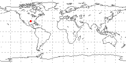 sample locations in study area
These data are part of the Brine Disposal Program funded by NOAA in the US Gulf of Mexico, compiled by NOAA/CEAS and partially conducted by R. W. Hann of Texas A and M University. Grain size analyses conducted on 230 grabs by Texas A and M University were added to the historic NGDC Seafloor Sediment Grain Size Database from multiple cruises of the Lady Gloria conducted during October of 1982. Data include collecting institution, ship, cruise, sample id, latitude/longitude, date of collection, water depth, sampling device, method of analysis, sample weight, sampled interval, raw weight percentages of sediment, within a given phi range. Some samples also have percentages of total gravel, sand, silt, clay, and statistical measurements such as mean, median, skewness, kurtosis, and standard deviation of grain size. Additional data submitted for the Brine Disposal Program by Science Applications, Inc. (SAI) and collected during multiple cruises of the Texas Star in September of 1977, the Dixie Isle in March of 198, and the Gus III from October 1978-May of 1979 were not added to the database due to errors.
Dataset Citation
- Cite as: R. W. Hann. 1983: Grain Size Data from the Brine Disposal Program, Gulf of Mexico. First. NOAA National Centers for Environmental Information. Accessed [date].
Dataset Identifiers
- ID not available.
ISO 19115-2 Metadata
gov.noaa.ngdc.mgg.geology:G02894
| Download Data |
|
| Distribution Formats |
|
| Ordering Instructions | Contact NCEI for other distribution options and instructions. |
| Distributor |
NOAA National Centers for Environmental Information ncei.info@noaa.gov |
| Dataset Point of Contact |
NOAA National Centers for Environmental Information ncei.info@noaa.gov |
| Dataset Point of Contact | Marine Geology Data Manager NOAA National Centers for Environmental Information geology.info@noaa.gov |
| Coverage Description | Gulf of Mexico |
| Time Period | 1982-10-02 to 1982-10-16 |
| Spatial Reference System | urn:ogc:def:crs:EPSG:4326 |
| Spatial Bounding Box Coordinates |
West: -93.509
East: -93.311
South: 29.66
North: 30.58
|
| Spatial Coverage Map |
| General Documentation |
|
| Associated Resources |
|
| Publication Dates |
|
| Edition | First |
| Data Presentation Form | Digital table - digital representation of facts or figures systematically displayed, especially in columns |
| Dataset Progress Status | Complete - production of the data has been completed Historical archive - data has been stored in an offline storage facility |
| Data Update Frequency | Not planned - Completed data set, no additions planned. |
| Supplemental Information | Only data from MGG23085001 are in the NGDC Seafloor Sediment Grain Size Database. Data sets MGG03115001, MGG03495001, MGG03505001, and MGG03515001 contained extensive errors and were not added to the database. |
| Purpose | environmental research |
| Use Limitations |
|
| Dataset Citation |
|
| Cited Authors |
|
| Publishers |
|
| Acknowledgments |
|
| Theme keywords |
Library of Congress Subject Headings
|
| Data Center keywords |
Global Change Master Directory (GCMD) Data Center Keywords
|
| Platform keywords |
Global Change Master Directory (GCMD) Platform Keywords
|
| Instrument keywords |
Global Change Master Directory (GCMD) Instrument Keywords
|
| Place keywords |
Global Change Master Directory (GCMD) Location Keywords
|
| Project keywords |
Global Change Master Directory (GCMD) Project Keywords
|
| Use Constraints |
|
| Access Constraints |
|
| Other Constraints | Cite as: R. W. Hann. 1983: Grain Size Data from the Brine Disposal Program, Gulf of Mexico. First. NOAA National Centers for Environmental Information. Accessed [date]. |
| Fees |
|
| Lineage information for: dataset | |
|---|---|
| Lineage Statement | These data were contributed by the originator to NOAA's former National Oceanographic Data Center (NODC) and are part of a larger compilation archived as oceanographic data by NCEI. The following brine disposal data sets with grain size information compiled by SAIC were submitted to NGDC in December of 1979: MGG03495001 (Gus III 10/3/78-11/10/78, Brine 1/SEDDY2; 1/23/79-1/28/79, Brine 2/SEDDY3; 4/25/79-5/2/79, Brine 3/SEDDY4); MGG03505001 (Texas Star 9/17/77, Brine 5); MGG03515001 (Dixie Isle 3/31/78, Brine 6); Brine 4 (returned for error correction/never resubmitted). Due to extensive errors in weight percentage totals, none of the preceding data files were added to the NGDC Seafloor Sediment Grain Size database, but copies of these data, with the exception of Brine 4, are in the archive. In June of 1981 data set MGG03115001 was received from SAI Oakridge through Francis Mitchel of NODC (42 files from 9/20/1977-10/19/1978 cruises of SW Researcher) but returned to NODC for NOAA/CEAS correction in May 1982 - the data were never resubmitted. In December of 1983, a final Brine Disposal data set MGG23085001 (13 cruises of the Lady Gloria) was received from Texas A and M which had no significant errors and was added to the digital grain size database. |
| Processing Environment | Native Dataset Environment: ASCII text |
| Source Datasets | |
| Lineage information for: repository | |
|---|---|
| Processing Steps |
|
| Acquisition Information (collection) | |
|---|---|
| Instrument |
|
| Platform | |
Last Modified: 2020-04-21
For questions about the information on this page, please email: ncei.info@noaa.gov
For questions about the information on this page, please email: ncei.info@noaa.gov