Archive of Geosample Data and Information from the Polar Rock Repository (PRR), Byrd Polar and Climate Research Center (BPCRC), the Ohio State University (OSU)
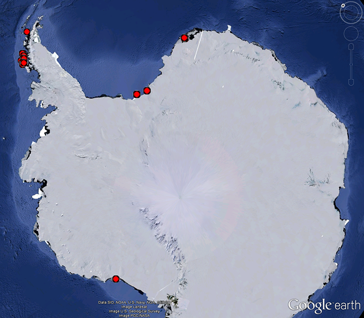 image of sea floor sample locations
The Polar Rock Repository (PRR) is part of the Byrd Polar and Climate Research Center (BPCRC) at the Ohio State University. The PRR is a partner in the Index to Marine and Lacustrine Geological Samples (IMLGS) database, contributing information to the IMLGS to help researchers discover geological samples curated in their facility and available for further research. Only underwater samples (dredges, trawls, and grabs) curated by the PRR are described in the IMLGS. The originating institution is the definitive source of information related to their sample collection. Each PRR entry in the IMLGS links back to a definitive web page for that sample at the PRR.
Dataset Citation
- Cite as: The Polar Rock Repository (PRR), Byrd Polar and Climate Research Center (BPCRC), Ohio State University. 2015: Geological samples available for research from the PRR. NOAA National Centers for Environmental Information. https://doi.org/doi:10.7289/V5RF5S18 [date of access].
Dataset Identifiers
- doi:10.7289/V5RF5S18
- NCEI Metadata ID: gov.noaa.ngdc.mgg.geology:archived-data_BPCRC-polar-rock-repository
ISO 19115-2 Metadata
gov.noaa.ngdc.mgg.geology:archived-data_BPCRC-polar-rock-repository
| Search Data |
|
| Download Data |
|
| Distribution Formats |
|
| Ordering Instructions | Contact NCEI for other distribution options and instructions. |
| Distributor |
NOAA National Centers for Environmental Information ncei.info@noaa.gov |
| Dataset Point of Contact |
NOAA National Centers for Environmental Information ncei.info@noaa.gov |
| Dataset Point of Contact | Marine Geology Data Manager NOAA National Centers for Environmental Information geology.info@noaa.gov |
| Dataset Point of Contact | Dr. Anne Grunow Polar Rock Repository (PRR), Byrd Polar and Climate Research Center (BPCRC), the Ohio State University (OSU) curator@bprc.mps.ohio-state.edu |
| Coverage Description | Global Ocean |
| Time Period | 1956-01-01T00:00:00.000Z to Present |
| Spatial Reference System | urn:ogc:def:crs:EPSG:4326 |
| Spatial Bounding Box Coordinates |
West: 180.00
East: -180.0
South: -78.48333
North: 58.25
|
| Spatial Coverage Map |
| General Documentation |
|
| Associated Resources |
|
| Publication Dates |
|
| Data Presentation Form | Digital table - digital representation of facts or figures systematically displayed, especially in columns Digital image |
| Dataset Progress Status | Ongoing - data is continually being updated Historical archive - data has been stored in an offline storage facility |
| Data Update Frequency | Irregular - The PRR contributes data to the NCEI archive and to the IMLGS as new samples are added to the collection. |
| Supplemental Information | The Polar Rock Repository is an NSF-OPP funded repository at the Byrd Polar and Climate Research Center, The Ohio State University. It was established in 2003 to curate and provide access to samples from Antarctica and the Southern Ocean. The repository has more than 60,000 rock, till, bedrock core and dredge samples available to researchers. The polar sample collection and online database includes field notes, photos, maps, cores, powders, and petrographic thin sections. Samples may be used for research by academic scientists and can be ordered online through the website or by visiting the PRR. |
| Purpose | The purpose of the Polar Rock Repository is to curate and make discoverable terrestrial samples, bedrock cores and dredges from Antarctica and the Southern Ocean for new research endeavors. The PRR provides samples and metadata to scientists through an advanced online database and ordering system. The PRR seeks out new collections from past and current US Antarctic researchers. The PRR has an extensive educational and community outreach program that reaches thousands of people each year. US educators can order online a "polar rock box" containing 45 rock specimens to be used for 1 month in the classroom. |
| Use Limitations |
|
| Dataset Citation |
|
| Cited Authors |
|
| Originators |
|
| Custodians |
|
| Sponsors |
|
| Publishers |
|
| Acknowledgments |
|
| Theme keywords |
Library of Congress Subject Headings
|
| Data Center keywords |
Global Change Master Directory (GCMD) Data Center Keywords
|
| Platform keywords |
Global Change Master Directory (GCMD) Platform Keywords
|
| Instrument keywords |
Global Change Master Directory (GCMD) Instrument Keywords
|
| Place keywords |
Global Change Master Directory (GCMD) Location Keywords
|
| Project keywords |
Global Change Master Directory (GCMD) Project Keywords
|
| Use Constraints |
|
| Access Constraints |
|
| Other Constraints | Cite as: The Polar Rock Repository (PRR), Byrd Polar and Climate Research Center (BPCRC), Ohio State University. 2015: Geological samples available for research from the PRR. NOAA National Centers for Environmental Information. https://doi.org/doi:10.7289/V5RF5S18 [date of access]. |
| Fees |
|
| Lineage information for: dataset | |
|---|---|
| Lineage Statement | Data are received by NCEI on an intermittent basis from the repository. Incoming data are checked for adherence to controlled vocabularies, illegal data types in numeric fields, and out of range latitudes/longitudes. NCEI adds links to related resources, where known, and may perform cursory visual inspection of data for reasonableness, asking the originator for guidance on discrepancies. NCEI informs the originator upon ingest of data to the IMLGS database, after which the originator provides one final quality control using the IMLGS map viewer. Data may also be updated/corrected at any time, at the originator's request. |
| Processor |
|
| Processing Environment | Native Dataset Environment: database tables with auxiliary text, images, and PDF documents. |
| Source Datasets |
|
| Lineage information for: repository | |
|---|---|
| Processing Steps |
|
| Acquisition Information (collection) | |
|---|---|
| Instrument |
|
| Platform |
|
Last Modified: 2022-11-21
For questions about the information on this page, please email: ncei.info@noaa.gov
For questions about the information on this page, please email: ncei.info@noaa.gov