Archive of Geosample Data and Information from the University of Minnesota National Lacustrine Core Repository (LacCore)
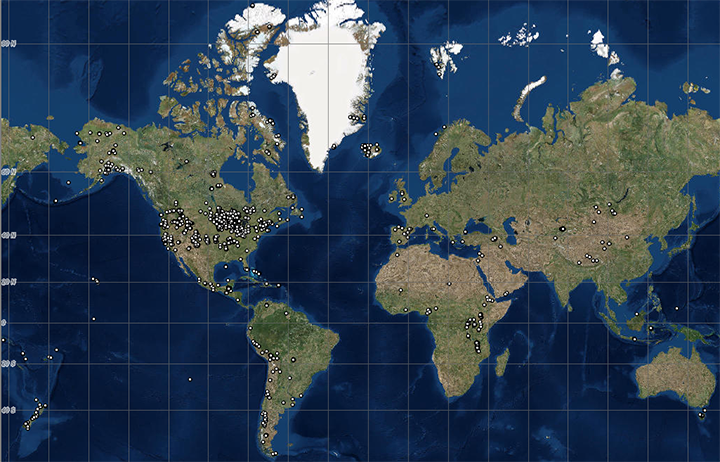 image of sea floor sample locations
The National Lacustrine Core Repository (LacCore), operated by the University of Minnesota
is a partner in the Index to Marine and Lacustrine Geological Samples (IMLGS) database, contributing
information to the IMLGS to help researchers discover geological samples curated in their facility.
The partner repository also sends related data, documents, and imagery to NCEI for long-term archive,
but the originating institution is the definitive source of information related to their sample collection.
LacCore has operated the National Lacustrine Core Repository since 2000, and now curates the world's largest
and most diverse collection of lacustrine sediment cores. The biggest contributors (by core volume) are drilling projects,
but small-volume projects outnumber the drilling campaigns by a factor of nearly 50. The vast majority of the curated
materials are moist, cylindrical cores split in half, but unsplit cores, grab samples, dry cores, and a rapidly-growing
number of rock cores, peat cores, freeze cores and permafrost cores round out the collection.
The Repository also curates unused subsamples and sample residues for re-distribution and analysis.
In addition to these physical holdings, LacCore captures metadata for all materials moving through the Facility;
thus cores processed at LacCore but stored at other institutions are integrated among the physical holdings for
the purpose of data discovery.
Dataset Citation
- Cite as: University of Minnesota National Lacustrine Core Repository (LacCore). 1996: Archive of Geosample Data and Information from the University of Minnesota National Lacustrine Core Repository (LacCore). NOAA National Centers for Environmental Information. https://doi.org/10.7289/V5G73BP3. Accessed [date].
Dataset Identifiers
- doi:10.7289/V5G73BP3
- NCEI Metadata ID: gov.noaa.ngdc.mgg.geology:archived-data_LacCore-sample-repository
ISO 19115-2 Metadata
gov.noaa.ngdc.mgg.geology:archived-data_LacCore-sample-repository
| Search Data |
|
| Download Data |
|
| Distribution Formats |
|
| Ordering Instructions | Contact NCEI for other distribution options and instructions. |
| Distributor |
NOAA National Centers for Environmental Information ncei.info@noaa.gov |
| Dataset Point of Contact |
NOAA National Centers for Environmental Information ncei.info@noaa.gov |
| Dataset Point of Contact | Marine Geology Data Manager NOAA National Centers for Environmental Information geology.info@noaa.gov |
| Coverage Description | Global lakebeds, estuarine, wetland, and riverine areas. |
| Time Period | 1962-01-01T00:00:00.000Z to Present |
| Spatial Reference System | urn:ogc:def:crs:EPSG:4326 |
| Spatial Bounding Box Coordinates |
West: -179.93987
East: 178.30679
South: -54.6514
North: 82.82983
|
| Spatial Coverage Map |
| General Documentation |
|
| Associated Resources |
|
| Publication Dates |
|
| Data Presentation Form | Digital table - digital representation of facts or figures systematically displayed, especially in columns |
| Dataset Progress Status | Ongoing - data is continually being updated Historical archive - data has been stored in an offline storage facility |
| Data Update Frequency | Irregular - The repository contributes data to the NCEI archive and to the IMLGS as new samples are added to their collection and/or as new sample data are available for public release. |
| Supplemental Information | The repository is located at the Twin Cities campus of the University of Minnesota. The facility consists of an open, state of the art Core Lab with a 200 cubic meter coolroom space for archival cold storage (4 degrees C) of split cores in D-tubes. There is also space for dry, room temperature storage of unsplit, dry cores in Lane Cabinets. For sampling projects, LacCore provides space adjacent to the coldroom storage, equipped with sampling tables, standard sample vials and tools. Cores may also be transported to the LRC Core Lab for study and sampling. The repository archives cores from several expeditions in North America, South America, Europe, and Africa. The collection encompasses short (~1m) gravity cores, mid-length (~6-10m) piston cores, and very long (>200m) drill cores. All cores are available for study by qualified individuals after a moratorium period following sample collection (see the LacCore web site for policies). Additonal related data and information are available directly from the contributing institution, which is the authoritative and most current source of data and information related to their sample collection. The IMLGS contains a subset of summary metadata from the institutional database. |
| Purpose | LacCore is the US National Lacustrine Core Repository operated with grants from the National Science Foundation to the Limnological Research Center (LRC) and the Large Lakes Observatory (LLO) at the University of Minnesota. The mission of LacCore is to curate sediment cores from lakes around the world and archive the data for use by the global community of scientists interested in unlocking the secrets of past environment and climate in lake sediment cores. Data and information are archived at NCEI to promote public access to research results and to increase their discoverability via the IMLGS. |
| Use Limitations |
|
| Dataset Citation |
|
| Cited Authors |
|
| Originators |
|
| Custodians |
|
| Sponsors |
|
| Points of Contact |
|
| Publishers |
|
| Acknowledgments |
|
| Theme keywords |
Library of Congress Subject Headings
|
| Data Center keywords |
Global Change Master Directory (GCMD) Data Center Keywords
|
| Platform keywords |
Global Change Master Directory (GCMD) Platform Keywords
|
| Instrument keywords |
Global Change Master Directory (GCMD) Instrument Keywords
|
| Place keywords |
Global Change Master Directory (GCMD) Location Keywords
|
| Project keywords |
Global Change Master Directory (GCMD) Project Keywords
|
| Use Constraints |
|
| Access Constraints |
|
| Other Constraints | Cite as: University of Minnesota National Lacustrine Core Repository (LacCore). 1996: Archive of Geosample Data and Information from the University of Minnesota National Lacustrine Core Repository (LacCore). NOAA National Centers for Environmental Information. https://doi.org/10.7289/V5G73BP3. Accessed [date]. |
| Fees |
|
| Lineage information for: dataset | |
|---|---|
| Lineage Statement | Data are received by NCEI on an intermittent basis from the repository. Incoming data are checked for adherence to controlled vocabularies, illegal data types in numeric fields, and out of range latitudes/longitudes. NCEI adds IGSNs/links to related resources, where known, and may perform cursory visual inspection of data for reasonableness, asking the originator for guidance on discrepancies. Preliminary processed data are placed in a test database for inspection by the originator, and iteratively corrected until the originator approves their publication to the production database. Data may also be updated/corrected at any time, at the originator's request. |
| Processor |
|
| Processing Environment | Native Dataset Environment: database tables with auxiliary text and PDF documents and digital imagery. |
| Source Datasets |
|
| Lineage information for: repository | |
|---|---|
| Processing Steps |
|
| Acquisition Information (collection) | |
|---|---|
| Instrument |
|
| Platform |
|
Last Modified: 2020-04-21
For questions about the information on this page, please email: ncei.info@noaa.gov
For questions about the information on this page, please email: ncei.info@noaa.gov