US Historic Declination Calculator
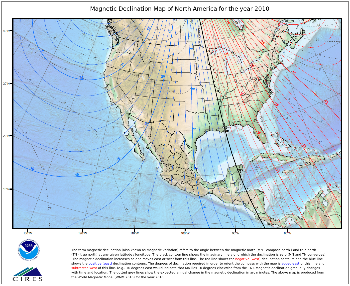 Magnetic Declination map for North America for the year 2010
This programs derives a table of secular change in magnetic declination for a specified point in the conterminous United States. It utilizes the USD polynomial and the IGRF spherical harmonic models. Declination is calculated using the current World Magnetic Model (WMM) or International Geomagnetic Reference Field (IGRF) model. While results are typically accurate to 30 minutes of arc, users should be aware that several environmental factors can cause disturbances in the magnetic field.
Dataset Citation
- Cite as: NCEI Geomagnetic Modeling Team. 2009: US Historic Declination Calculator. NOAA National Centers for Environmental Information. Accessed [date].
Dataset Identifiers
- NCEI Metadata ID: gov.noaa.ngdc.mgg.geophysical_models:US_Historic_Declination_Calculator
ISO 19115-2 Metadata
gov.noaa.ngdc.mgg.geophysical_models:US_Historic_Declination_Calculator
| Distribution Formats | |
| Ordering Instructions | Contact NCEI for other distribution options and instructions. |
| Distributor |
NOAA National Centers for Environmental Information ncei.info@noaa.gov |
| Dataset Point of Contact |
NOAA National Centers for Environmental Information ncei.info@noaa.gov |
| Dataset Point of Contact | NCEI Geomagnetic Modeling Team NOAA National Centers for Environmental Information geomag.models@noaa.gov |
| Time Period | 1750-01-01 to 2014-12-31 |
| Spatial Reference System | urn:ogc:def:crs:EPSG::4326 |
| Spatial Bounding Box Coordinates |
West: -180
East: 180
South: -90
North: 90
|
| Spatial Coverage Map |
| General Documentation |
| Publication Dates |
|
| Data Presentation Form | mapDigital |
| Dataset Progress Status | Complete - production of the data has been completed Historical archive - data has been stored in an offline storage facility |
| Data Update Frequency | As needed |
| Purpose | The purpose of the calculators is to deliver trusted magnetic field values from past observations to aid the public as well as the scientific community in proper navigation, positioning, and other operational and research magnetic field scenarios. |
| Use Limitations |
|
| Dataset Citation |
|
| Cited Authors |
|
| Publishers |
|
| Theme keywords |
Global Change Master Directory (GCMD) Science Keywords
|
| Data Center keywords |
Global Change Master Directory (GCMD) Data Center Keywords
|
| Place keywords |
Global Change Master Directory (GCMD) Location Keywords
|
| Use Constraints |
|
| Access Constraints |
|
| Other Constraints | Cite as: NCEI Geomagnetic Modeling Team. 2009: US Historic Declination Calculator. NOAA National Centers for Environmental Information. Accessed [date]. |
| Fees |
|
| Lineage information for: repository | |
|---|---|
| Processing Steps |
|
Last Modified: 2020-05-14
For questions about the information on this page, please email: ncei.info@noaa.gov
For questions about the information on this page, please email: ncei.info@noaa.gov