NOAA/WDS Paleoclimatology - Anjohibe Cave, Madagascar 370 - 1300 CE Stalagmite MA3 Stable Isotope Data
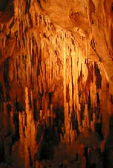 Paleoclimatology - Speleothem
This archived Paleoclimatology Study is available from the NOAA National Centers for Environmental Information (NCEI), under the World Data Service (WDS) for Paleoclimatology. The associated NCEI study type is Cave. The data include parameters of speleothems with a geographic location of Madagascar. The time period coverage is from 1580 to 650 in calendar years before present (BP). See metadata information for parameter and study location details. Please cite this study when using the data.
Dataset Citation
- Cite as: Voarintsoa, N.R.G.; Wang, L.; Railsback, L.B.; Brook, G.A.; Liang, F.; Cheng, H.; Edwards, R.L. (2017-10-15): NOAA/WDS Paleoclimatology - Anjohibe Cave, Madagascar 370 - 1300 CE Stalagmite MA3 Stable Isotope Data. [indicate subset used]. NOAA National Centers for Environmental Information. https://doi.org/10.25921/yv46-tv48. Accessed [date].
- Please refer to Credit tab for full citation information.
Dataset Identifiers
- doi:10.25921/yv46-tv48
- noaa-cave-22910
- NCEI DSI 1200_02
- NCEI DSI 1200_01
ISO 19115-2 Metadata
noaa-cave-22910
| Search Data |
|
| Download Data |
|
| Distribution Formats |
|
| Ordering Instructions | Contact NCEI for other distribution options and instructions. |
| Distributor |
NOAA National Centers for Environmental Information ncei.info@noaa.gov |
| Dataset Point of Contact |
NOAA National Centers for Environmental Information ncei.info@noaa.gov |
| Dataset Point of Contact | Data Center Contact NOAA World Data Service for Paleoclimatology 828-271-4800 paleo@noaa.gov |
| Coverage Description | Date Range: 370 CE to 1300 CE; Date Range: 1580 cal yr BP to 650 cal yr BP; |
| Time Period | 370 to 1300 |
| Spatial Bounding Box Coordinates |
West: 46.88
East: 46.88
South: -15.53
North: -15.53
|
| Spatial Coverage Map |
| General Documentation |
|
| Associated Resources |
|
| Publication Dates |
|
| Data Presentation Form | Digital table - digital representation of facts or figures systematically displayed, especially in columns |
| Dataset Progress Status | Complete - production of the data has been completed |
| Data Update Frequency | Data update frequency not available |
| Supplemental Information | STUDY NOTES: Stalagmite stable isotope (d18O and d13C) data from Anjohibe Cave, Madagascar for 370 - 1300 CE. ABSTRACT SUPPLIED BY ORIGINATOR: The timing and causes of paleoenvironmental changes in Madagascar have been debated, specifically in respect to human activity following the settlement in the late Holocene. Here we present d18O, d13C, layer-bounding surfaces, layer-specific width, mineralogy, and distribution of macroholes from Stalagmite MA3 from Anjohibe Cave to provide a detailed understanding of the paleoenvironmental changes in northwestern Madagascar between 370 CE and 1300 CE. The stable isotope records of Stalagmite MA3 are compared with stable isotope records of Stalagmites ANJ94-5 and MA2. Detailed examination of the proxies suggests three distinct intervals of changes. (1) Prior to 795 CE, changes in vegetation seem to have responded to changes in monsoonal rainfall linked to the relative position of the ITCZ. The period between ca. 755 CE and 795 was the driest, and the Stalagmite MA3 record is consistent with sediment records (pollen and lithology) from Lake Mitsinjo, northwestern Madagascar, and with sediment records (fossil pollen and charcoal) from Sainte Luce, southeastern Madagascar. (2) Between 795 CE and 870, the environmental conditions became more favorable, when vegetation recovered from the driest interval. The new conditions must have been suitable for community development in the region as suggested by archaeological evidence around Lake Mitsinjo and the Boeny region, and the establishment of the stone town of Mahilaka. (3) After 870 CE, a gradational change in plant communities from C3 to C4 marks the record until around 1130 CE, after which vegetation was dominated by C4 plants. This change cannot be explained by climate alone, as there is no clear relationship in the climate-sensitive proxies. Instead, it could have been caused by "Tavy", a variety of "swidden" agriculture practiced in the region. |
| Purpose | Records of past temperature, precipitation, and other aspects of climate derived from mineral deposits found in caves. Parameter keywords describe what was measured in this dataset. Additional summary information can be found in the abstracts of papers listed in the dataset citations. |
| Dataset Citation |
|
| Cited Authors |
|
| Originators |
|
| Publishers |
|
| Theme keywords |
Global Change Master Directory (GCMD) Science Keywords
|
| Data Center keywords |
Global Change Master Directory (GCMD) Data Center Keywords
|
| Place keywords |
|
| Use Constraints |
|
| Access Constraints |
|
| Fees |
|
Last Modified: 2023-09-01
For questions about the information on this page, please email: ncei.info@noaa.gov
For questions about the information on this page, please email: ncei.info@noaa.gov