NOAA/WDS Paleoclimatology - Hu et al. 2008 Heshang Cave, China 9KYr Stalagmite HS4 Stable Isotope Data
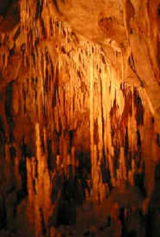 Paleoclimatology - Speleothem
This archived Paleoclimatology Study is available from the NOAA National Centers for Environmental Information (NCEI), under the World Data Service (WDS) for Paleoclimatology. The associated NCEI study type is Cave. The data include parameters of speleothems with a geographic location of China, Eastern Asia. The time period coverage is from 9470 to -52 in calendar years before present (BP). See metadata information for parameter and study location details. Please cite this study when using the data.
Dataset Citation
- Cite as: Hu, C.-Y.; Henderson, G.M.; Huang, J.; Xie, S.-C.; Sun, Y.; Johnson, K.R. (2011-03-17): NOAA/WDS Paleoclimatology - Hu et al. 2008 Heshang Cave, China 9KYr Stalagmite HS4 Stable Isotope Data. [indicate subset used]. NOAA National Centers for Environmental Information. https://doi.org/10.25921/m99q-1e73. Accessed [date].
- Please refer to Credit tab for full citation information.
Dataset Identifiers
- doi:10.25921/m99q-1e73
- noaa-cave-6095
- NCEI DSI 1200_02
- NCEI DSI 1200_01
ISO 19115-2 Metadata
noaa-cave-6095
| Search Data |
|
| Download Data |
|
| Distribution Formats |
|
| Ordering Instructions | Contact NCEI for other distribution options and instructions. |
| Distributor |
NOAA National Centers for Environmental Information ncei.info@noaa.gov |
| Dataset Point of Contact |
NOAA National Centers for Environmental Information ncei.info@noaa.gov |
| Dataset Point of Contact | Data Center Contact NOAA World Data Service for Paleoclimatology 828-271-4800 paleo@noaa.gov |
| Coverage Description | Date Range: 9470 cal yr BP to -52 cal yr BP; |
| Time Period | -7520 to 2002 |
| Spatial Bounding Box Coordinates |
West: 110.416
East: 110.416
South: 30.45
North: 30.45
|
| Spatial Coverage Map |
| General Documentation |
|
| Associated Resources |
|
| Publication Dates |
|
| Data Presentation Form | Digital table - digital representation of facts or figures systematically displayed, especially in columns |
| Dataset Progress Status | Complete - production of the data has been completed |
| Data Update Frequency | Data update frequency not available |
| Supplemental Information | STUDY NOTES: The dataset is a high resolution d18O and d13C record for the Holocene from a cave in the Yangtze Valley in central China. Stable isotope samples were drilled continuously from the entire length of HS-4. A total of 1223 samples were measured on a Finnegan MAT 251 instrument at Wuhan, China with a precision of 0.1 per mil (based on long-term repeatability of standard measurements). These have a resolution of ~2 years in the uppermost 2000 years and, on average, 16 years in the rest of the record. The chronology of stalagmite HS-4 has been established independently by U-Th dating (21 samples measured by MC-ICP-MS at Oxford University) and layer counting. Full details of the chronology and age model are provided in Hu et al. 2008. Heshang Cave location: (30°27'N, 110°25'E; 294 m) ABSTRACT SUPPLIED BY ORIGINATOR: A reconstruction of Holocene rainfall is presented for southwest China - an area prone to drought and flooding due to variability in the East Asian monsoon. The reconstruction is derived by comparing a new high-resolution stalagmite d18O record with an existing record from the same moisture transport pathway. The new record is from Heshang Cave (30°27'N, 110°25'E; 294 m) and shows no sign of kinetic or evaporative effects so can be reliably interpreted as a record of local rainfall composition and temperature. Heshang lies 600 km downwind from Dongge Cave which has a published high-resolution d18O record (Wang, Y.J., Cheng, H., Edwards, R.L., He, Y.Q., Kong, X.G., An, Z.S., Wu, J.Y., Kelly, M.J., Dykoski, C.A., Li, X.D., 2005. The Holocene Asian monsoon: links to solar changes and North Atlantic climate. Science 308, 854-857). By differencing co-eval d18O values for the two caves, secondary controls on d18O (e.g. moisture source, moisture transport, non-local rainfall, temperature) are circumvented and the resulting Dd18O signal is controlled directly by the amount of rain falling between the two sites. This is confirmed by comparison with rainfall data from the instrumental record, which also allows a calibration of the Dd18O proxy. The calibrated Dd18O record provides a quantitative history of rainfall in southwest China which demonstrates that rainfall was 8% higher than today during the Holocene climatic optimum (~6 ka), but only 3% higher during the early Holocene. Significant multi-centennial variability also occurred, with notable dry periods at 8.2 ka, 4.8-4.1 ka, 3.7-3.1 ka, 1.4-1.0 ka and during the Little Ice Age. This Holocene rainfall record provides a good target with which to test climate models. The approach used here, of combining stalagmite records from more than one location, will also allow quantification of rainfall patterns for past times in other regions. |
| Purpose | Records of past temperature, precipitation, and other aspects of climate derived from mineral deposits found in caves. Parameter keywords describe what was measured in this dataset. Additional summary information can be found in the abstracts of papers listed in the dataset citations. |
| Dataset Citation |
|
| Cited Authors |
|
| Originators |
|
| Publishers |
|
| Theme keywords |
Global Change Master Directory (GCMD) Science Keywords
|
| Data Center keywords |
Global Change Master Directory (GCMD) Data Center Keywords
|
| Place keywords |
|
| Use Constraints |
|
| Access Constraints |
|
| Fees |
|
Last Modified: 2023-11-07
For questions about the information on this page, please email: ncei.info@noaa.gov
For questions about the information on this page, please email: ncei.info@noaa.gov