NOAA/WDS Paleoclimatology - Early mid-Holocene SST variability and surface-ocean water balance in the southwest Pacific
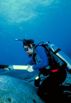 Paleoclimatology - Coral and Sclerosponge
This archived Paleoclimatology Study is available from the NOAA National Centers for Environmental Information (NCEI), under the World Data Service (WDS) for Paleoclimatology. The associated NCEI study type is Coral. The data include parameters of corals and sclerosponges with a geographic location of Vanuatu, Melanesia. The time period coverage is from -49 to -56 in calendar years before present (BP). See metadata information for parameter and study location details. Please cite this study when using the data.
- Cite as: Duprey, N.; Lazareth, C.E.; Corrège, T.; Le Cornec, F.; Maes, C.; Pujol, N.; Madeng-Yogo, M.; Caquineau, S.; Soares Derome, C.; Cabioch, G. (2014-01-27): NOAA/WDS Paleoclimatology - Early mid-Holocene SST variability and surface-ocean water balance in the southwest Pacific. [indicate subset used]. NOAA National Centers for Environmental Information. https://doi.org/10.25921/dg4e-ms12. Accessed [date].
- Please refer to Credit tab for full citation information.
| Search Data |
|
| Download Data |
|
| Distribution Formats |
|
| Ordering Instructions |
Contact NCEI for other distribution options and instructions. |
| Distributor |
NOAA National Centers for Environmental Information
ncei.info@noaa.gov
|
| Dataset Point of Contact |
NOAA National Centers for Environmental Information
ncei.info@noaa.gov
|
| Dataset Point of Contact |
Data Center Contact
NOAA World Data Service for Paleoclimatology
828-271-4800
paleo@noaa.gov
|
| Coverage Description |
Date Range: 1999 CE to 2006 CE; Date Range: -49 cal yr BP to -56 cal yr BP; |
| Time Period |
1999 to 2006 |
| Spatial Bounding Box Coordinates |
West: 166.98
East: 168.1
South: -22.28
North: -15.35
|
| Spatial Coverage Map |
|
| General Documentation |
|
| Associated Resources |
- Early mid-Holocene SST variability and surface-ocean water balance in the southwest Pacific
-
Associated Reference published 2012
Duprey, N., C.E. Lazareth, T. Corrège, F. Le Cornec, C. Maes, N. Pujol, M. Madeng-Yogo, S. Caquineau, C. Soares Derome, and G. Cabioch, 2012: Early mid-Holocene SST variability and surface-ocean water balance in the southwest Pacific. Paleoceanography, 27, , 10.1029/2012PA002350
|
| Publication Dates |
|
| Data Presentation Form |
Digital table - digital representation of facts or figures systematically displayed, especially in columns
|
| Dataset Progress Status |
Complete - production of the data has been completed |
| Data Update Frequency |
Data update frequency not available |
| Supplemental Information |
STUDY NOTES: This study contains the data from the giant clam samples: T-10-09 and T-02-08 and the Porites samples: VA-EPI; Psp0609; and Psp0709. The analytical precision (1σ) on oxygen isotopic determinations, based on 10 runs of the reference material NBS-19, was 0.08‰ vpdb.
ABSTRACT SUPPLIED BY ORIGINATOR: We present early mid-Holocene records of Sr/Ca, d18O and d18Osw from marine archives collected in Vanuatu: two Porites sp. corals (6.7-6.5 ka BP) and a Tridacna maxima giant clam (6.2-6.0 ka BP). Sr/Ca, d18O, and d18Osw were used as proxies for sea surface temperature (SST) and sea surface salinity (SSS). The fossil geochemical records were compared to modern Porites sp. and T. maxima records. Reconstructed mean SSTs from the two fossil Porites sp. and from the modern coral are similar, implying that the Western Pacific Warm Pool (WPWP)' southern edge had reached its modern location by 6.7-6.5 ka BP. The post-glacial SST rise in the Southwest Pacific was thus completed by the early mid-Holocene. The two early mid-Holocene corals and the giant clam recorded saltier conditions than modern related to 1) a decoupling between the precipitation regime and the SPCZ due to a northerly position of this climatic feature and 2) an increase of the moisture transport to the extra-tropics, driven by a strengthened or extended Hadley cell. The longest d18O coral profile displays an El Niño Southern Oscillation (ENSO) signal reduced by 20-30% compared to the period 1928-1992, in concordance with the reduced ENSO variability observed in the Pacific area during the first half of the Holocene. However, the decoupling between the SPCZ and the precipitation regime may have also contributed to the weak ENSO signal recorded in the early mid-Holocene coral d18O profile. |
| Purpose |
Records of past climate and ocean environment derived from stable isotope, trace metal, and other measurements made on corals and sclerosponges. Parameter keywords describe what was measured in this dataset. Additional summary information can be found in the abstracts of papers listed in the dataset citations. |
| Dataset Citation |
- Cite as: Duprey, N.; Lazareth, C.E.; Corrège, T.; Le Cornec, F.; Maes, C.; Pujol, N.; Madeng-Yogo, M.; Caquineau, S.; Soares Derome, C.; Cabioch, G. (2014-01-27): NOAA/WDS Paleoclimatology - Early mid-Holocene SST variability and surface-ocean water balance in the southwest Pacific. [indicate subset used]. NOAA National Centers for Environmental Information. https://doi.org/10.25921/dg4e-ms12. Accessed [date].
- Please cite original publication, online resource, dataset and publication DOIs (where available), and date accessed when using downloaded data. If there is no publication information, please cite investigator, title, online resource, and date accessed. The appearance of external links associated with a dataset does not constitute endorsement by the Department of Commerce/National Oceanic and Atmospheric Administration of external Web sites or the information, products or services contained therein. For other than authorized activities, the Department of Commerce/NOAA does not exercise any editorial control over the information you may find at these locations. These links are provided consistent with the stated purpose of this Department of Commerce/NOAA Web site.
|
| Cited Authors |
- Duprey, N.
- Lazareth, C.E.
- Corrège, T.
- Le Cornec, F.
- Maes, C.
- Pujol, N.
- Madeng-Yogo, M.
- Caquineau, S.
- Soares Derome, C.
- Cabioch, G.
|
| Originators |
- Duprey, N.
- Lazareth, C.E.
- Corrège, T.
- Le Cornec, F.
- Maes, C.
- Pujol, N.
- Madeng-Yogo, M.
- Caquineau, S.
- Soares Derome, C.
- Cabioch, G.
|
| Publishers |
- NOAA National Centers for Environmental Information
|
| Theme keywords |
Global Change Master Directory (GCMD) Science Keywords
- Earth Science > Climate Indicators > Paleoclimate Indicators > Biological Records > Coral Deposits
- Earth Science > Climate Indicators > Paleoclimate Indicators > Ocean/Lake Records > Coral Deposits
- Earth Science > Paleoclimate > Ocean/Lake Records > Coral Deposits
Global Change Master Directory (GCMD) Science Keywords
- earth science > paleoclimate > corals and sclerosponges
- earth science > paleoclimate > corals and sclerosponges
- earth science > paleoclimate > paleoceanography
- earth science > paleoclimate > climate reconstructions|corals and sclerosponges
- earth science > paleoclimate > corals and sclerosponges
- earth science > paleoclimate > corals and sclerosponges
- earth science > paleoclimate > climate reconstructions|corals and sclerosponges
- earth science > paleoclimate > corals and sclerosponges
- earth science > paleoclimate > corals and sclerosponges
- earth science > paleoclimate > paleoceanography
- earth science > paleoclimate > corals and sclerosponges > chemistry
- earth science > paleoclimate > corals and sclerosponges > oxygen isotopes
Paleoenvironmental Standard Terms (PaST) Thesaurus
- What: uranium/calcium; Material: Porites sp.
- What: delta 18O; Material: Porites sp.
- What: depth; Material: null
- What: age; Material: null
- What: magnesium/calcium; Material: Porites sp.
- What: strontium/calcium; Material: Porites sp.
- What: delta 18O; Material: delta 18O|sea water|strontium/calcium
- What: barium/calcium; Material: Porites sp.
- What: boron/calcium; Material: Porites sp.
- What: delta 18O; Material: bivalve
|
| Data Center keywords |
Global Change Master Directory (GCMD) Data Center Keywords- DOC/NOAA/NESDIS/NCEI > National Centers for Environmental Information, NESDIS, NOAA, U.S. Department of Commerce
|
| Place keywords |
- Ocean > Pacific Ocean > South Pacific Ocean > Melanesia > Vanuatu > Epi Island > LATITUDE -16.75 > LONGITUDE 168.1
- Ocean > Pacific Ocean > South Pacific Ocean > Melanesia > Vanuatu > Southeast Espiritu Santo Island > LATITUDE -15.35 > LONGITUDE 167.18
- Ocean > Pacific Ocean > South Pacific Ocean > Melanesia > New Caledonia > Fausse Passe de Uitoé reef > LATITUDE -22.28 > LONGITUDE 166.98
|
| Use Constraints |
- Cite as: Duprey, N.; Lazareth, C.E.; Corrège, T.; Le Cornec, F.; Maes, C.; Pujol, N.; Madeng-Yogo, M.; Caquineau, S.; Soares Derome, C.; Cabioch, G. (2014-01-27): NOAA/WDS Paleoclimatology - Early mid-Holocene SST variability and surface-ocean water balance in the southwest Pacific. [indicate subset used]. NOAA National Centers for Environmental Information. https://doi.org/10.25921/dg4e-ms12. Accessed [date].
- Use liability: NOAA and NCEI cannot provide any warranty as to the accuracy, reliability, or completeness of furnished data. Users assume responsibility to determine the usability of these data. The user is responsible for the results of any application of this data for other than its intended purpose.
- Please cite original publication, online resource, dataset and publication DOIs (where available), and date accessed when using downloaded data. If there is no publication information, please cite investigator, title, online resource, and date accessed. The appearance of external links associated with a dataset does not constitute endorsement by the Department of Commerce/National Oceanic and Atmospheric Administration of external Web sites or the information, products or services contained therein. For other than authorized activities, the Department of Commerce/NOAA does not exercise any editorial control over the information you may find at these locations. These links are provided consistent with the stated purpose of this Department of Commerce/NOAA Web site.
|
| Access Constraints |
- Distribution liability: NOAA and NCEI make no warranty, expressed or implied, regarding these data, nor does the fact of distribution constitute such a warranty. NOAA and NCEI cannot assume liability for any damages caused by any errors or omissions in these data. If appropriate, NCEI can only certify that the data it distributes are an authentic copy of the records that were accepted for inclusion in the NCEI archives.
|
| Fees |
- In most cases, electronic downloads of the data are free. However, fees may apply for custom orders, data certifications, copies of analog materials, and data distribution on physical media.
|
Last Modified: 2024-04-18
For questions about the information on this page, please email:
ncei.info@noaa.gov