NOAA/WDS Paleoclimatology - Nerfloen Norway 7800 Year Lake Sediment Data
 Paleoclimatology - Lake
This archived Paleoclimatology Study is available from the NOAA National Centers for Environmental Information (NCEI), under the World Data Service (WDS) for Paleoclimatology. The associated NCEI study type is Lake. The data include parameters of paleolimnology with a geographic location of Norway, Scandanavia. The time period coverage is from 7775 to -20 in calendar years before present (BP). See metadata information for parameter and study location details. Please cite this study when using the data.
Dataset Citation
- Cite as: Vasskog, K.; Paasche, O.; Nesje, A.; Boyle, J.; Birks, H.J.B. (2012-02-13): NOAA/WDS Paleoclimatology - Nerfloen Norway 7800 Year Lake Sediment Data. [indicate subset used]. NOAA National Centers for Environmental Information. https://doi.org/10.25921/fx10-df76. Accessed [date].
- Please refer to Credit tab for full citation information.
Dataset Identifiers
- doi:10.25921/fx10-df76
- noaa-lake-12503
- NCEI DSI 1200_02
- NCEI DSI 1200_01
ISO 19115-2 Metadata
noaa-lake-12503
| Search Data |
|
| Download Data |
|
| Distribution Formats |
|
| Ordering Instructions | Contact NCEI for other distribution options and instructions. |
| Distributor |
NOAA National Centers for Environmental Information ncei.info@noaa.gov |
| Dataset Point of Contact |
NOAA National Centers for Environmental Information ncei.info@noaa.gov |
| Dataset Point of Contact | Data Center Contact NOAA World Data Service for Paleoclimatology 828-271-4800 paleo@noaa.gov |
| Coverage Description | Date Range: 7775 cal yr BP to -20 cal yr BP; |
| Time Period | -5825 to 1970 |
| Spatial Bounding Box Coordinates |
West: 6.8667
East: 6.8667
South: 61.9333
North: 61.9333
|
| Spatial Coverage Map |
| General Documentation |
|
| Associated Resources |
|
| Publication Dates |
|
| Data Presentation Form | Digital table - digital representation of facts or figures systematically displayed, especially in columns |
| Dataset Progress Status | Complete - production of the data has been completed |
| Data Update Frequency | Data update frequency not available |
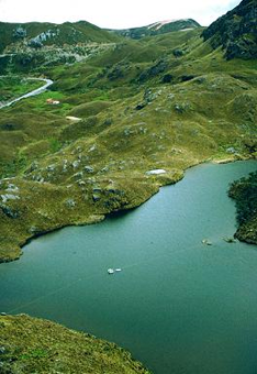
| Supplemental Information | STUDY NOTES: This file contains the data plotted in figure 8 in Vasskog et al. 2012. This includes the first principal component (1st PC) of 15 lake sediment parameters, and the ratio between bulk magnetic susceptibility measured at 77K and 293K, plotted against a 4th degree polynomial age-depth model. Principal Component Analysis (PCA) is employed to detect patterns of variability that are shared between the investigated lake sediment variables. The PCA includes primary count rates of Fe, Rb, Mn, Sr, Zr, and the K/Ti ratio, six grain-size classes as compositional percentages, and physical sediment variables LOI, DBD, and XBulk, resulting in a final data set containing 15 different variables, with a stratigraphical resolution of one centimeter. The first PCA explains 77% of the total variability of the data set. ABSTRACT SUPPLIED BY ORIGINATOR: We explore the possibility of building a continuous glacier reconstruction by analyzing the integrated sedimentary response of a large (440 km2) glacierized catchment in western Norway, as recorded in the downstream lake Nerfloen (N61°56', E6°52'). A multi-proxy numerical analysis demonstrates that it is possible to distinguish a glacier component in the ~8000-yr-long record, based on distinct changes in grain size, geochemistry, and magnetic composition. Principal Component Analysis (PCA) reveals a strong common signal in the 15 investigated sedimentary parameters, with the first principal component explaining 77% of the total variability. This signal is interpreted to reflect glacier activity in the upstream catchment, an interpretation that is independently tested through a mineral magnetic provenance analysis of catchment samples. Minimum glacier input is indicated between 6700-5700 cal yr BP, probably reflecting a situation when most glaciers in the catchment had melted away, whereas the highest glacier activity is observed around 600 and 200 cal yr BP. During the local Neoglacial interval (~4200 cal yr BP until present), five individual periods of significantly reduced glacier extent are identified at ~3400, 3000-2700, 2100-2000, 1700-1500, and ~900 cal yr BP. |
| Purpose | Records of past climate and environment derived from lake sediment records. Parameter keywords describe what was measured in this dataset. Additional summary information can be found in the abstracts of papers listed in the dataset citations. |
| Dataset Citation |
|
| Cited Authors |
|
| Originators |
|
| Publishers |
|
| Theme keywords |
Global Change Master Directory (GCMD) Science Keywords
|
| Data Center keywords |
Global Change Master Directory (GCMD) Data Center Keywords
|
| Place keywords |
|
| Use Constraints |
|
| Access Constraints |
|
| Fees |
|
Last Modified: 2024-03-15
For questions about the information on this page, please email: ncei.info@noaa.gov
For questions about the information on this page, please email: ncei.info@noaa.gov