NOAA/WDS Paleoclimatology - Bear Lake, Utah-Idaho 250,000 Year Proxy Data
 Paleoclimatology - Lake
This archived Paleoclimatology Study is available from the NOAA National Centers for Environmental Information (NCEI), under the World Data Service (WDS) for Paleoclimatology. The associated NCEI study type is Lake. The data include parameters of paleolimnology with a geographic location of Utah, United States Of America. The time period coverage is from 249950 to 0 in calendar years before present (BP). See metadata information for parameter and study location details. Please cite this study when using the data.
Dataset Citation
- Cite as: Kaufman, D.S.; Reheis, M.C.; Simmons, K.R.; Bright, J.; Dean, W.E.; Rosenbaum, J.G.; Moser, K.A.; Anderson, R.S.; Colman, S.M.; Heil, C.W.; Jiménez-Moreno, G. (2009-03-01): NOAA/WDS Paleoclimatology - Bear Lake, Utah-Idaho 250,000 Year Proxy Data. [indicate subset used]. NOAA National Centers for Environmental Information. https://doi.org/10.25921/s362-z710. Accessed [date].
- Please refer to Credit tab for full citation information.
Dataset Identifiers
- doi:10.25921/s362-z710
- noaa-lake-8650
- NCEI DSI 1200_02
- NCEI DSI 1200_01
ISO 19115-2 Metadata
noaa-lake-8650
| Search Data |
|
| Download Data |
|
| Distribution Formats |
|
| Ordering Instructions | Contact NCEI for other distribution options and instructions. |
| Distributor |
NOAA National Centers for Environmental Information ncei.info@noaa.gov |
| Dataset Point of Contact |
NOAA National Centers for Environmental Information ncei.info@noaa.gov |
| Dataset Point of Contact | Data Center Contact NOAA World Data Service for Paleoclimatology 828-271-4800 paleo@noaa.gov |
| Coverage Description | Date Range: 249950 cal yr BP to 0 cal yr BP; |
| Time Period | -248000 to 1950 |
| Spatial Bounding Box Coordinates |
West: -111.3333
East: -111.3333
South: 42
North: 42
|
| Spatial Coverage Map |
| General Documentation |
|
| Associated Resources |
|
| Publication Dates |
|
| Data Presentation Form | Digital table - digital representation of facts or figures systematically displayed, especially in columns |
| Dataset Progress Status | Complete - production of the data has been completed |
| Data Update Frequency | Data update frequency not available |
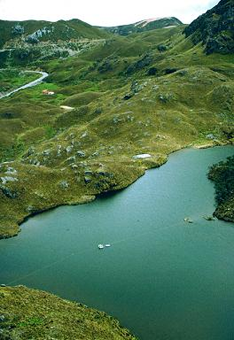
| Supplemental Information | STUDY NOTES: Appendices A-D from Kaufman et al. 2009, containing mineralogy, isotope, ostracode, and diatom data from Bear Lake core BL00-1. ABSTRACT SUPPLIED BY ORIGINATOR: A continuous, 120-m-long core (BL00-1) from Bear Lake, Utah and Idaho, contains evidence of hydrologic and environmental change over the last two glacial-interglacial cycles. The core was taken at 41.95°N, 111.31°W, near the depocenter of the 60-m-deep, spring-fed, alkaline lake, where carbonate-bearing sediment has accumulated continuously. Chronological control is poor but indicates an average sedimentation rate of 0.54 mm yrŋ1. Analyses have been completed at multi-centennial to millennial scales, including (in order of decreasing temporal resolution) sediment magnetic properties, oxygen and carbon isotopes on bulk-sediment carbonate, organic- and inorganic carbon contents, palynology; mineralogy (X-ray diffraction), strontium isotopes on bulk carbonate, ostracode taxonomy, oxygen and carbon isotopes on ostracodes, and diatom assemblages. Massive silty clay and marl constitute most of the core, with variable carbonate content (average = 31 ą 19%) and oxygen-isotopic values (d18O ranging from -18 per mil to -5 per mil in bulk carbonate). These variations, as well as fluctuations of biological indicators, reflect changes in the water and sediment discharged from the glaciated headwaters of the dominant tributary, Bear River, and the processes that influenced sediment delivery to the core site, including lake-level changes. Although its influence has varied, Bear River has remained a tributary to Bear Lake during most of the last quarter-million years. The lake disconnected from the river and, except for a few brief excursions, retracted into a topographically closed basin during global interglaciations (during parts of marine isotope stages 7, 5, and 1). These intervals contain up to 80% endogenic aragonite with high d18O values (average = -5.8 ą 1.7 per mil), indicative of strongly evaporitic conditions. Interglacial intervals also are dominated by small, benthic/tychoplanktic fragilarioid species indicative of reduced habitat availability associated with low lake levels, and they contain increased high-desert shrub and Juniperus pollen and decreased forest and forest-woodland pollen. The 87Sr/86Sr values (>0.7100) also increase, and the ratio of quartz to dolomite decreases, as expected in the absence of Bear River inflow. The changing paleoenvironments inferred from BL00-1 generally are consistent with other regional and global records of glacial-interglacial fluctuations; the diversity of paleoenvironmental conditions inferred fromBL00-1 also reflects the influence of catchment-scale processes. |
| Purpose | Records of past climate and environment derived from lake sediment records. Parameter keywords describe what was measured in this dataset. Additional summary information can be found in the abstracts of papers listed in the dataset citations. |
| Dataset Citation |
|
| Cited Authors |
|
| Originators |
|
| Publishers |
|
| Theme keywords |
Global Change Master Directory (GCMD) Science Keywords
|
| Data Center keywords |
Global Change Master Directory (GCMD) Data Center Keywords
|
| Place keywords |
|
| Use Constraints |
|
| Access Constraints |
|
| Fees |
|
Last Modified: 2024-03-11
For questions about the information on this page, please email: ncei.info@noaa.gov
For questions about the information on this page, please email: ncei.info@noaa.gov