NOAA/WDS Paleoclimatology - Emerald Basin MC-29D 1600 Year Multiproxy Sediment Data
 Paleoclimatology - Paleoceanography
This archived Paleoclimatology Study is available from the NOAA National Centers for Environmental Information (NCEI), under the World Data Service (WDS) for Paleoclimatology. The associated NCEI study type is Paleoceanography. The data include parameters of paleoceanography with a geographic location of North Atlantic Ocean. The time period coverage is from 1599 to 0 in calendar years before present (BP). See metadata information for parameter and study location details. Please cite this study when using the data.
- Cite as: Keigwin, L.D.; Sachs, J.P.; Rosenthal, Y. (2011-04-22): NOAA/WDS Paleoclimatology - Emerald Basin MC-29D 1600 Year Multiproxy Sediment Data. [indicate subset used]. NOAA National Centers for Environmental Information. https://doi.org/10.25921/wrzc-rh22. Accessed [date].
- Please refer to Credit tab for full citation information.
| Search Data |
|
| Download Data |
|
| Distribution Formats |
|
| Ordering Instructions |
Contact NCEI for other distribution options and instructions. |
| Distributor |
NOAA National Centers for Environmental Information
ncei.info@noaa.gov
|
| Dataset Point of Contact |
NOAA National Centers for Environmental Information
ncei.info@noaa.gov
|
| Dataset Point of Contact |
Data Center Contact
NOAA World Data Service for Paleoclimatology
828-271-4800
paleo@noaa.gov
|
| Coverage Description |
Date Range: 1599 cal yr BP to 0 cal yr BP; |
| Time Period |
351 to 1950 |
| Spatial Bounding Box Coordinates |
West: -62.795
East: -62.795
South: 45.885
North: 45.885
|
| Spatial Coverage Map |
|
| General Documentation |
|
| Associated Resources |
- A 1600-year history of the Labrador Current off Nova Scotia
-
Associated Reference published 2003
Keigwin, L.D., J.P. Sachs, and Y. Rosenthal, 2003: A 1600-year history of the Labrador Current off Nova Scotia. Climate Dynamics, 21, 53-62, 10.1007/s00382-003-0316-6
|
| Publication Dates |
|
| Data Presentation Form |
Digital table - digital representation of facts or figures systematically displayed, especially in columns
|
| Dataset Progress Status |
Complete - production of the data has been completed |
| Data Update Frequency |
Data update frequency not available |
| Supplemental Information |
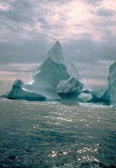
STUDY NOTES: High resolution multiproxy sediment data from Emerald Basin, offshore Nova Scotia, Canada covering the last 1600 years.
ABSTRACT SUPPLIED BY ORIGINATOR: A multicore from Emerald Basin, on the continental margin off Nova Scotia, has a modern 14C age at the top, and other 14C dates indicate a linear sedimentation rate of ~30 cm/ka to 1600 calendar years BP. This rate is great enough to record century-to-millennial scale changes in the surface and deep (~250 m) waters in the basin that are influenced by the Labrador Current. We applied five proxies for seawater temperature changes to the sediments of Emerald Basin, including the percent abundance and the oxygen isotope ratio (d18O) of the polar planktonic foraminifer N. pachyderma (s.), the unsaturation ratio of alkenones (Uk'37) produced by prymnesiophyte phytoplankton, and the d18O and Mg/Ca of benthic foraminifera. All five proxies indicate the ocean warmed suddenly sometime in the past 150 years or so. The exact timing of this event is uncertain because 14C dating is inaccurate in recent centuries, but this abrupt warming probably correlates with widespread evidence for warming in the Arctic in the nineteenth century. Because the Canadian Archipelago is one of the two main sources for the Labrador Current, warming and melting of ice caps in that region may have affected Labrador Current properties. Before this recent warming, sea surface temperature was continually lower by 1-2°C, and bottom water was colder by about 6°C in Emerald Basin. These results suggest that there was no Medieval Warm Period in the coastal waters off Nova Scotia. Because there is also no evidence of medieval warming in the Canadian archipelago, it seems likely that coastal waters from Baffin Bay to at least as far south as Nova Scotia were continually cold for ~1500 of the past 1600 years. |
| Purpose |
Records of past climate and ocean circulation derived from marine sediments. Parameter keywords describe what was measured in this dataset. Additional summary information can be found in the abstracts of papers listed in the dataset citations. |
| Dataset Citation |
- Cite as: Keigwin, L.D.; Sachs, J.P.; Rosenthal, Y. (2011-04-22): NOAA/WDS Paleoclimatology - Emerald Basin MC-29D 1600 Year Multiproxy Sediment Data. [indicate subset used]. NOAA National Centers for Environmental Information. https://doi.org/10.25921/wrzc-rh22. Accessed [date].
- Please cite original publication, online resource, dataset and publication DOIs (where available), and date accessed when using downloaded data. If there is no publication information, please cite investigator, title, online resource, and date accessed. The appearance of external links associated with a dataset does not constitute endorsement by the Department of Commerce/National Oceanic and Atmospheric Administration of external Web sites or the information, products or services contained therein. For other than authorized activities, the Department of Commerce/NOAA does not exercise any editorial control over the information you may find at these locations. These links are provided consistent with the stated purpose of this Department of Commerce/NOAA Web site.
|
| Cited Authors |
- Keigwin, L.D.
- Sachs, J.P.
- Rosenthal, Y.
|
| Originators |
- Keigwin, L.D.
- Sachs, J.P.
- Rosenthal, Y.
|
| Publishers |
- NOAA National Centers for Environmental Information
|
| Theme keywords |
Global Change Master Directory (GCMD) Science Keywords
- Earth Science > Paleoclimate > Ocean/Lake Records
- Earth Science > Climate Indicators > Paleoclimate Indicators > Ocean/Lake Records
Global Change Master Directory (GCMD) Science Keywords
- earth science > paleoclimate > paleoceanography
- earth science > paleoclimate > paleoceanography
- earth science > paleoclimate > paleoceanography
- earth science > paleoclimate > paleoceanography
- earth science > paleoclimate > paleoceanography
- earth science > paleoclimate > paleoceanography
- earth science > paleoclimate > paleoceanography
- earth science > paleoclimate > climate reconstructions|paleoceanography
- earth science > paleoclimate > climate reconstructions|paleoceanography
- earth science > paleoclimate > paleoceanography
- earth science > paleoclimate > paleoceanography
- earth science > paleoclimate > paleoceanography
- earth science > paleoclimate > paleocean > oxygen isotopes
- earth science > paleoclimate > paleocean > carbon isotopes
- Meridional Overturning Circulation (MOC)
- Sea Surface Temperature Reconstruction
Paleoenvironmental Standard Terms (PaST) Thesaurus
- What: alkenone; Material: sediment
- What: Neogloboquadrina pachyderma; Material: null
- What: delta 18O; Material: benthic foraminifer
- What: delta 13C; Material: benthic foraminifer
- What: delta 13C; Material: Neogloboquadrina pachyderma
- What: age; Material: null
- What: magnesium/calcium; Material: Cibicidoides pachyderma
- What: sea surface temperature; Material: alkenone unsaturation index
- What: sea water temperature; Material: magnesium/calcium
- What: delta 18O; Material: Neogloboquadrina pachyderma
- What: depth; Material: null
- What: magnesium/calcium; Material: benthic foraminifer
|
| Data Center keywords |
Global Change Master Directory (GCMD) Data Center Keywords- DOC/NOAA/NESDIS/NCEI > National Centers for Environmental Information, NESDIS, NOAA, U.S. Department of Commerce
|
| Place keywords |
- Ocean > Atlantic Ocean > North Atlantic Ocean > MC-29 > LATITUDE 45.885 > LONGITUDE -62.795
|
| Use Constraints |
- Cite as: Keigwin, L.D.; Sachs, J.P.; Rosenthal, Y. (2011-04-22): NOAA/WDS Paleoclimatology - Emerald Basin MC-29D 1600 Year Multiproxy Sediment Data. [indicate subset used]. NOAA National Centers for Environmental Information. https://doi.org/10.25921/wrzc-rh22. Accessed [date].
- Use liability: NOAA and NCEI cannot provide any warranty as to the accuracy, reliability, or completeness of furnished data. Users assume responsibility to determine the usability of these data. The user is responsible for the results of any application of this data for other than its intended purpose.
- Please cite original publication, online resource, dataset and publication DOIs (where available), and date accessed when using downloaded data. If there is no publication information, please cite investigator, title, online resource, and date accessed. The appearance of external links associated with a dataset does not constitute endorsement by the Department of Commerce/National Oceanic and Atmospheric Administration of external Web sites or the information, products or services contained therein. For other than authorized activities, the Department of Commerce/NOAA does not exercise any editorial control over the information you may find at these locations. These links are provided consistent with the stated purpose of this Department of Commerce/NOAA Web site.
|
| Access Constraints |
- Distribution liability: NOAA and NCEI make no warranty, expressed or implied, regarding these data, nor does the fact of distribution constitute such a warranty. NOAA and NCEI cannot assume liability for any damages caused by any errors or omissions in these data. If appropriate, NCEI can only certify that the data it distributes are an authentic copy of the records that were accepted for inclusion in the NCEI archives.
|
| Fees |
- In most cases, electronic downloads of the data are free. However, fees may apply for custom orders, data certifications, copies of analog materials, and data distribution on physical media.
|
Last Modified: 2024-02-11
For questions about the information on this page, please email:
ncei.info@noaa.gov