NOAA/WDS Paleoclimatology - Indo-Pacific Warm Pool Last Glacial Maximum Hydroclimate Proxy Synthesis
 Paleoclimatology - Climate Reconstruction
This archived Paleoclimatology Study is available from the NOAA National Centers for Environmental Information (NCEI), under the World Data Service (WDS) for Paleoclimatology. The associated NCEI study type is Climate Reconstruction. The data include parameters of climate reconstructions with a geographic location of Western Pacific Ocean. The time period coverage is from 21000 to 18000 in calendar years before present (BP). See metadata information for parameter and study location details. Please cite this study when using the data.
Dataset Citation
- Cite as: DiNezio, P.N.; Tierney, J.E. (2013-05-19): NOAA/WDS Paleoclimatology - Indo-Pacific Warm Pool Last Glacial Maximum Hydroclimate Proxy Synthesis. [indicate subset used]. NOAA National Centers for Environmental Information. https://doi.org/10.25921/5925-s744. Accessed [date].
- Please refer to Credit tab for full citation information.
Dataset Identifiers
- doi:10.25921/5925-s744
- noaa-recon-14428
- NCEI DSI 1200_02
- NCEI DSI 1200_01
ISO 19115-2 Metadata
noaa-recon-14428
| Search Data |
|
| Download Data |
|
| Distribution Formats |
|
| Ordering Instructions | Contact NCEI for other distribution options and instructions. |
| Distributor |
NOAA National Centers for Environmental Information ncei.info@noaa.gov |
| Dataset Point of Contact |
NOAA National Centers for Environmental Information ncei.info@noaa.gov |
| Dataset Point of Contact | Data Center Contact NOAA World Data Service for Paleoclimatology 828-271-4800 paleo@noaa.gov |
| Coverage Description | Date Range: 21000 cal yr BP to 18000 cal yr BP; |
| Time Period | -19050 to -16050 |
| Spatial Bounding Box Coordinates |
West: 55
East: -155
South: -16
North: 20
|
| Spatial Coverage Map |
| General Documentation |
|
| Associated Resources |
|
| Publication Dates |
|
| Data Presentation Form | Digital table - digital representation of facts or figures systematically displayed, especially in columns |
| Dataset Progress Status | Complete - production of the data has been completed |
| Data Update Frequency | Data update frequency not available |
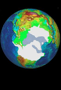
| Supplemental Information | STUDY NOTES: Synthesis of hydroclimatic proxy records for the Indo-Pacific Warm Pool at the Last Glacial Maximum, indicating wet or dry hydroclimatic conditions from both marine and terrestrial proxies. The files "terr_raw" and "marine_raw" contain the locations and hydroclimate state at the LGM from a collection of proxy records. Their "val" field indicates whether the proxy captured dry(val=-1)/unchanged(val=0)/wetter(val=1) or fresh(val=-1)/unchanged(val=0)/salty(val=1) climate at the LGM. The "n_obs" field is the number of proxy techniques used to estimate LGM hydroclimate from each location. A value "is_robust=1" indicates when different proxy techniques agree in their estimates of LGM hydroclimate at each location. The "is_robust" field also takes the value of 1 when only one proxy technique is used. A value "chrono_flag=1" indicates whether the proxy record contains one or more radiocarbon U/Th or well-constrained OSL dates near to or during the LGM. A value "chrono_flag=0" indicates that the LGM was dated via wiggle-matching the local benthic d18O to a global stack or another method. The files "terr_gridded" and "marine_gridded" are the final "gridded" data as seen in the main text of DiNezio and Tierney (2013), in which proxies were averaged within a search radius of 150 km. The "is_robust" field of "terr_gridded" and "marine_gridded" indicates whether the observations merged into each "gridded" point agree (is_robust=1) or not (is_robust=0). See DiNezio and Tierney (2013) for more details. ABSTRACT SUPPLIED BY ORIGINATOR: The Indo-Pacific warm pool - the main source of heat and moisture to the global atmosphere - plays a prominent role in tropical and global climate variability. During the Last Glacial Maximum, temperatures within the warm pool were cooler than today and precipitation patterns were altered, but the mechanism responsible for these shifts remains unclear. Here we use a synthesis of proxy reconstructions of warm pool hydrology and a multi-model ensemble of climate simulations to assess the drivers of these changes. The proxy data suggest drier conditions throughout the centre of the warm pool and wetter conditions in the western Indian and Pacific oceans. Only one model out of twelve simulates a pattern of hydroclimate change similar to our reconstructions, as measured by the Cohen's K statistic. Exposure of the Sunda Shelf by lower glacial sea level plays a key role in the hydrologic pattern simulated by this model, which results from changes in the Walker circulation driven by weakened convection over the warm pool. We therefore conclude that on glacial-interglacial timescales, the growth and decay of ice sheets exert a first-order influence on tropical climate through the associated changes in global sea level. |
| Purpose | Records of past temperature, precipitation, and other climate variables derived from paleoclimate proxies. Parameter keywords describe what was measured in this data set. Additional summary information can be found in the abstracts of papers listed in the data set citations. |
| Dataset Citation |
|
| Cited Authors |
|
| Originators |
|
| Publishers |
|
| Theme keywords |
Global Change Master Directory (GCMD) Science Keywords
|
| Data Center keywords |
Global Change Master Directory (GCMD) Data Center Keywords
|
| Place keywords |
|
| Use Constraints |
|
| Access Constraints |
|
| Fees |
|
Last Modified: 2023-09-01
For questions about the information on this page, please email: ncei.info@noaa.gov
For questions about the information on this page, please email: ncei.info@noaa.gov