NOAA GOES-R Series Advanced Baseline Imager (ABI) Level 2 Cloud Optical Depth (COD)
ABI-L2-COD; ABI-L2-COD2KM
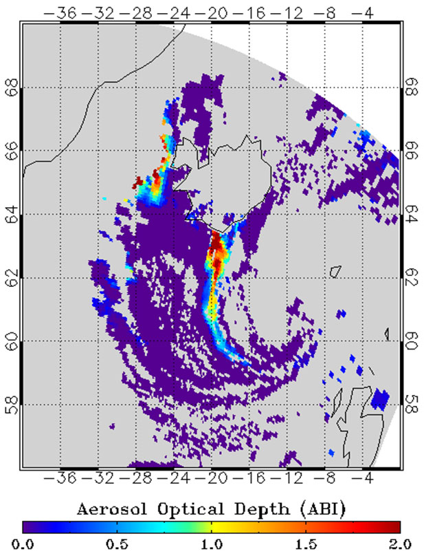 Example of the Cloud Optical Depth product as generated by the GOES-R Cloud Optical and Microphysical Properties algorithm.
The GOES-R Advanced Baseline Imager (ABI) Cloud Optical Depth product contains an image with pixel values identifying the measure of the extinction due to condensed water or ice clouds at a wavelength of 0.64 um. Separate algorithms are used for daytime, solar zenith angle to 82 degrees, and nighttime, solar zenith angle greater than 82 degrees, conditions. The product is generated in combination with the Cloud Particle Size product by the same algorithms. The product includes data quality information that identifies whether the daytime or nighttime algorithm generated the pixel, and provides an assessment of the cloud optical depth data values for on-earth pixels. The cloud optical depth value is a dimensionless quantity. The Cloud Optical Depth product image is produced on the ABI fixed grid at 4 km resolution for Full Disk and 2 km resolution for CONUS coverage regions. The product's spatial resolution increased from 4 km to 2 km on 22 March 2023. Product data is produced under the following conditions for the daytime algorithm: Cloudy; Geolocated source data to local zenith angles of 65 degrees and to solar zenith angles of 82 degrees. Product data generated by the nighttime algorithm is produced under the following conditions: Cloudy; Geolocated source data to local zenith angles of 70 degrees and solar zenith angles between 82 and 180 degrees. The cloud optical depth values reported range from 0 to 160. The sensitivity of the product to high optical depths is limited for nighttime conditions to the nighttime maximum threshold, which is an optical depth value of 16. Cloud Optical Depth product data is identified as degraded in the terminator region, which is a solar zenith angle between 65 and 82 degrees for the daytime algorithm, and 82 and 90 degrees for the nighttime algorithm.
- Cite as: GOES-R Algorithm Working Group and GOES-R Program Office, (2018): NOAA GOES-R Series Advanced Baseline Imager (ABI) Level 2 Cloud Optical Depth (COD). [indicate subset used]. NOAA National Centers for Environmental Information. doi:10.7289/V58G8J02. [access date].
| Download Data |
|
| Order Data |
|
| Distribution Formats |
|
| Ordering Instructions |
Contact NCEI for other distribution options and instructions. |
| Distributor |
NOAA National Centers for Environmental Information
ncei.info@noaa.gov
|
| Dataset Point of Contact |
Customer Engagement Branch
DOC/NOAA/NESDIS/NCEI > National Centers for Environmental Information, NESDIS, NOAA, U.S. Department of Commerce
ncei.sat.info@noaa.gov
|
| Time Period |
2017-06-08 to Present (time interval: 10-minute) |
| Spatial Reference System |
urn:ogc:def:crs:EPSG::4326 |
| Spatial Bounding Box Coordinates |
West: -156.2
East: 6.2995
South: -81.32
North: 81.328
|
| Spatial Coverage Map |
|
| General Documentation |
|
| Processing Documents |
- GOES-R Algorithm Working Group
-
GOES-R Algorithm Working Group
The GOES-R Algorithm Working Group creates the algorithms that process the quality controlled satellite instrument data and produces resulting data products.
- NOAA Satellite Information System Product Quality
- GOES-R Algorithm Theoretical Basis Documents
|
| Associated Resources |
- GOES-R Program Document Library
- GOES Operational Status - NOAA Office of Satellite and Product Operations
|
| Publication Dates |
|
| Edition |
Provisional |
| Data Presentation Form |
Digital image
|
| Dataset Progress Status |
Ongoing - data is continually being updated |
| Data Update Frequency |
Continual |
| Purpose |
Cloud Optical Depth will use both the visible and the near-infrared bands during the daytime and a combination of infrared bands for night-time detection. This product, together with the Cloud Particle Size Distribution product, will provide valuable information about the radiative properties of clouds. These two properties will enhance climate prediction, as they will provide global climate models with higher quality data regarding the Earth's energy and radiation budget. |
| Use Limitations |
- For a complete description of use limitations for this baseline product, see the Algorithm Theoretical Basis Document (ATBD).
|
| Dataset Citation |
- Cite as: GOES-R Algorithm Working Group and GOES-R Program Office, (2018): NOAA GOES-R Series Advanced Baseline Imager (ABI) Level 2 Cloud Optical Depth (COD). [indicate subset used]. NOAA National Centers for Environmental Information. doi:10.7289/V58G8J02. [access date].
|
| Cited Authors |
- GOES-R Algorithm Working Group
- GOES-R Series Program
|
| Principal Investigators |
- GOES-R Algorithm Working Group
|
| Resource Providers |
|
| Publishers |
- NOAA National Centers for Environmental Information
|
| Theme keywords |
Global Change Master Directory (GCMD) Science Keywords- Earth Science > Atmosphere > Clouds > Cloud Microphysics > Cloud Optical Depth/Thickness
Global Climate Observing System (GCOS) Essential Climate Variables (ECVs)- Atmospheric - Upper-air - Cloud Properties
|
| Data Center keywords |
Global Change Master Directory (GCMD) Data Center Keywords
- DOC/NOAA/NESDIS/NCDC > National Climatic Data Center, NESDIS, NOAA, U.S. Department of Commerce
- DOC/NOAA/NESDIS/NCEI > National Centers for Environmental Information, NESDIS, NOAA, U.S. Department of Commerce
- DOC/NOAA/NESDIS/STAR > Center for Satellite Applications and Research, NESDIS, NOAA, U.S. Department of Commerce
- DOC/NOAA/NESDIS/OSPO > Office of Satellite and Product Operations, NESDIS, NOAA, U.S. Department of Commerce
|
| Platform keywords |
Global Change Master Directory (GCMD) Platform Keywords
- GOES-16 > Geostationary Operational Environmental Satellite 16
- GOES-17 > Geostationary Operational Environmental Satellite 17
- GOES-18 > Geostationary Operational Environmental Satellite 18
|
| Instrument keywords |
Global Change Master Directory (GCMD) Instrument Keywords- ABI > Advanced Baseline Imager
|
| Place keywords |
Global Change Master Directory (GCMD) Location Keywords
- Geographic Region > Equatorial
- Geographic Region > Mid-Latitude
- Geographic Region > Northern Hemisphere
- Geographic Region > Southern Hemisphere
- Geographic Region > Western Hemisphere
- Geographic Region > Tropics
- Continent > North America > United States Of America
- Continent > North America > Central America
- Continent > South America
- Ocean > Atlantic Ocean
- Ocean > Pacific Ocean
|
| Project keywords |
Global Change Master Directory (GCMD) Project Keywords
- GOES > Geostationary Operational Environmental Satellites
- ABI-L2-COD
- ABI-L2-COD2KM
- gov.noaa.class:GRABIPRD
- GRABIPRD
|
| Data Resolution keywords |
Global Change Master Directory (GCMD) Horizontal Data Resolution Keywords- 1 km - < 10 km or approximately .01 degree - < .09 degree
Global Change Master Directory (GCMD) Temporal Data Resolution Keywords
|
| Stratum keywords |
Global Change Master Directory (GCMD) Location Keywords- Vertical Location > Troposphere
|
| Use Constraints |
- Cite as: GOES-R Algorithm Working Group and GOES-R Program Office, (2018): NOAA GOES-R Series Advanced Baseline Imager (ABI) Level 2 Cloud Optical Depth (COD). [indicate subset used]. NOAA National Centers for Environmental Information. doi:10.7289/V58G8J02. [access date].
- Use liability: NOAA and NCEI cannot provide any warranty as to the accuracy, reliability, or completeness of furnished data. Users assume responsibility to determine the usability of these data. The user is responsible for the results of any application of this data for other than its intended purpose.
|
| Access Constraints |
- Distribution liability: NOAA and NCEI make no warranty, expressed or implied, regarding these data, nor does the fact of distribution constitute such a warranty. NOAA and NCEI cannot assume liability for any damages caused by any errors or omissions in these data. If appropriate, NCEI can only certify that the data it distributes are an authentic copy of the records that were accepted for inclusion in the NCEI archives.
|
| Fees |
- In most cases, electronic downloads of the data are free. However, fees may apply for custom orders, data certifications, copies of analog materials, and data distribution on physical media.
|
| Lineage information for: dataset |
|---|
| Lineage Statement |
These data were produced by the NOAA Office of Satellite and Product Operations (OSPO) and are archived at the NOAA National Centers for Environmental Information (NCEI). |
| Processor |
- DOC/NOAA/NESDIS/OSPO > Office of Satellite and Product Operations, NESDIS, NOAA, U.S. Department of Commerce
|
| Processing Steps |
- The Cloud Optical Depth and Cloud Particle Size products are generated by the GOES-R ABI Cloud Microphysical and Optical Properties (COMP) ground processing algorithms for daytime and nighttime. The daytime algorithm employs a physical retrieval based on theoretically computed lookup tables while the nighttime retrieval employs the Community Radiative Transfer Model (CRTM) calculations in an iterative physical retrieval that seeks to minimize the difference between the compute TOA brightness temperature and the observations. The algorithm processes the data pixel-by-pixel, choosing to use the daytime or nighttime approach based on the solar zenith angle
- 2017-07-18T00:00:00 - The GOES-16 ABI Cloud Optical Depth algorithm reached beta maturity.
- 2018-02-26T00:00:00 - The GOES-16 ABI Cloud Optical Depth algorithm reached provisional maturity.
- The GOES-16 ABI Cloud Optical Depth algorithm reached full validation maturity.
- 2018-08-27T00:00:00 - The GOES-17 ABI Cloud Optical Depth algorithm reached beta maturity.
- 2019-09-24T00:00:00 - The GOES-17 ABI Cloud Optical Depth algorithm reached provisional maturity.
- The GOES-17 ABI Cloud Optical Depth algorithm reached full validation maturity.
|
| Processing Documents |
- GOES-R Algorithm Working Group
-
GOES-R Algorithm Working Group
The GOES-R Algorithm Working Group creates the algorithms that process the quality controlled satellite instrument data and produces resulting data products.
- NOAA Satellite Information System Product Quality
- GOES-R Algorithm Theoretical Basis Documents
|
| Source Datasets |
- NOAA GOES-R Series Advanced Baseline Imager (ABI) Level 1b Radiances
-
NCEI landing page for ABI-L1B-RAD
Source dataset landing page with general information and access links for the dataset.
- Description of Source: Level 1b radiances
- Temporal extent used: 2017-02-28 to Present
- Spatial extent used: N:81.328 S:-81.32 E:6.2995 W:-156.2
|
| Lineage information for: repository |
|---|
| Processing Steps |
- 2015-04-22T00:00:00 - NOAA created the National Centers for Environmental Information (NCEI) by merging NOAA's National Climatic Data Center (NCDC), National Geophysical Data Center (NGDC), and National Oceanographic Data Center (NODC), including the National Coastal Data Development Center (NCDDC), per the Consolidated and Further Continuing Appropriations Act, 2015, Public Law 113-235. NCEI launched publicly on April 22, 2015.
|
Last Modified: 2023-09-18
For questions about the information on this page, please email:
ncei.info@noaa.gov